
Abstract
Complex urban infrastructure disruptions can affect transportation, communication, and logistics systems simultaneously, forcing emergency operations to address both disaster relief and infrastructure restoration. This study proposes a multi-criteria decision framework under uncertainty to select Emergency Support and Logistics Center (ESLC) locations. The problem is modeled using five main criteria and 29 sub criteria covering demand and service level, logistics infrastructure and accessibility, cost and economy, risk and resilience, and governance and social factors. Criteria weights are obtained via the Best Worst Method (BWM), and candidate sites are ranked using Pythagorean Fuzzy Combinative Distance based Assessment (PF-CODAS), which evaluates alternatives through Pythagorean fuzzy (PF) membership and non-membership degrees and their distances from the Negative Ideal Solution (NIS). Results support a continuity-driven siting logic where Logistics “Infrastructure & Accessibility” is the dominant criterion and “Risk & Resilience” ranks second, reflecting the importance of network capability and hazard avoidance. The ranking identifies Hasdal (A3) as the best option (27.8005), followed by Hadımköy (A2) (10.1584) and Kurtköy (A5) (−2.2606). The proposed framework offers a transparent and reusable decision aid for ESLC planning in cities exposed to integrated infrastructure threats.
Keywords
1. Introduction
Infrastructure failures in complex urban regions, whether triggered by earthquakes, floods, cyberattacks, or cascading power and communication outages tend to propagate across interdependent networks rather than remaining localized. When transport, electricity, water, and digital services fail together, emergency response rapidly becomes a joint logistics and infrastructure support problem: crews, repair equipment, fuel, and relief supplies must be staged, coordinated, and routed under severe time pressure and high uncertainty. These cascading effects are often amplified by complex ground and environmental conditions that can damage access routes and lifelines simultaneously, including slope instabilities and terrain-driven hazards that constrain both mobility and on-site operability. In this context, Emergency Support and Logistics Centers (ESLCs) play a dual role: they act both as logistics hubs for relief items and as operational bases for infrastructure repair and coordination. Their location therefore has long term strategic implications for response time, network restoration, and social outcomes, which makes the siting problem inherently multi-criteria rather than purely cost-minimizing. Accordingly, ESLC siting must prioritize continuity of access and functionality under multi-hazard and multi-infrastructure disruption conditions, not only nominal proximity or cost efficiency.
Recent studies on emergency logistics facility location, humanitarian warehouse siting, emergency logistics centers, temporary shelters, and emergency operation centers have increasingly adopted geographic information system (GIS) and multi-criteria decision-making (MCDM) based decision frameworks to support disaster logistics planning. Although these approaches have provided valuable insights into accessibility, service coverage, cost efficiency, and site suitability, their ability to address logistics continuity under cascading infrastructure failures remains limited. Boonmee and Tanpruttianunt 1 demonstrated that emergency facility siting requires the integration of technical, social, and uncertainty-related factors, particularly public acceptance, accessibility, and infrastructure readiness. Yüksel et al. 2 and Kou et al. 3 further highlighted the usefulness of fuzzy decision-support models for prioritizing risk, regulatory factors, and expert-based judgments under uncertainty. Nevertheless, these studies do not provide an integrated framework for selecting ESLC locations in megacities where transportation, communication, and logistics systems may be disrupted simultaneously.
The main contributions of this study are fourfold. i) This study develops a comprehensive and context-sensitive decision framework for ESLC location selection under complex urban risk and infrastructure failure conditions. Unlike conventional facility-location studies that primarily focus on accessibility, coverage, or cost efficiency, the proposed framework considers ESLCs as multi-functional nodes that must simultaneously support humanitarian logistics, infrastructure restoration, coordination, and operational continuity. ii) The study expands the conventional facility-location criteria structure by incorporating not only demand, accessibility, cost, and physical risk factors, but also infrastructure interdependencies, operational continuity, resilience, governance, and social operability dimensions. By integrating demand and service level, logistics infrastructure and accessibility, cost and economy, risk and resilience, and governance and social factors, the proposed hierarchical criteria system provides a more holistic representation of ESLC siting requirements in metropolitan areas exposed to cascading disruptions in transportation, communication, energy, and service networks. iii) This study offers a robust uncertainty-oriented methodological contribution by integrating the Best–Worst Method (BWM) with Pythagorean Fuzzy Combinative Distance based Assessment (PF-CODAS). This hybrid structure enables expert-based criteria weighting and alternative ranking under linguistic uncertainty, while the CODAS logic provides a transparent negative-ideal distance-based evaluation mechanism. Accordingly, the proposed model provides a transparent, systematic, and reusable decision-support structure for identifying robust ESLC locations under complex urban risk conditions. iv) Finally, the study contributes to both the methodological advancement of emergency logistics siting and the practical planning of disaster-resilient logistics networks in infrastructure-vulnerable metropolitan areas. By linking operational continuity, multi-hazard exposure, infrastructure resilience, and governance-related considerations, the proposed approach supports more reliable and policy-relevant decisions for emergency preparedness and post-disaster response planning.
2. Literature review
Comparative literature review table.

Feng et al. 4 develop a GIS-based MCDM framework for ELCs in Xi’an, identifying nine spatial criteria, determining their weights with a combined entropy CRITIC procedure, and using VlseKriterijumska Optimizacija I Kompromisno Resenje (VIKOR) to rank 13 alternatives; population density emerges as the dominant factor, and sensitivity analysis highlights how weight changes can dramatically reshape siting decisions. This line of work shows how MCDM methods can bridge spatial analysis and managerial judgment in emergency facility planning. However, many GIS-MCDM applications still treat infrastructure interdependencies and operational continuity constraints in a limited way, especially when facilities must serve both humanitarian flows and infrastructure restoration tasks.
Within humanitarian relief logistics, several studies focus on pre-positioned warehouses and logistics hubs. Roh et al. 5 empirically identify warehouse location decision factors for humanitarian relief organizations using an Analytic Hierarchy Process (AHP) based survey, showing that “cooperation” and national stability outweigh pure cost and logistics attributes when choosing pre-disaster warehouse sites. Boltürk 6 extends this line by proposing a hesitant fuzzy AHP model for humanitarian warehouse site selection in the Marmara region, evaluating five candidate locations under five main criteria and sixteen sub-criteria; the hesitant fuzzy formulation captures decision-makers’ linguistic uncertainty and yields a more nuanced prioritization of alternatives. More recently, Çetinkaya et al. 7 combine GIS with AHP to locate an emergency warehouse near the Turkey-Syria border, structuring the problem around three main criteria and eleven sub-criteria, and generating a suitability map that reveals that only about 1–1.3% of the region is highly suitable once hazard and access constraints are enforced. Together, these studies illustrate a progression from survey-based AHP to fuzzy and GIS-integrated AHP models for humanitarian warehouse siting. Yet, warehouse-oriented criteria systems do not fully represent the technical support role required for infrastructure repair operations, such as maintaining dispatch continuity when lifelines degrade.
A parallel body of work addresses the siting of emergency logistics centers. Tang et al. 8 propose a composite MCDM framework in which improved Technique for Order Preference by Similarity to Ideal Solution (TOPSIS) is enhanced with grey relational analysis to capture development trends, Shannon entropy to derive objective indicator weights, and a coordinated development degree model (CDDM) to evaluate the joint evolution of relative proximity and indicator inhomogeneity in a Chinese coastal region. Their results show that combining development-trend information with distance-based TOPSIS measures produces more realistic and discriminating rankings of candidate ELCs than using TOPSIS alone. Feng et al. 4 similarly combine GIS with entropy, CRiteria Importance Through Intercriteria Correlation (CRITIC), and VIKOR to locate ELCs, emphasizing spatial exposure and accessibility alongside demand and showing that population density dominates other criteria when weights are elicited objectively. These ELC studies converge on a GIS-MCDM pattern in which criteria are most often grouped into environmental, economic, and technical/logistics dimensions, occasionally augmented with social indicators such as population distribution or service coverage. From the perspective of complex environments, this literature provides valuable spatial criteria but still tends to operationalize hazards mainly as static layers, rather than linking them to the facility’s ability to remain functional when interconnected lifelines fail.
Temporary shelters and emergency accommodation facilities introduce an even richer set of social and spatial considerations. Nappi 9 compile nine global criteria, twenty-four local criteria, and sixty performance indicators for collective temporary shelters spanning safety, habitability, cultural adequacy, and accessibility and use AHP with 23 experts to derive weights within a hierarchical multi-criteria model, implemented in the ShelterPro decision-support tool. Their framework demonstrates that factors such as privacy, universal accessibility, and long-term economic integration of affected populations can be systematically incorporated into MCDM models rather than treated qualitatively. More recent work on post-earthquake temporary sheltering areas and emergency assembly points further couples AHP or other MCDM techniques with p-median or covering models and GIS analysis, emphasizing multi-hazard exposure, land slope, and infrastructure access as dominant drivers of shelter site suitability. 11 These contributions highlight how social vulnerability and physical exposure can be integrated into structured, multi-layered decision models. For ESLCs, this insight suggests that governance and social operability should be modeled alongside physical exposure and network accessibility, rather than treated as secondary qualitative considerations.
At the command-and-control level, Di Matteo et al. 10 propose a hybrid AHP-ELimination Et Choix Traduisant la REalité (ELECTRE) methodology for the optimal location of Emergency Operation Centers (EOCs), explicitly modeling trade-offs between response time, population coverage, environmental constraints, and institutional considerations in Italian case studies. More broadly, recent GIS-based MCDM frameworks for post-earthquake emergency medical facilities combine interval AHP with distance-based techniques such as TOPSIS to account simultaneously for hazard intensity, vulnerability, accessibility, and medical capacity. Collectively, these studies confirm that emergency support facilities of various types’ warehouses, logistics centers, shelters, medical points, and EOCs share a common multi-criteria structure and tend to be analyzed with families of methods built around AHP and its fuzzy variants, distance-to-ideal techniques such as TOPSIS and VIKOR, outranking schemes such as ELECTRE, and entropy-based weighting. Nevertheless, ESLCs differ from single-function facilities because they must be robust nodes for both last-mile relief flows and infrastructure restoration logistics, often under simultaneous constraints on transportation and communications.
Despite this rich literature, several gaps remain when the focus shifts from single-function facilities to multi-role ESLCs serving complex infrastructure failures. First, most existing ESLC and warehouse studies organize criteria into a small set of high-level groups—typically environmental, economic, and technical/logistics aspects, with occasional social or demand indicators.4,7,8 Governance quality, inter-organizational cooperation, and social vulnerability are usually treated implicitly or through a few qualitative indicators, even though Roh et al. 5 AHP results show that cooperation and national stability can dominate more tangible cost and logistics attributes in humanitarian settings. Second, the resilience of the ESLC itself to cascading infrastructure failures its dependence on electricity, water, and digital connectivity, and its ability to remain functional under compound hazards, has rarely been modeled explicitly. Many GIS–MCDM site-selection schemes include hazard layers but do not systematically integrate interdependencies across infrastructure systems or the role of ESLCs as technical support hubs for restoration. Third, while recent models increasingly integrate objective weighting entropy, CRITIC and development trends or inhomogeneity measures into TOPSIS or VIKOR-based rankings, the resulting criteria systems remain fragmented across studies, making it difficult to transfer or adapt them to contexts characterized by simultaneous infrastructure and humanitarian demands.
The present study addresses these gaps by developing a location selection framework for ESLCs tailored to infrastructure failures in complex environments. Building on criteria structures emerging from humanitarian warehouse, ELC, shelter, and EOC studies, we synthesize a hierarchical evaluation system organized into five high-level dimensions: (i) demand and service level; (ii) logistics infrastructure and accessibility; (iii) cost and economic factors; (iv) risk and resilience; and (v) governance and social factors. Methodologically, the framework combines the BWM for criteria weighting with PF-CODAS for ranking, enabling preference-based linguistic assessments under uncertainty while preserving a clear negative-ideal distance logic. Empirically, expert judgments are consolidated through a Modified Delphi consensus process to reduce dispersion and improve the interpretability of the final ranking. Using this contemporary MCDM approach, the framework yields a transparent and transferable decision support tool that links the rich but fragmented site selection literature to the emerging challenges of resilient, multi-infrastructure emergency management.
3. The hybrid decision-making methodology
In this study, the determination of the most suitable locations for ESLCs under large-scale failures and disaster scenarios that may occur in complex and interconnected infrastructure systems is addressed as an MCDM problem. The ESLC location selection problem requires the simultaneous evaluation of numerous quantitative and qualitative criteria that may conflict with each other, such as demand and service level, logistics accessibility, cost, risk and resilience, as well as governance and social factors. For this reason, a hybrid decision-support approach based on Pythagorean Fuzzy Sets (PFSs) is proposed in this study to model uncertainty and ambiguity in expert judgments more effectively.
In the first stage of the study, the weights of the evaluation criteria are calculated using the BWM. Subsequently, the candidate ESLC alternatives are ranked using the PF-CODAS method, which is based on distances from the Negative Ideal Solution (NIS) and allows uncertainty to be represented within a broader and more flexible decision space. Through this integrated approach, both the relative importance of the criteria and the performance of the alternatives are analyzed by explicitly considering uncertainty, hesitation, and conflicting evaluations. As a result, a consistent, flexible, and decision-maker-oriented ranking is obtained for the ESLC location selection problem. The flowchart of the methodology adopted in the study is given in Figure 1. Flowchart of the study.
3.1. Preliminaries of Pythagorean Fuzzy sets
PFSs were introduced to the literature by Yager. 12 PFSs, which are an extension of the intuitionistic fuzzy sets proposed by Atanassov, 13 are deemed suitable for the calculations in this study due to the various advantages they offer over other fuzzy sets. While in classical fuzzy set theory, the degree of membership of an element in a set takes a value between 0 and 1, in PFSs, the sum of the squares of the degrees of membership and non-membership must be less than or equal to 1. 14 This feature of PFSs offers decision makers a broader scope of expression and allows for a more accurate representation of complex situations encountered in studies involving real-life applications.
In case studies where calculations are based on decision-makers’ opinions, individuals may express a high degree of involvement in a situation while simultaneously harboring certain reservations. PFSs offer a more suitable perspective for modeling such contradictory and uncertain situations. When the sum of the squares of the degrees of membership and non-membership is less than 1, the difference is defined as the degree of uncertainty or hesitation in the system.
Due to their aforementioned characteristics, PFSs are extremely powerful tools that enables decision-makers to effectively model situations of uncertainty, conflict, and hesitation.
Let X be a given set. A Pythagorean Fuzzy Number (PFN) Given the set 


Let 


The score value of a PFN 
Equation (9) presents the Pythagorean Fuzzy Weighted Average (PFWA) operator
17
:
3.2. Best worst method
BWM is a criterion weighting method introduced by Rezaei to overcome the structural limitations of the AHP, which is frequently preferred in MCDM problems. 18 Rezaei observed that as the number of criteria in AHP increases, the number of pairwise comparison matrices that need to be generated rapidly increases, creating a high cognitive load on decision-makers and leading to inconsistent evaluations. To address this shortcoming, BWM was designed to simplify the pairwise comparison process and make it more consistent.
The fundamental innovation of BWM is that, instead of comparing all criteria with each other, the decision problem is evaluated based on reference criteria that represent it. In this approach, experts determine the most important criterion as the “best criterion (
In BWM, comparisons are made solely based on reference criteria, ensuring that the method operates on a benchmarking-based logic. This structure more directly reflects decision-makers’ perception of priorities while also preventing unnecessary and indirect comparisons.
20
Mathematically speaking, in BWM, the number of comparisons required for n criteria is limited to only
In this regard, BWM stands out as a method that both reduces the evaluation burden on decision-makers and produces more consistent and reliable criterion weights. Particularly in decision problems where criterion priorities can be clearly defined and expert opinions show general consensus, the simple structure provided by BWM offers a significant advantage. For this reason, BWM has been preferred in recent years as a strong alternative to AHP in many areas such as logistics, supply chain, location selection, and risk assessment.
The optimization model is formulated as follows:
To facilitate computational efficiency, the above model can be equivalently reformulated as a linear minimization problem:
Upon solving this optimization model, the optimal criterion weights and the consistency parameter
3.3. Pythagorean Fuzzy CODAS
The CODAS method, introduced by Ghorabaee et al., 22 is an evaluation approach based on the distances of alternatives from the NIS. In the CODAS method, which uses two different types of distance, Euclidean and Taxicab (Manhattan) distances are the preferred measures. First, alternatives are ranked based on their Euclidean distances from the NIS; if the differences in Euclidean distances are negligible, the Taxicab (Manhattan) distance is then used as a second measure. This ensures that the alternatives can be distinguished.
In the traditional CODAS method, Euclidean and Taxicab (Manhattan) distances are suitable for calculations involving exact numbers; therefore, their direct use is not always possible in complex decision problems involving uncertainty and hesitation. This situation limits the applicability of the method, especially in case studies where uncertainty and expert judgment are critical, such as in disaster management problems. Accordingly, fuzzy CODAS approaches utilize fuzzy weighted distance measures to extend classical CODAS to uncertain decision environments.
This study aims to create a more flexible and realistic structure by integrating Pythagorean Fuzzy logic into the CODAS method. PFSs provide decision-makers with a broader scope for assigning membership and non-membership degrees, enabling more effective modeling of uncertainty and hesitation. In this context, the PF-CODAS method was employed to evaluate and rank the alternatives in the ESLC location selection problem, with the aim of obtaining more reliable and consistent results. To improve the reliability of subjective evaluations, expert judgments are consolidated through a Modified Delphi process, for details,15,23 resulting in a single consensus assessment for each alternative and criterion before the PF-CODAS computations. In each Delphi round, experts reviewed the aggregated feedback and revised their ratings until convergence was reached, and the final consensus ratings were used as the Pythagorean Fuzzy decision matrix entries. The application steps of the PF-CODAS method are presented below.6,24
Linguistic terms for evaluating alternatives.


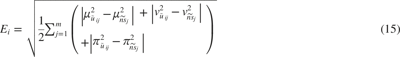
The minimum values for each criterion are identified based on the closeness index given in Equation (14)
25
:


In other words, the function defined in Equation (19) operates as follows: • If the Euclidean distance difference between two alternatives is greater than or equal to the threshold value, the relative evaluation value is calculated by combining the Euclidean and Taxicab distance differences. • If this difference is less than the threshold value, the relative evaluation value is based only on the Euclidean distance difference.

4. Case study
Definitions of the criteria.

Istanbul is a critical metropolitan area in terms of emergency planning due to its high population density, complex infrastructure structure, and exposure to multiple hazards. The strong interdependencies among transportation, energy, communication, and logistics networks can cause infrastructure failures to propagate rapidly across the city. Therefore, the strategic positioning of ESLCs are of great importance for reducing response times and enabling the rapid restoration of infrastructure systems. The spatial distribution of the alternative locations considered in the study and their positions within Istanbul are presented in Figure 2. Alternative ESLC locations.
Information about experts.

The evaluation of the alternative locations was conducted with the participation of experts from the same panel who possess specific knowledge and experience regarding the city of Istanbul. At this stage, expert judgments were collected using the Modified Delphi method to achieve consensus. The consensus-based evaluations obtained were then used in the analysis of the alternatives through the PF-CODAS method. This framework aims to enhance the consistency of the decision-making process and the reliability of the results.
In this study, the data collection process consists of two main stages. In the first stage, the necessary pairwise comparison information within the scope of BWM is collected from experts to determine the relative importance levels of the criteria. In the second stage, consensus-based linguistic evaluation matrices are constructed based on expert judgments for the assessment of the alternative locations. This matrix is obtained by achieving consensus among the experts with the Modified Delphi method.
Expert evaluations for main criteria.

When the expert evaluations are examined, the Logistics Infrastructure & Accessibility criterion is identified by the majority of experts as the most important main criterion. In contrast, the Demand & Service Level and Cost & Economy criteria are frequently assessed as the least important by the experts. This indicates that, in infrastructure-oriented emergency scenarios, accessibility and logistical continuity are considered more critical than other dimensions.
Decision vectors for main criteria.

Using the comparison vectors, the weights of the main criteria were calculated and are presented in Figure 3. In addition, consistency ratios were analyzed to assess the reliability of the expert evaluations. The results indicate that all expert responses fall within the predefined consistency thresholds and that the evaluations exhibit an acceptable level of consistency. Main criteria weights.
When the obtained main criterion weights are examined, it is observed that the Logistics Infrastructure & Accessibility criterion has a higher priority compared to the other criteria. This is followed by the risk and resilience dimension, which represents the capacity of the centers to maintain functionality under disruption conditions. While demand-oriented indicators as well as governance and social aspects play a complementary role in the decision structure, the relative influence of cost-based factors remains more limited. This distribution indicates that, in infrastructure-oriented emergency planning, operational continuity takes precedence over economic considerations.
In addition to the evaluation process for the main criteria, the best and worst criteria identified for the sub-criteria, along with their corresponding comparison vectors, are presented in Appendix Table A1. Using this information, the final weights of the sub-criteria were calculated in accordance with the main criterion weights. The calculated sub-criterion weights were derived in a manner consistent with the hierarchical structure and are presented in detail in Figure 4. Sub-criteria weights.
When the sub-criterion weights are examined, it is observed that the site selection decision is primarily shaped by physical and operational factors, particularly the strength of the regional road logistics network, distance to active fault lines and landslide/geo hazard risk. The spatial match with demand distribution, terrain suitability (slope and elevation) and ICT/communication infrastructure are identified as sub-criteria with a moderate level of influence. In contrast, the weights of sub-criteria related to cost and socio-political conditions remain relatively limited. These findings indicate that continuity and accessibility-oriented criteria are prioritized in the positioning of ESLCs.
Distances for alternatives.

Final scores of alternatives.

The obtained final scores indicate a clear performance differentiation among the alternative locations. According to the results, A3. Hasdal achieved the highest evaluation score and ranked first. This location is followed by A2. Hadimkoy and A5. Kurtkoy. At the lower end of the ranking, A7. Silivri, A4. Samandira and A1. Arnavutkoy are positioned. In particular, the lower-ranked alternatives exhibit relatively weaker performance in sub-criteria related to logistics accessibility and risk. Overall, the resulting ranking reveals that the ESLC site selection decision prioritizes regions that are more advantageous in terms of operational continuity and infrastructure integrity.
4.1. Sensitivity analysis
A sensitivity analysis was conducted to examine how variations in expert weights may influence the ranking results of the alternative ESLC locations. In the Base scenario, equal weights were assigned to all experts during the BWM stage and the obtained criterion weights were used as the reference structure for comparison. To evaluate the effect of expert dominance on the decision process, seven additional scenarios (Sc1 to Sc7) were generated. In each scenario, one expert was assigned a weight of 0.5, while the remaining six experts were assigned equal weights of 0.5/6. Based on these revised expert weights, the BWM calculations were repeated and new criterion weights were obtained. The updated weights were then transferred to the PF-CODAS method and the alternative rankings were recalculated under each scenario. Through this procedure, the sensitivity analysis aimed to assess the stability and reliability of the proposed decision framework under different expert weighting conditions. The results obtained from the seven scenarios are presented in Figure 5. Results of expert weight-based sensitivity analysis.
The sensitivity analysis results indicate that the proposed decision framework produces highly stable ranking outcomes under different expert weighting structures. In all scenarios, A3. Hasdal maintains its position as the best-performing alternative, while A2. Hadimkoy consistently ranks second. Similarly, A1. Arnavutkoy remains the lowest-ranked alternative across all scenarios. Minor ranking changes are observed among the middle-performing alternatives, particularly among A5. Kurtkoy, A6. Tuzla, A4. Samandira and A7. Silivri. However, these variations do not alter the overall ranking structure in a significant manner. The results demonstrate that the proposed methodological framework remains robust even when the influence levels of individual experts are substantially changed.
To further extend the sensitivity analysis, the influence of variations in the threshold parameter Results of threshold parameter-based sensitivity analysis.
The ranking results remain largely unchanged under different threshold parameter values. The top and bottom performing alternatives preserve their positions across all scenarios, indicating a stable ranking structure. Only limited variations are observed among some middle-ranked alternatives, particularly between A4. Samandira and A7. Silivri at higher
4.2. Comparative analysis
Results of PF-TOPSIS.

The complete consistency between PF-CODAS and PF-TOPSIS indicates that the final ranking is not dependent on a single distance-based MCDM technique. PF-CODAS evaluates alternatives based on their distances from the negative ideal solution, whereas PF-TOPSIS considers their relative closeness to both the positive and negative ideal solutions; nevertheless, both methods identify the same priority structure. This confirms the robustness of the proposed decision framework and supports the conclusion that Hasdal (A3) is the most suitable ESLC location, whereas Hadimkoy (A2) and Kurtkoy (A5) represent strong secondary alternatives.
5. Discussion
The study introduces a decision-support system for choosing ESLC sites in Istanbul that uses a combination of BWM and PF-CODAS methods to address in scenarios where infrastructure failures impact multiple transportation, communication and logistics networks. The framework operationalizes the problem through five main criteria and 29 sub-criteria, and it combines BWM to elicit consistent criteria weights from experts and PF-CODAS to rank candidate sites using consensus-based linguistic assessments obtained via a Modified Delphi process with a seven-member expert panel. The primary result of this research shows that ESLC site suitability in this environment depends more on operational continuity than on traditional demand- or cost-prioritized logic.
The weighting results show that Logistics Infrastructure & Accessibility is the most influential main criterion, followed by Risk & Resilience. Demand-related, governance-related, and social criteria still contribute to the decision structure, but their relative influence remains secondary, while cost-related factors have a more limited effect on the final prioritization. This result is important because it demonstrates a clear shift from conventional facility-location logic toward resilience-based emergency logistics planning. In many emergency logistics and warehouse location studies, demand concentration, population density, cost, or general accessibility indicators are treated as the main drivers of site selection. Feng et al. 4 found population density to be a dominant factor in their GIS–MCDM-based emergency logistics center location model. In contrast, the present study shows that, when the decision environment is defined by complex urban infrastructure failures, population- or demand-oriented indicators alone are not sufficient. A location may be close to demand points, but it may still be unsuitable if its logistics connectivity, road network redundancy, communication infrastructure, or hazard exposure limits its post-disaster functionality. The sub-criterion results further reinforce this interpretation. The prominence of the strength of the regional road logistics network, distance to active fault lines, and landslide/geohazard risk indicates that the ESLC siting problem is mainly shaped by the joint consideration of accessibility and survivability. These findings are consistent with Çetinkaya et al., 7 who emphasized the importance of integrating hazard and accessibility layers in emergency warehouse site selection, and with Liu, 11 who highlighted multi-hazard exposure, vulnerability, and accessibility in the site selection of post-earthquake emergency medical facilities. However, the present study extends this line of research by interpreting hazard and accessibility criteria not merely as spatial suitability layers, but as indicators of whether the ESLC can continue to operate when transport, communication, and service networks are disrupted simultaneously. The findings also relate to the humanitarian warehouse location literature. Roh et al. 5 showed that cooperation, institutional conditions, and national stability can be more influential than purely economic logistics factors in humanitarian warehouse location decisions. Similarly, this study includes governance and social factors such as cooperation with logistics agents and authorities, political and economic stability, the presence of humanitarian organizations, cultural adequacy, and availability of trained personnel. This finding is in line with Boonmee and Tanpruttianunt, 1 who proposed a fuzzy MCDM framework for community isolation center site selection and highlighted the importance of accessibility, community acceptance, and infrastructure readiness in resilient emergency facility planning. While their study addresses public health infrastructure during outbreak conditions, the present research extends this logic to ESLC location selection under cascading urban infrastructure disruptions, where logistics continuity and hazard resilience become the leading determinants of site suitability. However, these factors do not dominate the final weighting structure in the Istanbul case and although governance capacity and cooperation mechanisms are necessary to ensure the effective use of an ESLC, they cannot compensate for a location that is highly vulnerable to transport interruption or physical hazard exposure.
The PF-CODAS results produce a clear tiering of alternatives. The assessment results show that Hasdal (A3) achieved the highest score of 27.8005 which made it the top-ranked site while Hadimkoy (A2) and Kurtkoy (A5) followed as the second alternative with a score of 10.1584 and the third alternative with a score of −2.2606, respectively. The scores represent relative distances to the negative ideal solution, which serves as the reference point from which CODAS measures alternatives using Euclidean distance and applies Taxicab distance as an additional measure when Euclidean differences are low. The evidence shows that Hasdal functions as the main ESLC candidate while Hadimkoy and mid-tier options like Kurtkoy and Tuzla can serve as backup centers and additional hubs within a multi-center system. The implementation logic for this system applies to large metropolitan areas, which experience both corridor breakdowns and sudden increases in capacity. The ranking outcome contributes to emergency logistics planning in three ways. First, it supports the GIS–MCDM tradition represented by Feng et al. 4 and Çetinkaya et al. 7 by confirming that spatial and infrastructure-related criteria are essential in emergency facility siting. Second, it extends the humanitarian logistics literature represented by Roh et al. 5 and Boltürk 29 by incorporating expert uncertainty and governance-related considerations within a broader resilience-oriented framework. Third, it complements studies such as Nappi et al. 9 and Di Matteo et al., 10 which emphasize social, operational, and institutional trade-offs in temporary shelter and emergency operation center location problems. Unlike these single-function facility studies, however, the present study evaluates ESLCs as multi-functional nodes that must simultaneously support relief logistics, infrastructure repair, coordination, and continuity of operations.
The decision-making process of the hybrid approach matches the requirements of the decision-making environment. BWM reduces comparison burden while producing weights under a consistency-controlled optimization structure, and fuzzy modeling increases expressive power for uncertain judgments. The results depend on three factors, which include (i) expert-panel composition and consensus dynamics, (ii) the linguistic-to-fuzzy mapping and CODAS threshold behavior, and (iii) the assumption that criteria are treated as benefit-type within PF-CODAS. Future research should conduct more comprehensive sensitivity and robustness assessments by testing alternative weight distributions and CODAS threshold parameters. In addition, improved GIS and network analysis systems could enhance accessibility and hazard exposure evaluations. Future studies may also extend the current single-location ranking framework into a facility network design model that considers multiple emergency support and logistics centers, their capacities, and their specialized operational roles.
6. Conclusion
This research proposed a decision-support framework, which implements resilience principles to select ESLC locations in Istanbul during infrastructure system failures. The problem was formalized through a hierarchical structure of five main criteria and 29 sub-criteria and addressed using a hybrid approach that integrates BWM for consistent criteria weighting with PF-CODAS for ranking candidate sites, based on consensus linguistic evaluations obtained via a Modified Delphi process.
The results show that ESLC siting in complex metropolitan disruption areas depends mainly on operational continuity and Logistics Infrastructure and Accessibility and Risk and Resilience emerge as the most important factors for decision-making while cost-related factors show only minor effects on site preference. The PF-CODAS ranking identifies Hasdal (A3) as the leading candidate and provides a defensible prioritization that can inform phased implementation and, where relevant, multi-hub planning to strengthen redundancy.
The proposed framework provides a clear uncertainty management system, which can be used to conduct ESLC site evaluation because it handles multiple assessment criteria and expert uncertainty. The results depend on three factors, which include the specific expert panel member’s linguistic-to-fuzzy parameterization process and the PF-CODAS model assumption that all criteria function as benefit-type elements. The findings also offer implicit practical benefits beyond site ranking. The proposed framework supports continuity-oriented ESLC planning by identifying not only the most suitable primary location, but also potential backup hubs for a resilient multi-center logistics network. This can help decision-makers improve redundancy, reduce operational vulnerability, and strengthen preparedness against cascading infrastructure disruptions. Moreover, the uncertainty-based structure of the model increases transparency and supports more defensible emergency logistics planning decisions.
Despite its contributions, this study has some limitations that should be addressed in future research. The proposed framework is based on an MCDM structure and ranks a predefined set of candidate ESLC locations by considering expert judgments under uncertainty. However, MCDM methods alone do not determine the optimal number of facilities, capacity allocation, demand assignment, inventory positioning, or routing decisions. Therefore, future studies should integrate the proposed BWM–PF-CODAS framework with optimization techniques such as p-median, p-center, covering models, mixed-integer programming, robust optimization, or multi-objective programming. Such hybrid MCDM–optimization models would enable researchers and decision-makers to evaluate not only the relative suitability of candidate locations but also the optimal configuration of an emergency logistics network under capacity, coverage, cost, and disruption-related constraints.
Footnotes
Author contribution
B.K. [Data collection, methodology design, writing – original draft preparation.] M.C. [Data curation, formal analysis, writing – review & editing.] T.K.K. [Validation, formal analysis, writing – review & editing, corresponding author.] B.Y.K. [Literature review, data collection, validation, writing – review & editing.] E.A. [Conceptual framework development, methodological guidance, supervision.].
Funding
The authors received no financial support for the research, authorship, and/or publication of this article.
Declaration of conflicting interests
The authors declared no potential conflicts of interest with respect to the research, authorship, and/or publication of this article.
Data Availability Statement
The datasets generated and analyzed during the current study are available in the manuscript and the Appendix.
Appendix
Decision vectors and the most and least important sub-criteria identified by experts.
Main criteria
Expert
Best
Worst
Best-to-others
Others-to-worst
Demand & Service Level
Proximity to disaster-affected population
Population density in coverage area
9,2,1,3,2
1,5,9,3,4
Affected population within service radius
Proximity to main settlements/beneficiaries
3,1,3,8,6
7,8,4,1,4
Affected population within service radius
Population density in coverage area
7,1,2,3,3
1,7,6,5,4
Affected population within service radius
Proximity to main settlements/beneficiaries
4,1,2,7,3
4,7,6,1,6
Proximity to disaster-affected population
Proximity to main settlements/beneficiaries
8,6,1,9,7
3,2,1,1,3
Affected population within service radius
Proximity to main settlements/beneficiaries
4,1,2,6,3
3,6,5,1,4
Affected population within service radius
Proximity to main settlements/beneficiaries
8,1,2,3,2
1,8,4,3,4
Logistics Infrastructure & Accessibility
Strength of regional road logistics network
Distance to border crossings
2,3,4,5,7,1,2,3
3,2,2,1,1,7,3,2
On-site logistics accessibility and facilities
Distance to seaports
3,4,2,8,3,3,1,4
3,3,3,1,3,5,8,6
Distance to main highways
Distance to border crossings
1,4,3,4,8,2,3,5
8,5,6,6,1,7,6,4
Strength of regional road logistics network
Distance to border crossings
4,3,3,2,7,1,4,3
5,4,4,3,1,7,5,5
Distance to main highways
Distance to border crossings
1,7,8,8,9,6,6,6
1,4,4,4,1,2,2,3
Strength of regional road logistics network
Distance to airports
3,5,7,6,6,1,4,2
5,4,1,3,3,7,5,6
Strength of regional road logistics network
Distance to airports
2,4,5,9,4,1,2,3
5,2,2,1,2,9,5,3
Cost & Economy
Replenishment/inbound logistics cost
Regional economic development & openness
2,3,2,1,6
3,2,3,6,1
Storage and operating cost
Regional economic development & openness
1,4,5,4,8
8,6,4,5,1
Replenishment/inbound logistics cost
Regional economic development & openness
3,4,5,1,8
6,5,4,8,1
Replenishment/inbound logistics cost
Regional economic development & openness
3,2,5,1,7
5,6,2,7,1
Storage and operating cost
Regional economic development & openness
1,7,6,8,9
1,3,2,3,1
Regional economic development & openness
Labor cost
5,2,7,4,1
3,6,1,4,7
Storage and operating cost
Labor cost
2,3,7,1,4
4,2,1,7,2
Risk & Resilience
Landslide/geohazard risk
Human and asset security
3,1,2,6
2,6,3,1
Distance to active fault lines
Human and asset security
1,4,5,9
9,5,5,1
Distance to active fault lines
Human and asset security
1,2,4,6
6,5,2,1
Human and asset security
Landslide/geohazard risk
3,6,2,1
3,1,5,6
Distance to active fault lines
Human and asset security
1,6,7,8
1,2,3,1
Landslide/geohazard risk
Terrain suitability (slope and elevation)
3,1,7,4
5,7,1,3
Landslide/geohazard risk
Terrain suitability (slope and elevation)
1,2,8,3
8,4,1,3
Governance & Social Factors
Cooperation with logistics agents & authorities
Cultural adequacy of facility
2,1,3,6,2,3,4
3,6,2,1,3,2,2
Accessibility of daily services for affected people
Cultural adequacy of facility
5,4,4,8,4,1,5
5,6,5,1,5,8,5
Cooperation with logistics agents & authorities
Working and living conditions (including climate)
6,1,3,7,2,4,8
2,8,5,2,7,4,1
Accessibility of daily services for affected people
Cultural adequacy of facility
4,3,3,9,4,1,5
5,6,6,1,4,8,3
Availability of trained and qualified personnel
Presence of humanitarian organisations/NGOs
6,7,9,8,1,6,7
2,3,1,3,1,2,3
Cooperation with logistics agents & authorities
Cultural adequacy of facility
4,1,3,8,4,2,5
3,8,6,1,3,7,4
Cultural adequacy of facility
Working and living conditions (including climate)
2,1,3,7,2,4,4
4,7,2,1,4,2,4
Expert evaluations for alternatives.
A1
A2
A3
A4
A5
A6
A7
Population density in coverage area
MB
VB
EG
VG
G
MG
EB
Affected population within service radius
MB
MG
EG
VG
G
MG
VB
Proximity to disaster-affected population
VB
MB
G
MG
VG
EG
VG
Proximity to main settlements/beneficiaries
MB
MG
EG
VG
G
G
VB
Spatial match with demand distribution
B
VG
EG
G
MG
G
MB
Distance to main highways
MG
VG
EG
EG
VG
VG
G
Distance to railways
EB
G
VB
MB
VG
EG
MG
Distance to airports
EG
VG
G
G
EG
VG
EB
Distance to seaports
VB
G
MG
MB
VG
EG
G
Distance to border crossings
F
MG
F
MB
MB
MB
MG
Strength of regional road logistics network
G
EG
EG
VG
VG
G
MG
On-site logistics accessibility and facilities
VG
EG
MB
VG
G
VG
EG
ICT/communication infrastructure
G
G
EG
VG
VG
G
MG
Storage and operating cost
G
VG
EB
MG
MB
F
EG
Investment/land cost
MG
VG
EB
G
MB
F
EG
Labor cost
G
VG
EB
MG
MB
F
EG
Replenishment/inbound logistics cost
MG
EG
VG
G
MG
G
B
Regional economic development & openness
MG
VG
EG
G
VG
VG
MB
Distance to active fault lines
EG
VG
VG
MG
MB
B
VB
Landslide/geohazard risk
G
VG
B
MB
MG
VG
EG
Terrain suitability (slope and elevation)
MG
VG
B
B
MG
G
EG
Human and asset security
MG
G
VG
G
EG
MG
G
Political and economic stability
F
MG
MG
F
MG
F
F
Cooperation with logistics agents & authorities
VG
EG
EG
G
VG
G
MB
Presence of humanitarian organisations/NGOs
MB
M
VG
G
MG
MG
B
Cultural adequacy of facility
G
MG
VG
G
G
MG
G
Availability of trained and qualified personnel
MG
G
EG
VG
VG
G
MB
Accessibility of daily services for affected people
MB
B
EG
VG
G
MG
VB
Working and living conditions
MG
MB
VG
G
G
MG
G