



Abstract
This article examines street improvement projects in Tokyo and Seoul as case studies for tracing the active participation of Japanese urban planners in the global flow of urban planning concepts and technologies from the West to Japan, and then from Japan to Asia. Striving to recreate Tokyo as the “greatest capital in East Asia,” Japanese planners in the mid-Meiji Period envisioned improvement projects that, while adapted to meet local needs, exhibited a striking similarity with the primary concerns of contemporary “modern” Western planning ideas. Moreover, Japanese planners acted as transmitters of Western planning as these imported ideas and practices adapted in Tokyo in the 1880s were then exported to Korea along with Japanese imperialism in the early 1900s as planners sought to refashion Seoul as a suitable colonial capital to assert Japanese cultural hegemony. Street improvement projects in both cities provide tangible examples highlighting this technical innovation and conceptual diffusion overseas.
As our Tokyo is the home of the Emperor, the seat of the national government, and the center of institutions, culture, and development, the urban improvements of Tokyo are the model for all cities in the empire, large and small, and truly a project for the advancement of our civilization and enlightenment.
1
Introduction
This article examines street improvement projects in Tokyo and Seoul as case studies for tracing the participation of Japanese urban planners in the global flow of planning concepts and technologies from the West to Japan, and then from Japan to Asia. Despite differing legacies and social factors of urban reform between Japan and the West, Japanese urban planning did not develop unilaterally or independently. 2 Rather, Japanese urban visionaries, reformers, and planners were active participants in what Stephen V. Ward has called the “innovation” and “diffusion” of Western planning ideas and practice. 3 Although Seki Hajime did not introduce the Japanese equivalent of “city planning” (toshi keikaku) until 1913, Japanese urban planners over three decades earlier displayed an impressive familiarity with the planning traditions of Western cities—especially Paris. Striving to recreate Tokyo as the “greatest capital in East Asia” from the 1880s, these planners envisioned improvement projects that, while adapted to meet local needs, exhibited a striking similarity with the primary concerns of contemporary “modern” Western planning ideas, namely, reducing street traffic, promoting urban hygiene, and opening green spaces within the city. Moreover, Japanese planners acted as transmitters of Western planning as these imported ideas and practices adapted in Tokyo in the late nineteenth century were then exported to Seoul along with Japanese imperialism in the early twentieth century to cultivate Japanese cultural hegemony. In this way, as Home Ministry Chief Secretary Yamazaki Naotane proclaimed in 1885, “the urban improvements of Tokyo [were] the model (mohan) for all cities in the empire.” 4 Thus Japan’s role in the spread of Western planning was “multifaceted,” as it was both an importer and an exporter of Western urban modernity, as Carola Hein has noted. 5 Street improvement projects in Tokyo and Seoul are instructive as tangible examples for highlighting this technical innovation and conceptual diffusion overseas.
To map the diffusion of Western planning concepts and techniques across the Pacific to Japan and beyond, the article will begin with a discussion of Western influences on Japanese capital city planning strategies before demonstrating with three case studies how these strategies were applied to street improvement projects in Tokyo and Seoul. Seeking to legitimize the new regime in the eyes of both domestic and international observers, the Meiji government refashioned Tokyo based on lessons learned from observation of Western capital cities. Drawing from the records of the Iwakura Mission, this section will argue that Meiji leaders made three discoveries as they toured the grand cities of Europe and the United States: firstly, what made capital cities grand was not only their urban aesthetics but also their commercial function; secondly, what determined whether or not a city would prosper economically was the quality of its streets; and thirdly, the built environment of capital cities reified the power of the government and concretized its legitimacy by demonstrating its ability to rule and by constructing difference between the new rulers and the old. These lessons guided Japanese urban improvements for the rest of the Meiji period as planners set about the modernization of Tokyo. Perceiving a direct correlation between urban transportation and infrastructure, commercial prosperity, and the international prestige of a city, Japanese planners came to see the built environment—especially the condition of streets—as the first and most visible indicator of urban modernity and, in turn, the power of the government. For this reason, planners intent on projecting Japanese modernity and imperial power in the capital and the colonies started at street level.
Case studies of street improvement projects in Meiji Tokyo and colonial Seoul will then chart how Japanese planning strategies derived from Western lessons informed urban improvement projects in both cities as Japanese rulers sought to assert central authority. The first case study views Ginza Bricktown as contested terrain where the Meiji government’s attempts to manufacture historical rupture by imposing a prefabricated Western urban space onto the city were challenged by local opposition. Government leaders assumed that the construction of such an urban space at the heart of the capital would assuredly produce a bustling business quarter to showcase Japanese modernity. When local resident opposition forestalled the project, Japanese planners responded with a more pragmatic approach to urban redevelopment that focused on street improvements as the groundwork for spurring economic activity and producing modern urban space. The second case study highlights how this new approach, applied in the Tokyo Urban Improvements projects (Tōkyō Shiku Kaisei Jigyō) initiated in 1888, mirrored prevailing city improvement trends in Western Europe in the late nineteenth century. Whereas previous studies have diminished the symbolic importance of these mid-Meiji projects, a close reading of successive urban planning proposals will show that planners indeed saw urban improvements as a mechanism for shaping Tokyo into a suitably grand imperial capital—albeit one known as much for its commercial function as for its monumentality. In doing so, Tokyo planners echoed their Western contemporaries as they advocated transportation and infrastructure improvements meant to reduce traffic, expedite urban mobility, and enhance the livability of the city. Mapping of individual projects will illustrate, moreover, that planners by no means neglected to shape street improvements to frame spaces designed to celebrate both emperor and empire, especially after Japan embarked on colonial expansion in the late nineteenth to early twentieth centuries. Finally, the third case study will track the diffusion of Western planning concepts to the mainland of Asia by examining Japanese-initiated urban improvement projects in colonial Seoul. Informed by shared archives of metropolitan civil engineering knowledge and public works training, Japanese engineers of empire in Seoul improved streets as the foundation for modern urban spaces designed to project Japanese imperial power in built form.
Western Origins of the Tokyo Model of Imperial Space
It was in the context of modern nation-state formation that the Meiji government undertook the recreation of Tokyo as Teito, the “imperial capital.” Following the Meiji Restoration of 1868, the fledgling Meiji government faced a crisis of legitimacy on two fronts. Western imperialist nations lay in wait to see how successfully the new regime could emerge from the legacy of its Tokugawa predecessor and subdue pro-Tokugawa holdouts. In the face of these international and domestic challenges, government leaders pursued two intersecting tracks of legitimization. On one hand, as Harry Harootunian has described in Benjaminian terms, government reformers responded to the immediate “state of emergency” of the present by looking to the Japanese past, rediscovering and adopting the historical Dajōkan bureaucratic system as the new administrative structure. 6 In this way, the new regime pursued sovereignty by using [an invented] “tradition in the service of modernity,”—to use Gwendolyn Wright’s phrasing—thereby installing itself at the top of the traditional political hierarchy and justifying its rule with a patina of historicity. 7 On the other hand, the Meiji government anticipated legitimacy by embracing Western “modernity,” both in terms of political, military, and ideological systems, and in terms of material goods and built forms. As part of this strategy, Meiji leaders assembled a “toolkit of modernity” filled with instruments of tangible modernity, such as railways, architecture, telegraphs, modern hygiene, and modern urban planning. 8 It was by wielding such “instruments of modernity,” as Jeffrey E. Hanes has argued, that Meiji modernizers crafted a frame of “modern, exploitable space” for the new Japan. 9 As these tools suggest, the manipulation of geographic and urban space played a major part in Meiji efforts to physically and ideologically integrate the far reaches of the archipelago. Locomotives, for example, acted as engines of state formation through centralization and standardization as the national railway network cast a net of central power over the periphery. As conveyors of goods and symbols of progress, railways provided economical, industrial, and ideological advantages. 10 Urban reform, meanwhile, revolutionized the built environment of the cities, affirming a break with the past and creating the modern spatial conditions necessary for the capitalist mode of production. Not only would all of this hopefully assist in the revision of the “unequal treaties” by convincing the West of Japanese progress, but it would also forge Japan into a “rich country with a strong army” while distinguishing the new Meiji government from the old Tokugawa Shogunate.
Refashioning the Shogun’s city of Edo into the Emperor’s capital of Tokyo from the early 1870s, Meiji leaders imported Western planning concepts and techniques as they applied knowledge gained through firsthand observation of European and American cities to the modernization of the new Japanese capital. Visiting capitals such as Paris, London, and Washington, D.C., from 1871 to 1873 on the Iwakura Mission, Meiji government leaders had learned three related lessons about Western cities that would inform later urban improvements in Tokyo. The first lesson Japanese leaders learned when traveling to the West was that what made capitals “grand” was not only their aesthetics but also their economic function. The diary of the Mission kept by scribe Kume Kunitake, for example, recorded the mission members’ awe for the Parisian cityscape upon arriving in the city in 1872. “Tall buildings with gleaming white walls rose high on either side of boulevards paved throughout with stone, lined with trees and lit by gaslight,” Kume remarked, “and as the moon rose clear in the sky above, the sight of the celebrated city pleased the eye in all its elegance.” 11 Yet, while clearly impressed by the famous urban vistas of Paris, the Iwakura Mission members were equally admiring of the French capital’s commercial role in Europe. “Paris is thus the market-place for all the countries of Europe,” Kume transcribed, “and there is no rich and famous merchant house in either Europe or America which does not have premises here for both import and export.” It was this combination of aesthetics and function in Paris that made such a strong impression on Kume and the other members of the mission.
Throughout Europe and wherever in the world Europeans live, it is revered far and wide as the pinnacle of urban elegance. The beauty of this city calls to mind the palace of the emperor of heaven. . . . France has always been held in respect throughout Europe with Paris as the hub of civilisation [sic].
12
In other words, as Kume’s notes reveal, the Mission members quickly perceived a direct relationship between urban aesthetics, economic function, and international prestige.
The second lesson of grand capital cities the Iwakura Mission members recognized when touring the West was that quality city streets were the necessary groundwork for, and the first indicator of, commercial prosperity and the prestige that would follow. “The essential purpose of roads and waterways is not simply to make possible the movement of people,” Kume pronounced, “It is to facilitate the transport of all the goods produced on earth to places where their value is greater [sic].” For this reason, he went on to explain, “The vital importance of roads and waterways to commercial enterprises may be compared to that of arteries and veins to the human body.” As a result, “all the countries of Europe devote great effort to the construction and maintenance of roads and waterways.” Economic prosperity required efficient transportation, the thinking went, and fluid transportation was only possible with quality streets. Good streets, in turn, required good government. Consequently, Kume remarked,
We found that as we traveled through a particular country the condition of its roads would reveal to us immediately whether the national government was vigorous or in decline and whether the industry and commerce were active or lethargic [sic].
13
With this relationship between economic performance, road quality, and government power in mind, Kume fastidiously recorded “instructive” street construction techniques wherever the Mission traveled.
14
In addition to frequently jotting down road widths, remarking on the use of sidewalks to separate vehicle and pedestrian traffic, and admiring the planting of roadside trees to provide shade, Kume described in great detail tar-macadam and woodblock paving techniques in Washington, D.C.,
15
“tile”-like closely laid stone paving in London,
16
gravel and cement paving in Paris,
17
and the use of sand to keep the dust down on streets in Western Switzerland.
18
According to Kume, streetscapes were the measure of a municipality:
Across the length and breadth of London we did not see a single unpaved street. In Paris, around the Arc de Triomphe, broken stone is laid tightly and gravel is spread on top. When you enter any country [for the first time], you can tell immediately, by looking at the road surfaces, whether the government is efficient or not and whether the citizens are likely to be rich or poor.
19
Meiji government leaders and planners thus plainly recognized the importance of quality streets for producing a stately capital city—one that was not only commercially vibrant and economically prosperous, but one that also projected a modern and civilized appearance through its built environment. As Ishida Yorifusa has pointed out, this perception of a connection between road conditions, economic performance, and national prestige by the Iwakura Mission members is “of great interest as a recognition linked to the later Tokyo urban improvement debates.” 20 Indeed, confidence in this triangular relationship between transportation infrastructure, commercial prosperity, and international prestige informed urban improvements in Tokyo throughout the Meiji period.
The third lesson Japanese government leaders learned on the Iwakura Mission was that the grand Western capitals had frequently been constructed as political symbols heralding the departure of the ancien régime and announcing the arrival of the new. Thomas Hall points out that “political changes at the national level” were one of several “triggering factors” leading to capital city planning in the nineteenth century, recalling that Napoleon III had renewed Paris partly to “maintain and strengthen his position,” and that projects in Vienna and Madrid had been “aimed at strengthening the position of the central government in an unstable situation.” 21 Through a dramatic juxtaposition of modern and “premodern” or vernacular built forms, the new regime could demonstrate its permanence while also making a case for legitimacy. In the words of David Harvey, this modernist rupture between the past and present required a process of purposeful “creative destruction.” 22 By bulldozing new boulevards through Second Empire Paris, Harvey explains, Baron Haussmann was able “to show that what went before was irrelevant; that neither he nor Louis Napoleon was in any way beholden to the thinking or the practices of the immediate past.” 23 Similarly, Carl Schorske famously explained that in fin-de-siècle Vienna ascendant liberals cleared and constructed the Ringstrasse to demonstrate their values in “stone and space.” As Schorske maintains, such abrupt modernization of urban space was one example of the disruptive “a-historical” cultural transformations and rejections of past forms that marked the advent of modernity. 24
The ability of capital cities to perform as sites for declaring and demarcating the arrival of modernity by making “all that is solid [melt] into air” through a process of “creative destruction” was not lost on the Japanese members of the Iwakura Mission. As Kume relayed the mission members’ grasp of Parisian history, “Until one hundred years ago the city streets were narrow, crude buildings large and small were mixed in with one another, and the beautiful and the ugly were chaotically thrown together.” But then, Kume continues, “Napoleon I, called upon his extraordinary powers [of organisation] and devoted the enourmous wealth he had captured from various countries to the task of enhancing the beauty of Paris . . . at last pull[ing] down the small huts and hovels, remov[ing] the large ugly buildings among them.” 25 Elsewhere, Kume enthused about the construction of the Arc de Triomphe, writing, “Already by the turn of the century [Napoleon I] had triumphed over Italy, Austria and other countries, his might reverberated across Europe, and hordes of captives lay in his power.” “To commemorate this glorious achievement,” Kume went on, “he devoted great efforts to rebuilding the city of Paris, clearing away all the mean dwellings around here and driving a wide boulevard as straight as a hair through the district to his palace [Palais de Tuileries].” “On a site where eight avenues converged, he created a round open space about two hectares in area and had this arch built in the middle.” 26 As Kume’s diary demonstrates, although apparently more impressed with the legacy of Napoleon Bonaparte rather than that of his nephew Napoleon III, the Japanese ambassadors on the Iwakura Mission nevertheless appreciated the symbolic power of urban transformation.
Applying these three lessons to the recreation of Tokyo, Japanese planners modernized the built environment of the capital from the ground up—namely, by constructing railways, erecting Western-style architecture, and implementing modern street improvements and infrastructure planning. No doubt, each of these individual improvements had practical benefits, especially for Tokyo planners seeking to revive the commercial and economic prosperity the city lost as a result of the drastic population decline and concomitant economic stagnation resulting from the suspension of the Tokugawa “alternate attendance” (sankin kōtai) system. Railways, for example, fostered commerce and industry by connecting urban markets to productive rural regions. Planners also hoped that “improved streets” (kaisei dōro)—that is, streets that had been widened, straightened, paved in the most up-to-date techniques, and for the most part outfitted with sidewalks to separate vehicular and pedestrian traffic—would invigorate the economic function of Tokyo by increasing urban mobility, thereby promoting efficient commercial shipping and transportation of goods. Widened streets also acted as firebreaks, which together with nonflammable Western brick architecture, combated the frequent conflagrations in the city, demonstrating the permanence of the new capital and its economic potential. Or, as Jordan Sand has phrased, “Brick architecture announced that the capital would have fixed capital.” 27 In this regard, widened and straightened streets in Tokyo were more for reducing traffic and fires and accelerating commerce than they were for military logistics or defense from unruly mobs, as had been the case in Paris and other Western capitals.
Yet transformations of the built form of Tokyo also had more political motives. Put simply, Japanese government leaders modernized the built environment of Tokyo to produce modern urban spaces that would both impress visitors and announce the arrival of the new Meiji government. In doing so, Japanese planners anticipated what Kim Dovey has referred to as the “framing” of the spaces of everyday life. According to Dovey, the built environment of the city “mediates, constructs and reproduces power relations” through literal and discursive forms of framing. “In the literal sense,” Dovey writes, “everyday life ‘takes place’ within the clusters of rooms, buildings, streets and cities we inhabit. Action is structured and shaped by streets, walls, doors and windows; it is framed by the decisions of designers.” At the same time, “As a form of discourse,” Dovey continues, “built form constructs and frames meanings.” Dovey coins the term “framing” to capture the way that the design of built form can both “shape” and “enclose” daily action, while also providing the “context” for everyday life—or, “both the construction of a world and of a way of seeing ourselves in it.” 28 Designers and planners, then, frame space by designing and planning in ways that reflect and advance their interests, values, and worldview. In Meiji Japan, planners framed everyday urban space with what they identified as the tangible elements of urban modernity: the Western architecture, sidewalks, sewers, roadside trees, and paved streets of the modern cityscape. By constructing these tangible forms of modernity in the city, Japanese planners hoped to demonstrate the power of the Meiji government while impressing the ideas of civilization and culture onto the local population. Modern urban sites thus became “hegemonic spaces”—spaces that mediated the discursive project of modernity and transmitted the power of the ruling regime.
Japanese strategies of spatial power were hegemonic in two regards. First, Japanese modernizers sought to transmit power through modern urban space—this meant the introduction of built forms that embodied Japanese ideas of progress and civilization: railways, Western architecture, and improved streetscapes. Ginza Bricktown was the most famous example of the government’s attempt to recreate Tokyo as a “showcase” in this way. 29 Not only was the construction of brick buildings simultaneously carried out with street improvements, but the project also coincided with the completion of Japan’s first railway line and the opening of the adjacent Shimbashi Station (1872). To be sure, later programs continued this synthesis of elements, as improved roads were shaded by verdant roadside trees and the urban street network was highlighted with strategically placed monumental buildings—often Western-style railway stations, such as Manseibashi Station (1912), the second Shimbashi Station (1914), and finally, Tokyo Station (1914), the “Gateway to the Imperial Capital.” Modernization of the built environment was therefore done not only in anticipation of the commercial prosperity expected of modern capital cities, but also in an attempt to solidify and transmit Japanese power by concretizing in the built form of the city what Japanese planners saw as an advanced Japanese culture. As such, the empowerment of urban space in Japan was borne not out of a strategy of “enframing” space for the purposes of legibility or ordering, as described by Timothy Mitchell in the case of British Egypt, but instead was the product of an unwavering belief in the cultural superiority of modernity and a naive faith in the proselytizing power of progress. 30 Of course, in Japan’s case, this was a borrowed, Western modernity. Nevertheless, the creation of modern urban space to tangibly differentiate and distinguish the modern regime from its premodern predecessor would prove especially useful to a Meiji government avowed to clear away the “evil customs of the past,” and even more so to a colonial regime attempting to demonstrate Japanese modernity to a Korean colonized population. Because these empowered urban sites were intended to demonstrate Japanese power, and even donned imperial symbolism, they became localized nodes in a network of imperial space cast over the urban area. City streets were especially charged components in this project.
But what makes city streets in particular conduits of power? As Dovey notes, what ties the practice of spatial framing to power is that
most people, most of the time, take the built environment for granted. . . . The more that the structures and representations of power can be embedded in the framework of everyday life, the less questionable they become and the more effectively they can work.
This is truer for some elements of the built environment than for others. It is hard for large edifices to hide within the city. The symbolic demolition of the Japanese-built Government-General Building in Seoul in 1995 demonstrates that certain mediations of power in the built environment can be deconstructed when they fail to become anonymously embedded in the urban fabric. It is much easier for streets, on the other hand, to strengthen and preserve their hegemonic function by quietly passing into the level of the taken-for-granted. Dovey borrows from Pierre Bourdieu to conclude, “It is the ‘complicitous silence’ of place as a framework to life that is the source of its deepest associations with power.” 31 Once laid, streets form a framework that defines the surrounding built environment, transforms urban space, and directs the movement of people through the city. Building heights are often restricted by the width of the street they front, roadbeds demarcate public space, and streets determine the route taken from point A to point B, all the while being highly regulated by traffic signs, stop lights, and lane markings. Although street surfaces are frequently repaved, the street itself is rarely rerouted. The clearing of new streets through the city consequently has the power to dramatically alter the make-up of the neighborhood. 32 Even as the buildings lining the street are torn down and rebuilt, the street itself remains largely the same. Because streets formed the groundwork for hegemonic urban spaces, even the seemingly mundane act of paving became a strategy of extending spatial power.
Another way in which Japanese strategies of spatial power were hegemonic was that they attempted to garner popular consent by flexibly adapting to local conditions and demands. As Japanese modernizers attempted to construct cultural hegemony, they also carefully tried to manufacture consent. The overriding lesson of the Ginza Bricktown for Japanese planners was that the forceful imposition of power from above would elicit an equally tenacious and hostile resistance from below. Moving forward, therefore, Tokyo planners abandoned attempts to instantaneously transform the built environment, and instead more pragmatically focused on incremental transportation and infrastructure improvements, especially to urban streets. In other words, planners learned that the imposition of a rigid frame of urban space was unlikely to succeed. What was needed instead was a more plastic structure, malleable enough to conform to the existing built environment. Although the built forms framing modern urban space—the railways, the buildings, and the streets—were rigid structures, they were part of a flexible model that could be fit into available spaces. Rather than bulldozing through existing neighborhoods to open new thoroughfares or clear building sites, for example, Japanese planners slowly transformed the built environment of the city through gradual street improvement projects to extant streets and the construction of buildings on repurposed government-owned land. At the same time that this had pragmatic economic benefits of reducing costs associated with land purchase and removal of obstructive buildings, it also had the more practical result of ensuring the measured success of the projects and reducing public opposition. In this way, flexibly adapting to local conditions made the projection of power in built form more possible. This was as true in Tokyo as it was in colonial Seoul, where Japanese colonizers attempted to legitimize their rule, compel subservience, and earn the approval of their imperialist counterparts in the West by recreating Seoul as a suitable colonial capital that would project Japan’s power and modernity. As in Tokyo, the main priority of this colonial urban transformation was street improvement projects. Couching their actions in the rhetoric of facilitating commerce and industry and promoting civilization and enlightenment, moreover, Japanese colonial planners paved streets to create modern urban spaces intended to assert Japanese cultural hegemony. All the while, planners altered their idealized street plans to more closely reflect local demands, topographical conditions, and the existing built environment, in an attempt to secure consent and achieve successful implementation.
By elucidating common Japanese strategies of hegemonic spatial production in Tokyo and Seoul, the following three case studies will illustrate how Western urban planning concepts and techniques were diffused to Asia along with Japanese colonialism through Tokyo, “the model for all cities in the empire, large and small.”
Case Study 1—Ginza Bricktown
The Ginza fire erupted on the afternoon of the twenty-sixth day of the second month, 1872, scorching over 95 hectares and destroying over three thousand buildings in Tokyo’s central business district. 33 In response, the Meiji government planned a far-reaching modernization project of the entire affected area. The resulting district, which came to be known as Ginza Bricktown, gained renown as a modern urban space—known for its Western-style brick buildings, colonnaded arcades, macadam-paved roads, brick and stone sidewalks, roadside trees, and gas lamps. 34 While the district is remembered most for its brick buildings—hence the name “Bricktown”—this case study will argue that street improvements were as integral a part of the project. In this regard, Ginza Bricktown is more accurately remembered as what Carola Hein termed a “unified cityscape.” 35 Indeed, planners attempted to install a thoroughly Western holistic “streetscape” in the Japanese imperial capital designed to differentiate Tokyo from Edo, Meiji from the Tokugawa, and the new Japan from the old. As the planners of the Bricktown quickly found out, however, the heavy-handed methods used by the government to impose the project only provoked an equally tenacious reaction from the municipal government and local residents. Although the project was consequently curtailed because of a lack of public support and financial difficulties, the Ginza Bricktown provided several lessons that would prove instructive in making later urban improvements in Tokyo more successful.
The Meiji government took quick action after the Ginza fire to direct the reconstruction of the district. Building construction was prohibited the day after the fire, and the decision to rebuild the district in brick another three days later. Attempts to fireproof the built environment of Edo through block realignment and street widening to clear firebreaks had often followed large fires throughout the Tokugawa Period, as Jordan Sand has recently described. 36 What distinguished the government’s reaction to the Ginza fire of 1872 and the resulting Ginza Bricktown from previous fire reconstruction projects was that the project was planned in the context of Tokyo’s new role as the imperial capital. “To begin with, the Tokyo of today has changed,” the Bricktown Construction Decree (Rengagai Kenchiku Rei) released just six days after the fire made clear, “it has become the home of the Emperor (Renkoku no Moto).” 37 As this indicates, government leaders recognized the opportunity to rebuild the area as what André Sorensen has called a Western-style “impressive and fire-resistance district suitable for the imperial capital.” 38 For this reason, as the announcement concluded, “in the burned areas, the roads shall be widened, and construction of buildings all in brick shall commence immediately.” 39
To produce an adequately modern space, government leaders looked to the West for models of building and street construction. First, no fewer than five foreign architects and engineers either already under the employ of various government ministries or working privately in Japan at the time were solicited for advice on the reconstruction efforts. 40 The message from all of these “experts” was resoundingly clear: Tokyo’s streets were too narrow, excessively winding and confused, and the buildings lacked regulation. Louis Felix Florent, for example, advised that the most important things to be done were (1) the straightening of blocks and the widening of roads, and (2) the setting of building codes. 41 Ultimately, Inoue acquaintance Thomas Waters was hired to sketch designs for the brick buildings, producing what architectural historian Fujimori Terunobu has identified as the “Georgian” style popular in London at the time, and typified by Tuscan columns, pediments, and symmetrical features. 42 The widening and improving of the existing street infrastructure was an equally important part of the project. Indeed, surveys of the burnt areas started only two days after the fire, and the street schematic for the new district was completed just over two weeks later (see Figure 1). 43 As the Tokyo government clarified, the layout was designed “with the imperial palace as the basis (moto).” 44

Ginza Bricktown street plan 1872 by the Tokyo government.
Planning of the street network highlights the diffusion of Western planning concepts and construction techniques to Japan. As with the drafting of the brick buildings, the government relied on the advice of foreign experts in Japan along with Japanese knowledge of conditions in the West. When solicited for advice following the Ginza fire, Florent, for example, had advised dividing roads into three lanes: one in the middle for horse carriages, and additional lanes on either side where horses, cows, and other vehicles would not be permitted. 45 Another of the foreign experts, Colin Alexander McVean of the Tokyo Surveying Department, recommended a road network consisting of four classes of streets, among which the widest would be 50 feet with 10 feet sidewalks on both sides. 46 Not surprisingly, these were the exact widths recommended by famous fellow Scottish engineer William John Macquorn Rankine in the 1862 edition of his A Manual of Civil Engineering. Although he cautions “no general rule can be laid down” for street widths in populous areas, Rankine adds that where “the traffic is greatest, the width of carriageway is about 50 feet, with a pair of footways, each from 10 to 15 wide.” 47 Rankine’s Manual would later become a central part of the core civil engineering curriculum at the Imperial College of Engineering (Kōbu Daigakkō), and its successor, Tokyo University, under the direction of headmaster Henry Dyer, a student of Rankine’s at Glasgow University. 48
A second source for information on street planning was Japanese observations of Western cities. According to the recollections of Tokyo Governor Yuri Kimimasa, the widths of the widest roads in London (25 ken, ~150 ft.), New York City (24 ken, ~140 ft.), and Washington, D.C. (24 ken, ~140 ft.), were brought up for consideration in discussions about the appropriate street width for Ginza.
49
Inoue Kaoru later challenged Yuri’s account by revealing that Yuri had actually scoffed at such widths, saying “Why the hell would we need such a wide road (Anna baka-na hiroi machi wo tsukutte dō suru tsumori ka)?!?”
50
Inoue’s recollections of Yuri’s pessimism are corroborated by Tokyo government official Mishima Michitsune, who recalled years later that Governor Yuri had initially argued for roads of only 8-ken wide, the standard for Edo. Nevertheless, “Around that time,” Mishima later explained,
we received a report from a person staying overseas on the actual conditions of roads in foreign countries, explaining that their width is almost always more than 25-ken. As a result, it was argued that the width of Shimbashi Road [Ginza Main Street] should be made 20-ken, but it ended up being only 15-ken.
51
While the specifics of this report or the identity of its sender are yet to be determined, it is worth remembering that the Ginza fire and subsequent planning for the Bricktown project coincided with the Iwakura Mission’s sojourn in Washington, D.C. Moreover, after spending over one month in Washington, D.C., ōkubo Toshimichi and Itō Hirobumi had temporarily left the Mission, having departed before the Ginza fire and arriving back in Japan in the midst of Bricktown. 52
Construction crews applied technical details observed in the West to pave the new streets. Road widths for the district were set in four levels to distinguish thoroughfares, feeders, and local access streets. The width of 15 ken (~90 ft.) was set for the first-class route of the historical Tōkaidō highway running through the center of the district, with lower class streets set at 10 ken (~60 ft.), 8 ken (~50 ft.), and 3 ken (~20 ft.).
53
The new streets surfaces, meanwhile, were paved in gravel and hardened with stone rollers to provide a solid, durable surface for ox carts and horse-drawn carriages.
54
Finally, brick and stone-paved sidewalks separated pedestrian and vehicular traffic on all but the narrowest routes, and roadside trees and gas lamps were installed to provide shade and illumination for the large number of expected pedestrians. With such urban amenities, Meiji leaders hoped to produce a space comparable with Regent Street in London or the Rue de Rivoli in Paris. In this goal, they were not far off. As one poetic Tokyo-ite waxed lyrically,
The tall two-story buildings, towering into the blue sky one after the other as high as mountains; its grandeur is such that it completely imitates Western buildings! . . . The stone buildings, in other words, are like those of London, the English capital; the streets are like those in Paris, the French capital.
55
Once completed, the wondrous spectacle of the Western cityscape drew crowds of curious onlookers “killing time in the Ginza” (Ginbura). Still, the Bricktown was slow to attract residents and tenants. 56 One reason for this was that the unfamiliar new brick buildings turned out to be unsuited to the Japanese climate and were therefore not a very pleasant place in which to live. As Edward Seidensticker explains, “They were found to be damp, stuffy, vulnerable to mildew, and otherwise ill adapted to the Japanese climate, and the solid walls ran wholly against the Japanese notion of a place to live in.” 57 Likewise, as the Shimbun Zasshi reported in June of 1873 just after the first buildings had been completed, many of the new houses had sprung leaky roofs after just several days of rain. 58 As a result, from the time of the very first “handing over” of two finished buildings in mid-1873, an additional seven buildings lay empty. 59 At the time all when 216 of the buildings facing the Ginza Main Street were completed, 120, or over 55 percent, remained vacant. 60 These vacancies were not entirely unexpected, however, as planners preferred to knowingly construct buildings that would sit empty upon completion rather than delay the project too long fearing that they would lose the support of an increasingly frustrated public. “The Ginza Bricktown is not something that can be built all at once,” cautioned Public Works department head Ono Gishi while reporting the completion of the first buildings, “it is something that must be completed by steadfastly continuing construction sequentially one area after the next, without concern for vacant houses.” 61
A more pressing concern was the antagonism local residents held toward the project as a result of the Meiji government’s forcible imposition of the Bricktown. Even though the fire had cleared much of the land needed for the new project, the new district as planned by the government had extended far beyond the destroyed zones. To clear the way for construction, lands necessary for buildings and road widening had been “temporarily” purchased for an “appropriate” price and any remaining buildings or obstructive temporary shelters had to be relocated or torn down. 62 As a result, some landowners lucky enough to find that their plastered warehouses had survived the flames had to watch them later razed or moved at the hands of the government to make way for new brick buildings.
The overbearing tactics used by the Meiji government to implement the project roused local resistance on two levels. First, disgruntled residents of Ginza began to voice their displeasure with the project and the new houses even as surveyors were still at work demarcating building plots in preparation for construction. As a Tokyo government proclamation from just two months after the fire warned, anyone “who, clinging to old customs, sometime[s] recklessly ridicule[s] the newly regulated construction, and spread[s] groundless rumors to incite the people,” would face “strict treatment (genjū no shochi).” 63 In addition to voicing complaints, residents with nowhere else to go for shelter after the fire ignored the injunction on housing construction in the burnt districts and erected temporary homes amid the brick buildings then under construction. The obstruction posed by the makeshift dwellings forced the central government to plead to the Tokyo government in August 1872 to issue yet another order against such housing construction. 64 As will be discussed below, even those wealthier residents who chose to move into brick houses began to call on their powerful connections to assuage their expenses.
Second, keeping in mind the financial burden the new brick buildings would place on district residents, the Tokyo municipal government acted as a go-between mediating between the Meiji government “elite” and the “urban majority” of the local populace. 65 From the beginning of planning, the Finance Ministry’s goals for the district had been opposed by Tokyo Governor Yuri Kimimasa for political reasons. 66 Not only had Governor Yuri initially scoffed at the proposed road widths, he had been opposed to brick houses from the beginning on the grounds that they would be too expensive for Tokyo residents. It was not until Yuri was sent overseas to join the Iwakura Mission and removed from office soon thereafter that the project could proceed according to Meiji government plans. 67 Even after Yuri was moved out of the way, the Tokyo government continued to intervene to alleviate pressure on residents in several ways. First, they successfully negotiated to create breathing space for the retention of traditional building types on the backstreets of the Bricktown, provided that they were fireproof dozō-zukuri plastered warehouses. 68 Second, after being placed in charge of housing payment collection shortly before the first government-constructed buildings were completed, the Tokyo government did what it could to lessen rent burdens on building tenants. Endorsing a petition filed by a group of seven influential Ginza residents, including Anzai Jūbei of the famous Ginza Daikokuya, the Tokyo government forced the Meiji government’s hand in allowing twelve-month housing payment deferrals for tenants inhabiting the brick houses. 69 Finally, not forgetting landowners, the municipal government arranged a four-month land tax and “district fee” (kunyūhi) 70 exemption. 71
In the face of financial difficulties caused by vacancies compounded by this two-pronged resistance to the Bricktown, the Meiji government scaled back the project in late 1873 and suspended all central government–financed housing construction in 1875. 72 As a result of this premature termination, only about a third of the planned buildings were completed by the time the Bricktown project was declared finished in 1877. 73 More importantly, the Bricktown project failed to launch citywide urban reforms since the trendy Ginza flâneurs were not inspired to rebuild their own homes in brick. As Seidensticker reports, while nearly one thousand Western-style buildings were eventually constructed in the surrounding Kyōbashi Ward, there were fewer than twenty brick buildings in the rest of the city. 74
Although abortive and limited in scale, the Ginza Bricktown nevertheless provided a foundation for later Tokyo street improvement projects. Indeed, as Yoshikawa Akimasa declared in 1884, the Ginza Bricktown was “the starting point (kōshi) of Tokyo urban street improvements.” 75 More than anything else, the failure of the Ginza Bricktown indicated that the forceful imposition of space in the city was likely to incite opposition. In response, urban planners in the Home Ministry devised a more pragmatic approach to urban planning. Rather than hasty, instantaneous transformations of the built environment, planners would now focus on improvements to transportation and infrastructure carried out gradually as periodic fires made land available to lay a framework for urban redevelopment. With this more pragmatic and piecemeal approach, planners were able to produce the desired urban spaces while lowering associated costs and limiting resistance. In this way, knowledge gained in the West and tested in the Ginza Bricktown would be applied to urban improvement plans over the next two decades as Japanese urban planners attempted to make Tokyo “the greatest capital in Asia.”
Case Study 2—Street Improvements in Meiji Tokyo
Despite the failure of the Bricktown, Tokyo city planners remained steadfastly committed to the goal of reshaping Tokyo into the Japanese “Imperial Capital,” Teito. At this point, Tokyo planners bifurcated into two competing camps. Although their aspiration for the city remained the same—Tokyo as the “greatest capital in Asia”—their visions of what exactly that meant were entirely different. One group of planners was associated with the Foreign Ministry. To borrow a term from Shun-ichi J. Watanabe, this group can be called the “Europeanizationists,” and included such leaders as now Foreign Minister Inoue Kaoru and now Police Commissioner Mishima Michitsune, who according to Watanabe “shared the idea that Tokyo should in no way appear inferior to European capitals.” 76 Indeed, Inoue and Mishima were both central figures in the planning and implementation of the Ginza Bricktown, providing the aesthetic impetus of that project. For Europeanizationists, such as Inoue and Mishima, Tokyo as a grand capital meant a city that visually mimicked the idealized urban aesthetics of nineteenth-century European capitals: broad boulevards, opulent Baroque urban design, and monumental buildings. Even after the Bricktown, Inoue and Mishima continued to agitate for the instantaneous and dramatic transformation of Tokyo along European lines. As co-chairmen of the Special Architecture Bureau (Rinji Kenchikukyoku), Inoue and Mishima hired the German architectural firm Ende and Böckmann in 1885 to draft a series of Baroque-inspired buildings and urban plans for a government district in Tokyo that would have required the destruction of much of the central city, including the Ginza Bricktown. Because of the enormous costs—financial and otherwise—these plans would have required, the project collapsed after Inoue Kaoru resigned as foreign minister in 1887, leaving only two buildings completed.
Yet by the 1880s, the kind of vision of a splendid capital held by Inoue and Mishima was thirty years late. As Thomas Hall notes,
The projects that were realized in the second half of the nineteenth century were on quite a different scale and of quite another type: it was no longer a question of creating splendid ceremonial towns for princes, but of building large, modern, efficient cities for a new age.
77
That is, rather than planning for magnificent spaces, planners of European capitals now considered other factors, including “population growth, increasing pressure on the street network for the transport of people and goods, together with a growing awareness of hygienic needs.”
78
Similarly, as Steven V. Ward observes,
Modern planning thus brought a shift from the laying out of fortifications or grand urban places that buttressed the temporal power of kings, princes and aristocrats. Instead it expressed newer functional priorities of land use, infrastructure, efficient circulation and, increasingly, social welfare.
79
Even Napoleon III’s goal for Paris had been to make the city more livable by facilitating traffic, afer all, not to mention the parks, sewers, and water systems added by Haussmann. 80
While functional aspects of urban planning were not fully realized by the Europeanizationists such as Inoue and Mishima, it was much more keenly appreciated by a second group of Tokyo planners: those associated with the Home Ministry, most notably Tokyo Governors Yoshikawa Akimasa, Kusumoto Masataka, and Matsuda Michiyuki, as well as the American-trained civil engineer Haraguchi Kaname. Because this group advocated transportation and infrastructure improvements—namely, railways, streets, rivers, canals, and water and sewers systems—to improve the commercial function of the city, they can be characterized as the “Functionalist” group. For these Functionalist planners in the 1880s, Tokyo as the “greatest capital in Asia” did not mean a grandiose capital with wide-open plazas, lavishly opulent public architecture, or grand urban design; it meant a bustling city that was commercially vibrant and economically prosperous. In the minds of these Functionalist planners, international prestige would directly derive from and immediately follow the economic prosperity generated by improved transportation and infrastructure. As Governor of Tokyo Yoshikawa Akimasa emphatically declared in 1884, by improving the urban transportation network “we can expect [Tokyo] to exhibit a magnificent and splendid sight, where the urban areas are organized and the streets are flat . . . where thousands of customers gather and hundreds of kinds of goods converge,” in other words, “[a Tokyo] that will become the greatest capital in Asia.” 81 In this regard, it was the Functionalists, not the Europeanizationists, who were more up-to-date with contemporary Western urban planning thought and therefore most responsible for the diffusion of modern Western planning concepts to Japan.
Home Ministry planners produced a series of improvement plans for the capital, culminating in the Tokyo Urban Improvement (Shiku Kaisei) projects championed by Governor Yoshikawa in the mid- to late 1880s. Over the years 1884 to 1888, Yoshikawa presided over the most important stage of Tokyo urban planning during the Meiji period, and the most significant urban reforms in the capital prior to the Imperial Capital Reconstruction Plan (Teito Fukkō Keikaku) following the massive 1923 Kantō Earthquake. During his time as governor, and then as chairman of two successive urban improvement committees, Yoshikawa oversaw the production of no less than four successive urban plans that laid the framework for major improvements in Tokyo for over thirty years from 1885 to 1919. 82 As the following discussion will detail, Yoshikawa and Tokyo’s Functionalist planners echoed their European counterparts as they reacted to the failure of the Ginza Bricktown by pursuing pragmatic street improvements in an effort to refashion Tokyo as the “greatest capital in Asia.” Notably, these planners envisioned imperial capital Tokyo less as a splendid urban spectacle than as a commercially thriving modern metropolis grounded firmly on improved infrastructure. Building from the strong foundation of systematic transportation and infrastructure improvements, Home Ministry planners gradually included more comprehensive social facilities and monumental structures modeled on capitals in the West. What allowed these Home Ministry projects to succeed where the competing Foreign Ministry projects failed was that Functionalist planners forged a malleable planning model of efficient, aesthetic, and hygienic urban space that could be molded to fit into the existing built environment, as opposed to imposing a rigid, ready-made urban space onto the city. The second part of this case study will briefly illustrate how this flexible planning system accomplished the construction of an imperial space at the heart of the imperial capital centered on Tokyo Station.
In the 1870s and 1880s, planners in large cities across Europe were confronting and responding to traffic congestion caused by rapidly growing urban populations jammed into outdated street networks. German planners, in particular, were earliest in appreciating the demands of urban reform. In what is recognized as the first city planning textbook, published in 1876, Reinhard Baumeister wrote that the “two tasks” of city extension were “to produce new housing and to expedite circulation.”
83
Working from a draft by Baumeister, the influential Confederation of German Architects and Engineers Associations (Verband Deutscher Architekten-und Ingenieur-Vereine), meanwhile, declared the first basic principle of urban extension two years earlier: “(1) The scope of city planning consists principally in fixing the base lines of all traffic movements and transit facilities, viz: streets, street cars, railroads and canals, which must be treated liberally and systematically.”
84
Brian Ladd explains the reasons for German city officials’ focus on “traffic and circulation” in the 1870s:
The narrow, winding streets of the medieval town centers, always crowded, were now overwhelmed with pedestrians and wagons. The resulting traffic jams and the difficulty of getting from place to place were the problems felt most acutely by the administrators of commercial cities and by merchant dominated city councils.
85
Planners in Tokyo shared with their European counterparts frustration with the urban transportation system and the negative effects it had on the commerce. Echoing Baumeister and the German planners from a decade earlier, Yoshikawa emphasized the inadequacy of Tokyo streets as he stressed the need for improvements in the Japanese capital:
As Western civilization has recently gradually spread eastwards, reaching a today where carriages, rickshaws, telegraphs, and horse-powered trolleys travel in abundance, the previously existing streets have already become unbearably narrow and crowded; the passing pedestrians only exacerbate the extreme danger.
“Likewise,” he added, “the flow of the canals being inadequate, there has come to be many inconveniences in the transportation of goods.” 86 To alleviate traffic congestion and accelerate commercial mobility, Yoshikawa commissioned the 1884 Urban Improvement Statement (Shiku Kaisei Ikensho). This plan called for the widening and straightening of existing streets, improvements to rivers and canals, new bridges, a new central railway line, and a new central railway station to link the surrounding regions to the Tokyo market. 87 The largest component of the plan by far was streets improvements. The plan identified at least forty-two existing routes that were to be widened into one of six width classes (lower class roads were said to be “too numerous to list each individually”). 88 The largest of these roads would be roughly 90 feet wide, with a central traffic lane of around 54 feet and sidewalks of approximately 18 feet on both sides. 89 Notably, these transportation improvement schematics were drawn up by Haraguchi Kaname, an 1878 civil engineering graduate of the Rensselaer Polytechnic Institute in Troy, New York. 90
Despite their focus on systematic transportation improvements, urban plans produced by Functionalist planners in no way lacked imperial significance or symbolism. Instead, it was through these very transportation improvements that planners attempted to make Tokyo into a capital appropriate for nation and emperor. To reiterate, Japanese visitors to Paris on the Iwakura Mission had been just as impressed with its commercial function as the “market-place of Europe” and “hub of civilization” as they had been with the aesthetics of its famous urban visages. Therefore, when Home Ministry planners imagined imperial capital Tokyo, they envisioned a city that was renowned first and foremost for its commercial prosperity and only second for its monumentality. Street improvements in particular were seen as an efficient way to accomplish both, as improved street infrastructure would expedite circulation while also beautifying the city. Moreover, planners frequently cited Tokyo’s status as the national capital and home of the emperor as the principal reason for urban improvements. While Yoshikawa wrote in terms of Tokyo as the “greatest capital in Asia,” Home Minister Yamagata Aritomo elevated the rhetoric in his endorsement of Yoshikawa’s 1884 Urban Improvement Statement. “As the home of the Emperor (Renkoku no Moto) and the capital of the entire country,” Yamagata restated,
the welfare of Tokyo and its politics bear greatly on the national scale. . . . We must, at this time, determine a foundation for improvements and plan for gradual ordering, looking forward to the limitless prosperity of the Imperial Capital (Teito) together with national strength (kokusei).
91
Yoshikawa and Yamagata were by no means the first planning officials to tie the condition of the city’s infrastructure to its status as the imperial capital. As early as 1879, for example, Tokyo Governor Kusumoto Masataka had left instructions for his successor as governor, writing, “[Tokyo] is where the central government is located, where people from all places come to gather; it is the foremost capital city of the entire nation.” For this reason, Kusumoto wrote, he had initiated three programs during his tenure. The first of the three programs had been related to the raising of local capital, but the remaining two dealt with urban reforms: (1) upgrades to the fresh water supply system and (2) block realignment and improvements to roads and canals. Outlining a list of necessary future improvements, including new canals, new roads, new water systems, new gas lines, new fire-prevention zones, and new wharfs, Kusumoto recommended the drafting of a master plan to guide future projects. “For Tokyo urban improvement projects,” he advised, “lasting success cannot be expected unless a plan is first established.” Without such a plan, Kusumoto warned, “projects carried out first could become obstacles later, and, if the course of projects loses direction, we will have certainly lost our chance to succeed.” 92
Language of a link between the built environment and the international prestige of the imperial capital was amplified by the next governor of Tokyo, Matsuda Michiyuki. Fulfilling Kusumoto’s call to action soon after taking office as governor in late 1879, Matsuda produced an urban improvement plan titled the “Tokyo Central District Demarcation Issues” (Tōkyō Chūō Shiku Kakutei no Mondai) in 1880. 93 “The land of Tokyo,” Matsuda reiterated at the beginning of the plan, “is where the central government is located, it is where people of all classes, foreign and domestic, come to gather; in other words, it is the capital of the entire nation.” 94 “If we do not act now to make the improvement of this [city] an objective,” he insisted, “it will have a great effect on the appearance of our entire nation.” 95 Matsuda then enumerated an expansive list of almost 50 separate items needed to make Tokyo a suitable national capital, such as government buildings, post offices, and other municipal facilities; new water systems, gas lines, roads, bridges, and rivers; new fire-prevention measures, house building codes, and fire insurance rate zones; the zoning of various factories, warehouses, and markets; and the construction of port facilities to promote city commerce and trade. “By doing such things,” Matsuda concluded, “[Tokyo] will assuredly for the first time live up to being [lit. not be embarrassing as] the capital of the entire nation.” 96
As the comprehensive improvements itemized by Governors Kusumoto and Matsuda indicate, Home Ministry planners from early on understood that more comprehensive improvements would be needed to make the capital more presentable, not to mention livable. Yoshikawa himself graphically bewailed the poor hygiene and sanitation of the capital in 1888, saying the lack of water and sewer systems meant “various harmful organic matters are mixed into the drinking water, harming the people’s health” and that “Sewage pools together, giving rising to various miasmas (dokuke) that constantly envelop the urban area.” It got worse: “And especially for the so-called tenement slum houses,” he reported in detail,
which get terrible puddles and runoff from the stacked piles of feces when it rains, there is no direct sunlight, and no airflow. Not only are these areas hiding places for fugitives, but they are also birthplaces of epidemics, leading to the suffering of enough crimes to make countless vengeful spirits.
97
Certainly this was not the image of a Tokyo that would assuredly “live up to being the capital of the entire nation.” While his 1884 Urban Planning Statement was admittedly focused on transportation, Yoshikawa did not overlook the importance of comprehensive reforms. In laying out the procedural order of projects in the 1884 plan, Yoshikawa had written that “streets, bridges, and canals are the beginning (hon nari); water systems, buildings, and sewers are the end (matsu nari).” 98 Although critics of Yoshikawa have pointed to this statement as evidence that he was favoring transportation over social issues, it seems Yoshikawa merely meant that the road layout must be finalized first since water and sewer pipes would be laid under the streets and building lines would be determined by street widths. 99 Furthermore, this criticism overlooks a second plan produced by Yoshikawa in 1885 called the “Report on Matters Concerning the Construction of a Port in Shinagawa” (Hinkai Chikkō no Gi ni Tsuku Jōshin). While the focus of this plan was obviously the construction of a commercial port, Yoshikawa argued that improvements must not stop at road and river transportation. Restating that “Tokyo is the capital of all the lands of our great country (waga ōyashima) it is not merely the capital of Musashi province,” Yoshikawa added that it was necessary to “advance the health of the people by updating water and sewer systems, prevent damages from disastrous fires by rebuilding dwellings, and comfort the spirits and please the eyes and ears by improving entertainment districts and installing parks.” 100 Thus, even Yoshikawa recognized the importance of comprehensive reforms to make the imperial capital a livable city.
The coverage and the monumentality of the plans grew at an even faster pace as more planners became involved in the planning process. One of the first to speak out was Home Ministry Accounting Bureau Chief Secretary Yamazaki Naotane. 101 During the first meeting of the Tokyo Urban Improvement Examination Committee (Tōkyō Shiku Kaisei Shinsa-kai) in early 1885, Yamazaki implored the Committee to make the planned reforms as far-reaching as possible. Taking the floor, Yamazaki straight away belittled the Yoshikawa plan, remarking, “this ‘urban improvement’ (shiku kaisei) is really just a ‘road-widening’ argument. . . . I feel that the things that we are here discussing today are narrow in scope, as they are nothing more than rerouting streets, and digging new canals.” Because “it would not be an exaggeration to call Shiku Kaisei the improvement of Tokyo,” Yamazaki observed, “building construction, water system improvements, sewer flows, and especially the construction of a port” should all be concluded in future plans. “Even if roads are constructed,” Yamazaki asserted, “if the water system is incomplete and houses are not fireproof, then there is no benefit.” 102 Receiving Chairman Yoshikawa’s permission to announce his own improvement goals, Yamazaki appealed for Tokyo to be rebuilt following the Parisian model. Harking back to his time as a student in Paris in the 1870s and as a participant of an official mission to France in 1882, Yamazaki sketched vivid examples of what he had in mind: the streets, he regaled the Committee, could be remade like the well-known Parisian boulevards, Asakusa and Shiba parks would be rebuilt like Park Monseau, the Honganji temple should be reconstructed like the San Jacques Cathedral, and the areas around the imperial palace might be remodeled like the Louvre. Having dramatically painted his vision for Tokyo, Yamazaki urged the other members of the committee to take a much more symbolic view of urban improvements in Tokyo in light of its national role. “Our Tokyo, the Imperial Capital (Teito) of the entire country,” Yamazaki reminded the Committee, “is the seat of the government. . . . If we are to improve [this city] in any way, then it should most properly be a project of the national government.” “As our Tokyo is the home of the Emperor (Renkoku no Moto), the seat of the national government, and the center of institutions, culture, and development,” Yamazaki pleaded, “the urban improvements of Tokyo are the model (mohan) for all cities in the empire, large and small, and truly a project for the advancement of our civilization and enlightenment (makoto ni kaimei shinpo no jigyō tari).” 103 As a result of Yamazaki’s rousing speech, the Committee greatly expanded the facilities covered in the plan as each member introduced his or her own ideas for urban amenities seen in the Western capitals. First, the Committee placed Yamazaki in charge of drawing up plans for a theater to be built in central Tokyo. Without fail, Yamazaki argued for the construction of a theater along the lines of the famous Parisian “Opera,” noting, “In all the countries of Europe and America, be they empires, monarchies, or republics, they all have a ‘imperial,’ ‘royal,’ or ‘national’ ‘theater’ where the emperor, the empress, and all the officials and gentlemen come face to face.” 104 Second, following Yamazaki’s lead, the other committee members drew on their own overseas travel experience to voice proposals for facilities in the image of the grand Western capitals. Not surprisingly, nearly half of the Committee had participated in either the Iwakura Mission or had otherwise traveled to the West on other tours or embassies. 105 Iwakura Mission ambassador and Home Ministry Hygiene Bureau Chief Nagayo Sensai, for example, championed the introduction of parks and plazas, arguing “there is no country in Europe whose capital has no parks.” 106 Recalling his own time on the Iwakura Mission, Kusaka Yoshio, meanwhile, pointed out that roads in Berlin were 65 meters wide, so Tokyo too should make them as wide as possible. This idea received strong support from the rest of the committee, especially Mishima Michitsune. As a result, the widths of all roads were increased. Finally, Shibusawa Eiichi was put in charge of drawing up proposals for meat and produce markets, slaughterhouses, and new chamber of commerce and stock exchange buildings. With this confluence of Western-inspired urban amenities, the Committee’s 1885 report—frequently called the Examination Committee Plan (Shinsa-Kai An)—included provisions for parks, an opera house, theaters, markets, slaughterhouses, and a stock market, all of which were based on the “civilized capitals of the West” (ōbei kaimei no futo). 107 As Yoshikawa wrote in his introduction to the plan, by carrying out extensive reforms on both land and sea, “we will garner benefits and advantages in military preparation, commerce, hygiene, and fire prevention, thereby making Tokyo the most magnificent and resplendent capital in all of Asia.” 108
The more comprehensive set of urban amenities envisioned by the Examination Committee was retained when these urban plans finally moved off the drafting table with the passage of the 1888 Tokyo Urban Improvement Ordinance (Tōkyō Shiku Kaisei Jōrei), providing the legal and financial basis to begin construction. Article 1 of the Ordinance established the Tokyo Urban Improvement Committee (Tōkyō Shiku Kaisei Iinkai) charged with deliberating and drawing up a master plan to guide the ensuing projects. Picking up from the earlier Examination Committee plan, the Committee announced the Tokyo Urban Improvement Plans (Tōkyō Shiku Kaisei Sekkei)—also known as the “Old Plans”—in May 1889 (see Figure 2). In total, the (Old) Plans outlined the building or widening of 316 streets, the digging or improving of thirty canals and rivers, the connection of the northern and southern rail termini, and the construction of a “central station,” in addition to plans for forty-nine parks, eight markets, five crematoria, six cemeteries, and a new fresh water and sewer system. 109 The Imperial Edict authorizing the Ordinance endorsed the more comprehensive coverage of the plans, while indicating the mix of elements believed necessary to produce a stately capital city. “We hereby approve and promulgate the Tokyo Urban Improvement Ordinance,” the edict declared, “for the purpose of planning the lasting commercial, hygienic, fire-prevention, and transportation benefits of the Tokyo urban area.” 110
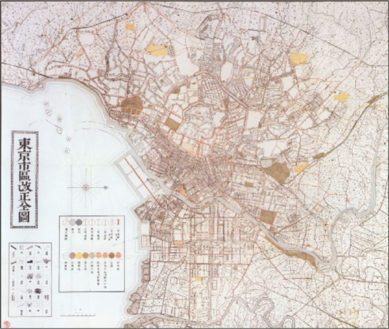
Tokyo urban improvement (old) plans 1889 (Tōkyō Shikukaisei Zenzu, 1889).
Construction and paving methods employed in the Tokyo Urban Planning projects reveal how planners applied Western techniques as they surgically improved existing streets to produce urban spaces that would be both commercially prosperous and aesthetically pleasing. Work on street improvements commenced in 1888. Projects for the most part consisted of widening, straightening, and paving existing streets according to their designated class to alleviate traffic and improve commercial circulation. The projects detailed in Figures 3 and 4 are typical examples of this effort to make streetlines more uniform, eliminate traffic bottlenecks, and provide better access to bridges. This entailed the expropriation of necessary street-front properties and the removal of obstructing buildings to clear land for the new roadbeds. Procedures for the acquisition of private property were set by law in 1889, designating the Home Minister as final arbiter of purchase price in case of disagreements between the landowner and the Tokyo government. As Suzuki and Ishida have demonstrated, this law was based on the 1852 décret that cleared rights-of-way for Haussmann’s famous Parisian boulevards. 111 Of the nearly 38.3 million yen spent on the Tokyo Urban Improvement projects, street improvements alone consumed approximately 26 million yen. Of this, 24.5 million yen went to the purchase of land and the removal of existing structures, with the remaining 1.5 million yen funding actual construction. 112 Once rights-of-way had been secured, creation of the modern streetscape could begin. First laying subterranean sewer and water pipes where called for, workers paved street surfaces either in crushed stone (saiseki) using an adaption of the Telford and Macadam paving techniques, or in “normal gravel” depending on road class. 113 Only then were sidewalks, drainage ditches, and roadside trees installed as stipulated in the plans. 114 When increasing financial difficulties threatened to disrupt the projects, the Improvement Committee responded by identifying the improvements requiring immediate completion in the New Tokyo Urban Improvement Plans (Tōkyō Shiku Kaisei Shin-sekkei) in 1903. In effect, this New Plan was a dramatic scaling-back of the Old Plans to expedite projects. As a result, the number of roads designated for improvements was reduced from 316 in the Old Plans to eighty-six in the New, river and moat improvements from thirty to only seven, and parks from forty-nine to twenty-two, while the overall land area of markets, crematoriums, and cemeteries changed only slightly. Thirty-seven roads were later added, raising the grand total of roads improved through the Tokyo Urban Improvement projects to 123. 115 In all, 123 streets were improved, totaling approximately 109 miles. 116 Almost 50 miles of sidewalks and 6,448 roadside trees to “garnish the beauty of the city,” meanwhile, were installed by the end of the Meiji period as a result of the projects. 117
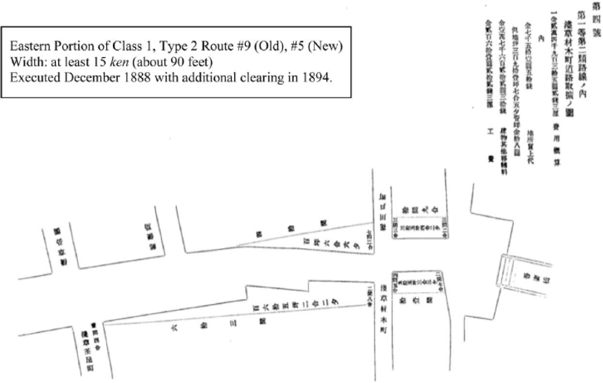
Azumabashi Bridgehead Project 1888 (executed December 1888 with additional clearing in 1894).
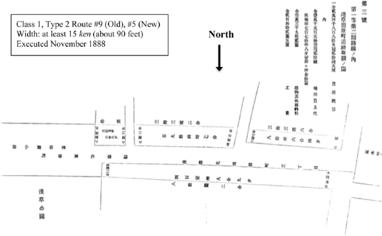
Asakusa Tawaramachi Project 1888 (executed November 1888).
Amid more pragmatic, transportation-focused modernization of the existing built environment, the Tokyo Urban Improvement Committee did not fail to produce monumental sites designed to project Japanese power. This was accomplished by shaping the street network to accentuate strategically placed monumental structures, producing opulent urban design on a smaller scale. Two vivid examples of this can be seen in the choreographed road layouts of the Imperial Palace Outer Gardens and the entryway to the Akasaka Detached Palace, both of which were implemented under the aegis of the Tokyo Urban Improvement Committee (see Figure 5). One site in particular that deserves a closer look was the space framed by the axial boulevard linking the imperial palace to Tokyo Station. Today, this boulevard is officially registered as Special Road 404, but known colloquially as “Imperial Progress Boulevard” (Gyōkō Dōri). 118 Planning for this space began as early as the 1884 Urban Planning Statement, when Governor Yoshikawa called for a new railway link through the city center and a new central railway station. Reflecting the concerns of planners in the 1880s, the purpose and location of the envisioned “central station” were entirely commercial. Not only was the station to be located immediately to the West of the thriving central commercial areas of Nihombashi and Kyōbashi, the proposed site was government-owned property that could be acquired at little to no cost. Placing the central station in this area, therefore, would be a cost-effective way to construct a commercial depot to service the business areas to the East. As architectural historian Terunobu Fujimori points out, there did not seem to be a connection between the central station, Marunouchi as a business district, and the imperial palace at the time planning commenced. 119 Indeed, the first Western-style buildings of the nearby Marunouchi “One Block London” were not completed until 1894. Before being sold to the Mitsubishi Corporation four years earlier, in fact, Marunouchi was nothing more than a vacant army parade ground overgrown with weeds. 120
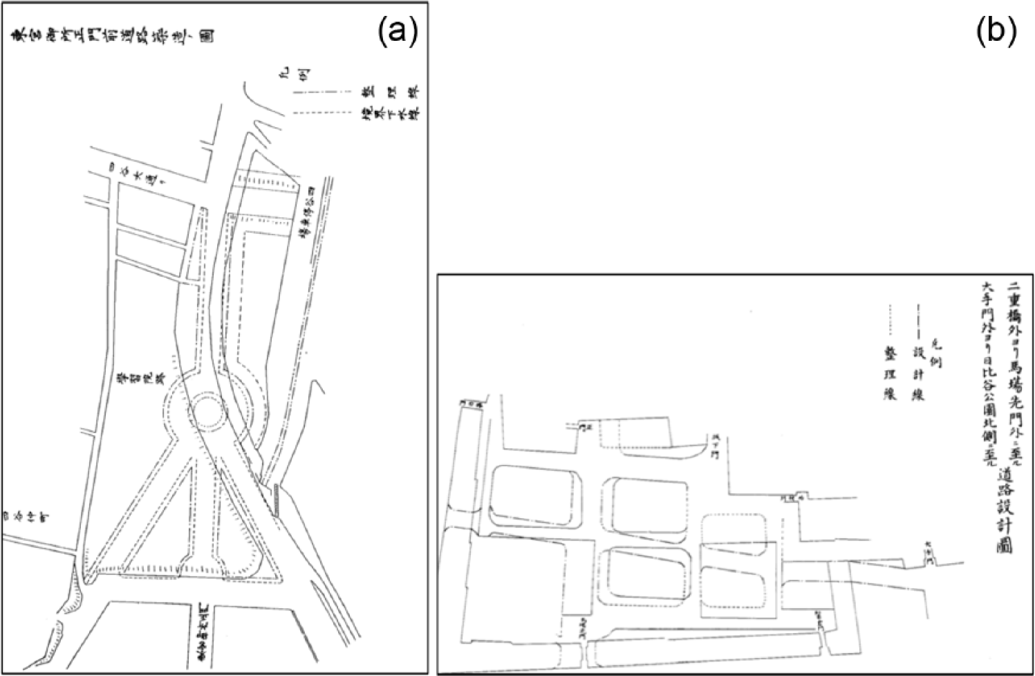
Monumental urban design in Tokyo: (a) 1909 Tōgū Palace (Akasaka Detached Palace) main gate road widening project (approved March 1909); (b) 1905 Nijūbashi-Babasakimon and Otemachi-Hibiya Park road widening projects (executed March 1905).
As Tokyo became a capital of both emperor and empire following victories in war against China and Russia and the acquisition of Japan’s first formal colony of Taiwan, planners began to see the need for a symbolic space at the heart of the imperial capital. This new view of Tokyo impacted the design of both the central station and the surrounding space. With the station’s new imperial roles in mind, the government desired a building that would make a suitable architectural statement and turned to the most prominent Japanese architect of the Meiji period, Tatsuno Kingo. Hired in 1903, Tatsuno replaced Franz Baltzer, a German engineer who had been hired earlier to design the elevated urban railway leading to the station. According to Tatsuno’s recollections, Baltzer’s designs did not fulfill the Japanese government’s desires for an appropriately modern and monumental station for the Japanese imperial capital. As Tatsuno later wrote,
It appears that [Baltzer’s original plan] was not for a long, continual building as it is now, but . . . rather to line up individual buildings along the railway line. But that is nothing more than lining up small houses, and was said to be too shabby (misuborashii) for the central station of the Imperial Capital (Teito).
Tatsuno was therefore instructed to design a more magnificent station. “I received a request from the head of the Railway Operations Bureau at that time, Hirai [Seijirō],” Tatsuno recalled, “to make the building continuous and to emphasize the magnificence of the building.” 121 Clearly, Hirai and Tatsuno understood the symbolic importance of the building that would become Tokyo Station. Hirai, for one, was a classmate of Haraguchi Kaname’s at the Rennselear Institute in Troy, New York. 122 Tatsuno, for his part, knew that a grand capital city needed a grand central station, writing: “All of the great cities of Europe,even London, even Berlin; they all have central stations.” 123 In addition to instructing Tatsuno to design a fittingly Western-style station, the government also ordered the building plans to be expanded to match the increasing importance of the expanded Railway Agency as it took control of 90 percent of railway trackage in Japan following the nationalization of seventeen private railway companies between the years 1906 and 1907. 124 Consequently, two significant changes were made to the existing station plans even after the commencement of foundation work in 1908. First, because the station would serve as the Railway Agency headquarters, it was necessary to build a station large enough to accommodate the required office space, not to mention reflect the Railway Agency’s importance as a cabinet-level department in charge of railways stretching across the empire. For this reason, as Tatsuno described, plans for the station, which had at first only been one story, were expanded to two floors, and then later to three. Second, as the size of the station expanded, so too did its construction budget. From an original estimate of ¥420,000, the cost of the building soared over 600 percent to a final price of ¥2,800,000. 125
As the magnificence of the station building design intensified, so too did the monumentality of the surrounding streetscape. Notably, these monumental street plans came not from the imperial government, but from local planning forces in the Tokyo Urban Improvement Committee, which after 1898 was split equally between Tokyo representatives and central government officials. 126 Through a series of plan changes, streets around the station were redesigned to form a large station-front public plaza (hiroba) and processional boulevard leading to the palace. Planning for the Tokyo Station plaza began as early as 1897 when planners removed plans for a road to bisect the station grounds, leaving the resulting space as a plaza that was later enlarged in 1913. 127 Designs for the processional boulevard date to 1908, when the Improvement Committee approved a motion by newly appointed member Aki Toratarō to nominate a special committee to propose additional routes to the New Tokyo Urban Improvement Plans. 128 When the nine-member Road Planning Enquiry Committee reported their recommendations two years later, one of the included routes was a ceremonial link between the Imperial Palace and the planned central station (see Figure 6). Not surprisingly, the stated purpose of this route was to enhance the monumentality of the station. “With the growth of the Imperial Capital, there are many unsatisfactory parts of the current Urban Improvement Plans,” Improvement Committee Executive Secretary (kanji) Toki Kahei explained the route selection. One in particular was “the lack of a road leading to the central station.” 129 Unanimously approved by the Improvement Committee, this route was added to the New Plans with a length of 121 ken (~720 ft.) and a width of 40 ken (~240 ft.), making it the widest street in Tokyo. 130 Construction of this new axial boulevard commenced from December 1911, just months after the construction of Tokyo Station got underway. 131
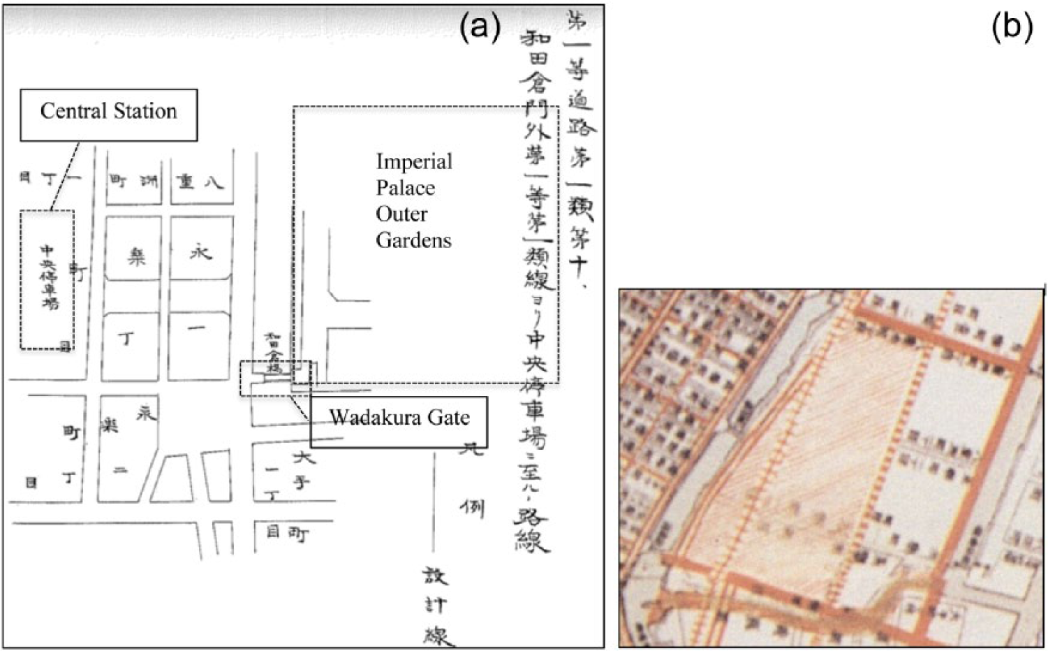
With a ceremonial station-front plaza matching its monumental Western architecture, Tokyo Station capped an urban space that united railways, architecture, and urban planning to project imperial power when opened in December 1914. Through both its function as a railway depot and its Western “Renaissance”-style façade, Tokyo Station symbolized modernity and civilization. As a product of the Tokyo Urban Improvement projects and situated within a monumental streetscape, meanwhile, Tokyo Station tied the national railway network to the urban fabric of the city. As the personal train station of the emperor, moreover, Tokyo Station embodied the emperor system. Not only did it directly face the imperial palace, but also the station’s ornately decorated central pavilion was reserved for the imperial family. If the two symbols of progress in Meiji Japan were the monarch and the locomotive, they were conjoined in Tokyo Station. 132 The urban space framed by Tokyo Station and its surrounding streetscape, thus, symbolically linked the various mechanisms of Japanese modernity and power: the emperor system, railways, and the modern built environment.
Following the Ginza Bricktown, then, with the common goal of creating in Japan a grand capital like those observed in Europe, various urban planners in Tokyo attempted different approaches to improving the city. While Europeanizationists in the Foreign Ministry remained myopically focused on the haphazard imposition of a holistic European space on the city, Functionalist planners in the Home Ministry turned their attention instead to more pragmatic transportation and infrastructure improvement projects. Convinced that improved streets and fluid mobility would lead to the commercial prosperity required to make Tokyo into a grand capital, these Functionalist planners emphasized street improvements as the foundation of increasingly comprehensive urban reforms over the course of the Meiji period. This focus on transportation in Meiji period was therefore not merely a systematic public works program, nor did it indicate a lack of imperial symbolism. Rather, the consistent focus on transportation was a pragmatic approach to urban improvements in line with current international planning trends carried out in constant recognition of Tokyo’s role as the imperial capital. Moreover, as the example of Tokyo Station shows, the adaptive planning system developed over the course of the Meiji Period could be deployed to produce spaces heavy with imperial symbolism and power. This focus on flexible street improvements was in turn carried to Seoul as Japanese colonial planners in Korea followed the model of the Tokyo Urban Improvement Projects to recreate Seoul as a modern colonial capital.
Case Study 3—Street Improvements in Colonial Seoul
More than twenty years after the Tokyo Urban Improvement projects moved from the planning table to the construction site, Japanese colonial authorities in Seoul, or “Keijō” as the city was renamed by Japan, announced the first of what would become two phases of street improvements carried out by the Government-General of Korea. As in Meiji period Tokyo, these street improvements were undertaken in an attempt to produce “Japanese” spaces that would project Japanese power by constructing “colonial difference.” 133 This meant not only the building of “modernity” but also the destruction of the “primitive” to emphasize the rupture between colonizer and colonized. “It is said that if we are to build a new age here in Korea, then the present must be destroyed,” wrote Tokyo Imperial University professor of ancient history Kuroita Katsumi in 1922. “But even that destruction is done for the purpose of creation.” 134 Just as early Meiji Japanese planners had approached the Ginza Bricktown project in Tokyo as an opportunity for the Meiji government to differentiate itself from the Tokugawa Shogunate, Japanese planners would now use “creative destruction” as a tool in the colonies. 135 For Japanese colonial planners, the built environment was the most visible “mark” of colonial difference. Streetscapes of straight, paved, and clean thoroughfares outfitted with sidewalks, sewers, and roadside trees, it was believed, would join with Western architecture to frame modern urban spaces that dramatically contrasted with surrounding areas not yet improved. To Japanese planners who saw street conditions as the barometer of civilization, it was so-called “culture streets” (bunka dōro) and “civilized cities” (bunmei toshi) that would convey Japanese cultural hegemony in both Taiwan and Korea. 136 Colonial planners searching for lessons to inform the refitting of Seoul, in particular, had to look no further than the imperial capital, Tokyo. Accordingly, rather than building an idealized colonial “New” city on the outskirts of the vernacular city, colonial planners created imperial space in Seoul by surgically modernizing the built environment of the existing city from the inside out. The debt these programs in Seoul owed to the earlier projects in Tokyo underlines how planning concepts flowed from Japan to Asia as Japanese colonizers manipulated the urban space of Seoul to solidify colonial rule through the projection of Japanese power in built form. After placing the modernization of Seoul in the context of colonial public works in the peninsula, this case study will demonstrate how the urban improvements of Tokyo provided the model for street improvements in Seoul. As a result of connections between the bureaucratic planning personnel and the educational background of civil engineers in both cities, the Seoul programs exhibited striking conceptual and technical parallels to the Tokyo projects. Once in Seoul, colonial planners employed the same pragmatic planning system developed in Tokyo as they adapted their plans to fit the existing street layout to create imperial space.
The improvement of Seoul was only one part of a massive peninsula-wide engineering and public works program intended to legitimize Japanese colonial rule, while militarily consolidating, politically centralizing, and economically integrating Korea into the expanding Japanese empire. The years following the annexation of Korea in 1910 saw Japanese engineers carry out a number of public works projects aimed at advancing Japanese claims to ownership and control of colonial space: expansion of the railway network, restoration of rural highways, improvement of rivers, construction of ports, redevelopment of major urban centers, and the laying of water and sewer systems among others. As Ambe J. Njoh has argued, such public works projects “were necessary to broadcast the authority and power of the colonial state over the colonial subjects.” 137 By executing projects that would make colonial territory “ordered, sanitized, and amenable to regulations, and structured to enhance the flow of economic activities such as trade and communications,” Brenda Yeoh explains, colonizers structured the built environment to “facilitate colonial rule and express colonial aspirations and ideals.” 138 Similarly, William C. Bissell notes that colonizers embraced scientific and sanitary urban planning as a way to legitimize colonial rule, while also satisfying the ideological and material needs of the imperializer. 139
For Japanese colonizers, public works were meant to fulfill several goals: (1) to justify Japanese rule by asserting ownership of colonial territory through exploitation and improvement of the environment, both natural and built; (2) to garner acceptance and approval of Japanese colonialism from the colonized Koreans, the Japanese expatriate community, and Western imperialists by demonstrating Japanese cultural hegemony; and (3) especially in the case of Seoul, to announce the arrival of the new Japanese colonial regime and concretize the transition of rule by juxtaposing the urban modern with the vernacular “pre-modern.” Giving projects a level of nationwide planning impossible in Japan even in the early Meiji period, public works in Korea were planned by the Civil Engineering Council (Doboku Kaigi) established within the Government-General by Imperial Edict just one month after annexation in 1910. This committee appears to have been modeled on the similar Public Works Council (Doboku-kai) created within the Japanese Home Ministry in 1892 to plan nationwide maritime and riparian improvements. 140 In the case of the Civil Engineering Council in Korea, however, the Council’s purview was extended to “the inquiry and deliberation of the systems (seido), planning (keikaku), and provision (setsubi)” of public works across the entire peninsula, including “rivers, roads, harbors, navigational beacons, railways, light railways, tramways, power supplies, and water and sewer systems.” 141 The urban improvement of Seoul was a major component of this peninsula-wide effort to project Japanese power in colonial space. Of the forty-three items covered by the Council before 1923, twelve concerned the Government-General’s plans for improving the built environment of the colonial capital. 142
Continuities in the bureaucratic planning structure of urban improvements in Tokyo and Seoul, and the educational background of the civil engineers doing the construction work in both cities, resulted in pronounced parallels between the metropolitan and colonial projects. At the bureaucratic planning level, the presence of Yamagata Isaburō drew a direct line from the Iwakura Mission, through the Tokyo Urban Improvement Projects, to the Keijō Urban Improvement projects. The nephew and adopted heir of Yamagata Aritomo, Yamagata had traveled to Europe as a member of the Iwakura Mission and stayed on for an extended study-abroad in Germany. Upon returning to Japan in 1882, he held a number of central government and prefectural positions before transferring to the Tokyo municipal government in 1893. While there, Yamagata applied his knowledge of Western cities to the improvement of the Japanese capital as chief of the municipal Home Bureau (Naimu-bu) and as a member of the Tokyo Urban Improvement Committee (Tōkyō Shiku Kaisei Iinkai) for over a decade from 1893 to 1906. Yamagata finally served as chairman of the Improvement Committee from 1902 to 1906, before leaving to take office as minister of communications in the first Saionji cabinet. Shortly before the annexation of Korea in 1910, Yamagata was appointed vice-resident-general (Fuku-Tōkan) of Korea. Following the annexation, Yamagata was promoted to administrative superintendent (Seimu Sōkan) in the Government-General, which put him effectively second in command of the Japanese colonial administration in Korea from 1910 to 1919. 143 Solidifying the bureaucratic link between street improvements in Tokyo and Seoul, one of Yamagata’s primary duties as administrative superintendent was to sit as chairman of the Civil Engineering Council. During Yamagata’s tenure, the Council deliberated Seoul street improvements six times, including each of the Government-General’s projects. 144
Bureaucratic continuities between Tokyo and Seoul urban improvement projects were buttressed by strong ties between metropolitan engineering schools and colonial worksites as engineers trained in Japan were shipped to Korea to carry out projects planned by the Civil Engineering Council. Several Japanese engineers in fields such as architecture, agriculture, forestry, fisheries, and mining had been appointed to either the Korean government or to the Residency-General in the years prior to annexation in 1910. During this time, only one, 1882 Tokyo University graduate Nagahara Teisaburō, was appointed specifically for civil engineering. 145 Testifying to the importance of public works projects in Japan’s colonial strategy, however, the number of Japanese civil engineers in Korea increased dramatically following annexation. In 1912, for example, 169 civil engineers (gishi) and assistants (gishu) were assigned to the Government-General for “surveying architecture, public works, and government properties .” 146 From that point forward, the Government-General public works authorities consisted of, on average, as many as 20 or more engineers and nearly 150 engineers assistants spread across civil engineering and maintenance sections, and local offices. Archival records indicate that, like Nagahara, many of these engineers were trained in the Japanese civil engineering educational system, especially at Tokyo and Kyoto Universities. The History of Civil Engineering Projects in Korea (Chōsen Doboku Jigyōshi) published by the Government-General in 1937, for example, lists all past and present personnel related to all sections of the Government-General Public Works Bureau as of 1928. Included in this list is twelve engineers (gishi) stationed in the Government-General Civil Engineering Keijō Branch Office, which was established in 1914 to carry out government-sponsored engineering projects in Seoul. Of these twelve, over half (seven) had graduated from either Tokyo or Kyoto Imperial Universities. 147 This is significant because not only was the engineering education students received at these schools based on the Western engineering tradition of William Rankine and Henry Dyer, but also fifth- and sixth-year civil engineering students at Tokyo Imperial University received their practical training apprenticing on local road, river, and railway construction projects around Tokyo. 148
Arriving in Seoul, Japanese engineers found a city that had already undergone several urban reform projects carried out by either the Korean court or Japanese expatriates living in the city. As Todd Henry has described, in an attempt to “re-create the royal city of Hanyang into an ‘imperial capital’,” the Great Han Empire had cleared stalls impeding the city’s main thoroughfares, installed new roads, and constructed several monuments. 149 Another series of improvements was carried out by the Japanese Settlement Assembly (Kyoryūchi minkai)—later called the Seoul Resident’s Association (Keijō Kyorūchimindan)—who had voted to levy a tax to fund street repairs in the settlement as early as 1895. Improvements continued in 1901, at which point, according to a 1912 history of the Association, “the Settlement for the first time began to look like a Japanese village (machi).” 150 Jun Uchida points out that this had been the point of the president of the organization, Nakai Kitarō, who had envisioned building two-storied brick houses “just as the Meiji state had done along the streets of the Ginza.” 151
Nonetheless, planners in the colony tried to justify Japanese improvements by exaggerating the poor state of urban areas in Korea and the need to hasten Korean progress. In doing so, they echoed the discourse of their urban improvement predecessors in the metropole. As the aforementioned official History of Civil Engineering Projects in Korea recorded, for example,
[In] the urban areas of Korea, as a rule, the streets are narrow and excessively winding, making the city blocks even more irregular; not only do they cause many hindrances in transportation, hygiene, and fire prevention, but they also cause many impediments in the development of the urban area.
152
Likewise, the “great inconvenience to communications, and sanitary and fire-brigade arrangements” posed by the “narrow, dirty, and crooked streets” of Korean cities was a common theme in the Government-General’s Annual Reports.
153
Planners also tied the improvement of streets to the development of civilization. A 1922 Government-General report, furthermore, asserted that urban planning was necessary in Korea because of its “current low level of civilization (kaimei)” and the need for “comparatively rapid future development.”
154
Later, the Government-General elaborated that street improvements were necessary because Korea was “still in the first stages of modernization in many ways” and “nothing [was] more keenly required” to “forward the sound development of a Korean town.”
155
Improving streets in Seoul in particular was seen as imperative for producing the commercial efficiency and modern appearance expected of the colonial capital. “Most of the streets, even in the city of Keijo [sic], the capital,” the Government-General lamented in 1912, “developed very irregularly, so that great inconvenience has hitherto been felt in street communications and sanitation.”
156
A 1935 Civil Engineering report went further: “Because of the outdated transportation system, the urban streets within Keijo, as seen in the back streets of the northern parts of the present-day city, are meandering and narrow, as if they were mazes.”
157
Engineer Iwamiya Noboru, meanwhile, tied street improvements to urban aesthetics, speaking in familiar terms,
because the streets in traditional Korean cities for the most part lacked any order and were so crooked, and their widths so narrow, they were so inconvenient that we could simply not leave them in that condition for the sake of [Seoul’s] transportation, hygiene, security, and appearance.
158
Clarifying that “Keijo [sic], the capital, was no exception” to the “miserable state in which most Korean towns were before the Japanese authorities took in hand the improvement or reconstruction of their streets,” the Government-General explained that street projects in Seoul were intended to “set an example to other towns.” 159
Setting to work in Seoul, Japanese colonial engineers drew on their metropolitan training and experience as they drafted and carried out street improvements to project Japanese power throughout the urban body. Over the years 1911 to 1937, the Government-General and Keijō Municipal Government carried out a series of concurrent street improvement. The most well known of these were the Keijō Urban Improvement (Keijō Shiku Kaishū) projects planned by the Civil Engineering Council and implemented by the Government-General over two phases between 1912 and 1929. Not only were the street widths of the Keijō Urban Improvement projects derived from the earlier Tokyo projects (see Table 1 ), 160 but engineers also used the same macadam paving techniques, 161 installed sidewalks, 162 and planted roadside trees. 163 Glancing at the optimistic street plans drawn up by Japanese planners, it is clear they were products of the visionary planning typical of the colonial “laboratory.” Phase 1 of the Keijō Urban Improvement (see Figure 7), announced in November 1912, called for an opulent baroque-style grid network of streets traversing the entire city center, featuring radial boulevards focused on Hwangt’ohyŏn Plaza and “Kōganechō Plaza” located in the center of the southern Japanese residential area. 164 Phase 2, started from 1919, updated the total number of routes to be improved to forty-seven (see Figure 8). 165 Like the phase 1 plan, this second plan also laid out an elaborate grid network of streets cast over the city center. Although the monumental rotary plazas from the first plan were absent from this phase 2 plan, new radial boulevards accentuated the planned location of the future Government-General Headquarters Building directly in front of the historical Kyŏngbok Palace. The grid of broad boulevards, plazas, and rotaries envisioned in these plans vividly illustrate what Baek Yung Kim has compellingly called the Japanese “panopticonization” of Seoul. By creating wide urban plazas, Kim argues, colonial urban planners increased the legibility of the urban area, making it more visible to the imperial gaze. To evade this surveillance, Korean colonial subjects avoided these large plazas and instead traveled along older alleyways, especially in the northern, more traditional parts of the city. 166
Comparison of Tokyo and Seoul street widths.
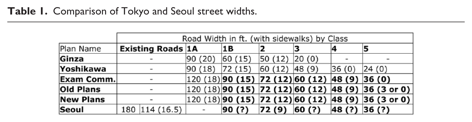


Phase 1 road map.
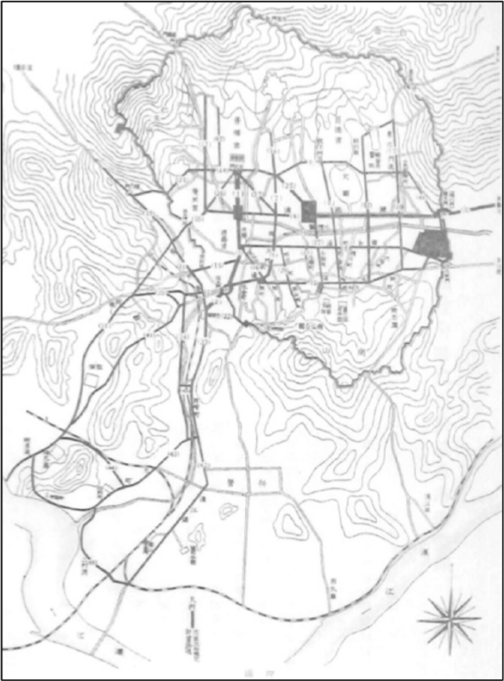
Phase 2 Government-General street improvement plans.
To be sure, Japanese manipulations of the colonial built environment in Seoul did not stop with major thoroughfares or plazas. Rather, the colonial municipal government supplemented Government-General projects by extending street repairs into backstreet areas with three phases of its own projects. First, municipal public works authorities took over execution of the Government-General’s projects after 1929. With subsidies from the National Treasury, the city completed just over 5 miles of ten uncompleted routes from the Government-General programs between 1930 and 1937. 167 Before this, the city had again used national subsidies to improve and pave 3.5 miles of eleven separate trunk roads, including the major east-west thoroughfares of Chongno Road, Kōganechō Road, and Meijimachi Road between 1924 and 1930. 168 Finally, spanning both of these projects, the municipal government used city funds to carry out sectional improvements and paving of nearly 20 miles of ninety-six older backstreets located largely in the southern half of the city from 1917 to 1937. 169 As one civil engineering report explained, “because these construction projects carry out sectional improvements in the especially unregulated backstreets of the old urban area, the results are remarkable.” 170 By carrying out the seemingly innocuous paving of Seoul’s backstreets, Japanese colonizers framed colonial urban space in an attempt to demonstrate Japanese modernity in even the illegible backstreets and the hardest to reach parts of the city. 171
Over the course of all of these projects between 1911 and 1937, Japanese colonial planners in the Government-General and municipal government worked in concert to complete the widening and improvement of a total of 141 streets in the city, for a total length of just over 42 miles, of which 128 acres was paved, lined by 21 acres of paved sidewalks, and shaded by over six thousand trees. 172 Upon completion, the Government-General frequently boasted that these streets improvements “[brought] about an extraordinary change in both the appearance and traffic efficiency of the city,” and “[added] one more step in the beautifying of the city and the convenience of traffic.” 173 The partial paving of the trunk streets in “tar macadam” and asphalt, especially, was said to “[add] to the modern aspect of the city.” 174
Improving “the modern aspect of the city” in the southern, Japanese half of the city especially, Japanese colonial planners attempted to create a Japanese enclave of urban modernity within the vernacular city. At one level, this was done to make Japanese expatriate settlers feel more at home by provided amenities to which they had grown accustomed in Japan. At a deeper level, however, the production of an organized, hygienic, and visibly “modern” Japanese space in the city was intended to assert Japanese cultural hegemony to the colonial population. Japanese planners programmed these spaces to announce that Japan not only had the power to modernize the built environment but also had a more advanced, civilized culture. Calculated juxtapositions between Japanese urban modernity and icons of the Korean “primitive” city, such as the Namdaemun, were designed to reinforce this hegemonic use of urban space.
As Japanese colonial planners designed hegemonic spaces, they molded their idealized plans to fit the existing built environment as much as possible. Consequently, Japanese colonial urban planning was hegemonic not only because it was meant to produce power or to normalize Japanese conceptualizations of modernity, civilization, and urban space, but also because it co-opted earlier improvement efforts and flexibly adapted to the existing built environment. It was through these pragmatic alterations that colonial planners were able to ensure the measured success of the project. The space produced was therefore imperial, both because it was designed to project the cultural hegemony of the Japanese empire, and because it was deliberately charged with imperial symbolism. A prime example of how Japanese colonial planners deployed a malleable frame of streets, architecture, and urban design to forge imperial space at the heart of the colonial capital is the rerouting of the city’s central axis and the placement of the Government-General Building constructed in 1926 at its head. For many, this is seen as the most egregious example of Japanese attempts to distort the urban space of Korea in an attempt to disrupt the geomantic spirits of the city and sever the spiritual ties said to link the Korean King Kojong to his people.
175
Undeniably, Japanese colonial planners designed this axial route as a space intended to project Japanese imperial power. At one end of the boulevard sat the administrative offices of the Japanese colonial government, placed directly in front of the historical residence of the Korean king, Kyŏngbok Palace. Although construction was not completed until 1926, the location for this building had been selected as early as 1912—the same year phase 1 of the Keijō Urban Improvement programs was announced.
176
The boulevard was therefore clearly designed from the beginning with the Government-General Building in mind. At the other end of the boulevard, meanwhile, sat another monument of Japanese colonial control over Korea: Seoul Station. For Japan, the boulevard connecting the Governor-General building and the Seoul railway station was a symbolic link between two icons of Japanese domination over Korea, the colonial administration and the railway network. Because this new route replaced Namdaemun Road to the East as the main north-south route through the city and linked various symbols of Japanese colonial power, it is often regarded as the symbolic center of Japanese colonial power in Korea. As Todd Henry argues,
[The] main north-south axis—beginning at the Kyongbok Palace grounds, passing by the entrances to Namsan’s Chosen Shrine and Seoul Train Station, and terminating at the military boom town of Yongsan—was thus aimed at consolidating Japanese control over the Korean neighborhood of Chongno and clearing the way for the efficient circulation of goods and people necessary to facilitate the imperial development of the city and beyond.
177
Map analysis shows that even this most striking of Japanese assertions of spatial power was the product of a flexible planning system whereby planners adapted plans to existing conditions. Rather than forcefully clearing whole neighborhoods to carve a brand new street through the existing built environment, Japanese colonial planners followed routes that already existed. In doing so, planners were not only able to pragmatically reduce necessary land purchasing costs, they were also able to ensure the measured success of the plans in practice. This can be charted in a series of period maps. Figure 9 is a detail of the 1-10,000 scale Complete Map of Keijō, Korea (Kankoku Keijō Zenzu) published by the Japanese-owned Keifu Railway Company in 1903. This map is valuable for providing perhaps the most detailed cartographic depiction of Seoul prior to the initiation of major Japanese street improvement projects. As this map shows, the route of the future central axis is roughly discernible in the existing street pattern. The only major deviation is the zigzag around the Kyŏng’un Palace (later renamed the Toksu Palace), which served as the Royal Palace of King Kojong at the time. Figure 10 shows a detail of the 1-10,000 scale map of Seoul published by the Government-General in 1917 based on a 1915 survey by the Government-General Cartographical Department.

Adapted from the Complete map of Keijō, Korea, 1903 (Kankoku Keijō Zenzu).
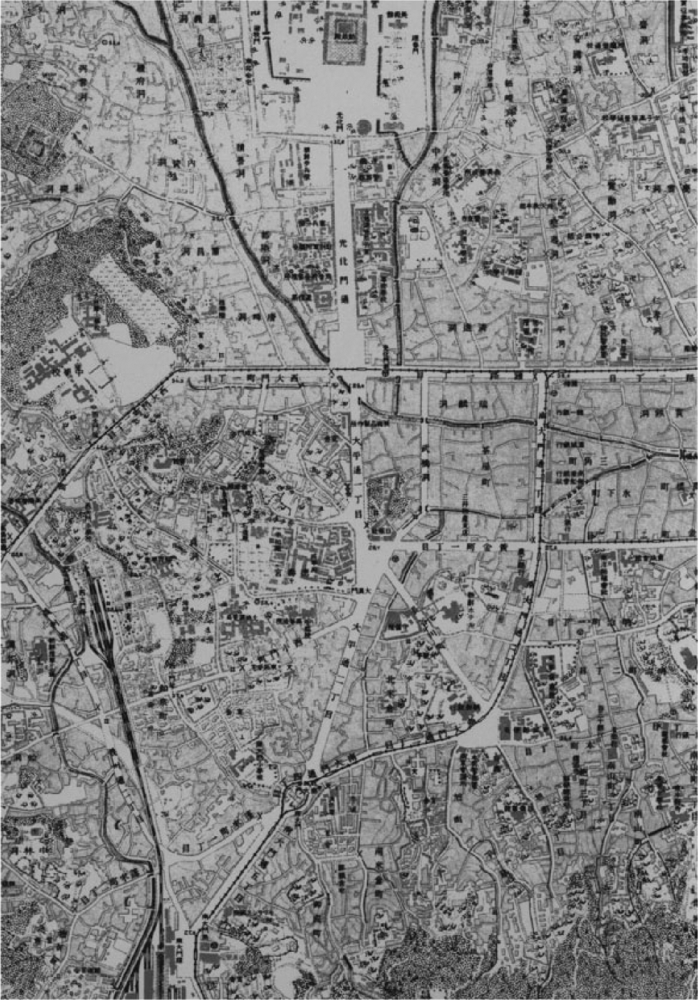
Detail of 1917 Government-General map of Seoul.
Comparing these maps reveals how the axial T’aep’yŏng Boulevard emerged from the existing built environment through a series of surgically executed projects. First, zooming in on the main southern entrance to the city, the Namdaemun, in Figure 11, we can see that the city walls on either side of the gate have been torn down, leaving the gate itself standing alone at the center of a newly constructed rotary. Japanese engineers attached to the Korean government carried out this project using Korean government funds starting in 1907. Because the existing route through the gate itself was only 3 ken (~18 ft.) wide and “the inconvenience and danger for transportation could not possibly be concealed any longer,” new 8 ken (~48 ft.) roads were constructed on both sides. The historical gate, meanwhile, was retained to “preserve the beauty of the city” (shigai no bikan wo tamotashime). 178 While the southern gateway to the city already had special significance as a result of the geomantic (China: feng shui; Korea: pungsu; Japan: fūsui) principles on which the city had been founded, now detached from the surrounding traditional city, the Namdaemun was repurposed as an isolated ceremonial archway into the city. As Gwendolyn Wright has argued, such dramatic embrace of vernacular built form in the colonial setting was often an attempt to justify colonial rule and limit popular resistance by “temper[ing] the disruptions” of modernity on colonial societies. 179 Likewise, as Chon Uyong has pointed out, such purposeful retention of “shabby” traditional structures juxtaposed to nearby modern buildings such as the Namdaemun train station served as a reminder of the transition of power while also encouraging the association of the new buildings with the old structures of power. 180 Solidifying this link between the old gate and neighboring Namdaemun Station, the existing road from the gate to the station was widened into a 19 ken (~108 ft.)-wide thoroughfare starting in 1910. 181 This juxtaposition between the traditional and the modern was magnified when the shoddy wooden building of Namdaemun Station was replaced by a new Western-style building in 1925. Designed by Tsukamoto Yasushi, a student of Tokyo Station architect Tatsuno Kingo, the newly renamed “Keijō Station” owed a great debt to Tatsuno’s trademark “Tatsuno Style” of red brick and white ornamentation.
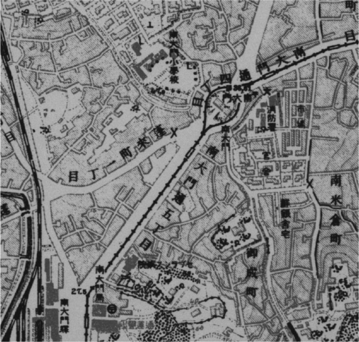
Detail of the Namdaemun from Figure 10.
Following the axis northward from the Namdaemun Gate along T’aep’yŏngno Road (Figure 13), we see that the road was widened to a width of 15 ken (~90 ft.) all the way up to Hwangt’ohyŏn Plaza at the intersection with Chongno. Moreover, the zigzagging pattern of the existing street was eliminated by carving out a portion of the Kyong’un palace, shaping the new Taehanmun Plaza from the confluence of the existing streets. Carried out from 1911 to 1913, this project was planned by the Civil Engineering Council as part of the phase 1 Provincial Road Project (Dai-ikki Jidō Jigyō) in an attempt to tie Seoul more tightly into the peninsular transportation network. 182 We can also see that a new reinforced-concrete bridge was erected over the Ch’ŏnggye River, and existing structures were removed to widen Hwangt’ohyŏn Plaza. The widening of the plaza, in particular, was done at the surprisingly low cost of ¥1,600, as compared with over ¥700,000 expended on just these 1911-1913 projects. 183 One explanation for these low costs may perhaps be drawn from earlier street widening projects carried out inside the Japanese Settlement in 1904. As the Settlement history records, “the cost of land and building purchasing was surprisingly only a small amount . . . naturally, it is said that police enforcement had a lot to do with this.” 184
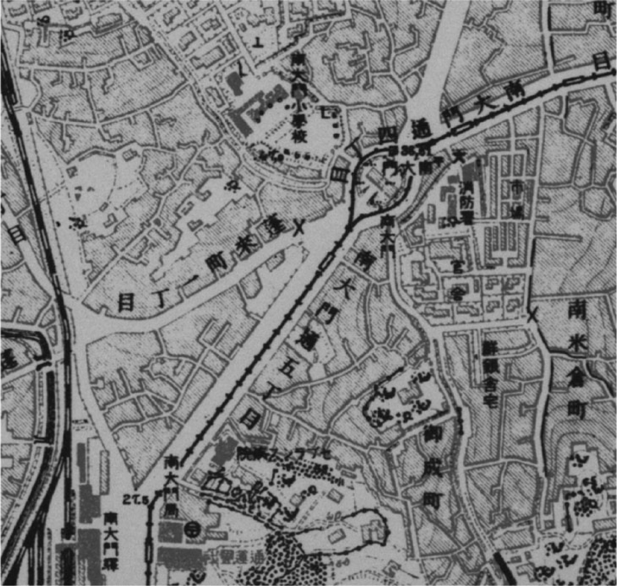
Detail of T’aep’yŏngno road from Figure 10.

Detail of Kwanghwamun street from Figure 10.
Finally, Figure 13 is a detail of the Kwanghwamun processional way extending northward from Hwangt’ohyŏn toward the Kyŏngbok Palace. The width of this route, already the widest street in Seoul at 30 ken (~180 ft.), was preserved when repaved by the municipal government over the years 1930 to 1931 as a continuation of the Government-General Keijō Urban Improvement projects. 185 As can be seen in this map, the historical Kwanghwamun Gate was removed, and the new Japanese Government-General Building was erected in its place directly in front of the former Kyŏngbok royal palace in 1926 (Figure 14). Rather than aligning the building with the slightly slanted layout of the original palace grounds, the building was situated perpendicular to the existing processional way. Construction office chief Fujioka Jūichi explained the basis of this alignment: “down the beautiful modern road, one can gaze the majestic appearance of the building.” 186 A similar reason was proffered by the Government-General: “aligning the location of the new Building to the center of the existing structures would be to deviate from the center line of the street facing the building, and would prevent appreciation of the magnificence of the building.” 187 Designed by architect Nomura Ichirō in the Edwardian Neo-Baroque style then popular in England, the building represented Japan’s image of its colonial self: the stout ferro-concrete exterior projected Japan’s firm colonial rule, while the palatial marble interior ornamentation attempted to overwhelm visitors with Japan’s heightened culture and modernity (Figure 15).
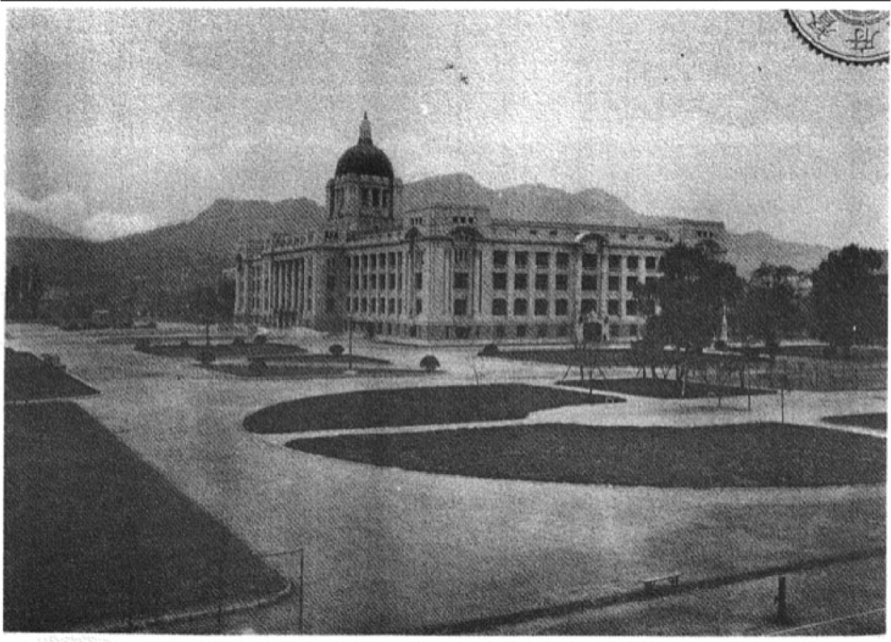
Government-General Building.
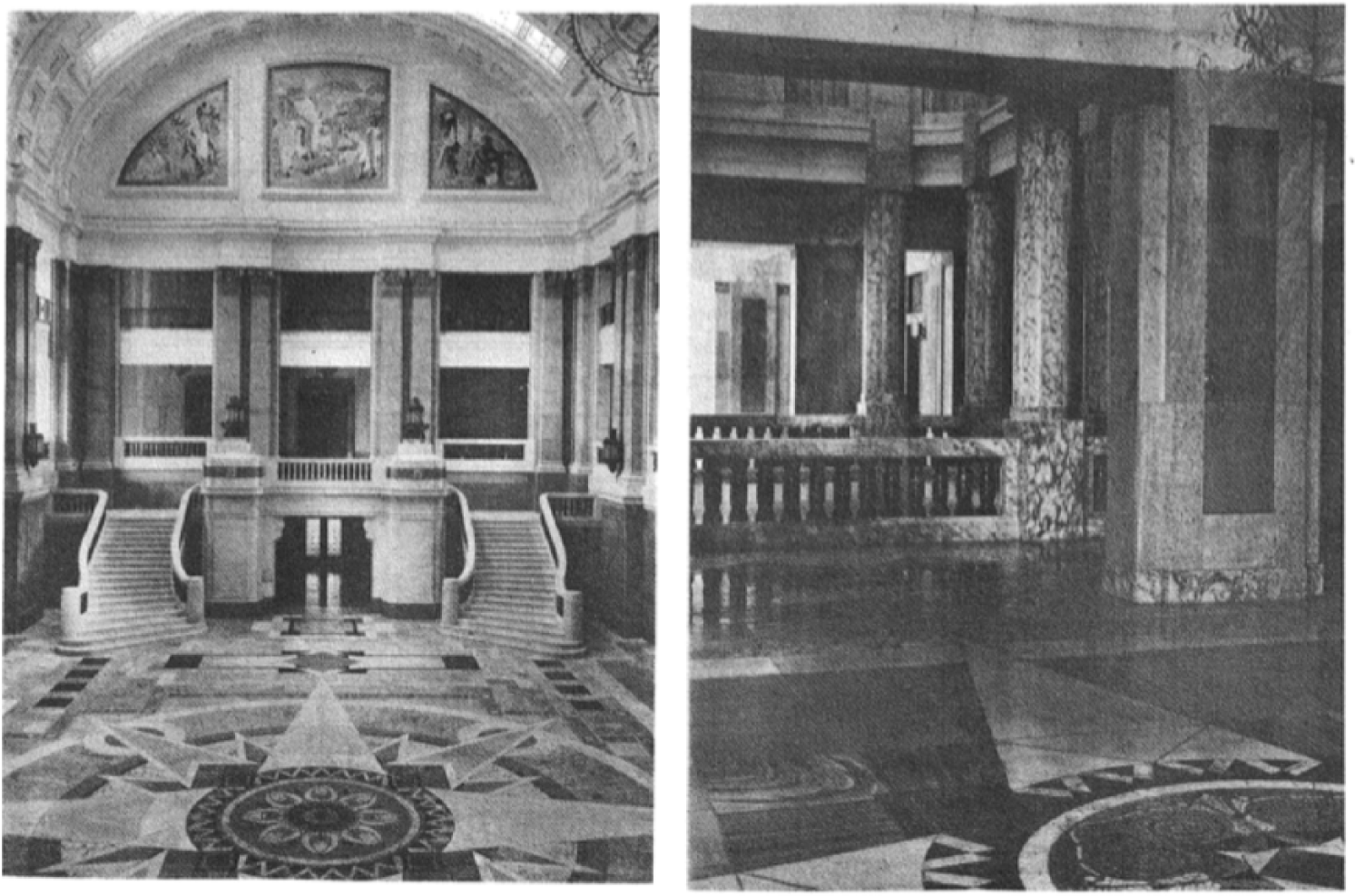
Government-General Building interior.
Built in a Western design and placed at the end of an axial boulevard that linked to Seoul Station and the Japanese-controlled railway network beyond, the Government-General Building capped an imperial space in central Seoul, coupling the physical power of the railway station to the political and ideological rule of the Government-General. As with the link between the imperial palace and Tokyo Station in the metropole, this axial boulevard in colonial Seoul united railways, architecture, and urban planning to project Japanese authority and imperial power. As the main station of the colonial capital, Seoul Station was the focal point of the X-shaped Japanese-controlled railway network cast over peninsula. In this regard, the station symbolized the physical control and economic integration Japan sought to achieve over Korea through the construction of railways. Located at the beginning of the axial boulevard, moreover, Seoul Station was the gateway to the colonial capital and the entryway to Japanese imperial space located at the heart of the city. Affirming the imperial symbolism of this space, the Government-General Building housed a throne for the Japanese emperor (see Figure 16).
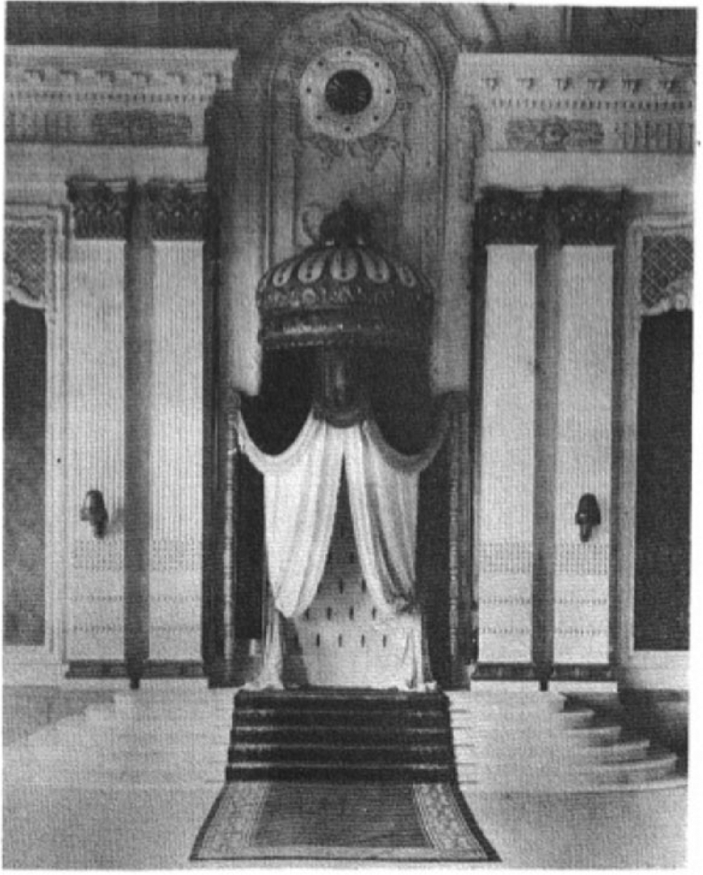
Throne room for the Japanese emperor in the Government-General headquarters building in Seoul.
The Japanese space framed by the Government-General Building and the axial T’aep’yŏng Boulevard took center stage as Japanese colonizers sought a wide audience for the display of colonial difference in built form by advertising urban improvement efforts worldwide with progress reports complete with photos staged to dramatically illustrate the success of their projects. The Keijō Urban Improvement Projects: 20 Years of Memories (Keijō Shikukaisei Jigyō: Kaiko Nijūnen) published by the Government-General Civil Engineering Office in Seoul in 1930 is remarkable in this regard as a 100-page portfolio of dramatically staged before-and-after photos aggrandizing the modern transformation accomplished by Japanese urban improvement programs in Seoul. To a similar end, colonial authorities published large numbers of reports and books starting from the beginning of the protectorate period in 1905 boasting of the success of their multifaceted reform efforts. The Government-General’s Japanese-language “Annual Reports” (Shisei Nenpō), for example, ostentatiously celebrated the success of Japanese-led reforms on the Peninsula, complete with illustrations, charts, and graphs.. Companion Annual Reports, and other texts, meanwhile, were published in English and distributed to libraries worldwide in an attempt to solicit support for Japan’s “mission civilisatrice” and to legitimize Japanese rule in the eyes of the Western imperialist audience. With titles such as Annual Report on Reforms and Progress in Chosen (Korea), Annual Report on Administration of Chosen, and Thriving Chosen: A Survey of Twenty-Five Years of Administration, these reports publicized Japanese-initiated reforms, especially urban improvements in Seoul and other cities. Bringing the global diffusion of Western urban planning concepts and techniques full-circle, these reports proudly displayed before-and-after photos of Seoul as a kind of show-and-tell of Western urban planning put to work in Korea (see Figure 17).
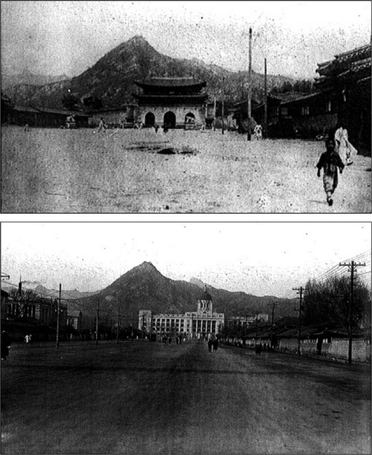
Japanese colonizers dramatically staged “before-and-after” photos such as these of Kwanghwamun street in 1905 (top) and 1930 (bottom) to popularize urban improvements in Seoul around the world.
Conclusion
When Yamazaki Naotane declared in 1885, “the urban improvements of Tokyo are the model for all cities in the empire, large and small,” he admittedly did not have Japanese-ruled Seoul in mind. Not even in his most grandiose visions of Tokyo as a Parisian-style imperial capital, perhaps, did he imagine Tokyo as the metropole of an overseas Japanese colonial empire. After all, at a time ten years before Japan acquired its first colony of Taiwan in 1895 and twenty-five years before the annexation of Korea in 1910, Yamazaki’s allusion to the entirety of the Japanese “empire” may have been nothing more than a splendid rhetorical flourish.
Yet, as the preceding discussion of street improvements in Meiji Tokyo and colonial Seoul suggests, Yamazaki’s apt description of the role of Tokyo vis-à-vis the rest of the empire proved prophetic. Setting about the recreation of Tokyo as the grand imperial capital, Teito, Japanese planners searched for Western planning and technical knowledge applicable to Japan. The lesson they learned from these observations was a conceptual connection between urban transportation infrastructure, commercial vitality, and prestige. Grand capitals, in other words, should not only appear modern in their built environment but should also be bustling with economic activity. Improving streets—by widening, straightening, paving, and installing sidewalks, gutters, and trees—held the key to making this happen. Thus when the wholesale transposition of a Western urban space in the Ginza Bricktown was unsuccessful, Japanese planners persisted with street improvement projects. It is also why street improvement projects continued to comprise the central element of Tokyo urban improvement programs throughout the Meiji Period. By providing a frame of improved urban streets, Japanese planners hoped to spark commerce and provide the infrastructure of modern urban space to make Tokyo the greatest capital in Asia.
When colonial planners arrived in Seoul tasked with redeveloping the city into a suitable colonial capital, they followed the model of street improvements in the metropole Tokyo. Borrowing the rhetoric of facilitating commerce and industry, and promoting civilization and enlightenment, colonial planners initiated street improvement projects that would improve transportation infrastructure while modernizing the urban space of the city. The technical aspects, moreover, of these projects in Seoul relied heavily on the precedent of the Tokyo projects. Just as in Tokyo, where the production of modern urban space was intended to establish Tokyo as a great imperial capital, street improvements in Seoul were meant to demonstrate the modernity and power of the Japanese empire. In this way Japanese imperial aspirations were articulated through Western concepts of urban planning and engineering that had been carried across the Pacific, and were then transmitted to Asia with Japanese colonialism.
Footnotes
Declaration of Conflicting Interests
The author(s) declared no potential conflicts of interest with respect to the research, authorship, and/or publication of this article.
Funding
Research for this article was made possible by generous financial support from Fulbright IIE, the University of Oregon, Bowdoin College, and the Kobe College Corporation.