



Abstract
Eads (33Ct750) is a recently discovered Hopewell hilltop earthwork, which encloses ∼10 ha above the Bares Run-O’Bannon Creek-Little Miami River confluence area. Eads falls within the interquartile size range of other Ohio Hopewell earthworks. Like the nearby Foster's enclosure, Eads is a sub-meter earthwork with a single pronounced east-to-west berm, > 70.0 m in length and > 5.0 m in height. The peak of promontory aligns with the center of the Goodnough-Brock mound (33Ct751) at a compass direction of 300o, the summer solstice sunset azimuth for the Middle Woodland cultural period. The archeoastronomy alignment and artifacts recovered from a pedestrian survey and test excavations suggest that the Eads hilltop earthwork was designed, built, and used for ceremonial purposes.
Introduction
This paper presents the recent discovery of the Eads (33Ct750) Hopewell hilltop earthwork and the Goodnough-Brock mound (33Ct751). The area enclosed by Eads is compared to the size of other Ohio Hopewell hilltop earthworks. An archeoastronomy alignment between the two sites is examined along with the results of a pedestrian survey and test excavations to suggest the cultural purpose of the earthwork design.
Cultural context
Hopewell is an archaeological cultural complex named after a Middle Woodland cultural period archaeological site on the farm of Mordecai Hopewell. James B. Griffin (1967) noted that Algonquian Native American tribes are the direct descendants of the Hopewell. Like contemporary Algonquian tribes, all mtDNA haplogroups (i.e., A, B, C, D, X) can be found among the Hopewell (Mills, 2003; Pritchett, 2013; Tankersley and Tench, 2009). The Hopewell archaeological record, which dates between ca. 100 BCE and 400 CE, includes monumental landscape architecture, the largest geometric earthen enclosures in the world, intricate water management systems, massive burial mounds, and extensive ceremonial centers (Brose and Greber, 1979). Caldwell (1964) defined a Hopewell social interaction sphere on the basis of distinctive symbols, artwork, and exotic goods, which have been traced from unprecedented continental distances of more than 2400 km.
The geographic breadth of the Hopewell Interaction Sphere suggests a widespread social network, which spanned from the Atlantic Ocean to the Rocky Mountains and from Canada to the Gulf of Mexico (Beyers and Wymer, 2010). The geographic and temporal distribution of Hopewell archaeological sites are associated with a stable and sedentary society with a political hierarchy (Greber, 2003). The greatest concentration of Hopewell archaeological sites occurs in the Ohio River valley located along the tributaries of the Scioto and the Little and Great Miami rivers (Beyers and Wymer, 2010; Brose and Greber, 1979).
Archaeological investigations of Hopewell archaeological sites began in the eighteenth century and increased dramatically during the late nineteenth and twentieth centuries (Brose and Greber, 1979). During this time, archaeologists focused their excavations on large clusters of burial and effigy mounds and geometric earthworks constructed on late Pleistocene terraces and floodplains. While hilltop earthworks were documented in the Little Miami River valley during this period, they did not attract the same attention as large concentrations of burial mounds and their funerary objects. With the exception of Fort Ancient, hilltop earthen architectural features have been largely ignored by archaeologists and their role in the Hopewell cultural complex remains poorly understood (Coon, 2008). Their function, purpose, and role remains in question.
Archaeologists have offered a variety of explanations for the construction and use of Hopewell hilltop earthworks. Prevailing theories include their use as ceremonial centers, defensive fortifications, and hydrologic systems. The ceremonial center theory suggests that the area enclosed by hilltop earthworks were sacred places used for ritual and mortuary activities. In this regard, they would have been places where seasonal communal gatherings took place and goods were ritualistically exchanged or gifted (Weinberger, 2006). Alignments to cycles of the sun (i.e., solstices and equinoxes) and the moon (e.g., standstills) demonstrate that the architectural features of hilltop earthworks provided Ancestral Algonquians with a predictive astronomy, which would have been crucial to the timing of seasonal ceremonies and rituals (Romain, 2000, 2015).
The defensive fortification theory suggests that earthwork enclosures were strategically located on hilltops as protected places of refuge during times of warfare (Prufer, 1968; Squier and Davis, 1848). This theory assumes that there was an ideological and social breakdown of the Hopewell Interaction Sphere, which resulted in armed conflict from an immigration of another culture into the Ohio River valley (Prufer 1964). The problem with the defensive fortification theory is that hilltop earthworks are not well suited to defensive purposes and there is no direct positive evidence that the enclosures were ever intended for use as protective refuges (Coon, 2008; Riordan, 1996, 1998; Romain, 1996). Also, Hopewell hilltop earthworks appear at the beginning, rather than the end, of the Middle Woodland cultural period (Coon, 2008).
The hydraulic systems theory suggests that hilltop earthworks were highly engineered landscapes that allowed Ancestral Algonquians to manage renewable water resources (Connolly, 1995; Tankersley and Balantyne, 2010). In this scenario, Hopewell hilltop earthworks were constructed by reshaping the natural contours of bluff tops, which allowed water to flow from gravity-fed drainage ditches into reservoirs created by earthen and log dams built across natural ravines (Tankersley and Balantyne, 2010). Dams were built on steep-sloping catchment basins, which captured seasonal groundwater, precipitation, and surface runoff before it had a chance to percolate through the subsoil. While well-defined Hopewell hydraulic features have been documented at Miami Fort in Hamilton County, Ohio (Tankersley and Balantyne, 2010) and Fort Ancient in Warren County Ohio (Connolly, 1995), they are not present at all hilltop earthworks. Also, the presence of water management systems does not preclude the possibility that they were constructed for ceremonial purposes.
Geologic setting of the Eads earthwork
Eads is a hilltop earthwork located in the glaciated region of Ohio River valley. The earthwork is situated on a ridgetop overlooking the Bare Run-O’Bannon Creek-Little Miami River confluence area (Figure 1). It is underlain by a deeply weathered, pre-Wisconsin, glacial drift, which is composed of clay and erratics. The Illinoian till plain is deeply leached, poorly drained, and weakly fertile because it has been exposed to weathering since the beginning of the Sangamonian interglacial ∼125,000 years ago (Potter, 2007). The till plain deposits are deeply eroded into Upper Ordovician, Cincinnatian Series limestones and shales (Meyer and Davis, 2009). The valley walls below the earthwork are steep and exceed 130 m in height.
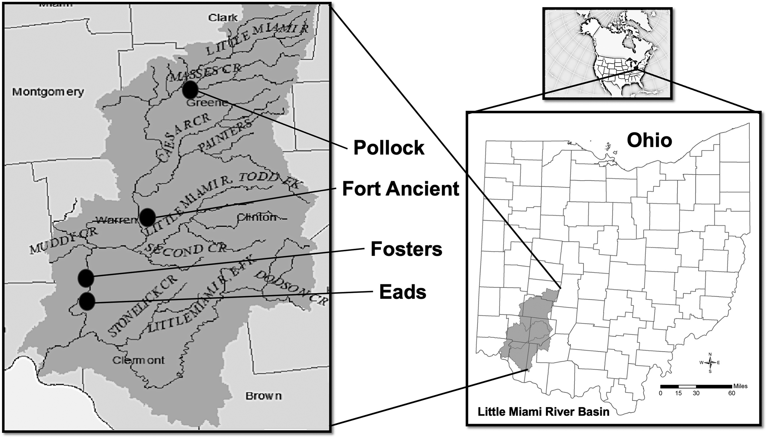
Geographic setting of the Eads earthwork in Bares Run-O’Bannon Creek-Little Miami confluence area.
Eads earthwork (33Ct750)
The Eads earthwork was discovered in 2020 by geologist, Stephen D. Meyers during his examination of a planned reservoir site for the Garden of Eads park. Meyers noticed that there was a large anthropogenic earthen berm along the bluff edge and an anthropogenic terrace on the slope below. He recognized that the dimensions of the earthwork were similar to the nearby Foster's hilltop enclosure (Putnam, 1981; Tankersley and Newman, 2016). Like Putnam's (1981) description of the Foster's earthwork, Meyers found a singular, pronounced, east-to-west earthwork segment that was 72 m in length with a peak of 5.34 m. Unlike the Mariemont earthwork, described and radiocarbon dated to 1480–1640 CE by Tankersley and Herzner (2021), Eads is a surviving remnant of a large enclosure. Like the nearby Foster's hilltop earthwork, the remaining portions of the earthwork are sub-meter in height and enclose ∼10 ha.
A review of the historical records showed that the two site is not shown on the Mills (1914) Archaeological Atlas of Ohio. The land was part of the Virginia Military Reserve (VMR), a 17,000 km² area of land in what is now the state of Ohio. The VMR was a substitute for cash as payment for veterans of the American Revolution (Everts, 1880). Although the property was historically used as pastureland for cattle, it was never plowed or modified. Modern housing developments have destroyed portions of the hilltop enclosure.
Transit survey and mapping
Tacheometric measurements of the earthwork's dimensions were mapped with a transit level and metric stadia rod. All data points were measured relative to an arbitrary datum established on the till plain surface within the enclosure, 133.98 m north of the base of the earthwork. Global Positioning System (GPS) locations provided the geographic position (latitude and longitude) of the site. Tacheometric, GPS, and historic map data, were encoded into ArcMap, an Esri ArcGIS geospatial processing program. The physical details of the landscape were generated using a topographic map (Figure 2) and a bare-earth digital elevation model (DEM) derived from light detection and ranging (LiDAR) data (Figure 3).

Topographic setting of the Eads earthwork and Goodnough-Brock mound.

A bare-earth digital elevation model (DEM) derived from light detection and ranging (LiDAR) data for the Eads earthwork and Goodnough-Brock mound area.
Pedestrian survey
A pedestrian survey of cultural material was conducted over all naturally exposed areas of the earthwork and terrace surfaces. Parallel pedestrian transects were partitioned at 3-m intervals in west-to-east and east-to-west patterns. All surface exposures including slopes, ravines, and tree throws were examined. Although the area had been cleared of dense understory vegetation, the forested surface was covered in leaf litter. Natural camouflaging prevented a full recovery of all surface artifacts.
Two typologically distinctive artifact groups were recovered during the pedestrian survey: ceramic and microblade core technologies. A microblade core (30 × 20 cm) was found on the surface, 37 m west the earthwork's peak (Figure 4). It was manufactured from Pennsylvanian age Zaleski chert, which outcrops ∼170 km to the east (Kagelmacher, 2000). Hopewell potsherds were found on the southern slope immediately below (∼4 m) the peak of the earthwork (Figure 5). The Hopewell plain body potsherds are heavily weathered with oxidized exteriors and smoothed, smudged interiors (Sparks-Stokes, 2019). The potsherds are tempered with Upper Ordovician limestone and grog (crushed fired pottery). Other artifacts recovered from the surface include a microblade, thick fragments of fired clay or daub (10–25 cm, Figure 6), heat altered and fire-cracked rock, and an early stage bifacial preform (50 × 40 × 25 cm, Figure 7) manufactured from Silurian age Cedarville-Guelf chert. It outcrops 80 km northwest of the earthwork (Kagelmacher, 2000).
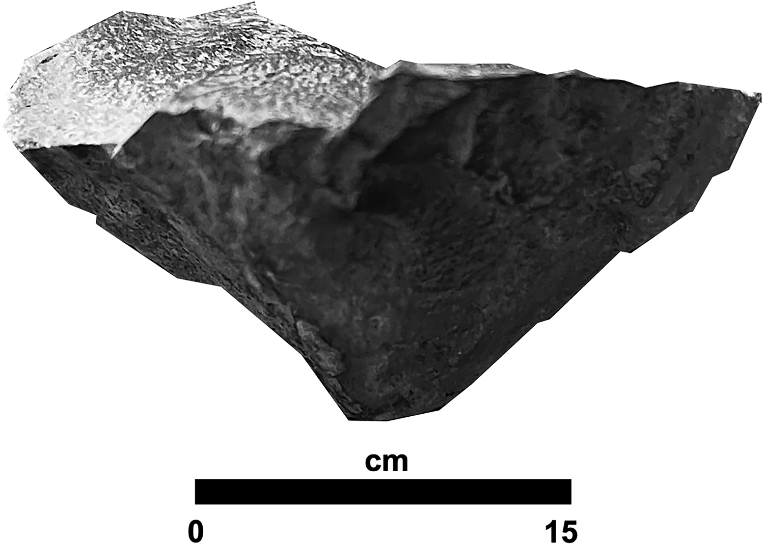
A microblade core manufactured from Pennsylvanian age Zaleski chert.
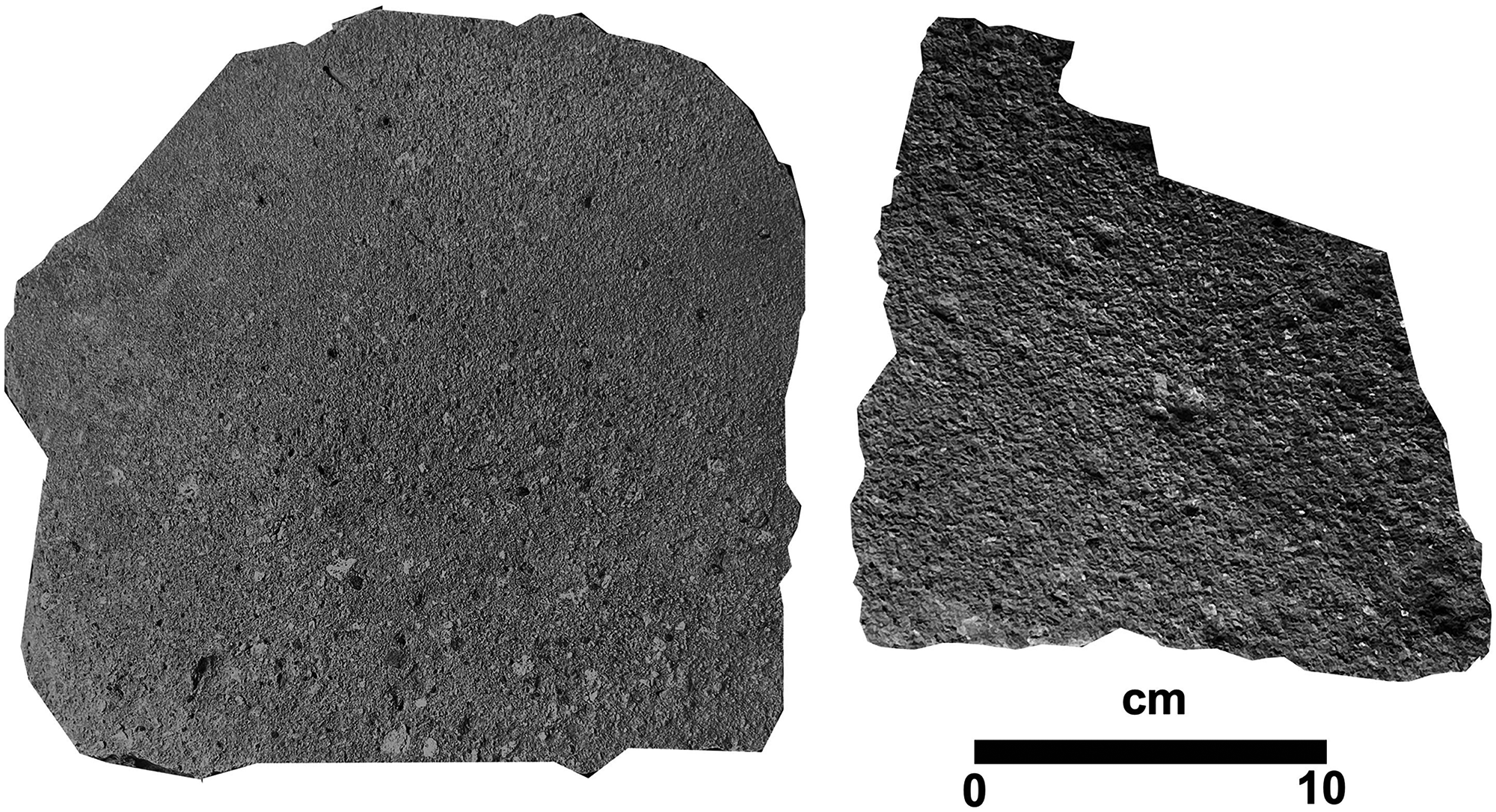
Heavily weathered, plain body, Hopewell pot sherds.
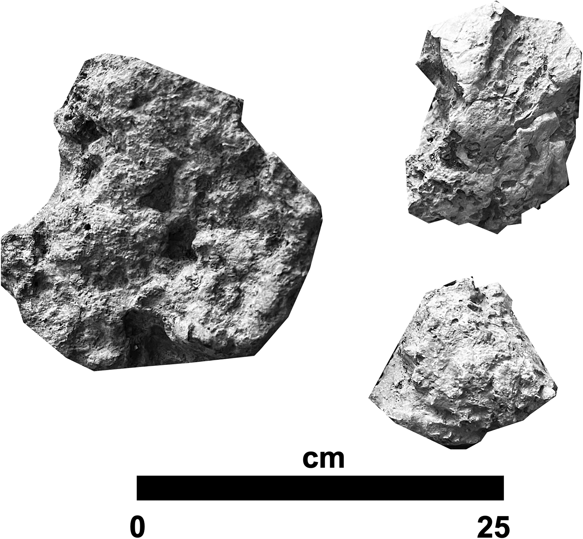
Large fragments of heat-altered clay or daub.
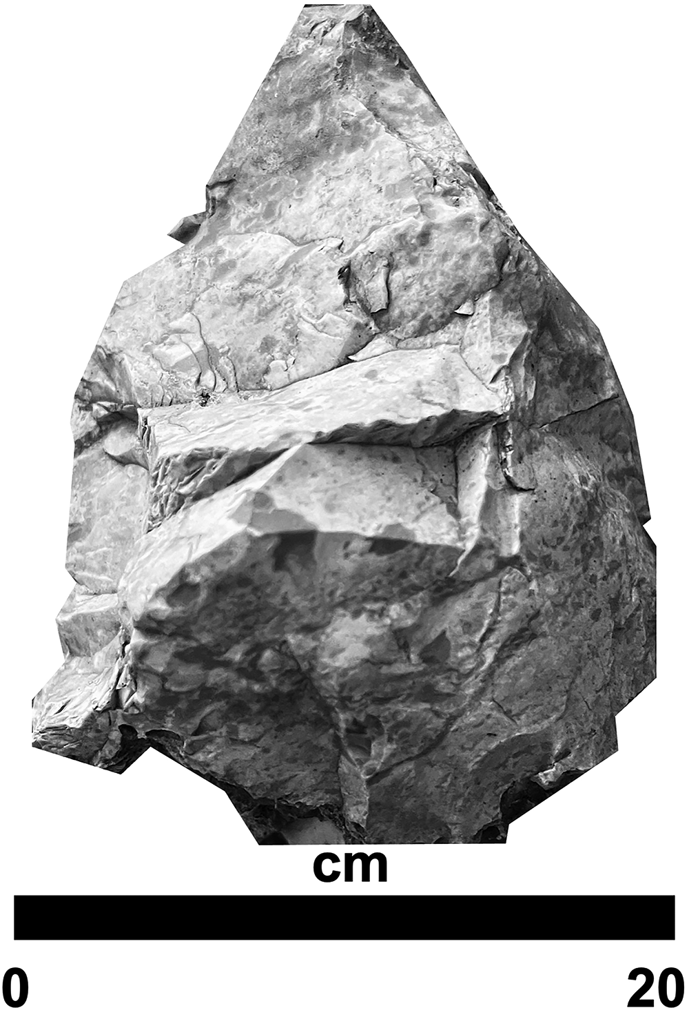
An early stage bifacial preform manufactured from Silurian age Cedarville-Guelf chert.
Test excavations
In order to be minimally invasive to the earthwork and to identify cultural and natural stratigraphy, two 0.5 m2 test-pits were hand excavated: one in the peak area of the earthwork and another on the anthropogenic terrace on the south slope. The test pits were excavated in 10-cm arbitrary levels and all of the excavated sediment was hand screened through a 0.3 cm2 sieve. Natural and cultural stratigraphy were defined by Munsell soil color and texture.
Middle Woodland cultural period artifacts were found in a dark brown (10YR 3/3) loam (A horizon) in the uppermost 10 cm of the earthwork. It was underlain by a > 1.0 m thick dark yellowish-brown (10 YR 4/4) clay loam (B horizon). A 0.6 cm thick burned stratum was found at a depth of 0.21–0.26 m and a stone pavement manufactured from Upper Ordovician limestone was exposed beneath it at a depth of 0.47 m (Figure 8). The stone pavement, which occurs below the burned stratum, likely represents the base of the earthwork. Four strata were exposed in the test excavation on the anthropogenic terrace: a dark brown (10YR 3/3) loam (A horizon, 0–18 cm), dark yellowish-brown (10 YR 4/4) clay loam (B horizon, 18–70 cm), a light olive-brown clay (C horizon, 70–100 cm), and Upper Ordovician limestone and shale bedrock, below 100 cm (Figure 9). A pitted stone was found in the clay loam at a depth of 38 cm.
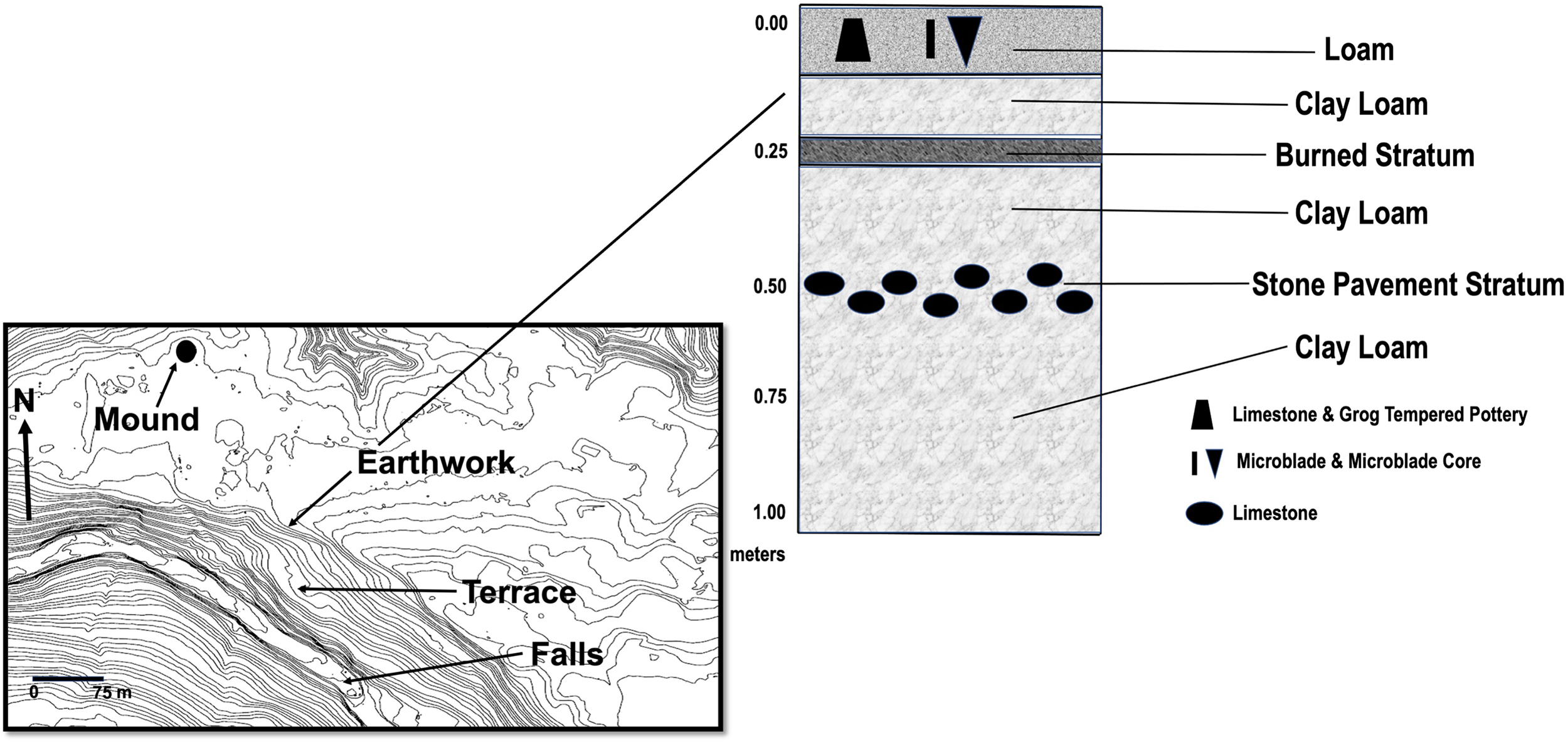
Eads earthwork stratigraphy exposed in a 0.5 m2 test unit excavation.
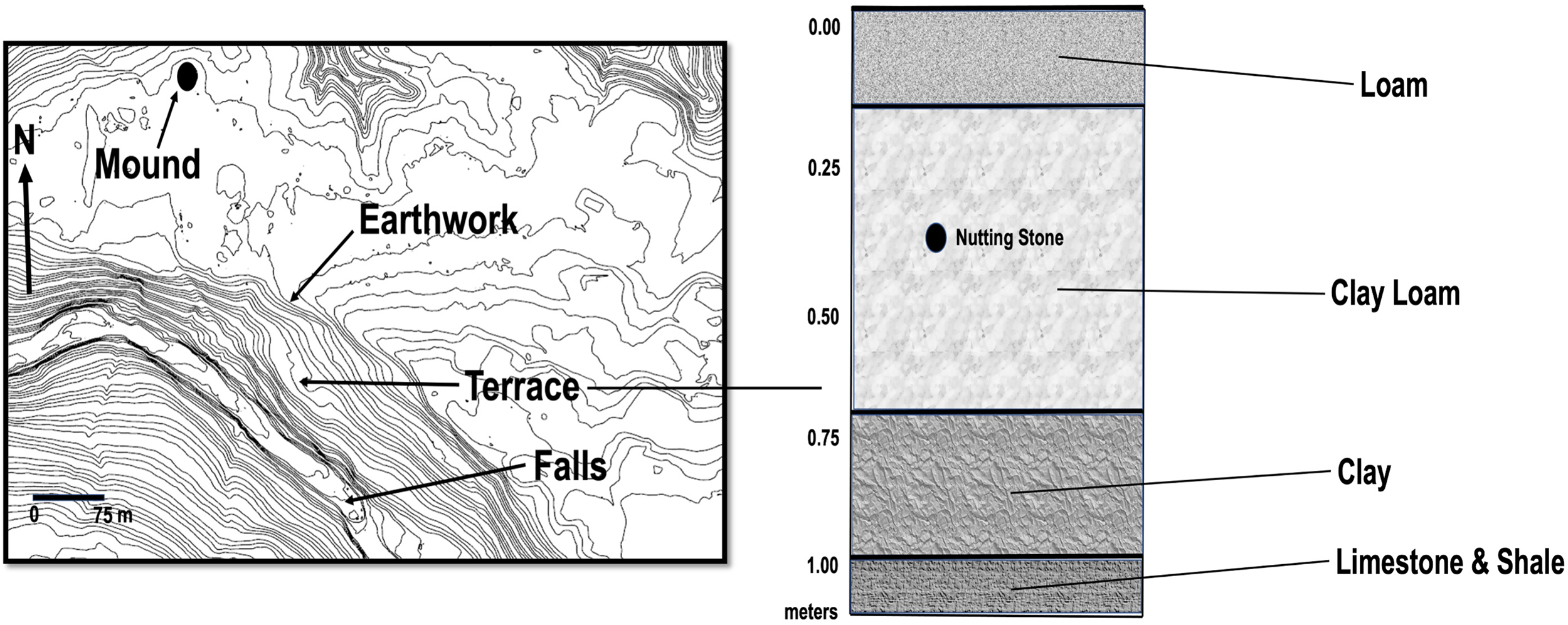
Anthropogenic terrace stratigraphy exposed in a 0.5 m2 test unit excavation.
Relative dating
In 1785, Friedrich von Schiller defined a basic law of geochronology known as superposition. The law of superposition states that in undeformed stratigraphic sequences that have not been overturned, the youngest sediments occur at the top of the stratigraphic sequence (Harris, 1989). A Hopewell microblade core, a Hopewell microblade, Hopewell plain body limestone and grog tempered potsherds occur in the uppermost 10 cm of the earthwork along with fired clay or daub and an early stage bifacial preform. Given that typologically distinctive Hopewell artifacts occur in the upper 10 cm of the undisturbed earthwork stratigraphy, the earthwork has to have been built during or before the Middle Woodland cultural period. Given that hilltop enclosures in the Little Miami River valley date to the Middle Woodland cultural period, Eads is most likely a Hopewell cultural complex earthwork (Weinberger, 2006).
Goodnough-Brock mound (33Ct751)
The Goodnough-Brock mound is located on the northern edge of the ridgetop, 257.83 m (258.03 m, ground length) northeast of the peak area of the Eads earthwork (Figure 10). The mound is 1.61 m high with a north-south diameter of 25.42 m, an east-west diameter of 24.15 m, and a volume of ∼290 m3. The dimensions of the mound are comparable to the Riker-Todd mound (Tankersley and Tench, 2009) and those within the enclosure of Fort Ancient (Romain, 2000; Romain, 2004). Aside from slumping and bioturbation, the mound remains intact. There is no historical evidence that the mound was ever excavated, looted, or plowed. The mound has remained in the Goodnough-Brock family since the creation of the Virginia Military Reserve (Everts, 1880). Like the Eads earthwork, the mound site is not shown on the Mills (1914) Archaeological Atlas of Ohio.

Areal photograph and DEM of the Goodnough-Brock mound.
Archaeastronomical alignment
The highest point or peak of the Eads earthwork and the center of the Goodnough-Brock mound are aligned at a compass direction of 300o within 0.5o, which is the summer solstice sunset azimuth for 39o15′ north latitude during the Middle Woodland cultural period (Figure 11) (Aveni, 1972; Romain, 2000). It is noteworthy that the highest points of the Eads earthwork and Goodnough-Brock mound are both at an elevation of ∼210 m above mean sea level. Romain (2000) found comparable summer solstice sunset alignments along the diagonals of the Anderson, Hopeton, and Mound City earthwork enclosures.
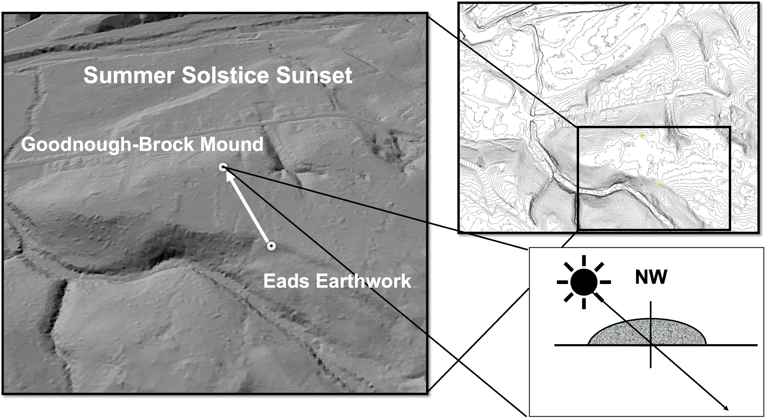
The peak of the Eads earthwork and the center of the Goodnough-Brock mound are aligned at a compass direction of 300o within 0.5o, which is the summer solstice sunset azimuth for 39o15′ north latitude during the Middle Woodland cultural period.
Discussion
Mainstream archaeological investigations of the Hopewell cultural complex have focused on burial mounds and their funerary goods. With the exception of Fort Ancient, hilltop earthen enclosures have been largely ignored for more than two centuries. The recently discovered Eads earthwork and Goodnough-Brock mound provide an opportunity to evaluate these archaeological features in the broader context of the Hopewell cultural complex.
The area enclosed by the Eads earthwork is comparable to other Ohio hilltop enclosures (Figure 1, Table 1). They range in size from 53.5 to 3.2 ha. Eads encloses ∼10 ha, which is below the average size (15.38 ha) of other Ohio hilltop earthworks size. However, this average is skewed by the area enclosed by the Spruce Hill and Fort Ancient enclosures. They are five times larger than all other hilltop earthworks. Eads is closer to the median size (7.1 ha) of Ohio hilltop enclosures. If we look at the Eads earthwork within the statistical context of Ohio Hopewell hilltop earthworks spatial quartiles (5.0, 7.1, 14.7 ha), it is close in size to the interquartile range (IQR) of 9.7 ha. Fort Ancient and Spruce Hill are statistical outliers at 50.5 and 56.7 ha respectively.
Ohio Hopewell hilltop earthworks ranked by the area (ha) enclosed.

The physical features and alignments of the Eads earthwork suggest that it was used for ritual activities rather than defensive, hydraulic, or secular purposes. Ancestral Algonquian people likely gathered within the enclosure to conduct ceremonies, which corresponded with solar observances of the rising and setting azimuths of the sun. The Algonquian summer solstice ceremony is a renewal of the annual cycle indicated by the northernmost sunrise and sunset and the day of the shortest shadow.
The Algonquian Great Peace ceremony, also known as Busk and Green Corn, is marked by the summer solstice, the longest day of the year, and the beginning of summer (Howard, 1981). It includes ritual dancing, fasting, feasting, fire building, naming, prayer, and spiritual cleansing. The Green Corn ceremony is a thanksgiving celebration to the creator for the first maize crop and the beginning of the Algonquian New Year. It is a week-long ceremony that is performed around a central fire within an enclosure. For Algonquian people, fire is the earthly form of the sun (Howard, 1981). The sacred fire is built at the center of the enclosure during the Green Corn ceremony and symbolizes the sun. During Green Corn, the logs of the fire are oriented in the cardinal directions and four perfect ears of corn are burned (Romain, 2000).
Howard (1981) and Romain (2000) believe that the Green Corn ceremony is one of the oldest and most important ceremonies among Algonquian people and it can be traced to the Middle Woodland cultural period. However, recent direct AMS radiocarbon dating of Middle Woodland maize kernels postdate CE 900 (Simon et al., 2021). The earliest known Middle Woodland maize cob reported from the Meadowcroft rockshelter postdates CE 1800 (Hart and Adovasio, 2022). Therefore, it is more likely that the Green Corn ceremony is a post-Hopewell syncretism with an Ancestral Algonquian summer solstice ceremony, which occurred with the diffusion of maize into the Ohio River valley.
Ancestral Algonquian people invested a great deal of time and energy to plan, construct, and sustain the Eads earthwork so ritual activities could take place inside the enclosure over a period of years, decades, and perhaps centuries. The presence of the Goodnough-Brock mound implies that mortuary activities may have also taken place within the enclosure. The paucity of artifacts recovered during the pedestrian survey and test excavations suggests that ritual sweeping of the ceremonial space may have taken place. While evidence for both sacred and secular activities have been documented at other hilltop enclosures, the absence of a dense midden suggests that the Eads earthwork enclosed a space used exclusively for ceremonial activities. It is possible, however, that a midden may have been where there are nearby modern buildings or along the slopes.
Footnotes
Acknowledgements
This article and the discovery of the earthwork would not have been possible without the help of Steve Meyers who unexpectedly passed away before the completion of this research. Fieldwork was made possible with the invaluable support of the Charles Phelps Taft Foundation. We are most grateful to Dale Eads for access to the Eads earthwork site and Jan Beller for access to the Goodnough-Brock mound. The authors also want to thank the editor and anonymous reviewers their suggestions, which greatly improved this article.
Declaration of Conflicting Interests
The author(s) declared no potential conflicts of interest with respect to the research, authorship, and/or publication of this article.
Funding
The author(s) disclosed receipt of the following financial support for the research, authorship, and/or publication of this article: This work was supported by the Charles Phelps Taft Research Center, (grant number No Number).
