



Abstract
Situated in the arid heart of the Deccan, Daulatabad has been the centre of historic settlements dating back to the first millennium
Much has been written about this remarkable personality, his origins in the Kambata region of Ethiopia, his travel to the sub-continent via the Arab slave trade, his rise to become the Vakil us Saltanat of the Nizam Shahis of Ahmadnagar and his legendary defence of the kingdom against Mughal expansion into the Deccan. This article, however, explores a less-known aspect of Ambar’s career, his role in constructing an extraordinary system of water management that enhanced the capacities of Daulatabad fort to enable it to support a large garrison and indeed, become a second capital of the Nizamshahi sultanate. Through site-based interactions and conversations with the local community, the personality of Malik Ambar as a local hero and his influence in the region has been reconstructed, enabling an interesting perspective of a historic personage ‘from below’.
The ability of historic settlements to survive over centuries and sustain their relevance can be ascribed to their skill in conserving and managing water, particularly in arid regions like the Deccan. Daulatabad, along with its neighbouring settlements of Khuldabad and Ellora, has been an important nodal centre along the north-south trade and pilgrimage routes dating back to the first millennium
Although an elaborate system of water provision had been constructed around Devagiri by the Yadavas in the twelfth century, it was the hydrological genius of Malik Ambar, an Abyssinian slave who rose to become the Vakil-us-Saltanat or Peshwa of the Nizamshahi state in the sixteenth to seventeenth centuries, that enabled the building of elaborate waterworks that collected the run-off from the surrounding hills and conveyed it to the Daulatabad fort. Malik Ambar himself was a product of a flourishing Indo-Arab slave trade and represented the unique cosmopolitan culture of the medieval Deccan. Having spent his life in consolidating the fractured polity of the Nizamshahi Sultanate with its capital at Ahmadnagar, and resisting Mughal expansion into the upper Deccan, it was in Daulatabad that he finally came to rest, his simple mausoleum contributing to the domed skyline of Khuldabad. Malik Ambar is an acknowledged hero among the local community of Daulatabad and Khuldabad, where tales of his exploits in keeping the Mughal ‘invaders’ away contribute to the formation of a regional identity. My experience of this identity was through the revelation of Malik Ambar’s water system by community members. Their uncovering of ‘Malik Ambar ki Pipeline’ involved their understanding of a historic personage interspersed with personal memories of the streams, waterfalls and other elements of the water system, a convergence of community and individual memories.
This article explores the manner in which Malik Ambar, a historic personality from East Africa, was brought to the sub-continent by Arab slave traders via Baghdad and then was assimilated into the complex society and politics of the Deccan, living on in the memory of local communities in Daulatabad. Aspects such as ‘region’, ‘community’ and ‘landscape’ are also investigated and contextualised within the particular environment of the Deccan. The trope of water, in its material and metaphorical sense, is of great significance as the provider of sustenance to the region and the bearer of its identity through the generations. My sense that Malik Ambar’s role in constructing the water system at Daulatabad contributes significantly to his importance in the region, is based on that premise. 2
‘Region’, ‘Community’, ‘Landscape’: Unpacking the Terminology
Since this article is deeply engaged with subjective categories such as ‘region’ and ‘community’, it is useful to problematise these ideas and contextualise them within the environment of the Deccan. To begin with, the Deccan itself is a fluid place, with varying dimensions depending on the perspective of the approach. Geographically speaking, it is a part of peninsular India bound by the Eastern and Western Ghats on the sides and the Satpura range to the north, consisting primarily of highland plateau tapering down to the plains of the Kaveri delta to the south. In colloquial terms, for residents of northern India, it vaguely signifies most places south of the Vindhyas! Its name is an anglicised version of Sanskrit Dakshina (south), as referenced in the Dakshinapatha, the ancient north-south trade and pilgrimage route that extended from Pataliputra to Pratishthana, 3 or Dakshinadesa. 4 Mohammad Qasim Ferishta, the seventeenth-century chronicler and resident of the Deccan, defined it in terms of language and kinship. ‘Dakan’ was one of four sons of ‘Hind’, and, in turn, had three sons, ‘Marhat’, ‘Kanhar’ and ‘Tiling’, that is, subsumed the territories inhabited by speakers of Marathi, Kannada and Telugu. 5 Ferishta’s juxtaposition of sub-continental (Hind) and provincial (Dakan) entities is interesting enough in its political inclusiveness, but the combination with linguistic identities makes the conceptualisation positively remarkable in its nuanced complexity. It leads smoothly into an understanding of Marathwada (Home of Marathas), a term to denote the Marathi speaking region of the northern Deccan, mentioned in the records of the Nizam of Hyderabad. Marathwada is a widely recognised geo-political entity within Maharashtra state today, encompassing the modern districts of Aurangabad, Parbhani, Beed, Nanded and Osmanabad. Apart from its linguistic associations with Marathi speakers, there is also a colloquial notion of Marathwada possessing a particular climate and soil type, cooler and more fertile than the hot, dusty environment of the neighbouring region of Khandesh, for example.
Richard Eaton, in his discussion of the defining characteristics of the Deccan, states that it lacked an enduring geo-political centre, unlike the empires and kingdoms of the north and south. 6 Divided into the Vijaynagara and Bahmani kingdoms in the fourteenth and fifteenth centuries, after the Battle of Talikota in 1565, the latter later broke up into five sultanates, the Nizamshahis of Ahmadnagar, Adilshahis of Bijapur, Qutbshahis of Golkonda, Baridshahis of Bidar and Imadshahis of Berar. Eaton goes on to argue that the Deccan lacked a political master narrative like Delhi, and was defined by its interaction with northern powers such as the Delhi Sultanate and the Mughals, becoming a counterpoint to the kingdoms, people and culture of north India, who made several incursions into its territory.
This article submits that political developments in the Deccan have to be viewed from a different perspective than those in the north. First, trade routes played a very important role in defining the cores and hinterlands, a number of major dynastic capitals were defined by their strategic location in relation to corridors of trade. Pilgrimage routes added another dimension to networks of connectivity between the urban centres of the Deccan. Second, access to the maritime trade across the Arabian Sea opened doors to the inflow of Arabs and more importantly for us, Africans, who mingled with Deccan society and brought in a level of cosmopolitanism that was missing in the north. The Deccan also received people of Persian and Central Asian origin, particularly soldiers, nobility and the Sufis who emigrated in large numbers following Muhammad bin Tughlaq’s shift of his capital from Delhi to Daulatabad. Overall, the Deccan had multiple geo-political cores and hinterlands as also an extremely high level of ethnic diversity in its social fabric. It is in this decentralised yet networked context that we must view the region of Marathwada and the citadel of Daulatabad within it.
The district of Aurangabad is part of the Upper Godavari river basin and drained by two major tributaries of the Godavari, the Shivna and the Purna. The district slopes towards the south east, consisting of plateau highlands in the north, evolving into gently undulating plains to the south finally reaching the riverine plains of the Godavari. The Sattara and Mahadeo hills enclosing the valley of the river Dudhna in the east, and the Kundari and Kinkura ranges to the west approach one another towards Daulatabad and Aurangabad city. Daulatabad is located on one such hill at a height of 2,326 feet, and the surrounding table lands of the Deccan plateau enclose fertile and verdant valleys. 7 The mean annual rainfall in Aurangabad district is 725.8 mm, but the intensity of agricultural activity varies: the Gangapur, Vaijapur and Sillod talukas that lie within the great fertile plains of the Godavari towards the south, are far more conducive to higher agricultural yields than the rocky and hilly terrain of Khuldabad and Daulatabad. 8 The fortified citadel of Daulatabad occupied a strategic defensive position along the trade route winding through the Ghats, constituting a political ‘core’ which protected the agrarian hinterland spread out below to the south.
The district is covered by a rock type known as Deccan Trap, a form of Basalt composed of pre-historic lava flows depicting ancient volcanic activity. 9 Water occurring in vesicular sections, joints and fragmented planes constitutes the groundwater reserve. Groundwater is replenished by the infiltration of rainwater. 10 Therefore, in Daulatabad, Ellora and Khuldabad the entire ecosystem consists of a certain quantity of groundwater accumulation on account of the specific rock conditions, soil cover and vegetation. In addition, the slope and contours of the hills and plateaus create catchment areas for collection as well as replenishment of ground water, leading to specific patterns of irrigation and water usage by local human settlements through history. This arrangement of geological, geographical and climatic processes is a finely balanced bio-network involving a fundamental interaction between human activity and the environment. This balance determines the carrying capacity of the region and requires a deep understanding of water usage for the sustainability of human settlements by the local community.
The idea of landscape has undergone considerable evolution since its earliest roots in agricultural history in Europe, in which it denoted a defined space acted on by human agency, developing as a man-made system functioning to serve human communities. 11 Its significance in terms of local ecologies and human economic endeavours remains, but is overlaid by a history of human engagement with physical, ecological and ritual elements in the environment. Such a record of human interactions through space and time can be viewed as a palimpsest, where material and cultural transformations carry the imprint of past associations and activities. In other words, Cultural Landscapes are spaces focused on people, and the experiential, social, epistemological and emotional dimensions of their existence. An archaeology of Cultural Landscapes, or Landscape Archaeology, is an emerging field concerned with how people visualised the world, how they engaged with one another across spaces, how they chose to manipulate their surroundings and how they were subliminally driven to do things in accordance with their locational surroundings. 12 Landscapes can be ‘ecological’, as in people construct frames of knowledge to know the world that they inhabit, ‘institutional’, wherein space is structured and behaviour normalised through codified social practices, and ‘territorial’, as spaces for contestation. The landscape at Daulatabad, Ellora and Khuldabad, subsumes important pilgrimage centres such as the jyotirlinga temple at Grishneshwar and the dargahs of Shaikh Burhanuddin Gharib and Shaikh Jalaluddin Ganj-e-Rawan in addition to containing the most noteworthy fortified citadel of the region, displays all three characteristics. This article aims to focus on the ecological frames adopted by local communities at Daulatabad to relate to their landscape. It will, however, extend the outlines of the community’s ecosystem to include their historic past and personages that contributed to the creation of a local identity.
Today, Daulatabad is a large village located in Aurangabad taluka with a population of about 6,200 persons. 13 Agriculture is the primary occupation in the region, however, local craft such as velvet, himroo and gold and silver lace are a testament to its position along a major trade route and the historical presence of a substantial urban centre. Marathas and Kunbis are the primary landowning castes, the former considered to be the region’s aristocracy owing to their association with the famous leader Shivaji. 14 Brahmins are also important landowners in the region in addition to being associated with the large number of temples. A number of Brahmins are educated professionals, doctors, accountants and government employees, as are the small community of Jains, who run schools and medical clinics in the urbanised pockets of Verul.
Daulatabad and its surrounding settlements such as Ellora (Verul), Mhaismal and Sulibhanjan villages contain a variety of tribal settlements, some of which belong to pastoralist nomadic people who were possibly travelling through the region with their herds since prehistoric times (Verul Tanda). Another community of nomadic people, the Banjaras of Palaswadi Tanda claim Rajput descent and assert that they migrated to the region following the death of Maharana Pratap of Chittor, in whose armies they claim their ancestors were employed. 15 The residents of Shardulwadi Tanda are known locally as Pardesis (from foreign lands), and are believed to be of a low caste. The Tandas are pastoralist or tribal hamlets attached to villages and subsumed under the Gram Panchayat. The institution dates back to earlier times when there was a symbiotic relationship between the nomadic pastoralists and the settled agriculturists, the former arriving with their herds at harvest time, when the crop stubble could be consumed by the animals. Under the modern Indian state, they have been induced to settle down and allotted land near the village, bringing them within an administrative framework. However, place names like Mhaismal (Sanskrit. Mahisha—buffalo) resonate with their association with pastoralist nomads since ancient times. 16
The Bhils are a substantial tribal group in the area, originally inhabitants of forests. Spread across Marathwada, neighbouring Khandesh and beyond in Gujarat and Rajasthan, they are traditionally nomadic, and their settlements consist of extremely basic temporary structures, little more than camps. Considered to be outcasts, associated with thieving and unlawful activity, they are often in trouble with local authorities over issues such as hunting birds and brewing liquor, both conventional activities within their itinerant way of life. They also engage in cultivation either as landless labour or on rocky land that is unwanted by mainstream agriculturists. They also own some cattle and herds of goats.
Daulatabad, Verul and Khuldabad has a significant Muslim population, some of whom belong to landed families since the times of the former Hyderabad state. At the beginning of this study in 2009, the population of Khuldabad taluka, adjacent to Daulatabad, was 55 per cent Muslim. Many of them are cultivators and own their own land. In contrast to the Marathi speaking Hindu population, Muslims are fluent in Dakhani Urdu, a language associated with Hyderabad. High class aristocratic Muslim families in the region tend to highlight their Persian ancestry, indicating their descent from the Persian nobility that came from the north during various military incursions during the Delhi Sultanate and the Mughal period. However, the bulk of the cultivators are of Deccani origin, converted to Islam many generations ago. An interesting addition to Deccan society were the Habshis, 17 Abyssinians who were brought into the sub-continent as military slaves. There was a thriving market for Habshis amongst the Deccan sultanates, and they were cultivated and nurtured by their aristocratic masters in return for their unswerving loyalty. On the death of their masters, the slaves were usually free and quickly assimilated into local society. 18 The following section investigates a unique trend that characterised medieval Deccan society, the incursion of Habshis as military slaves into the sub-continent, and the deep impact that they had on the geo-politics of the region.
Malik Ambar: The Slave Who Rose to Become Peshwa
The second half of the sixteenth century was a period of great turmoil in the Deccan. Following the battle of Talikota in 1565, the Vijaynagara empire was in decline and the erstwhile Bahmani state had given way to five sultanates, Ahmadnagar, Bijapur, Golkonda, Bidar and Berar. Of these, Ahmadnagar and Bijapur were powerful kingdoms, controlling important western ports of the Konkan coast and thereby, the Arabian Sea trade. Between the fifteenth and seventeenth centuries, this trade was at its zenith, a major constituent of which were the Habshis, Ethiopian slaves. The story of Malik Ambar, one such Habshi, links the Deccan with the highlands of East Africa through the great cities of Baghdad and Yemen, an expression of the dynamic sweep of the institution of Arab trade. 19
The sixteenth century was also a time of tremendous confusion and disorder in East Africa. The ancient Solomonic kingdom of Ethiopia, creating an extraordinary synthesis of Semitic and Cushitic cultures, had ruled the land since the early historical period. 20 In the fifteenth to sixteenth centuries, the Adal Sultanate, that had controlled the area of southern Ethiopia, diminished in power, leading to invasions by the Oromo tribes and the enslavement of large numbers of the local agricultural population. Kembata, a province in southern Ethiopia, resisted Oromo domination, but, along with neighbouring districts, fell into infighting and fragmentation. Meanwhile, Arab slave traders carried out raids in the countryside, searching for potential merchandise to feed the lucrative markets of the Indian sub-continent. 21
Piecing together Dutch, Arabic and Mughal sources, a rough sketch of Malik Ambar’s early life may be constructed. He was believed to have been born in 1548 or 1549 and was possibly sold into slavery by impoverished parents. His birth name, Chapu, stayed with him throughout his life despite his efforts to redesignate himself as Malik Ambar, an embracing of his Deccani identity. If he spent his early years in Kembata his mother tongue would certainly have been Kambaatisaata, a Cushitic dialect of southern Ethiopia. His being sold to slave traders would indicate his pagan origins, as the Arabs avoided enslaving Muslims and the Ethiopian Christian state would not allow the sale of Christians into slavery. Chapu’s childhood in Kembata would have ensured a familiarity with the arid terrain of the Rift Valley, a memory that would serve him when he established the skills of guerrilla warfare (Bargigiri) in the Deccan. It would also have given him a sense of the flow and movement of water along the slopes of the plateau, another skill that might have come to his aid during his reinforcement of the resources at Daulatabad many decades later.
Chapu was initially sold in the slave market at the southern Ethiopian city of Harar, and then taken to the Yemeni port of Mocha. His owner, Qazi Hussain, converted him to Islam and named him Ambar (Ambergris, or precious jewel). He was then resold for 20 ducats and sent to the Baghdad slave market, travelling briefly to Mecca, and then finding his way into the household of one Mir Qasim al-Baghdadi, a wealthy merchant who reared him like a son and educated him. Ambar’s experience of life in Baghdad, an exemplar of a modern, well-appointed city with its Abbasid moorings intact, would have exposed him to its high quality infrastructure and excellent administration, that could have influenced his actions as he planned and built the city of Khadki, later Aurangabad.
In 1575, Mir Qasim took him on a trip to the Deccan, where he was sold into the service of Chingiz Khan, the Peshwa (Prime Minister) of the Nizamshahi sultanate. Chingiz Khan too, was a Habshi presumably from Kembata. Here, Ambar was exposed to the particular society of the Deccan, with its ethnically heterogenous nobility comprising ‘Westerners’ of Iranian origin, Deccanis or ‘locals’ who were of Afghan and Turkish stock. 22 The Habshis constituted a substantial and powerful group playing an important role particularly in the military polities of Bijapur and Ahmadnagar. The Marathas were an indigenous landed Hindu group, also important for their contribution to the Deccani political, agrarian and social ecosystem as warriors and administrators. Ambar, entering this heterogenous ecosystem laterally, was adopted and nurtured by the household of Chingiz Khan, who, having himself risen through the ranks from military slave to Peshwa, developed great trust and regard for him. He was even married to Bibi Karima, an African woman, and along with the Habshi household of which he was now a part, merged with an ethno-linguistic community that was an influential part of the eclectic Deccani nobility. 23
Following the death of Chingiz Khan, Ambar found himself a free man and moved to the neighbouring sultanate of Bijapur to seek his fortunes. He returned to Ahmadnagar in the 1590s along with a retinue of Arab soldiers, to considerable political confusion. Ibrahim Nizam Shah, sultan of Ahmadnagar, had been killed in a battle with the forces of Bijapur at Shahdurg. The Mughals had besieged Ahmadnagar fort and Chand Bibi, the aunt of the infant successor, Bahadur Nizam Shah had declared herself regent and put up a spirited defence of the sultanate. Ambar, in the service of Abhang Khan, a Habshi general of Ahmadnagar, tried to resist the imperial forces but in 1600, the fort of Ahmadnagar fell to the Mughals, Chand Bibi was killed and the young Sultan imprisoned in Gwalior. Ambar melted away into the countryside and attempted to resuscitate the wavering fortunes of the Nizamshahi sultanate. 24
Having expanded his own militia to over 7,000 cavalry, mostly Habshis from the constant inflows through Arab trade networks, Ambar found a viable heir to the Nizamshahi throne in the court of Bijapur. 25 He married his own daughter to him and, thus cementing his alliance with the royal household of Ahmadnagar, promoted him as the next sultan, with himself as regent and Peshwa. Over the next two decades, he waged an unrelenting campaign to resist Mughal domination and revitalise the Nizamshahi state. With the death of Emperor Akbar and succession of Jahangir to the Mughal throne, campaigns against Ambar only increased in intensity, but could never subdue him. In 1610, he managed to evict the Mughals from Ahmadnagar fort, and established the revived Ahmadnagar court in Daulatabad. He now held undisputed control over the fortunes of the Deccan sultanate and, having married his son Fateh Khan to the daughter of Yaqut Khan, a powerful Habshi noble of Bijapur, successfully attempted to stitch together a Deccani political/military network of resistance to Mughal domination. His armies, as also those of Bijapur, included regiments of Habshi cavalry. 26 It is interesting that this network was strongly African in character, a unique trend in Indian political history that was never experienced again.
Malik Ambar and the Marathas
In many ways, Malik Ambar exemplified the unique multi-cultural spirit of the Deccan, attracting and drawing to himself quintessentially Deccani communities such as the Marathas and the Habshis and creating a core of resistance to the northern hegemony of the Mughals. He famously earned the hatred of the Mughal Emperor Jahangir, whose frustration at his army’s inability to eliminate Ambar became something of an obsession. This is represented by the portrait of the emperor painted by Abul Hassan, wherein he is portrayed shooting arrows towards the decapitated head of Malik Ambar, a virtual consummation of Jahangir’s heart’s desire. The emperor is shown standing on a globe, indicating his domination of the world. 27 Clearly the emperor’s dream remained unfulfilled, and Malik Ambar died, undefeated, of old age, in 1526.
The Marathas, a high caste group of Marathi speaking landowners, were an influential local group in the region. Seeing in them an opportunity to strengthen his links with the landed classes, Ambar trained and mobilised them, converting them into a deadly fighting force. Through them, he perfected the art of Bargigiri, guerrilla warfare, attacking the heavy Mughal artillery and infantry using surprise strikes and raids and then melting away into the surrounding hills and forests. This technique involved specialised knowledge of the terrain and topography, which Malik Ambar and his bands of Maratha warriors used to their advantage.
Eaton calls the Ahmadnagar sultanate under Malik Ambar a ‘joint Habshi-Maratha enterprise’. 28 His incubation of the Marathas had far-reaching consequences for the Deccan. He appointed Maloji Bhonsla, grandfather of Shivaji, Patil of Verul village. Maloji’s son Shahji, too, was Ambar’s right-hand man. After Ambar’s death in 1526, Shahji took up the cause of fighting for the survival of the Nizamshahi state. When Ambar’s son Fateh Khan capitulated to the Mughals, Shahji placed an 11-year-old boy on the throne and named him Sultan Murtaza Nizam Shah III. Over the next three years, he tried his best to muster support for the dynasty, negotiating with the Habshis and Maratha commanders and gathering troops to confront the Mughals. However, it was a losing battle and finally, betrayed by Bijapur, Shahji was forced to watch helplessly as all support melted away. In 1636, the Nizamshahi state was formally dissolved through a treaty between the Mughals and Bijapur and its territory was divided between the two powers. However, the legacy of Malik Ambar revived in the next generation, as Shivaji, Shahji’s son, united the Marathas and launched a legendary campaign against the Mughals, using the very skills of Bargigiri that Ambar has inculcated in them.
In the first two and a half decades of the seventeenth century, Malik Ambar not only kept the Mughals at bay but also displayed remarkable talents in administration, city planning and building. The confusion and unrest created in the countryside by repeated military campaigns and battles had severely impacted crafts and agricultural productivity. This in turn, had affected state revenues and when he assumed his new responsibilities as Peshwa, Ambar was confronted by a severely depleted treasury. He addressed the problems by providing encouragement to the peasantry and improving the land revenue administration. He introduced a system of calculating land revenue based on the one pioneered by Raja Todar Mal in the Mughal empire, the famous dahsala system. The arable land was divided into separate classes based on its fertility and the state revenue rate was fixed. He removed the multiple middlemen in the revenue collection process and appointed Patils or revenue collectors for each village, thereby establishing a more direct relationship with the cultivators. Waste lands were reclaimed and made cultivable and productivity increased. Land ownership was made over to cultivators while tenants were given a share of the crop. These measures increased Ambar’s popularity immensely amongst the cultivating classes. His land revenue system was later adopted by Shivaji, when he consolidated the Maratha empire, thus proving the strength and relevance of his legacy.
Malik Ambar also carried out extensive building works, notably the construction of the city of Khadki in 1605 near the ancient settlement of Harsul, a trading town on the Dakshinapatha about 15 km southwest of Daulatabad. Later renamed Aurangabad, Khadki was planned and built on a monumental scale, with massive gateways, palaces, Diwan-e-Aam and Diwan-e-Khas, hammams, etc. 29 The piece de resistance was the Neher-e-Ambari, an elaborate water system bringing run-off from the surrounding highlands into the city. Its complex arrangement of canals, conduits, aqueducts, underground channels and reservoirs ensured adequate water supply to sustain the massive garrison and civil establishment in the city, comprising, it is believed, 700,000 inhabitants. 30 The Neher-e-Ambari survives to this day, and could be regarded as Malik Ambar’s most significant legacy to the region.
Thus, Malik Ambar was an extraordinary personality, combining several paradoxical trends that characterised the multi-cultural nature of the Deccan. A foreigner to the region, he carried within his very person memories of a similar climate and terrain in Ethiopia as also the benefit of his education in Baghdad, through which he contributed to rebuilding the Nizamshahi state. He enabled the inflows of Habshis into the region and was part of a powerful sub-community, rising from slave to high nobility along an established path. With an unerring strategic understanding of the geo-politics of the Deccan, he incubated the Marathas and armed them with the skills of Bargigiri, an ability that later made them a power to reckon with in the sub-continent and fulfilled his goal of bringing down the Mughal regime more thoroughly than even he could have envisaged. In the fanatically racist fantasies of Jahangir, Ambar symbolised the rebellious spirit of the Deccan. In a sense, the Deccan truly provided a space where a foreign entrant along with his ideas, skills and ideals, was assimilated into local society
Prior to his building of the city of Khadki, Ambar revamped the water collection systems at Daulatabad. 31 He constructed a system of transporting water from Mavsala tank or Hauz-e-Qutlugh as it was then known, to Daulatabad fort, over a distance of about 2 km. The tank, whose boundary wall and steps date back to the Yadava period, and appears to have been in continuous usage, was mobilised by Ambar to augment the water supply for the fort and its inhabitants. The complex hydrological system involved the harnessing of rainwater through a 2 km dyke towards the northeast of the fort, and the transportation of the water to the Nagar Talaab at Daulatabad. A series of three dams were constructed within the dyke by Malik Ambar, creating a set of cascading lakes along with a network of terracotta pipelines encased in mortar, enhanced by wells, hydraulic valves and natural channels apart from the lake water. The high quality of this water engineering is illustrated by the fact that the cascading lakes allowed for siltation and cleaning of the rainwater prior to its entry into the fort water reservoirs, thus preventing silting of the main public water supply. 32
Remnants of the ceramic pipeline are still to be found encased in stone, with hydraulic valve systems to enable water to move uphill over the uneven terrain, as well as link up with streams and wells along the way. An artificial waterfall was created by Ambar as part of the hydraulic system, along with a pleasure pavilion adjoining it. The entire system was placed within a fruit orchard, the maintenance of which was originally entrusted to the local Bhil and Kunbi communities, whose descendants are aware and have an interesting perspective of the historical significance of the water channel. The next section investigates this aspect in detail, examining the manner in which the hydraulic principles used by Malik Ambar to build upon existing water bodies dovetail with community knowledge, memories and usage of the system several centuries later. Two important results emerge from this interaction. First, the interface between past and present, creating a continuum of knowledge and usage of water, takes place in a physical landscape whose components are meaningful in terms of diverse social, political and ecological factors interacting around the theme of water. Second, the community’s awareness of their past by claiming a historical personage like Malik Ambar takes place through the medium of water. The significance of Ambar is highlighted by the essential nature of the resource that he conserved—that is the reason he is remembered and cherished.
In the Footsteps of Malik Ambar: Uncovering a Water System
A sheet of water, the Mavsala reservoir, sparkled in the morning sun. An earthen bund wall, with steps leading down to the water, stretched out before me, curving to the left, encircling the water on three sides. I stood disconsolately on the wall, a dilapidated building euphemistically called Rang Mahal behind me as I tried to find some evidence of an elaborate water management system that had supported a vast military garrison in Daulatabad fort, three centuries ago. Completely at sea, as I peered into the distance towards the corner of the bund wall, a man rose from where he had been squatting a short distance away, fixing a pipe to pump water out of the reservoir and into the adjacent field. ‘What are you searching for, Madam?’ the rich notes of the Dakhni Urdu dialect still ring in my ears. Annoyed at having to explain the rudiments of history to a man who was obviously a local farmer, I said dismissively ‘Are there some old structures here, to take out water from this talaab?’ ‘So you are searching for Malik Ambar’s pipeline?’ he smiled. The blood drained from my face and my academic arrogance fell away. ‘How do you know about Malik Ambar?’ I stammered. ‘He was from here’. (yahin ke to the). His easy claim to the historic figure from three centuries ago rang with a peculiar conviction. Over the next five hours, B. D. Shah, a local farmer from Daulatabad, revealed to me the particularities of the complex water management system that Malik Ambar had constructed to transport water to the fort. Random piles of stones, holes in the ground, waterfalls and streamlets revealed themselves to be carefully curated components of a scheme, where every part had meaning and played a role. The beauty of Shah’s revelation lay in his personal association with each element of the system, with stories and memories attached to them. It brought the landscape to life as a palimpsest, where the past lived on in the present.
Shah claimed that Mavsala talaab had been built by the Yadavas when they ruled in Devagiri, and the steps or ghats dated to that period (Figure 1). 33 He stated that the first stage of fortification at Devagiri was carried out by the Yadavas, for which purpose craftsmen were brought in from Iran. He recounted the legend of the siege of Daulatabad Fort by Alauddin Khalji during the reign of Raja Ramachandra Rai, wherein the latter finally capitulated following the capture of his son, Sankara Deva by the Khalji forces. According to him, the talaab, even then, was built to provide water to Devagiri fort.
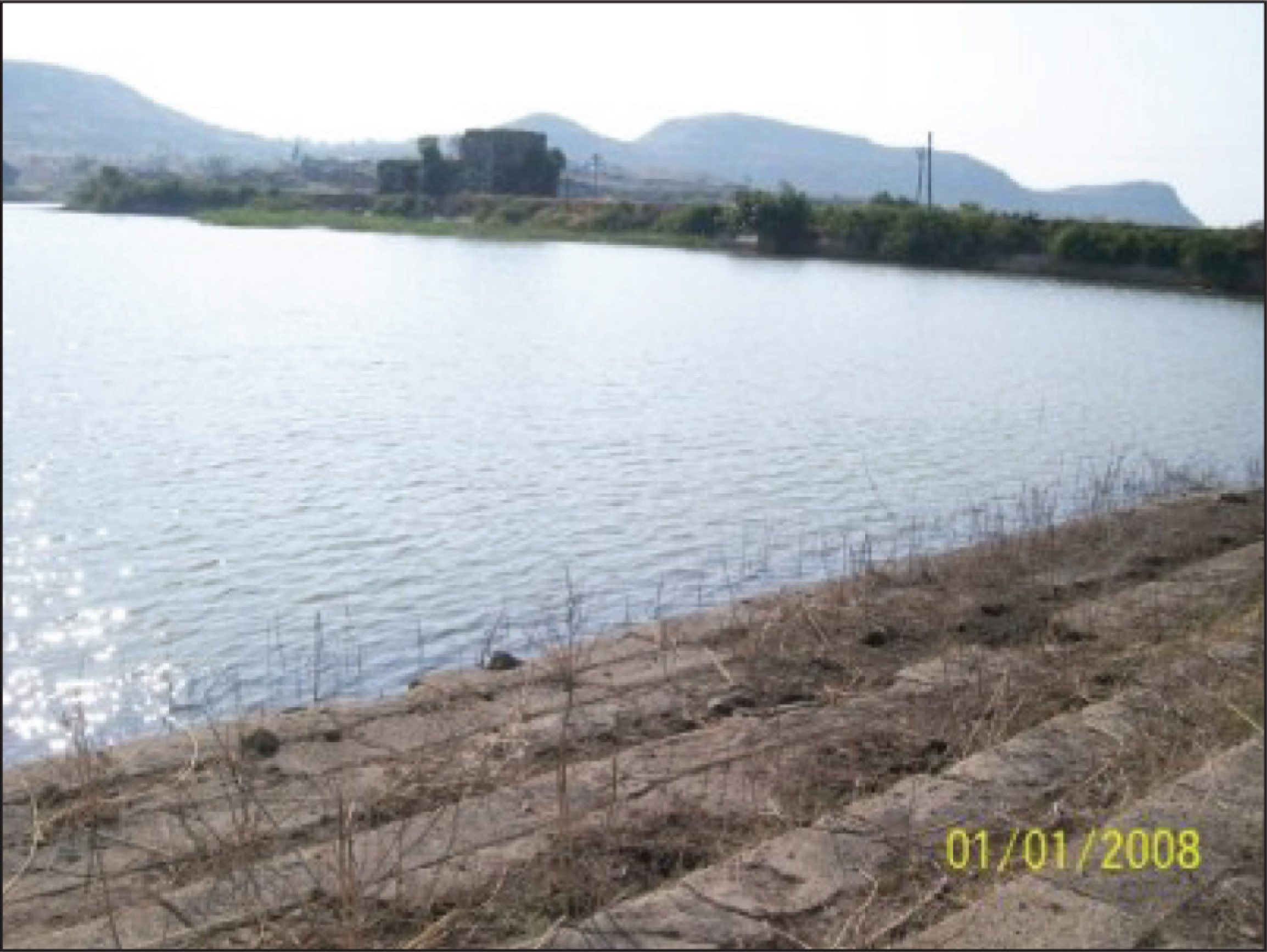
Another informant at the site was Murlidhar Balaji Sonavane, of the Bhil community, a neighbour and childhood friend of Shah. Sonavane stated that his ancestor was given the marfat (usufructuary right) for taking care of the tank surroundings and the Rang Mahal by the Nizamshahi rulers. They were given a small plot of land as maintenance, which they cultivate to this day. He stated that there was an orchard covering 32 acres extending from the Rang Mahal until the next talaab, called Abpashdara now called Hiranya lake, downhill from Mavsala towards Daulatabad. One could still find remains of the orchard, mango, guava, ramphal (Bullock’s heart), jamun (Indian Black plum), sitaphal (custard apple) trees growing in the area. His ancestors looked after the orchard as well.
Sonawane informed us that prior to Ambar intervention, a stone structure on the embankment with two holes was fitted with bamboo poles to which a leather bucket was attached to pull up water. Two oxen were yoked to the bamboo poles and they walked up and down the embankment slope, pulling up leather buckets filled with water which flowed over the side via a channel and into the fields. Rope weathering marks are discernible on the stone (Figure 2).
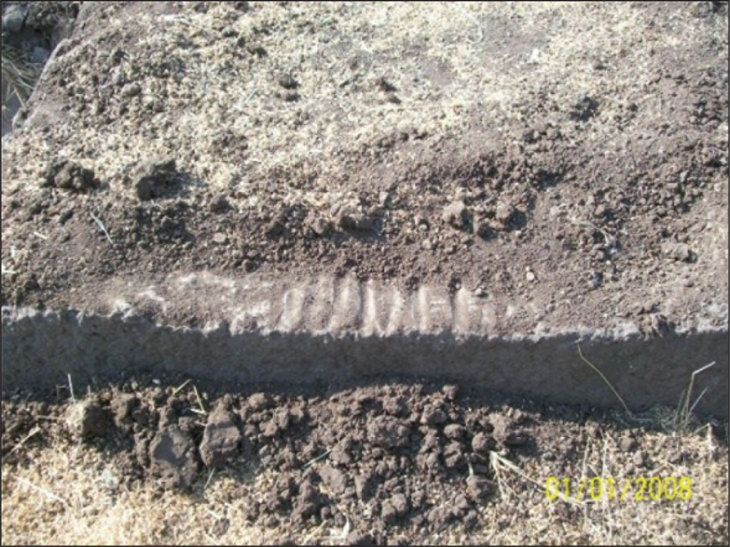
Shah then directed us to ‘Malik Ambar’s pipeline’, 34 the complex hydraulic system set up by the Nizamshahi Peshwa to transport water to Daulatabad Fort. He pointed out that the level of water at Mavsala was at exactly the same height at that in the ‘khandakh’ (defensive moat) at Daulatabad fort. He indicated a flight of newer stone steps into the talaab, separate from the older Yadava period ones. These were possibly built by Malik Ambar. The last 4–5 steps have holes opening into water channel running below, tunnelled through the steps, under the embankment into a ‘pressure chamber’ on the other side (Figure 3). There were stone poles used as sluices to control the outflow of water from the reservoir.
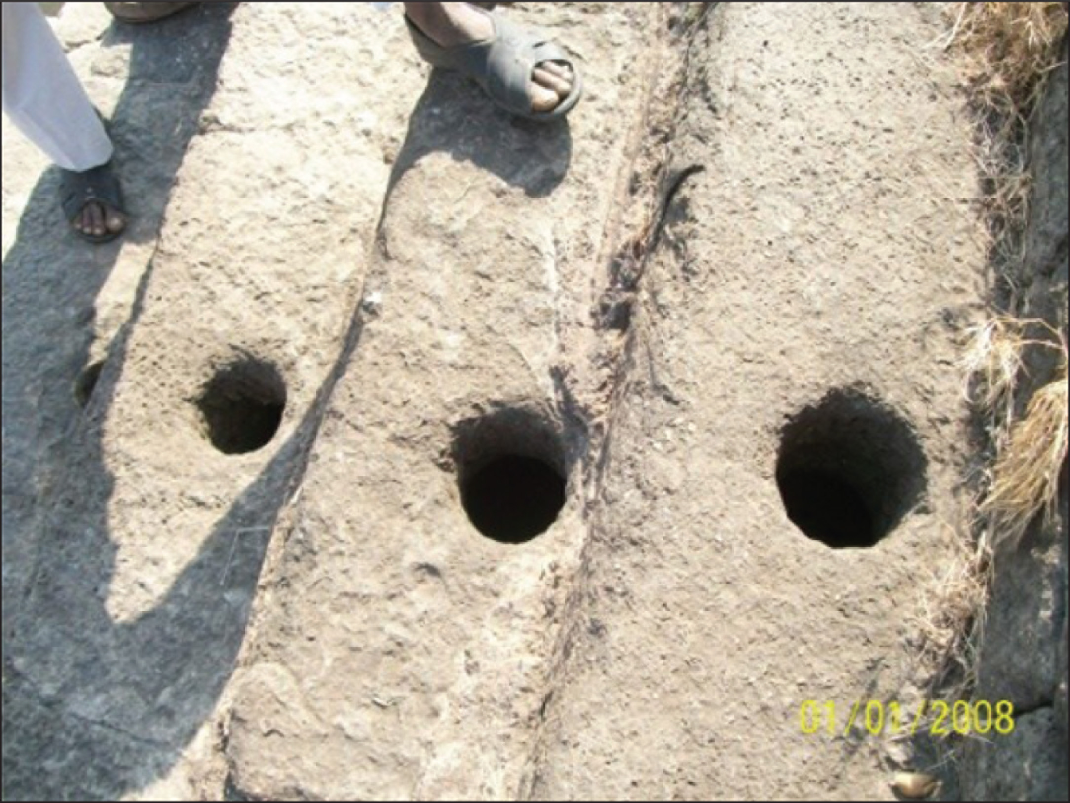
The water would be allowed to flow out of the talaab through a channel under the bund wall, from where it would be transported via ceramic pipelines over the terrain towards Daulatabad. The dyke with its high walls was a natural feature channelling the water in the required direction. Ambar constructed check dams at two stages along the dyke, creating three lakes cascading into one another, channelising the run-off from the surrounding slopes of the dyke. Today, the lowest talaab, called Abpashdara or Hiranya lake, is the only one filled with water, the other two having dried up (Figure 4).
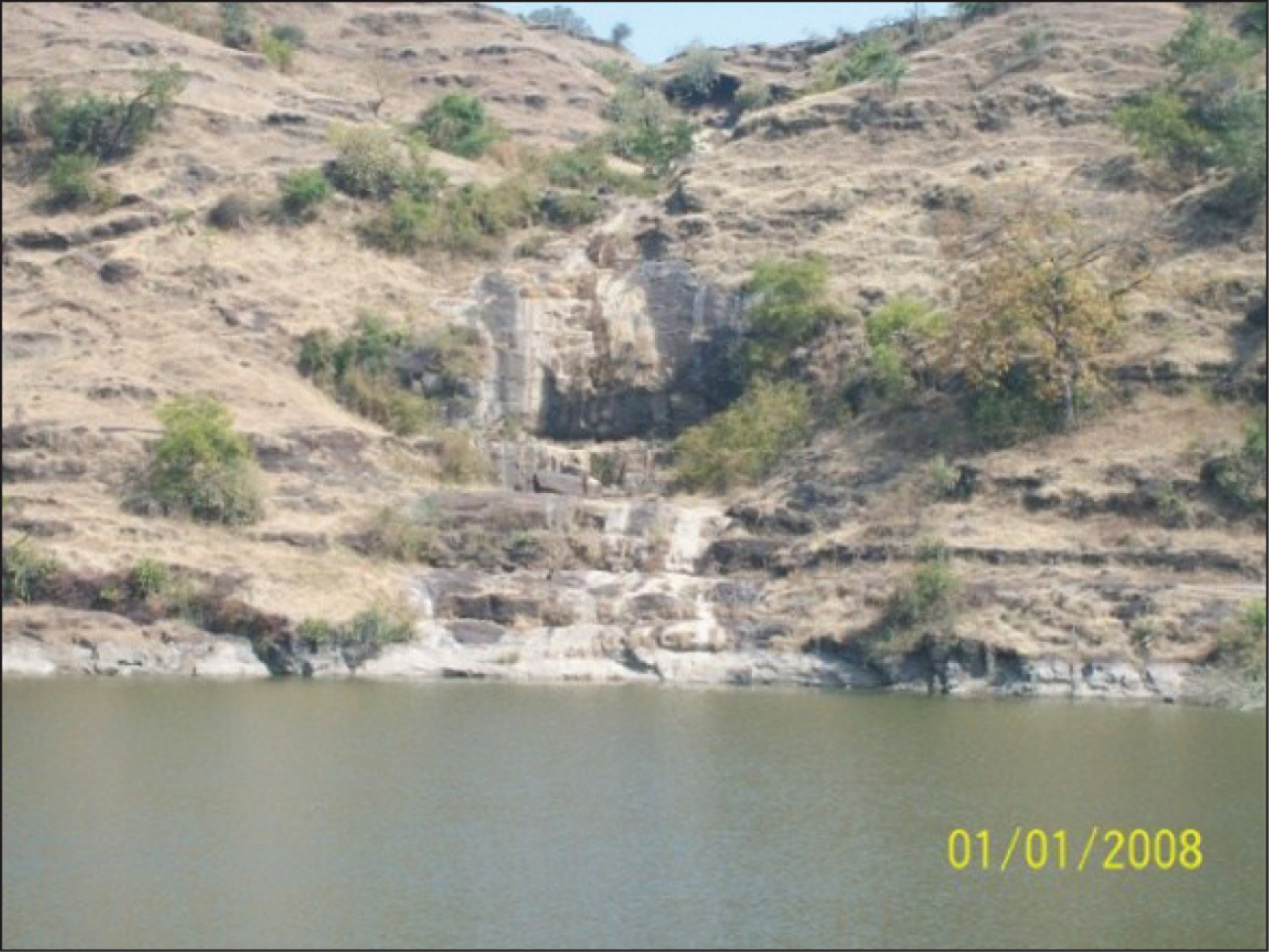
A comparison may be made with the Khooni Bhandara or Kundi Bhandara of Burhanpur, a 400-year-old water system envisaged and constructed by Mughal Subahdar Abdur Rahim Khan-e-Khanan in 1615. The system taps the catchment area of the surrounding Satpura hills via qanats, underground channels using Persian technology, that transport and distribute the percolated rainwater over 0.342 hectares across Burhanpur town. In light of the cultural and political connectivities between Burhanpur and Daulatabad (Burhanpur was founded on the basis of a vision of the Khuldabad Sufi saint Burhanuddin Gharib 35 ), it is not surprising that there are common features and sharing of technological knowledge of water conservation between the two medieval towns.
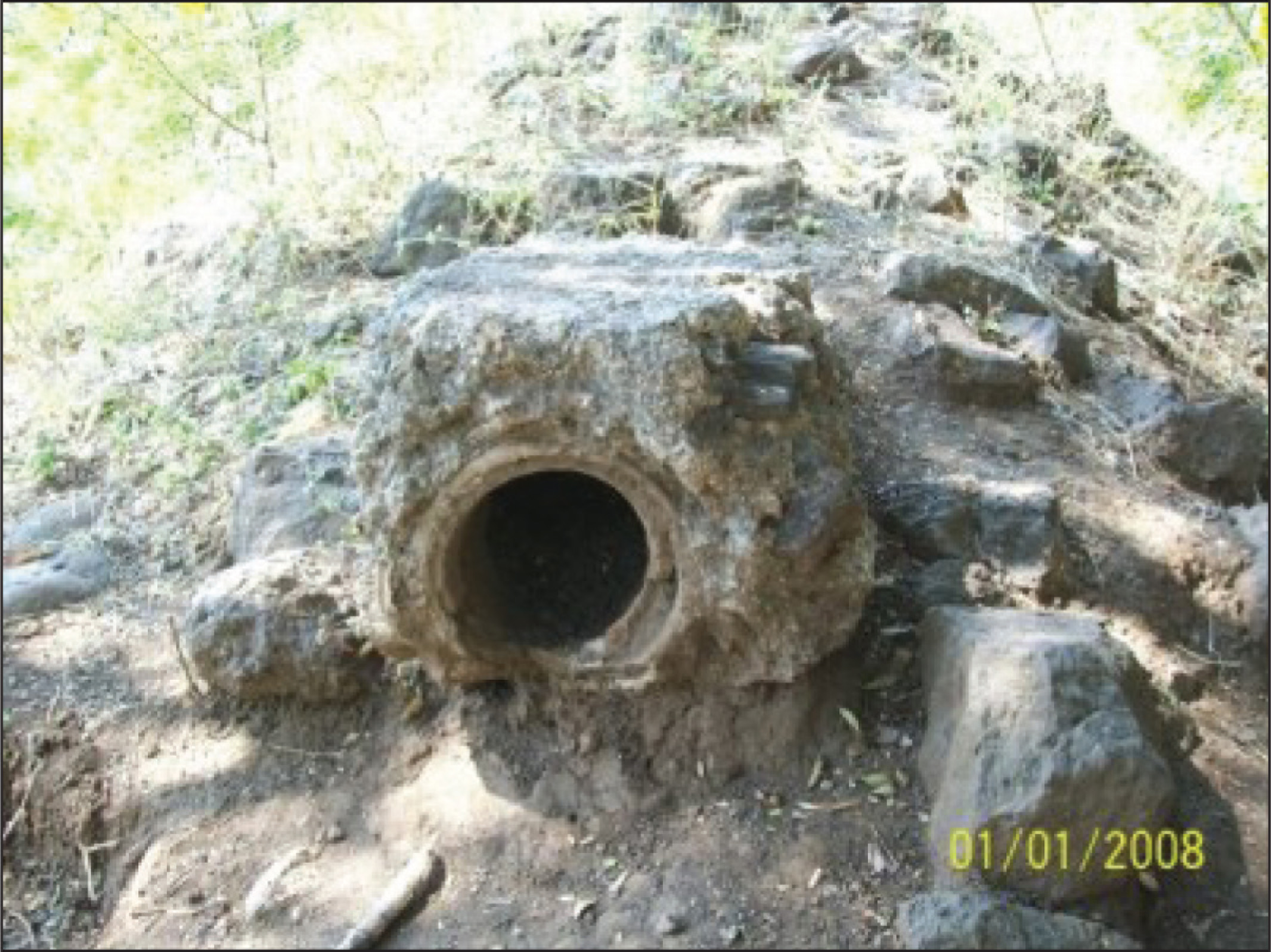
The ceramic pipeline was broken and parts of it were scattered across the floor of the dyke owing to excavation of clay by brick kiln owners (Figure 5). Walking along the bank of the dry reservoirs, enclosed on two sides by the steep stone walls of the dyke, criss-crossed by dry feeder channels, we entered a jungle that was a part of the original fruit orchard of the Nizamshahis, according to Shah and Sonavane.
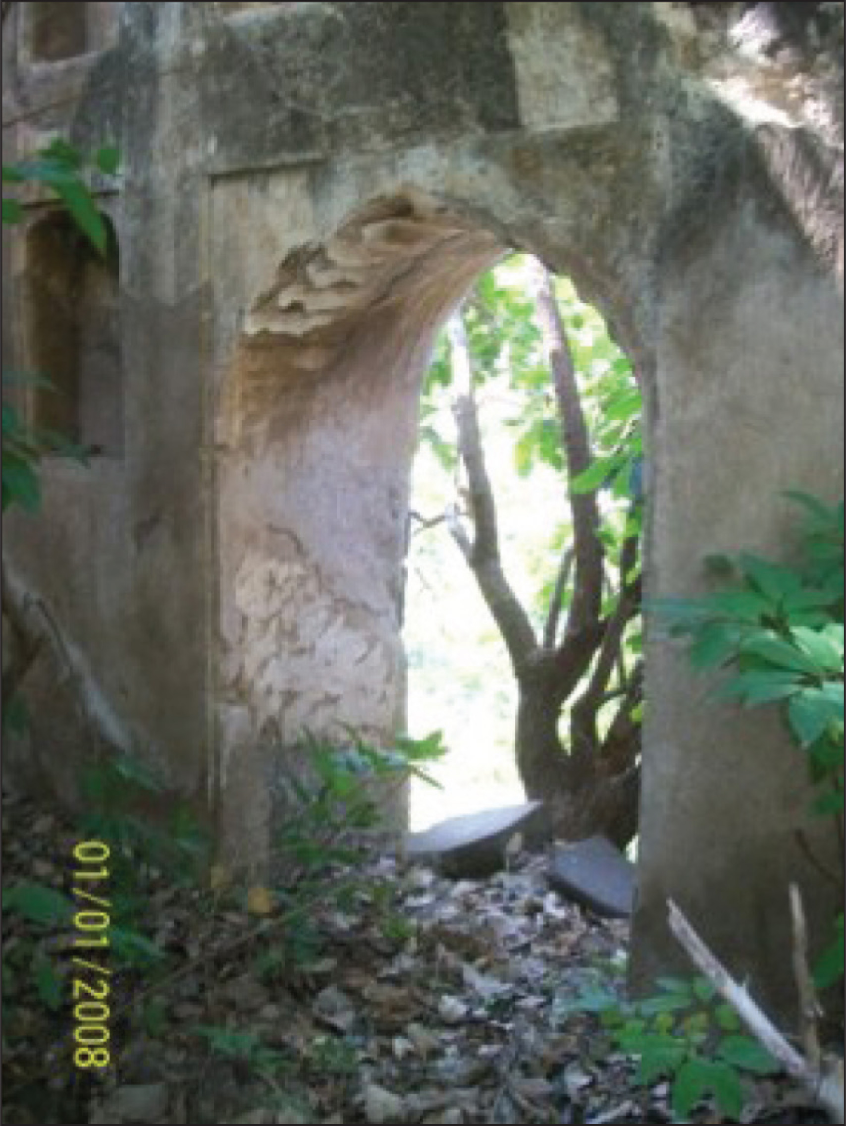
Following the pipeline deep into the forest within the dyke, we approached a dressed stone wall, part of the first embankment that dammed the upper lake in the system of the three cascading lakes, another pressure chamber and finally a waterfall with a stone pavilion, its crenelated arches depicting a seventeenth-century construction, indicating Malik Ambar’s time period. According to Shah, the pavilion was a place for the royal ladies to enjoy the cool spray of the waterfall, which supplemented the water supply system. There was a small stream carrying overflow from the waterfall, running along the opposite wall of the dyke, which had narrowed considerably. A bridge/acqueduct had been constructed over the stream (Figure 7).
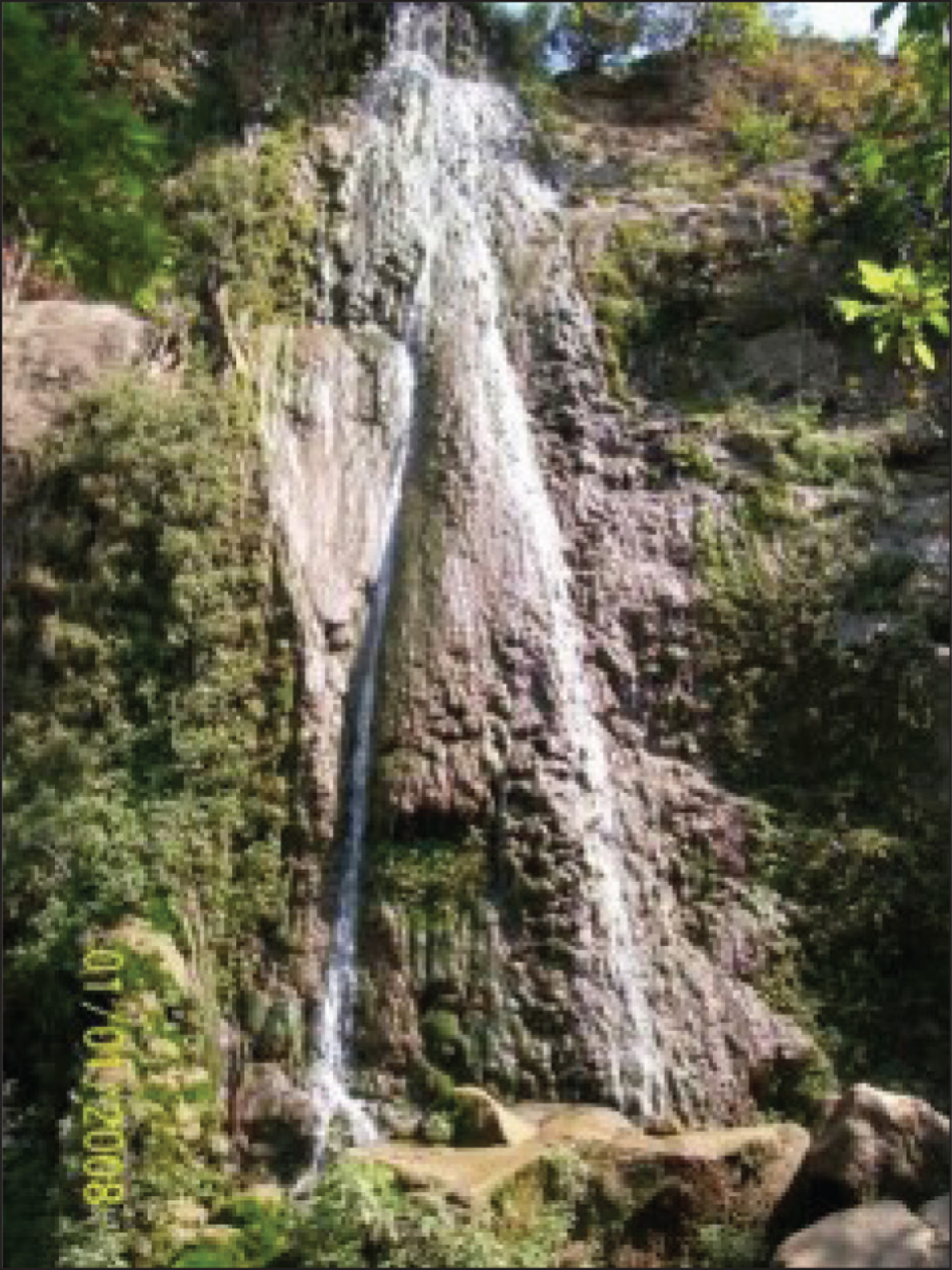
The waterfall was man-made, supplemented by a well dug 25–30 feet into the top of the dyke to supplement the water in lean months (Figure 8). The presence of bridges and aqueducts indicate the presence of significant waterworks. The diverse channels were difficult to discern at this stage, but clearly some of the water was diverted into the ceramic channels, while some flowed into the stream that ran alongside the opposite dyke wall and fed into the Abpashdara.
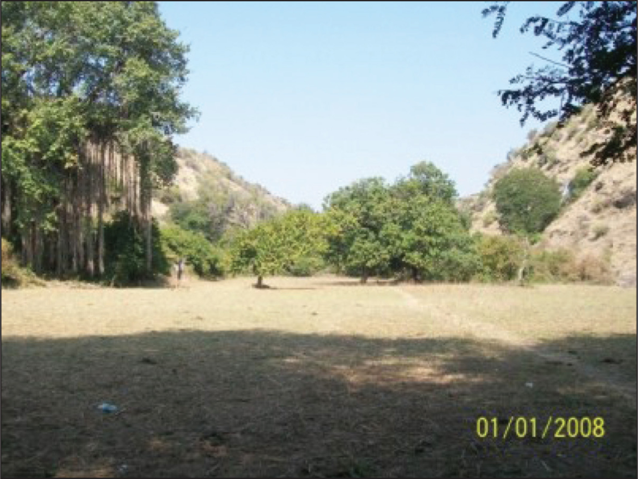
The area was deserted except by Bhils and pastoralists, whose cattle were grazing in the abandoned orchard (Figure 6). There was a gigantic Banyan tree that is known as ‘Jalali Baba’s Dargah’, believed to be one of the legendary 1,400 Sufi Pirs that migrated into the region in the fourteenth century, along with Muhammad bin Tughlaq when he shifted his capital from Delhi to Daulatabad. Only Bhils worship at the ‘Dargah’, standing under the tree and the shadow (saya) of the Baba is believed to protect the area. The Bhils report a fragrance indicating the Baba’s presence. According to Shah and Sonavane, Bhils were skilled at creating jheeras, hand dug holes in the ground near the stream. In about an hour, water from the stream would percolate through the soil and fill the jheera, providing adequate drinking water for their use. They would then move on, leaving the jheera for the next group that came that way. Awareness of the significance of trees and water bodies was strong within the Bhil community, indicating their alignment with the forests as components of a shared landscape.
Shah and Sonawane recounted their childhood memories of playing in the waterfall and eating the fruit of the trees in the surrounding orchard. They shared a childhood belief that there was a cave behind the waterfall, hidden by thick thorny bushes, within which lay a massive royal treasure, guarded by serpents. The apocryphal nature of the story underpinned the fact that their environment was intertwined with their lives through myth, memory and belief.
Ivan Illich in a seminal essay distinguishes the states of ‘living’ and ‘dwelling’ as two separate aspects of being. To live is simply temporal, but to dwell in an environment means to inhabit the traces, to retrace the lives of our ancestors. 36 The living landscape then becomes truly a product of interaction between the inhabitants and their environment, social, economic and ecological as well as between communities and their past, through memory. Communities shape their dwelling space according to their ideas, needs and aspirations. Malik Ambar is a part of Daulatabad’s past, hence lives on in the landscape through the community’s memory and of his waterworks, imprinted upon the countryside.
Water occupies an interesting position in this scheme, through its ability to bridge the past and present, its symbolic as well as material forms, its scarcity as well as its ubiquity, underground and overground. Illich has discussed in some detail the significance of the Well of Mnemosyne, the Greek Titan goddess whose waters hold the memories of all humankind who have passed into the next world. A hero, blessed by the gods, if he drinks the water from the Well of Mnemosyne, remembers not only his own past, but that of all who have passed on, leaving their memories in the water. 37 Mnemosyne represents orality, poetry, myths, legends, all that is memorised. Water, her element, carries within it civilisational memories, the collective consciousness of a community. Thus, the waterworks of Malik Ambar, assimilating the skills and memories that he carried over from his origins in Ethiopia and Baghdad, became a part of the landscape of the Deccan and found expression in the memories of the local community.
Conclusion
The multi-centred Deccan with its manifold political narratives, involving different dynasties, Persian, Turkic and Afghan groups of nobility, Habshis and Sufis denoting linkages with West Asia and Africa along with indigenous Marathas, was a counterpoint to the north with its singular dynastic record. It expressed this difference through its resistance to northern hegemony, spearheaded by the Nizamshahi state under the leadership of Malik Ambar. By virtue of his Ethiopian origin, Ambar embodied the ‘other’ for the Mughals, particularly the Emperor Jahangir, for whom his dark skin was the crux of his alienness and therefore his unsuitability to defy Mughal dominance. Yet it was his Ethiopian origin and his training in Baghdad that gave Ambar the ability to resist the Mughals, his skill in Bargigiri provided his Deccan armies the unique facility to repel the attacks of their mighty forces.
The Deccan landscape was an amalgam of plain and plateau, trade and agriculture, ‘foreign’ Habshi and indigenous Maratha. The racial, linguistic and cultural solidarity of its multiple groups was premised on loyalty to the region, as displayed by Malik Ambar and later his protégés, the Marathas. Building the capacities of Daulatabad not merely by military fortification but more seminally, by augmenting its water supply and later by constructing an exemplary city, Khadki, later Aurangabad. Ambar’s water system at Daulatabad represents a complete understanding of the terrain, building upon established resources and moulding them to achieve greater capacities.
Memories of Malik Ambar are remarkably alive in the contemporary consciousness of local communities of Daulatabad. By revealing the workings of the entire system that transported water from a Yadava period reservoir at Mavsala to the fort via an arrangement of three cascading lakes, ceramic channels, waterfalls and streamlets, B. D. Shah, a local farmer displayed not only an exemplary understanding of a historic water system but the manner in which his own past was intertwined with the landscape he inhabited. The Bhils too, inhabit the Daulatabad landscape bearing water management skills that are closely aligned with the nature of their environment. The fact that water is the medium for carrying forward community memories across the centuries resonates with Ivan Illich’s example of the Well of Mnemosyne, whose waters are bearers of the collective memories of a society. It is this shared consciousness that defines the spirit of the Deccan.
Footnotes
Declaration of Conflicting Interests
The author declared no potential conflicts of interest with respect to the research, authorship and/or publication of this article.
Funding
The author received no financial support for the research, authorship and/or publication of this article.