



Abstract
This article retreads our geographic and literary performance in March 2015, following, almost 30 years later, the traces of Gianni Celati’s travel diaries Verso la foce (‘Towards the River Mouth’) through the Po River Delta, in Northeastern Italy. In our reading of Celati’s text and during our 2-days performance, we decided to ‘go along’ the Po River, considered as a ‘liquid chronotope’ that discloses and shapes a geographic and narrative ‘liquid landscape’. We moved ‘from text to action’ and, interpreting literary maps ‘as always mappings’, we performed the ‘implicit map’ that emerges from Celati’s travel diaries. The purpose of the article is to re-activate the geographic understandings of Po River Delta’s waterscape: through our performance, we aimed to re-read Celati’s literary/geographical observations for interpreting the transformations of this peculiar Italian landscape. Moreover, the perspective of a photographer enhances the narration of the performance to open up the readers to further ‘visions’ of the Po River Delta.
A ‘literary guide’ of the Po Valley
The imagination too is a part of the landscape: she inspires love for something outside around us, but more often she puts us on the defensive with too many fears; without her we wouldn’t be able to take a single step, but we never know where she carries us. Inextirpable goddess behind every gaze, figure of the horizon, be it so.
1
(Gianni Celati, Verso la Foce (Towards the River Mouth))
This essay recounts aspects of a geographical performance in March 2015, following traces from Gianni Celati’s travel diaries Verso la foce (Towards the River Mouth) collected and published in 1989. First, the article introduces our preparations and methodological design for the performance, intended here as an embodied literary mapping experience, aimed at exploring the entanglements between literary pages and real places of the Po Delta. 2 It also presents the conceptual questions that led us to follow Celati’s travels through the territories at the mouth of the Po River, in north-eastern Italy. Second, the article describes some of the highlights of our performance, ‘activating’ Celati’s text and the resulting geographic considerations. The mapping performance we recall here was only one situated moment of an ongoing, multifaceted process of performative research. 3
If every research project and journey can be said to have a starting point, we began ours with a belief that it is possible to re-read the ‘novel as a geographer’, 4 disclosing new kinds of geographic interpretations. Persuaded that literature was not a mere instrumental tool to confirm our geographic knowledge, we aimed to let geographic comprehensions of this fluvial landscape emerge from our chosen literary text.
Thanks to the intensity of Celati’s observations of the complex spatial relations in the postmodern Italian landscape, 5 he seemed to be a test case perfectly suited for this experimental approach to geoliterary fieldwork. In fact, both literary critics and geographers have recognised Celati’s ability to portray, through his literary texts and documentary films, the geographic transformations of the Po Valley during the fast-changing period of the mid- and late-1980s. 6 The dual literary and geographic gaze of this ‘writer-geographer’ emerges especially in his four-diary collection Verso la foce. As a ‘geographer of the plans’, 7 Celati almost scientifically observes the transformations affecting the fluvial landscape, and as a writer, he translates his observation into a typical ‘Po narrative’. 8
Travelling along the ‘liquid chronotope’
Through the four travel diaries comprising his collection, Celati narrates four different journeys made in 1983, 1984 and 1986 along the course of the Po River. However, we decided to construct our performance based on the fourth diary (from which the title of the whole collection came) for mixed literary and geographic reasons. Not only does the fourth diary fulfil a substantial role because the end of the narrative coincides with that of the river flow, and the river mouth allegorically represents the writer’s limits in depicting the complexity of those ‘uncertain lands’, but in these terminal territories, the landscape’s shape and configuration are more deeply influenced by the river’s flow. This complexity of geographical observation makes the final diary – in our view – the most interesting and inspiring.
In our reading of Celati’s text, as well as during our performance, we decided to ‘go along’ the Po River, treating it as a central feature in the construction of a geographic and narrative ‘liquid landscape’. This kind of topographical imagination is not entirely common in Italy, where rivers have been economically and culturally marginalised, if not neglected, over the last decades.
We contend that in Verso la foce, the Po River operates as a ‘liquid chronotope’, structuring the narration, and steering the author’s geographical observations of the journeyed territories. In fact, on a narratological level, the Po River as a linear reference point lends coherence to the plot, connecting the four diaries of the collection and guiding Celati’s journeys. On a regional level, it has produced, across the ages, those ‘waterscapes’ that are a permanent feature of the Po Valley’s shape. On the geographical level, the river is a ‘liquid chronotope’, a water landmark that influences the landscape configuration, and its socio-economical organisation; on a narrative level, the river’s ‘liquidity’, its uncertain fluid essence, affects the writer’s wavering gaze, and his drifting narrative voice. 9
Therefore, our aim was to ‘go along the liquid chronotope’ not walking along the banks of the Po River, but following the literary guide of Celati’s text in passing through the Po Valley and profiling the signature features of this fluvial landscape. Bridges, water pump buildings, abandoned colonial houses (Figure 1 and 2), the Enel power station of Porto Tolle, 10 marshes and fish farms, local coffee bars, banks and canals, as well as seaside tourism buildings are not only recurring elements in his narrative but also ‘liquid chronotopes’ that as constitutive landmarks identify the Po River Delta’s landscape. Performing Celati’s text, we interpreted the chronotopes as local configurations of time-space, as well as points in relational networks and spatial stratifications. The singularity of each chronotope resides in its mediations of here and there, past and present, similarity and difference. Those chronotopes guided our route through the Po Valley, constantly reminding us of the river’s fundamental presence and centrality in structuring that ‘liquid landscape’.

Bridges as chronotopes: one of the last ‘pontoon bridges’ at Bocasette di Porto Tolle. Photograph: Ignazio Lambertini.
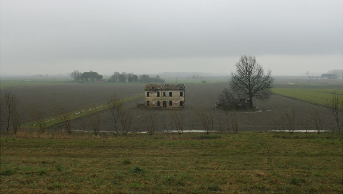
Abandoned houses as chronotopes of the Po River Delta’s plan, close to the banks of the Po di Goro at Ariano nel Polesine. Photograph: Ignazio Lambertini.
Activating the ‘implicit map’
In Verso la foce, the reference to mobility and performative process emerges directly from the narration. 11 Through frequent in-text cartographic references, Celati implies an internalised, ‘implicit map’ 12 of the Po Valley. Moreover, through the spare style of the travel diary, the intense use of verbs of motion and the repeated mention of precise toponyms, the writer–geographer invites readers to experience those waterscapes.
If even literary maps could be interpreted as ‘always mappings’, 13 we decided to embrace Celati’s invitation to move from the implicit literary map to explicit literary mapping practice through the described territory. 14 Practically, we moved ‘from text to action’, 15 rearranging mapping as storytelling about journeys. Reading the text, we obtained the names of the places described and visited by Celati to relocate them on the cartographic space and to create a map of the movements depicted in the book. In this way, we studied the territory and imagined our journey, with Celati as our geoliterary guide (Figure 3.).
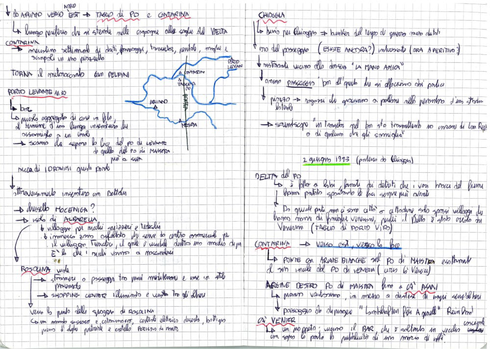
The pages of our travel dairy with the travel notes and a hand-drawn cartographic sketch of a part of our itinerary (provided with the names of the places described by Celati).
Our intention was not to follow religiously in Celati’s footsteps, almost 30 years later. The performance was to be informed by his text, but not restricted to its pathways, or by its descriptive observations. In contrast to Celati, who navigated by a specialist, technical map of the Geographical Military Institute, and thanks to our geographic knowledge and previous work on this area, to orient ourselves, we used an ‘everyday map’, not technical or detailed and even without scale (Figure 4.).

Above the ‘banal’ touristic map realised by the Po Delta Park we used during our performance. It is interesting to note that the map is without a scale, shallow and little detailed. The red points on the map show the places where we stopped during our performance.
Three gazes ‘in’ the landscape: the reader, the geographer and the photographer
During experimental fieldwork, we decided to explore the places by partly driving and partly walking. The quickened perspective from the car, even if apparently less engaging than the pedestrian one, permitted us to embrace a broader, large-scale vision of the Po River Delta’s landscape. When leaving the car behind, to approach the river banks on foot, our apprehension of landscape shifted, and we gained a deeper bodily engaged experience of it.
We decided to enrich our vision, enhancing it with the third perspective of a photographer. Beyond the gaze of the literary critical reader, who offered a deep reading of Celati’s text, and the scientific geographer, who constantly ‘oriented’ us thanks to his acquired knowledge of the region, the photographer’s outlook offered much to the fieldwork performance. First, it recalled Celati’s own practice. During his narrative journeys and documentary filmmaking, Celati was often accompanied by photographers, such as the famous Italian Luigi Ghirri. Our documentary intent was then to photographically ‘register’ the landscape transformations for comparison with the materials collected by the writer more than quarter of a century ago (Figure 5). Second, we figured the artistic, geographically ‘uninformed’ gaze of the photographer as a heuristic tool to open up our structured and framed imaginary to different visions of the landscape. Constantly reading passages of Celati’s diaries, we conducted the performance by not guiding the photographer’s gaze, never asking him to take specific pictures of what we observed or found interesting, but trying to stimulate his perception through the literary text.
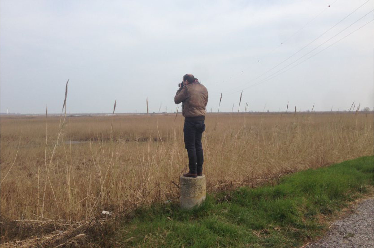
The photographer Ignazio Lambertini at Pila.
Reciprocally enriching our different perspectives, as reader, geographer and photographer, we headed out on a shared journey, observing the performance, the text and the landscape with three distinct and yet connected gazes.
Reading the map, performing the text
The Po Delta, easily mistaken for being a flat, static and timeless entity, is in fact a dynamic landscape permanently in motion from one place or time to another. The coastline and different branches of the Po River have changed radically over the centuries. Its delta landscape can be considered a land in continuous formation. 16
Our performance of the last diary of Verso la foce was based more on a broad spatial imaginary rather than linear or temporal circumstances. Inspired by Celati’s fieldwork method that focused on poetic descriptions of specific places written at the moment of perception, directly in situ, we organised our exploratory journey – not just by following the explicit map we drew but also by reading parts of the book, getting gradually closer to the exact places described in its pages. This mutual exchange between pages and places allowed us to re-open the past as portrayed by the author, re-activating geographic understandings and especially re-imaging new endings for places. 17
The starting point of our geographic performance was a small house in an Occitan-style block of flats in the village of Lido di Spina, one of the seven beachfronts called Lidi ferraresi, built between the 1950s and the 1960s, during the economic growth that transformed Italy into a ‘fully industrialised country’.
18
The urbanisation of the Italian coastlines seemed at that time an utterly new phenomenon, a product of Italy’s successful growth called ‘Economic boom’ or ‘Economic miracle’.
19
These Lidi mostly consist of summer residences; during the rest of the year, the place can look like a ghost town. The first day of our performance was on 16 March 2015, a Monday. We went to the only open café in Lido di Spina to have breakfast and to discuss our plan. One of the few sounds audible, breaking the unreal silence, was a chainsaw, being used to cut down a roadside pine tree. A passage from Celati’s diary immediately sprang to mind:
On my map the area of extensive reclamation is a giant tangle of canals that cross ancient marshlands. To the south the Po di Volano, an old branch of the Po, flows through here. In its final stretches it passes through dreadful places now, all covered with asphalt, seaside resorts built for summer tourism, crowded anonymous developments that in winter are empty as cemeteries.
20
Here, it seemed that the words of the writer–geographer had transformed themselves into concrete elements. On the performative level, this meant redefining the book’s concept in dynamic terms, ‘understanding it as a process (a route) rather than as an essence (a root) and therefore transforming it into an instrument of landscape analysis’. 21
Transported by the reading of the text, we decided to orient ourselves first to the southern point visited by Celati, the town of Anita, and then we headed north along the Po di Volano. Anita is a small, built-up area in the middle of one of the most extended projects of land reclamation but is especially the perfect example of what Celati defines in the introduction as ‘[. . .] a type of desert of solitude, which is however also everyday normal life’. 22
Landscape ‘narrations’: the examples of Barricata and Pila
Leaving the banks of the Po di Volano behind, we drove along the coast, and after crossing the Po di Goro and Po di Gnocca river-mouths through two of the last pontoon bridges, we arrived at the famous Sacca di Scardovari, a sort of artificial bay particularly important for mussel and clam farming. At the extreme end of the strip of land between the sea and the Sacca di Scardovari, we were absorbed by the ‘Village of Barricata’, practically a massing of prefabricated buildings for tourists arranged in parallel formation, interspersed by small trees and completely enclosed by a high plastic net (Figure 6).
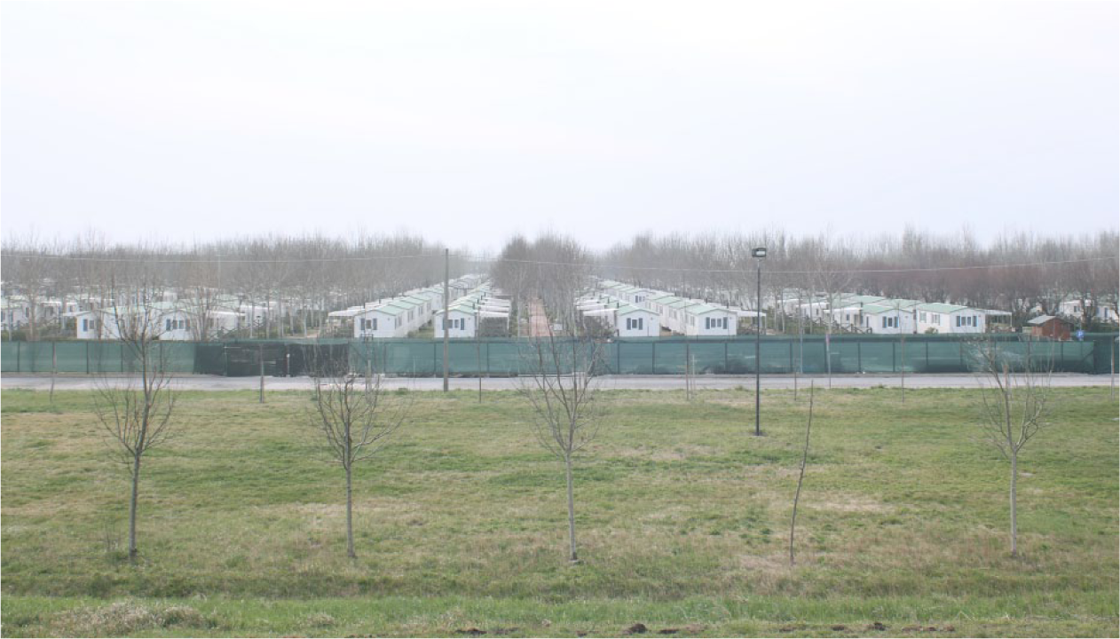
The multitude of prefabricated buildings of a holiday resort at Barricata, near to the Sacca di Scardovari. Photograph: Ignazio Lambertini.
We got out of the car, and while the photographer was directing his attention to the surrounding landscape, sitting on a rock along an embankment, we read page 139:
Along the road, boxy two-story farmhouses are spread out at regular intervals, built about three decades ago during a time of agrarian reform. Here and there a house lies abandoned in the fields, its doors and windows bricked up, covered with invasive plants. The only person I could see was a lone old man, sitting on a chair under a tree and looking at the ground.
And a few lines after,
When I reach the levee leading to the point, it is almost evening. Nearby is a little trailer encampment, not far from a large sawmill that emits at intervals the sound of an electric saw still at work. The sea extends out in front of me, and the road leads to the right along the levee that borders the large inlet near Scardovari.
23
Barricata is a very recent, extreme case of standardisation of the tourist landscape at the edge the Po Delta. It could resemble another extreme and standardised mode of exploitation of the same landscape, which was the past, intensive practice of land reclamation for agricultural purposes. As we looked at the houses, a sense of deep disorientation filled the conversation; it seemed that everything there resembled everything else. 24
The following day, we decided to explore the northern area of the delta landscape. Arriving at Pila in the late afternoon, we parked the car at the town’s border. From here, we walked along the high banks of the Po Grande (or Po di Pila) until the last of the land slips into the sea. On page 132, Celati, as a writer–geographer, provides us not only with a narrative description, but even a socio-spatial observation of the place:
All places will come to the same end, becoming descriptive abstractions or the specialized projects of experts. A large touristic park will be created here, and tourists will come in buses to see I don’t know what, relicts of old sorrows, propagandistic billboards, places that are no longer places.
25
In the 1980s, Pila was a village at the extreme east of the delta close to the main mouth of Po River (Po Grande or Po di Pila), surrounded by marsh areas and failed attempts at land reclamation. Today the small village is promoted (especially by the Po Delta Park) and sponsored as the traditional ‘fishermen’s village’. The old tinplate shacks have been replaced by new cavanas (shelters for fishers), and the rearranged fish market permits tourists to buy fresh fish and talk with the fishers; in other words, a ‘tourist experience’ has been created ad hoc. A new mythology of fishers and their truthfulness, with the controversial power station of Porto Tolle (pollution issues) in the background, has been produced in a natural park as a sign of the typical incoherence of Italian environmental policies (Figure 7.). Not (yet?) ‘Disneyfied’ as Celati predicted, the Po Delta is suspended between marginalisation and landscape promotion. Perhaps, it is in this economic, cultural and aesthetic suspension that a path towards a sustainable future life for this landscape has to be imagined.
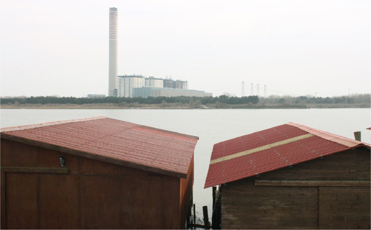
Fishermen’s cavanas with the Enel Power Station of Porto Tolle on the background in the small village of Pila. Photograph: Ignazio Lambertini.
Conclusion: drifting towards the river mouth
In this essay, we have presented momentary episodes of our experience of performing the literary map of Verso la foce. We have reflected on the literary and topographic aspects of this creative enterprise, comparing what we have learnt from the places’ descriptions in the book and what we have recognised during our fieldwork exploration. From the first analysis, we can observe a significant repositioning of the local economy from land to water (river and sea), in contrast with the historical anthropocentric actions directed at building new lands for new inhabitants in a new landscape, particularly through intensive land reclamation activities. The closure of the power station of Porto Tolle in 2012 and the strengthening of the Po Delta Park, after a difficult reception, are exemplary of this sort of change.
26
Economic and social ‘water oriented’ restructuring in recent years is well represented by an increase in green tourism along the branches of the Po River where the brackish wetlands are now a place for bird watching, school-age tourism, cycling holidays, cultural events, local food and wine tasting, riding horses; by the importance of mussel and clam farming (70% of the Italian production comes from the delta); by the development of high-quality products (rice, eels and marinate fishes); and by boat tourism (cruises along the river, kayaking and canoeing). We are conscious that this could be a tendency.
27
A tendency ‘towards the mouth’ that we could also read between the lines – since the diaries also constitute an ‘atlas of drifts’
28
– drifts towards the infinite horizon distinctive of the lowland, as Celati traces:
The Po Delta is made of lobes formed of detritus carried by the various branches of the river that continually shift the land further seaward. Around here there no cities or towns, only little settlements with Venetian family names, the delta having been created by Venetians to channel here all the detritus carried over centuries by the river. These lands are thus masses of detritus that are slipping over the continental shelf towards the sea, [. . .] and with a large river that comes to its end fanning out in six branches: as if this were the penchant of everything here, to open up, drifting towards the sea, reaching a mouth where all apparitions eclipse back into detritus.
29
In the last pages, the writer-geographer arrives at the end of his journey in Porto Tolle and decides to leave his compass and military maps on the banks, where they might be rediscovered by someone at some future date.
30
It is a symbolic passage where Celati, by abandoning the geographic instruments and consequently his attempt at describing the new Italian landscape, chooses to embrace an empathetic acceptance of it (Figure 8):
If it started to rain now you would get wet, if tonight it is cold your throat will hurt, if you turn back on foot into the dark you will have to be brave, if you keep wandering you will wear yourself out. Every phenomenon in itself is serene. Call to things because they will remain with you until the end.
31
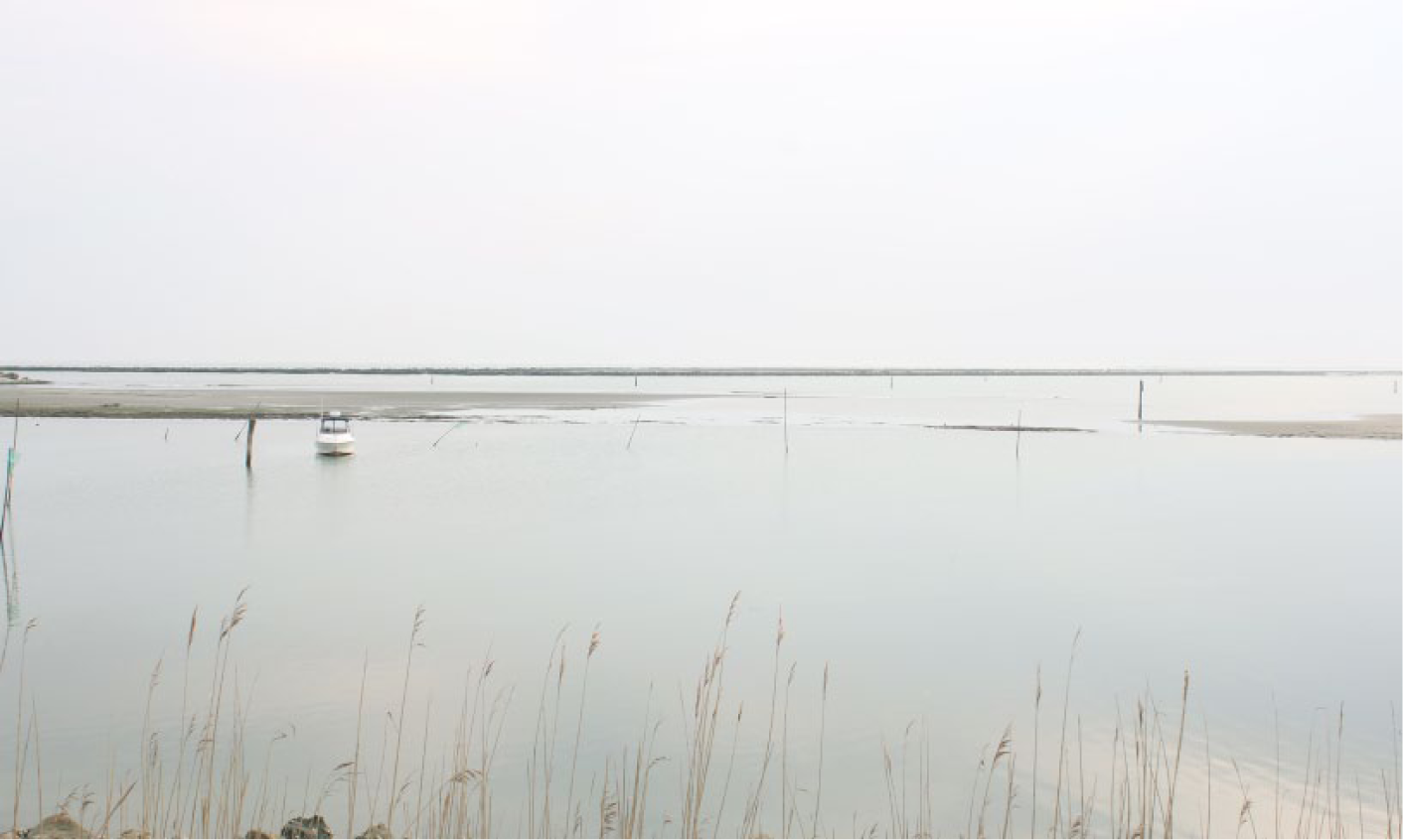
Sacca di Scardovari. Photograph: Ignazio Lambertini.
The images of the landscape, whatever they are literary, cartographic or photographic, should be understood not as documents, but as empathic projections that can help us learn something about the life of a landscape, provided that we are able to ‘be in’ and ‘be open to’ that landscape.
Footnotes
Acknowledgements
A draft of this piece has been presented at the Waterscapes and Historic Canals as a Cultural Heritage conference held in Venice (14–15 May 2015). We are grateful to Francesco Vallerani, Stephen Daniels and Davide Papotti for the useful comments provided in that occasion, to Veronica Della Dora for discussing with us the initial project and the final article, and to Tania Rossetto for her valuable help in all the steps of this ongoing project. We are also thankful to Patrick Barron for providing us the English translation of Celati’s original text and to the editor Prof. Hayden Lorimer for his constructive comments. Finally, a sincere thank goes to our friend Ignazio Lambertini, whose artistic gaze represented a central added value of our research.
Funding
The author(s) received no financial support for the research, authorship and/or publication of this article.