



Abstract
Traditional water systems as a water management practice in today’s context are overridden by various factors and are struggling to be a functional part of the city. These systems now demand regeneration regarding their history, cultural and traditional practices, and the indigenous geographical conditions of the area. This research documents and investigates the struggles of one of the partially functional traditional water system in Aurangabad, locally known as ‘Neher’ system. It was observed that this Neher system in Aurangabad, constructed in the 16th century, is still a viable water supply method for few agricultural and domestic uses with enormous heritage and cultural values attached to the system. This paralyzed yet functional Neher system calls for protection and conservation as indigenous water heritage and, simultaneously, as a sustainable source of supplying water.
Introduction
Water has been the reason for major human settlements to get established and flourish. Be it a conventional riverine system or a cascade of man-made lakes and tanks, each system has its link to indigenous conditions such as building material, climatic conditions, cultural and traditional practices. These time-tested traditional water systems were envisioned for much more than just managing water resources. These structures were seen to have large associated values, rituals, and related fairs and festivals which provided a city with a body of common property resource management practices and sustainable ways of water management. But in the present context, these are overridden by a changing environment and now governed by haphazard agricultural patterns, capacity and capital intensive borewells and location-insensitive construction around these structures. These systems now struggle to merge with and be part of the change around them, and demand revival. Often the monumental components of such systems are conserved, but the larger feeder network is overlooked mostly because these are not documented enough as an entire system. The aim of this study is to document spatial, physical and social challenges of reviving traditional water system embedded in an urban setting by taking an example of one of the ‘living’ Neher-based water systems in Aurangabad.
‘Neher’: Traditional Water Systems of Medieval Time
In climatic conditions with average annual rainfall of 250 mm and less than 100 mm, a systematic and planned use of underground water resources becomes crucial. Following this, in early 8th century
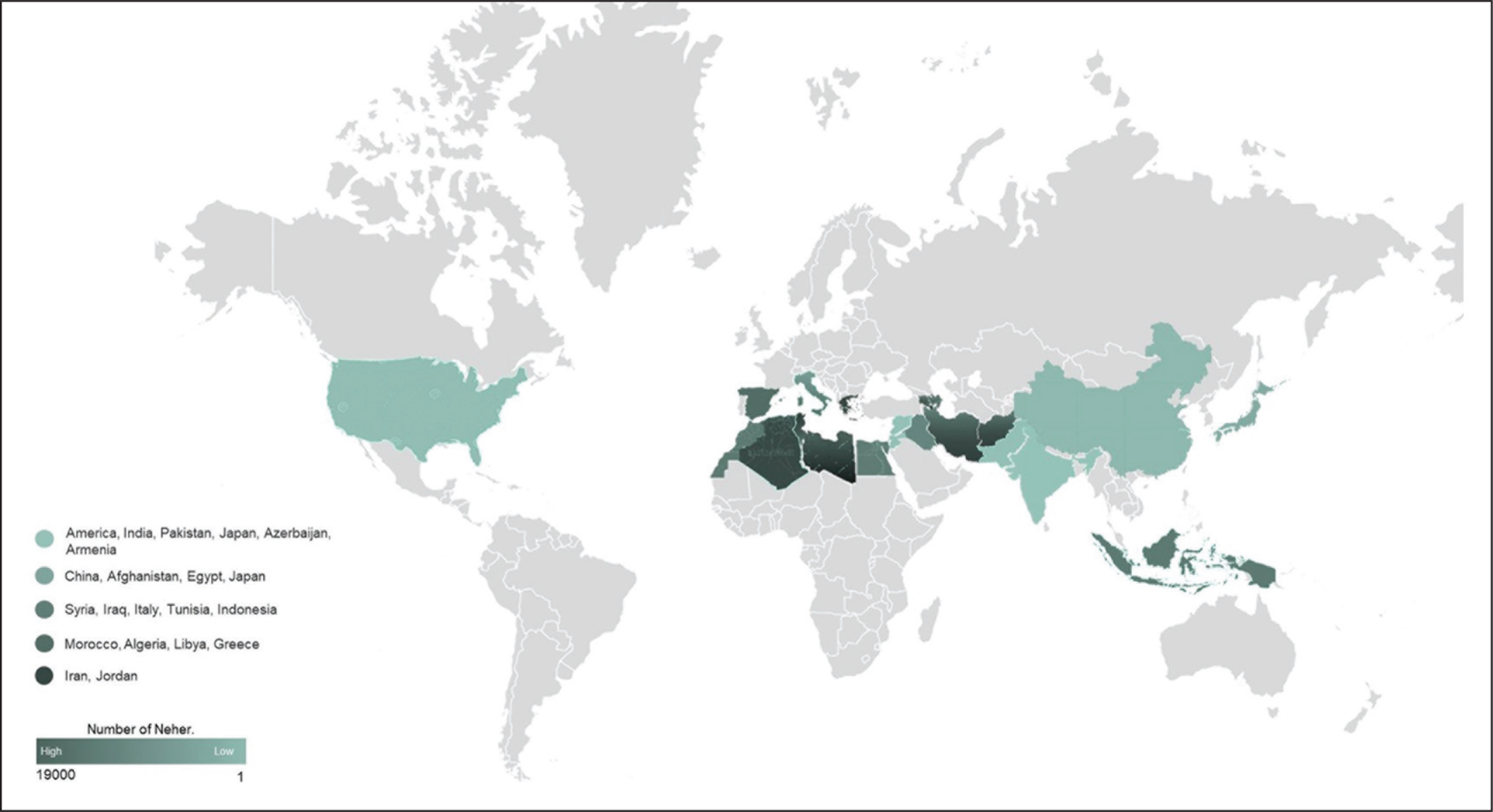
A ‘Qanat/Karez’ (Neher-based system) is a combination of water channels above and below the ground used to bring water to a settlement or fields from a natural source, say an aquifer, mountain spring, lake or a reservoir. ‘The Qanat/Karez system comprises of gradually sloping, horizontal and subterranean water tunnels carved into the water-bearing permeable rock’ (Deccan Heritage Foundation, 2014, p. 1). This system usually connects the higher elevation point where water accumulates to the plains of the city with comparatively lower elevation. A typical cross section of the Neher depicts various components and sections of the system (see Figure 2).

The Challenge
Along with the benefits of Karez water system which are widely known, there are a number of challenges associated with this system. As this system is often studied with varied dimensions of social, cultural, usage values and historical importance, reviving it as a water supply source is often overlooked. The problem further aggravates as this system fails to accommodate growing water demands and hence bounds the ability to act as a supplementary water source for the whole of the city (Mandavkar, 2008). As a result, Karez revival often has a linked dilemma of social, cultural and monumental structure or a reliable water supply source. This subsequently is leading to negligence towards the overall system and is irreversibly disappearing beyond repair.
A similar case is seen in Aurangabad, where its northern neighbourhood is dotted with scattered and shattered parts of this hidden heritage of the past 400 years old: the underground living aqueduct, the Neher system. Derelict towers jammed against new houses, pools of shining water glimpsed between the weeds and debris in vacant plots are a common sight here. Two, three or five living Nehers, accounts differ, exist in the city with no protection/revival/maintenance from the Archaeological Survey of India (ASI) or the state Department of Archaeology or Aurangabad Municipal Corporation (AMC). Even the route mapping of the Nehers has not been recorded or even mapped since a 1931 survey which was conducted under the rule of the Nizam of Hyderabad. There is utter negligence in granting building permission for the plots with Nehers passing under the land parcel. A plot near Maharashtra State Highway–8 in the Sawangi area with an enclosed manhole on the Neher, shows a sign reading ‘Plot Vikri Chalu’ (plot for auction) foreshadowing the functionality of the Neher system passing below once it is sold (Karnad, 2017).
Vitality of Neher System in Aurangabad as a Water Supply System
Aurangabad has been enduring tough summers every year for the last few decades. Back when the severe drought of 1972 in Marathwada region had hit the city, authorities categorically invested in an alternative water source by constructing a dam on a tributary of the Godavari River, the Jayakwadi dam (Purandaree, 2013). This dam was built mainly for irrigation purposes and is 50 km down to the south of the city.
But this too did not seem to sustain, as with the adverse climatic conditions and less rainfall, the aged supply system of Jayakwadi and the large energy requirement for lifting and pumping water for 50 km stands as a huge task for local managers. On the other hand, the vitality of this 400 years-old traditional supply system is crucial as even after piecemeal destruction faced by Neher’s components, there are few parts of the city where the medieval system is functional and provides water for 3–4 months (Sadgir & Kahalekar, 2007).
Neher in Aurangabad
The Aurangabad District Gazetteer, 1884, states that
Water resources are plentiful in the city owing to its locational attribute as the Kham River flows through the centre of the town, there is a subterranean water system which conveys water from the hills by means of underground channels and earthen pipes and fountains.
There are 14 such Nehers in the city, namely ‘Neher-e-Ambari, Neher-e-Panchakki, Neher-e-Begumpura, Neher-e-Shahnoor Hamvi, Neher-e-Palsi, Photi Neher, Latchman Doss Bairagi’s Neher, Shah Ali Neher, Lall Munikar’s Neher, Dul Badul’s Neher, Devlalli Neher, Neher-e-Lal Mahal, Neher-e-Kiradpura, Neher-e-Nasarullah’ (Ramzan, 2010).
Methodology of Research
An extensive stakeholder consultation, in-depth interviews and site survey of Nehers in the city were the major tools of the study. For historical, technical and administrative descriptions of Nehers, the Heritage Cell in the AMC, ASI officials and local experts were consulted. After scrutinizing all the functional Nehers, one of them was identified as the most vulnerable Neher (in terms of condition, continuity and data availability) and was taken for further detailed study. Neher-e-Panchakki, the selected Neher, was surveyed in detail, covering all aspects of manhole-wise route mapping, condition assessment, land-use/activity mapping of the catchment area and detailed focused group discussion (or FGD’s) with the residents and farmers around. This was conducted by the Shivani Khadke and a local architectural firm with a team of 13 members on-site, empanelling 3 architects, 1 civil engineer, 2 diving experts, a videographer, a photographer, 4 helpers and 1 snake catcher (!).
Assessing Nehers in Aurangabad
Physical assessment of 3 out of the 14 Nehers mentioned in the Gazetteer was carried out by reconnaissance survey. These three Nehers, namely Neher-e-Ambari, Neher-e-Panchakki and Neher-e-Begumpura were observed and investigated to be functional. Route map was prepared as a part of the assessment (see Figure 3).

Neher-e-Ambari, the first underground aqueduct system in Aurangabad, was constructed in the year 1617
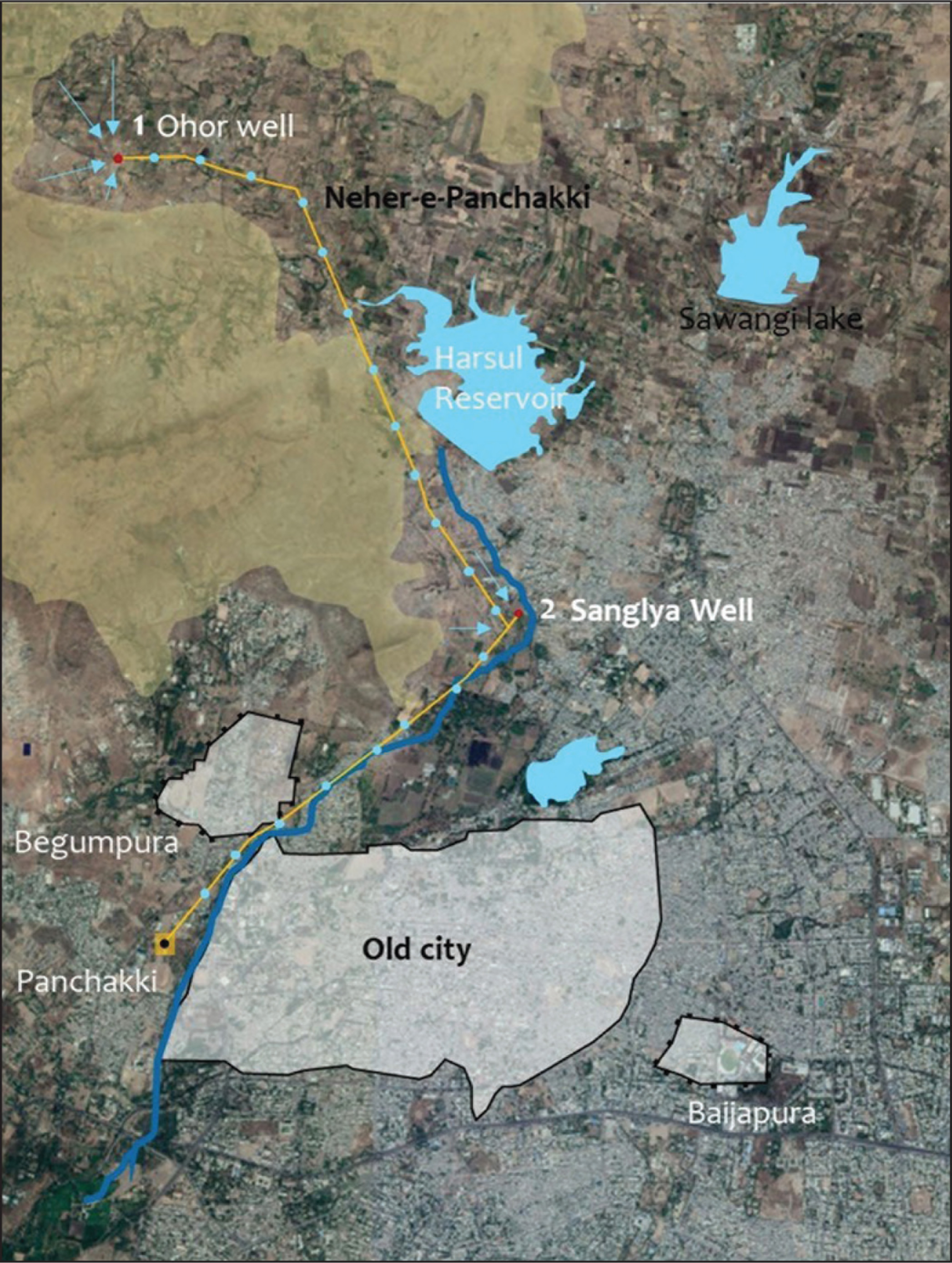
Around the 17th century, the technique of Neher-e-Ambari was replicated and with reference to it, Neher-e-Panchakki was constructed. This Neher is 6.85 km long with 66 manholes on it while the water source of the Neher is Ohor River and Sanglya well.
Neher-e-Begumpura, also known as Thatte Neher, is a privately owned Neher built by Kishan Rao Thatte. This Neher was originally built for the Thatte Wada and its neighbourhood, but later the network was extended to provide water for the whole of Begumpura. Currently, the Neher water is only supplied to Bibi ka Maqbara. This Neher is 5 km long with 25 manholes on it.
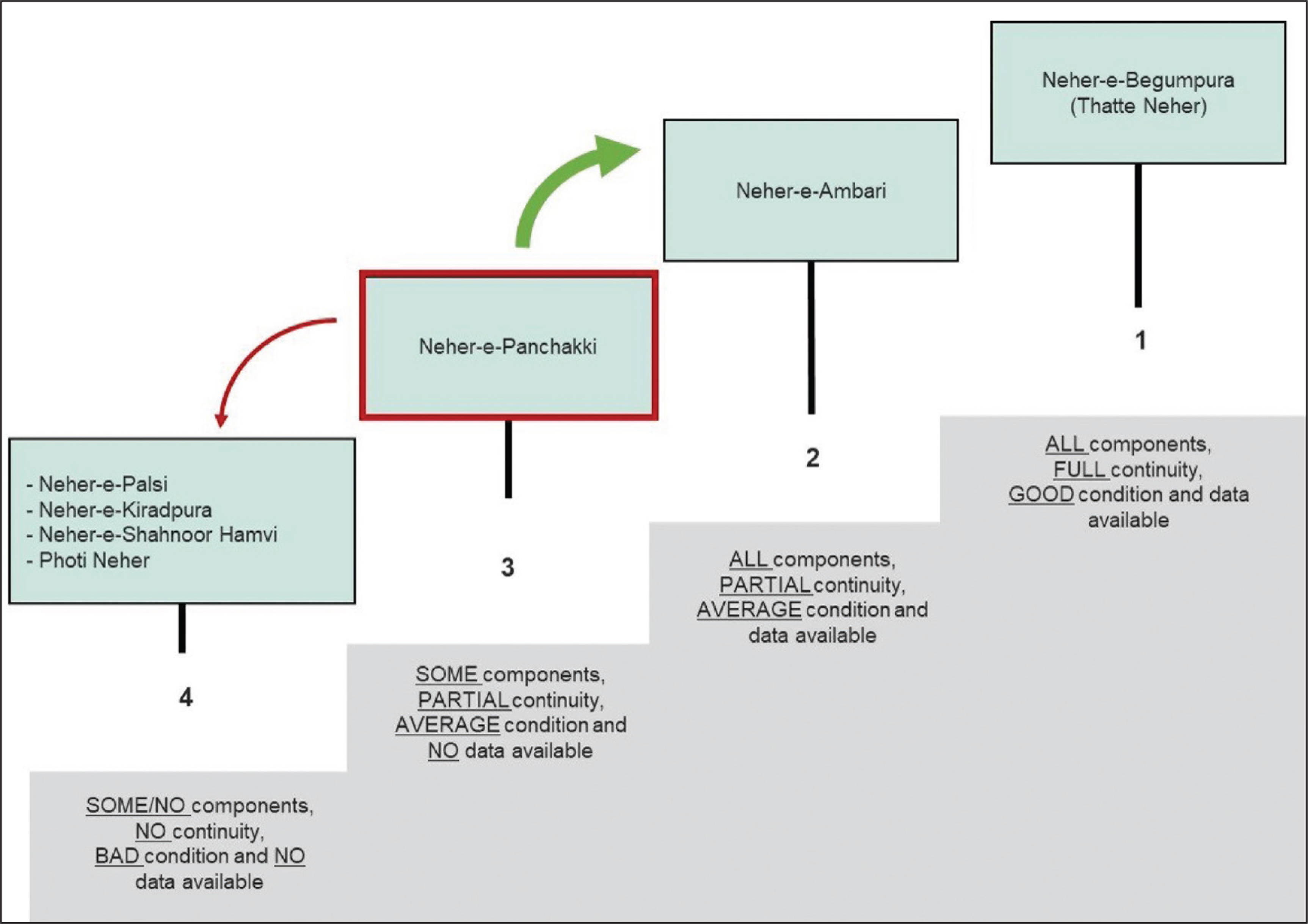
After briefly studying the three functional Nehers, a primary vulnerability assessment was conducted wherein these Nehers were assessed based on the physical continuity of the Neher alignment and components, condition of the components and data available/recorded in any form. As a result of which, Neher-e-Begumpura being an ASI protected Neher, has nearly all its data recorded and was observed to be in good condition. The system components of this Neher were also identified and documented by ASI. On the other hand, Neher-e-Ambari has had ample research and documentation efforts owing to the fact that it is the oldest and has been recognized due to its historical and monumental value. Hence, data is recorded in the form of its mapping and component study. While Neher-e-Panchakki was identified as the most vulnerable Neher, owing to its partial continuity, average condition, and no recorded data of the components and route map. However, it is worth noting that the end of the Neher at Panchakki is a well-known tourist destination and maintained by the Waqf Board. The following represents the results of the primary vulnerability assessment and a brief study of these living Nehers in the form of a vulnerability ladder. The Nehers on the lowest step of ladder are most vulnerable (see Figure 4).
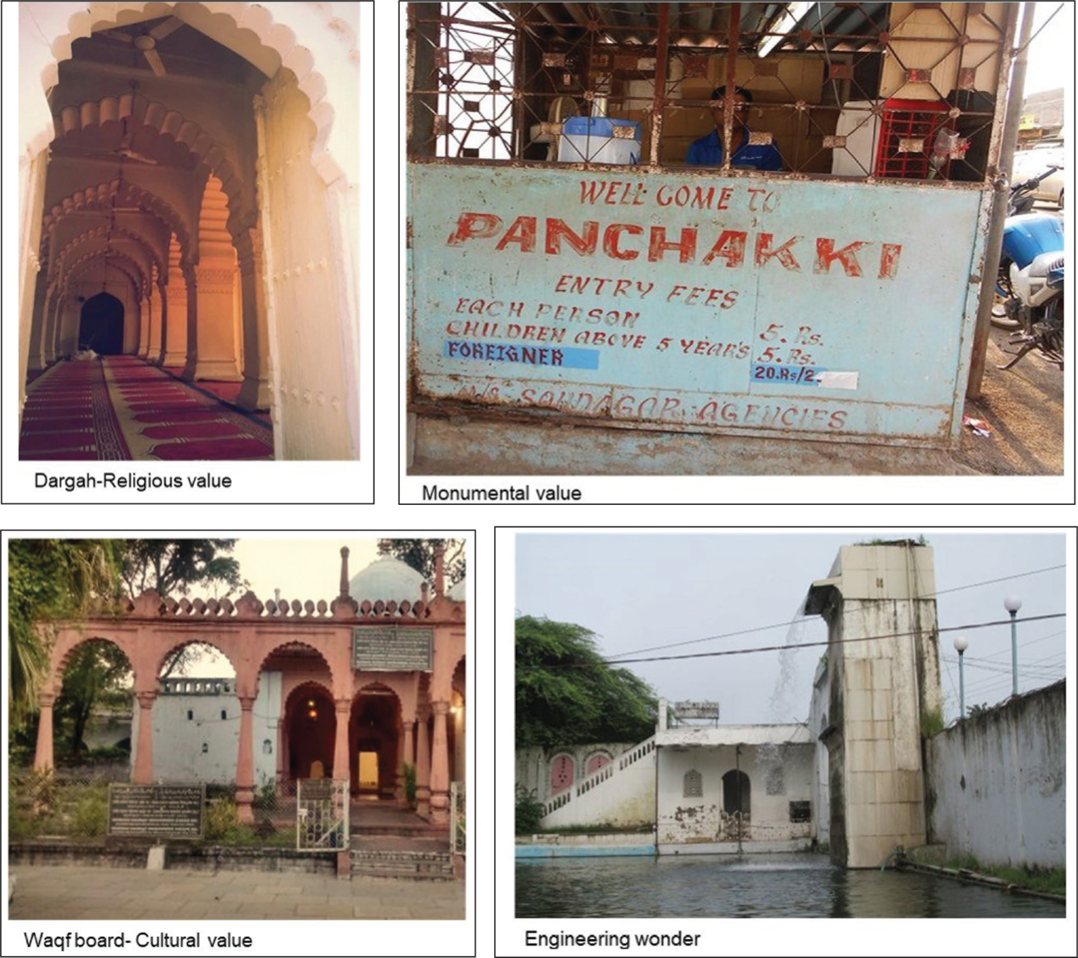
Neher-e-Panchakki is at a stage where without detailed analysis and intervention it may further decay as many of its components are structurally weak and parts of the tunnel are broken, but simultaneously there is a potential to revive it as components of this Neher are recognized for their cultural, religious and heritage value (see Figure 5). Panchakki, known as the watermill, was originally designed to generate energy via water which is transported by the underground tunnel and has been recognized for its engineering value. There is an active Waqf Board which is adjoining Panchakki, and it also has a Dargah in its premise which further gives the Neher cultural and religious value. This monument is a recognized tourist destination and has a huge potential to attract tourists visiting the city.
Vulnerability Assessment of Neher-e-Panchakki
Vulnerability assessment of Panchakki Neher system was carried out from two perspectives—‘Neher system analysis’ and ‘user-catchment analysis’—as both are equally important to ensure the physical continuity of system components and tapping water in the system. In ‘Neher system analysis’, details of the route, condition and components were studied. While ‘user catchment analysis’ included delineation of users who access the Neher, studying surrounding land use, ownership and groundwater extraction practices.
Neher System Analysis
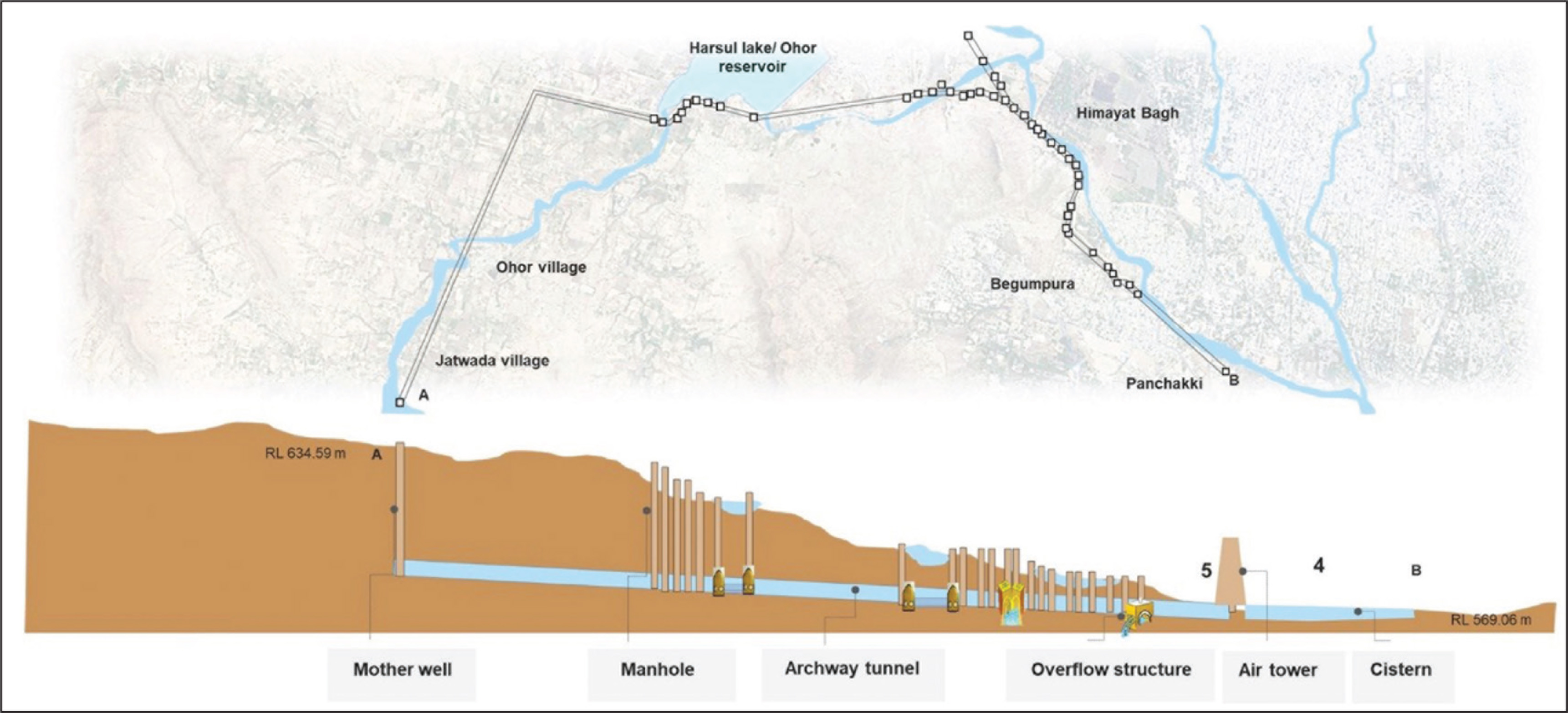
Neher system analysis was carried out for each component (see Figure 6), including all ground components such as manhole openings, air tower, cistern or storage tank, and overflow structure and archway tunnel were assessed through visual observation and discussion with accompanying field experts to understand their physical condition.
Key Findings from the Field Analysis
Mother well: There are two ‘mother wells’ or water sources for Neher-e-Panchakki (see Figure 7): One is Harsul Lake near Ohor village at the foothill of Jatwada ranges and the second is Sanglya well (see Figure 8). The on-site situation of both sources for Panchakki Neher reflects a worrisome scenario. The whole of the 6.6 km Neher is mainly dependent on these and these remain completely dry in the case of Harsul Lake and silted in the case of Sanglya well for most of the months. As communicated by the city authorities, the predominant reason for this derelict condition was rainfall patterns faced by the city. However, field observations suggest that groundwater exploitation through deep borewells around these source wells, diversion of smaller connecting streams and the lack of periodic maintenance to remove silt were potential reasons adding to natural causes like low rainfall.
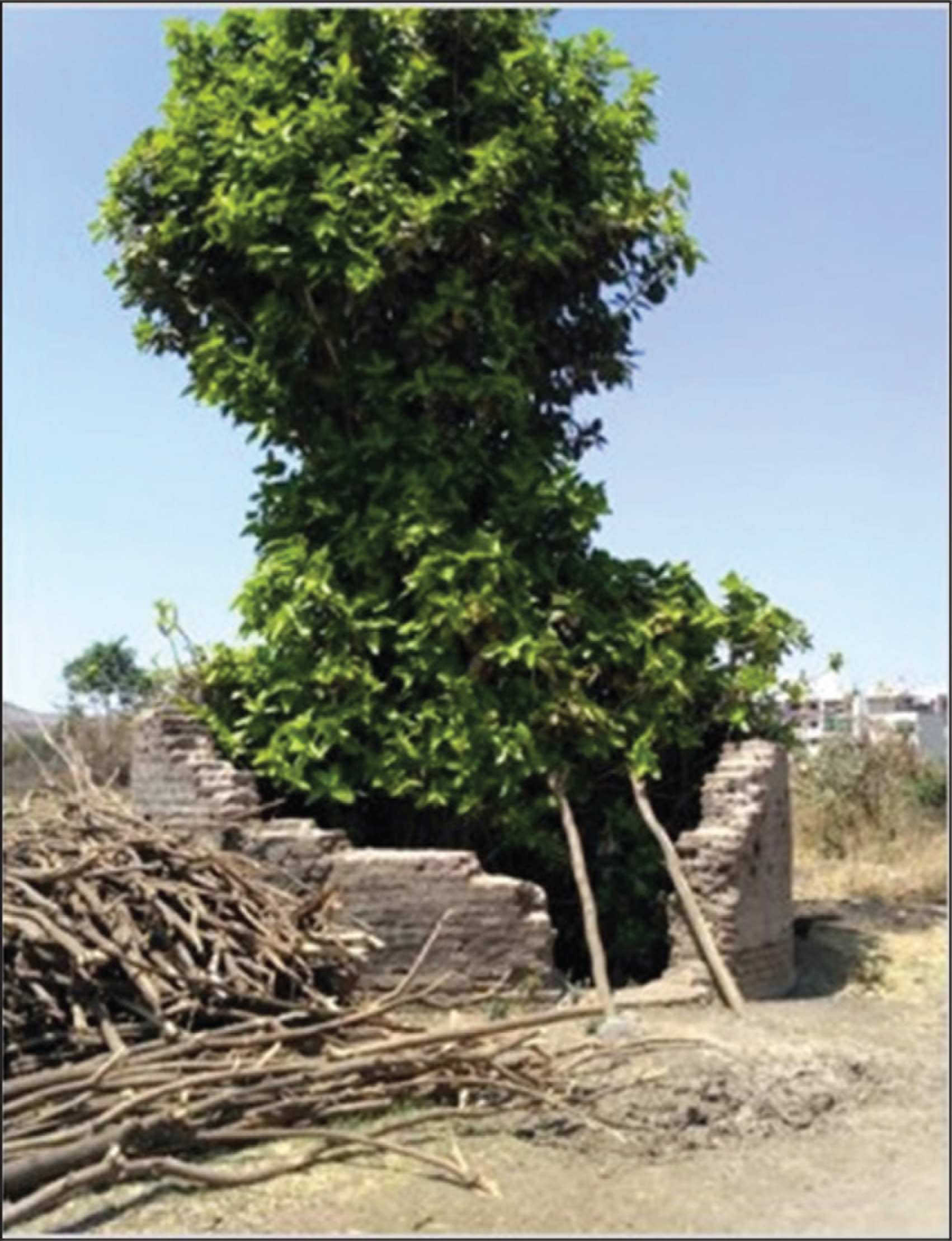
Manholes: Neher-e-Panchakki has 66 manholes of which while surveying only 53 could be accessed and seen; rest are all either encroached upon or are covered by trees/plants. There were few cases where the manhole ground structure is demolished and the openings are closed. Lack of awareness was the major issue observed while studying this component (see Figure 9).

Archway tunnel: The archway tunnels of Neher-e-Panchakki are seen to be damaged and structurally weak with silting, solid waste dumping and fungal growth at various locations. These tunnels as designed have inlets for spring water to join in the tunnel, but these too face the problem of blockage and diversion of stream water upstream.
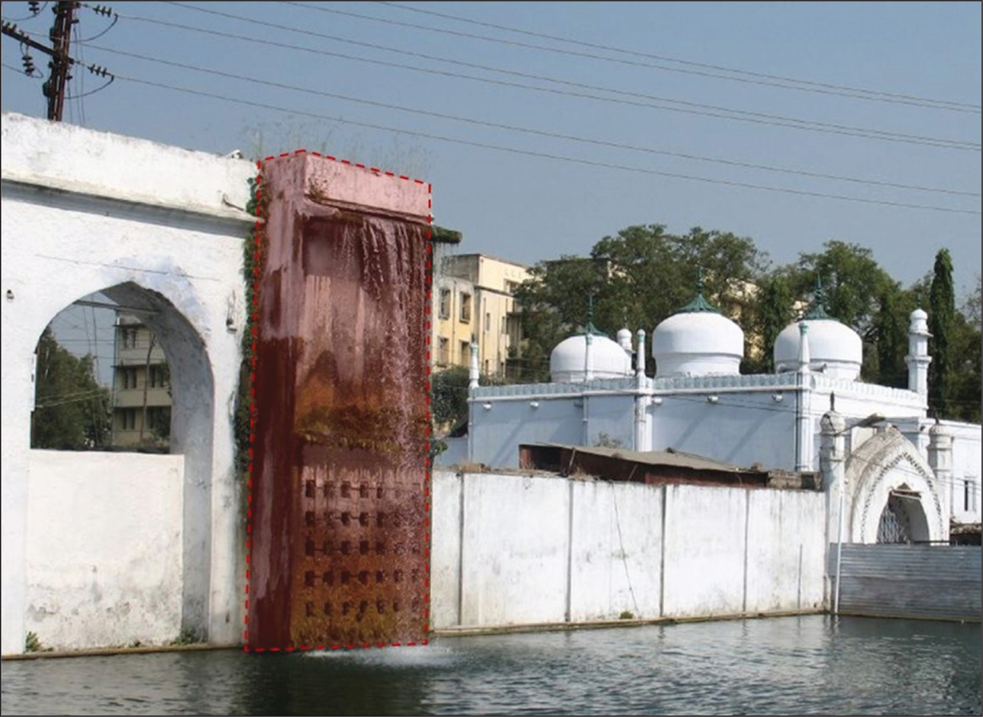
Overflow structure: The overflow structure on Neher-e-Panchakki is just before the Panchakki tank, which also has the last manhole over it. The condition of the structure is in a really poor state where there is solid waste dumped in the manhole, the secondary storage tank of the overflow structure is broken and the whole system does not function in its designed manner. People are seen washing clothes under this broken structure from which water abruptly flows from various points in the rainy season (see Figure 10).

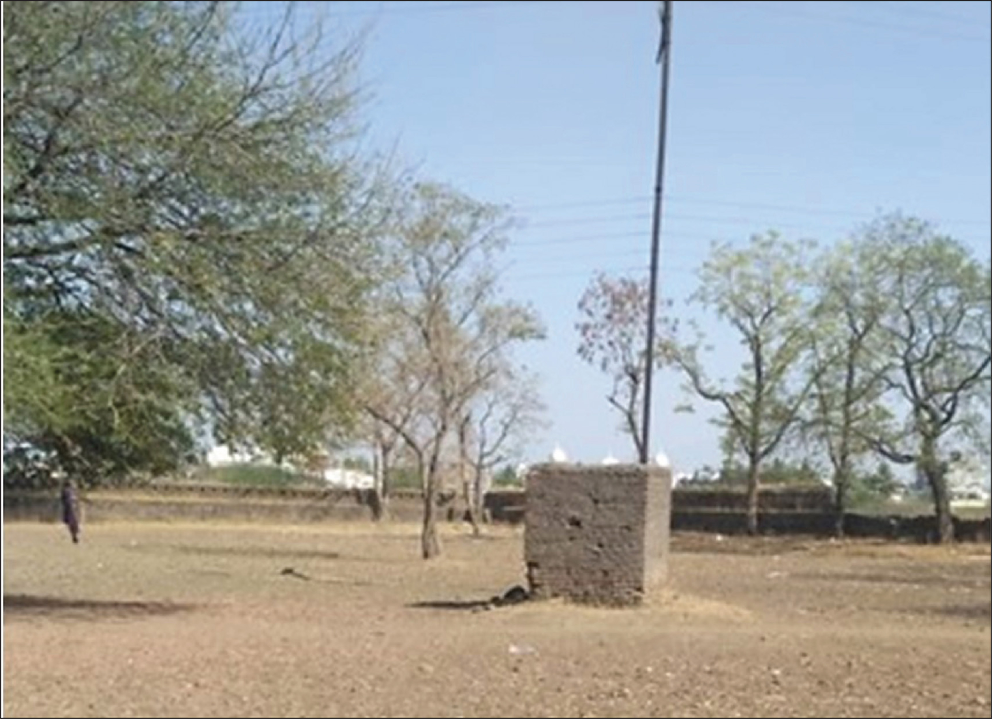
Air tower: In spite of the fact that maximum attention on the Neher-e-Panchakki is given on the Panchakki tank that is the endpoint of the Neher, the condition of the famous air tower is in a really bad state. Lack of maintenance and awareness about the whole system linked to it are a few of the major reasons observed (see Figure 11).
Cistern: Panchakki tank premise has the tombs of Hazrat Baba Shah Musafir and Baba Shah Mastan and adjoining it is a mosque. This place has a large number of religious tourists which consider this Neher water holy. In spite of this fact, there is no maintenance or cleaning of the tank.
User Catchment Analysis
Catchment related analysis was conducted to study the cohesiveness of users and the system. This was done by identifying the user catchment, which was demarcated through a transect walk along the Neher and a primary survey interacting with residents along the Neher. The length of 6.85 km of Panchakki Neher and its adjoining area was divided into four parts after which the ownership around these structures, activity pattern, groundwater extraction patterns and related issues were identified and studied.
Key Findings from User Catchment Analysis
The land ownership of the adjoining land parcels of the system was majorly private except for a large land parcel which was adjacent to Bibi Ka Maqbara and was owned by ASI (see Figure 12).
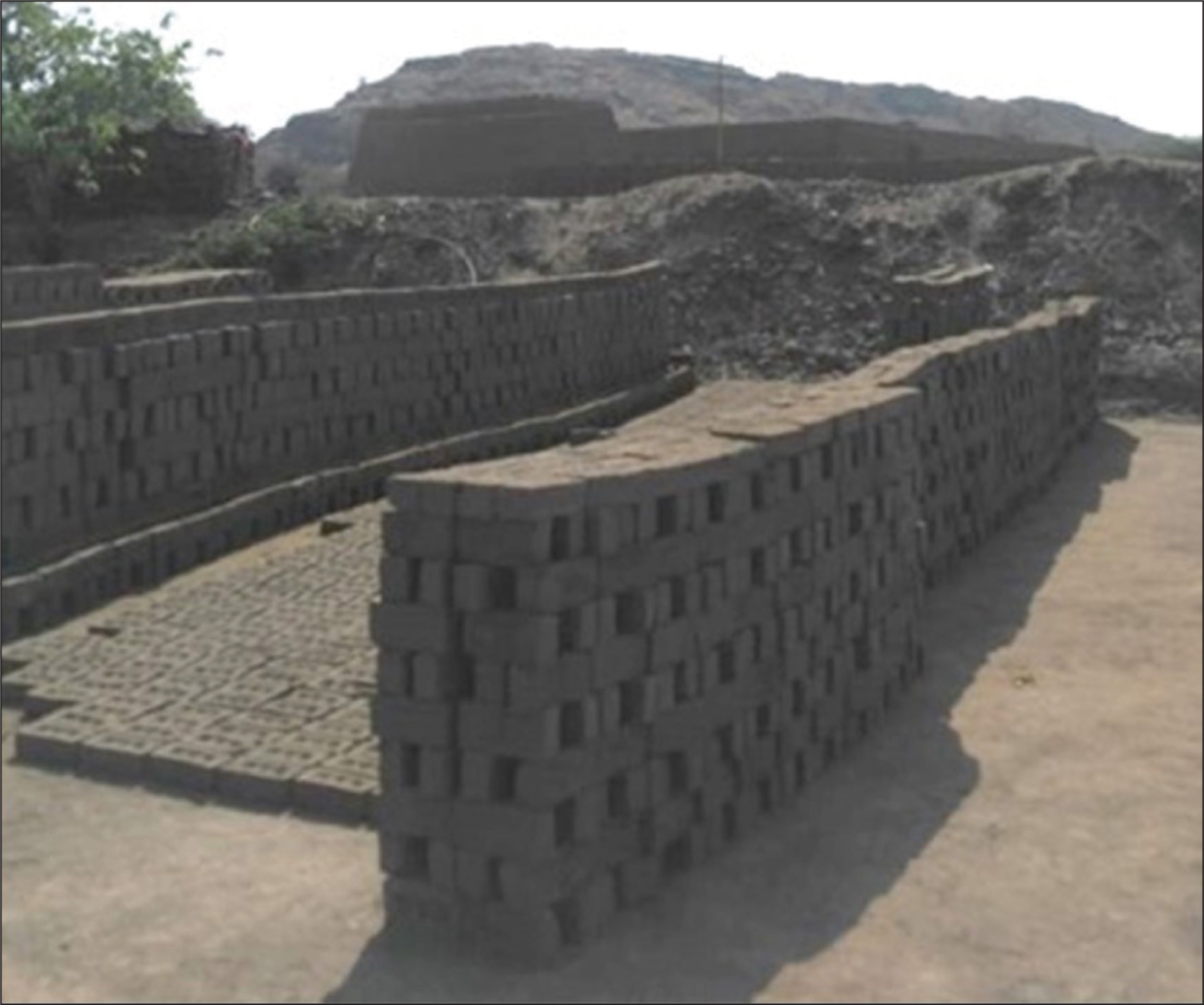
The activity or the land use of these catchment areas were majorly farmlands. People in these areas still receive water for at least 4 months. But there were cases where a clear exploitation of this system was observed as these farmlands have, in turn, rented out land to brick kilns (see Figure 13) and the spring water which ideally joined the Neher system is now being diverted for commercial uses.
Lack of awareness being a major issue as in many cases residents near the Neher used to think it was a well and are unaware about the intricacies of this underground system.
Conclusion and Way Forward
The Neher system in Aurangabad is a centuries-old, traditional approach towards utilizing groundwater for agricultural and domestic use. However, with rapid population growth and the advent of pumping technology (and electricity), this system is now facing slow destruction. Location-insensitive unplanned development and the lack of attention towards illegal tapping of spring water which would earlier join the Neher tunnel have significantly affected the existence of the system in the changing urban environment. As a result, these are now dying wisdom and demand revival or at least better efforts at maintenance.
But there exists a quandary among the stakeholders of varied backgrounds as they view this system with different lenses. Neher-e-Panchakki has its own set of social and cultural values associated with its various components, while it simultaneously acts as a major source of water for at least four months/year in its catchment area. This system in Aurangabad, therefore, has the potential to be protected as indigenous water heritage, and simultaneously, can be utilized as a sustainable way of supplying water. Theme-based solutions for Panchakki Neher specifically were identified as a part of the study which include (see Figure 14): exhibiting a stretch of underground tunnel and linking it to the city heritage walk; strategic physical upgradation plan of the identified degraded components; watershed management with respect to the identified encroachments; and a regulatory framework for withdrawal patterns and a parallel tunnel for overcoming seasonal fluctuations. The most important factor in this revival process would be to raise awareness and knowledge among the policymakers and all other stakeholders to preserve the unique identity of this Neher system and bridge the existing gap in our water wisdom.

Footnotes
Acknowledgements
The authors are grateful to Dr Shaikh Ramzan, for his insights on initial attempts to document one of the Neher systems. Also, Ar. Pradeep Deshpande and team, for helping to conduct an in-depth primary survey of Nehers in Aurangabad; also to ASI officials for insights to governance aspects of the system. And to residents and other stakeholders living near to the Panchakki Neher for their cooperation and support to fulfil the primary survey requirements as it was the major source for performing detailed data analysis. All diagrams/maps are prepared by the author unless otherwise mentioned.
Declaration of Conflicting Interests
The authors declared no potential conflicts of interest with respect to the research, authorship and/or publication of this article.
Funding
This study was undertaken as part of the Directed Research Project (dissertation programme) conceived and guided by Dr Mona Iyer, as a four months-funded project of Masters in Urban and Regional Planning Program, CEPT University, May 2019.