



Abstract
Drawing on ethnographic research in the Falkland Islands (Malvinas), this paper analyzes how disputed oil interests become embedded in data infrastructures for environmental governance. Nearly four decades after a war that cemented the South Atlantic archipelago’s British status, offshore oil discoveries have led Argentina's government to renew its sovereignty claim, arguing that the islands are within its waters. Nonetheless, the British Falkland Islands Government (FIG) has licensed unilateral drilling. Centering on a “data gap” project, financed by the FIG and its oil licensees, the article describes how marine ecologists tag penguins with tracking sensors, as part of a new geographic data infrastructure for the South Atlantic. Data representing penguin foraging are supposed to feed into environmental impact assessments for oil exploration. The article demonstrates how these data and confidence ratings in environmental impact statements reinforce access to and control over maritime territory and resources. Extending recent claims that data have become key actors within environmental governance networks, this research finds that particular data practices may actually enhance fossil fuel industry interests through measures of transparency, leaving ambiguous matters related to transboundary impacts and local pollution unresolved.
Introduction
Nearly four decades after surrendering the Falkland Islands (Malvinas in Spanish) to the United Kingdom (UK) in a violent 1982 war, offshore oil discoveries have led Argentina to renew its sovereignty claim. 1 In response, the Falklands’ settlers held a 2013 referendum on self-determination, voting 99.8% in favor of remaining British, with just three “no” votes out of 1517 valid ballots. 2 Scholarly literature on the Falklands focuses primarily on the geopolitical machinations and memory of the 1982 conflict (Benwell, 2016; Freedman and Gamba-Stonehouse, 1990; Guber, 2009; Lorenz, 2006). However, overlapping maritime claims have now made the archipelago a key site for examining the socio-spatial relations between and among sovereignty, natural resources and environmental science. Since the war, enhanced access to and control over marine resources has transformed the archipelago into a commercial fishing hub and now: an offshore “oil frontier” (Watts, 2015). In 2010, Rockhopper Exploration, one of the Falklands’ small, British oil licensees—named after a local penguin species—discovered commercial amounts of oil (the equivalent of 400 million barrels) in the Sea Lion well of the North Falkland Basin. Rockhopper’s partner Premier Oil, a larger British independent firm with experience producing oil in other frontier areas, has prepared to begin exploiting it. To shed light on an under-analyzed aspect of this emergent extractive economy, the present study analyzes how the dual prospects of oil and sovereignty in the Falklands form assumptions for experts assessing environmental impact (Dodds and Benwell, 2010). As I will discuss, unlike most cases of mis-assessment, in which third party consultants typically disregard local or Indigenous communities out of ignorance of social dynamics (Bedi, 2013; Dougherty, 2019; Westman, 2013), Falklands-based experts used their own rootedness and objectivity as responsible scientific authorities on the region to instill public confidence in what they considered to be minimal environmental risks of a potential oil spill. They have done so through particular data practices and transparency measures that effectively authorize resource exploitation, yet exclude key aspects of environmental degradation related to transboundary impacts and ambiguities regarding local pollution.
The Falkland Islanders are trying to control their own future in part through resource management. This regime of environmental governance is rooted in a broader history of British imperialism in the South Atlantic and settler colonialism in South America. According to Patrick Wolfe (2006), settler colonialism is a structure rather than an event, which is predicated upon the elimination or exclusion of Indigenous Peoples from land. Native scholars have shown how counterhegemonic Indigenous movements continue to defy the ongoing imposition of settler colonial land claims that undergird resource development projects (Coulthard, 2014; Estes, 2019; Gilio-Whitaker, 2019; Simpson, 2014). While there is no historical evidence of a pre-colonial Indigenous human population in the Falklands, I have explored elsewhere how colonists have asserted “settler indigeneity,” through environmental practices, ranging from past “extermination” of Native humans and nonhumans in Tierra del Fuego to present non-native species eradication and native habitat restoration in the Falklands (Blair, 2017). Focusing here on a new environmental data collection project, financed jointly by the Falkland Islands Government (hereafter, FIG) and its offshore oil licensees, I analyze how marine ecologists normalize potential offshore oil impacts, as local authorities on natural resource governance.
In the age of “big data,” asymmetrical forms of “data colonialism” (Thatcher et al., 2016) dispossess individual humans of their self-generated everyday information. This article explores how collection of routine data on nonhumans also advances extractive capital accumulation. Drawing on twenty months of participant observation, interviews, and document analysis in the Falklands, Argentina, and the UK, I describe how marine ecologists tag penguins with tracking sensors as part of a new “spatial data infrastructure” of the South Atlantic (Alvarez León, 2018). This digital information platform has supported the deployment not only of remote sensing devices, but also models, standards and institutions that serve collectively to fortify existing public and private geopolitical arrangements. Data representing the penguins’ foraging patterns and other curated ecological facts are intended to contribute new degrees of confidence to environmental impact assessments, influencing oil drilling. I argue that by filling “data gaps”—an emic term used by my interlocutors to describe apparent absences in published ecological research in the region—scientists reinforce corporate-national control over territory and natural resources in a popular-democratic framing of good environmental governance.
Infrastructure and environmental science in a disputed oil frontier
This article employs scholarship at the interface of political ecology and science, technology and society (or science and technology studies, STS) to better understand the actions of experts in an emergent oil frontier (Forsyth, 2002; Goldman et al., 2011). In its early years, political ecology adapted ideas from critical political economy and used them to understand how land degradation or famine were historically produced in underdeveloped areas, through uneven access to and control over resources. 3 This emphasis on the local imbalance of power in political ecology has also influenced recent insights on how energy and mineral resource extraction sites are enmeshed in technopolitical networks of elites, including scientists, engineers, shareholders, military personnel and petrostate functionaries (Appel, 2012b; Bond, 2013; Bridge, 2008; Coronil, 1997; Ferguson, 2005; Hecht, 2012; Mitchell, 2011; Onley, 2004; Rogers, 2015; Watts, 2004; Wylie, 2018). Recent social scientific research on the politics of oil, environment and infrastructure in extractive frontiers has focused on the relations between material practices and socio-technical values (Anand et al., 2018; Appel et al., 2015; Barry, 2013; Bowker, 1994; Harvey, 2014; Hetherington, 2018). Michael Watts has defined the oil frontier specifically as “the spatial, temporal, and, of course, vertical dynamics in which fields within a province are discovered, developed, and recovered—from primary reserve creation to tertiary recovery from existing ‘matured’ reservoirs” (Watts, 2014: 194). 4 Across oil frontiers, energy companies have built expansive infrastructures, ranging from underground pipelines to aboveground “man camps” and rigs. Together, these frontier infrastructures have given oil a future-oriented yet short-lived temporality that obscures lasting forms of dispossession and contamination (Appel, 2012a; Baker, 2016; Barry, 2013; Ferry and Limbert, 2008; Limbert, 2010; Weszkalnys, 2015). Here, I contend that by performing transparency, scientific data infrastructures also authorize future pollution of the marine environment in offshore oil frontiers.
The current political-ecological dynamics of data infrastructure extend from a wider history of imperial science in the South Atlantic and settler colonialism in the Southern Cone (Blair, 2017, 2019a). A late colonial frontier, the Falklands/Malvinas archipelago served initially as a staging ground for the conquest and settlement of Patagonia. In 1829 Buenos Aires named Luis Vernet, a merchant originally from Hamburg, the Political and Military Commander of the Malvinas. Vernet inherited rights over an abundance of feral cattle that had flourished after the abandonment of overlapping French (1764–1767), British (1765–1770; 1771–1774) and Spanish (1767–1811) temporary settlements. However, in response to Vernet’s detainment of three US sealing schooners, Andrew Jackson’s administration ordered the Lexington to destroy his settlement, clearing the way for the British to decisively reclaim sovereignty on 2 January 1833. Charles Darwin visited aboard the Beagle just after the British reclaimed the islands, but in the 20th century, scientists used the Falklands primarily as a stepping-stone to support voyages to the South Pole (Blair, 2019a; Dodds, 2002). Antarctica’s perceived importance for British imperial science converted the South Atlantic into an under-researched “knowledge frontier” by comparison.
Two competing state-sponsored research programs have tried to fill this apparent scientific lacuna. In 2014, Argentina’s Ministry of Science, Technology and Productive Innovation launched its Pampa Azul (Blue Pampa) campaign. The government attempted to re-brand the Pampa, a place name that typically refers to the expansive agricultural “interior” of Argentina, incorporated into the nation through the genocidal Desert Campaigns of the military to eliminate Indigenous Peoples from the territory in the 1830s and 1880s. Instead, the government has begun to suggest that the Atlantic Ocean is a long-neglected Pampa Azul, rich in biodiverse species and natural resources available for scientific research and commercial development. Moreover, because the Pampa Azul campaign is primarily framed as a public research program, the Argentine government has sought to wrap its geopolitical objectives for the South Atlantic in a cloak of science. Pampa Azul’s explicit slogan is “Scientific knowledge in service of national sovereignty.”
A competing research center formed within the Falklands, which promoted a contending “South Atlantic universal” vision (Blair, 2019a; Trouillot, 2003). The South Atlantic Environmental Research Institute (SAERI) is the focus of this article. With initial seed funding approved in December 2011 from the FIG, the Government of South Georgia and the UK, SAERI was founded in order to develop a “knowledge economy” to complement the commercial fishing, tourism, agriculture and oil exploration sectors in the Falklands. The scientists who operate SAERI had long-established links to the University of Aberdeen, the British Antarctic Survey and FIG’s Fisheries Department, as well as quasi-governmental and non-governmental organizations, such as Falklands Conservation, an affiliate of Birdlife International. As I discuss further in what follows, SAERI was in the process of becoming incorporated as a non-governmental organization in its own right during my field research. SAERI is now registered as a Charitable Incorporated Organization, as well as a 100% shareholder in the SAERI (Falklands) Limited trading subsidiary. Current and former government directors continue to serve as advisors and trustees, but oil consultancy contracts have become a key source of private capital for expansion of the institute’s scope of analysis and governance. The islands had long served as a staging post for research in Antarctica, yet little was known about the environment, biodiversity, and the population dynamics of manifold species in the South Atlantic, so SAERI has aimed to contribute new high-impact research and consultancy on a broad range of ecological dynamics: from marine ecology and oceanography to climate geology. SAERI rented me office space throughout my fieldwork in the Falklands, which gave me an inside perspective on their activities, procedures and operations. SAERI’s staff scientists invited me to take part in their field research, which included shallow marine dive surveys and penguin-tracking, which I describe in the next section.
During my research in the South Atlantic, SAERI included me in their events and appreciated my critical and applied social scientific perspective. This methodology has been informed by a broader field of public or engaged anthropology that encourages direct participation in activism or advocacy, as well as research that seeks to “study up” among experts and elites (Edelman, 1999; Goldstein, 2014; Hughes, 2017; Hymes, 1972; Kirsch, 2018; Nader, 1972; Scheper-Hughes, 1995). In other research contexts I have engaged reflectively with local social movements in the role of an advocate for marginalized communities and their environments (Blair, 2019b). Here, I sought to observe the actions and expressions of my expert interlocutors, and offer social scientific insights that might strengthen environmental governance, yet without accepting benefits from oil associates. I participated in meetings of the Falkland Islands Offshore Hydrocarbons Environmental Forum (FIOHEF), an advisory group for the Data Gap Project. 5 I also attended public meetings and provided comments on a new marine spatial plan for the South Atlantic. Toward the end of my fieldwork, SAERI hosted a public talk that I gave for local residents. And after departing the islands, SAERI invited me to participate in a workshop on data analysis and marine spatial planning at the University of Cambridge. FIG also invited me to submit an application to lead a socio-ecological impact monitoring study, but since the oil licensees were partial funders—who were considered to be operating illegally according to Argentine law—this may have risked fines and imprisonment of up to fifteen years in Argentina, so I politely declined to apply. However, as a result of the workshop in Cambridge, I served as an external reviewer and provided comments for the Gap Project’s Phase 1 Report. SAERI welcomed my suggestions and has made efforts to address them. Nevertheless, as I will discuss, these scientific studies have generally advanced rather than deterred oil development in the South Atlantic.
The Gap Project: Filling the oil frontier with facts
In this section and the following one, I will examine how SAERI has pivoted from being a government agency to accepting external contracts, not just as a research center but also as an energy consultancy firm. The motivations of the institute’s knowledge production have shifted from that of a public service initiative to a private enterprise. This has significant implications for the nature of data infrastructure when scientific facts have become imbued with value beyond, or even contrary to the environmental cause of sustainability or biodiversity conservation. Moreover, this broader transition toward deregulation has accelerated resource exploitation and capital accumulation through new strategies to generate information about the environment (Castree, 2008; Dempsey, 2016; Fortun, 2004; McAfee, 1999; Smith, 2006). As I outline in the next section, rather than serving as the local regulator that reviews environmental impact statements (EIS), SAERI has begun to work directly for oil companies. This contract work includes original environmental research, as well as expert assessment of third-party reports. In what follows, I describe how SAERI started to become an instrument for propelling the Falklands’ emergent offshore oil industry, primarily through the Gap Project: an initiative to highlight and address “gaps” in environmental research data on the South Atlantic.
With joint funding from the FIG and the Falkland Islands Petroleum Licensees Association, the Gap Project was an outcome of the public–private FIOHEF advisory body. Once the forum had identified some of the priority gaps, SAERI recruited two researchers to carry out the project, both on a two-year contract. The intention was to complete the gap analysis by “first oil,” an indeterminate starting point of oil production (Weszkalnys, 2015). Both of the researchers came to the islands from Australia: Keith specialized in benthic (seafloor) systems, as well as oceanic and fisheries data, while Wendi focused on higher predators, specifically penguins. 6 A third independent scientist later contributed supplemental research on pinnipeds (seals and sea lions) (Baylis et al., 2018). The proposed concept was that, together, these data would fill potential gaps in upcoming environmental impact assessments (EIAs) and environmental management plans. Nonetheless, as I will show in the following section, SAERI’s unique position as a locally rooted public–private scientific enterprise transformed the EIA into a political-ecological process that minimizes risks through particular transparency measures and selective or ambiguous information regarding transboundary impact and local pollution.
Most of Keith’s research took place on his computer or outside of the islands. The seafloor covering the oil wells is too deep for human divers to reach, so Keith intended to hire an ROV (Remotely Operated Underwater Vehicle): an amphibious drone, equipped with a camera and arms for collecting samples. This had not yet taken place during my fieldwork, so Keith’s main remit was to build a foundation of data infrastructure by collating, reviewing and analyzing extant evidence collected during previous research. In some senses this made Keith’s task less onerous because the industry provided access to most of the benthic data that it held. In addition to meeting with consultants who have done surveys in the past, Keith established affiliations with the British Geological Survey (BGS) and the Natural History Museum in London, making his objective not only to collate or store the data, but to literally “curate” it, i.e., to build up ecological and biological records needed to underpin environmental data sets that would enable searchability and recoverability.
However, developing a strategy for forming a “unified taxonomy” out of the extant benthic data proved a challenge. First, it turned out that BGS had little to no oversight of sampling in the Falklands. There was a complete disconnect between research undertaken by professional survey companies in the field and remote, subcontracted storage and analysis in London. As Keith put it, It's all a much bigger mess than we thought, but it does highlight the need to be centralizing this in the Falkland Islands, especially if we're going to have an oil and gas industry which is going to require environmental data.
Having worked with Chevron, BHP Billiton and other companies operating offshore in Western Australia, Keith praised the collaborative nature of the Falklands’ nascent energy industry, which seemed less guarded than other extraction sites. There is extraordinary access to both government and industry, largely because of the multi-stakeholder environmental forum. “This is what we should have been doing 20 years ago [in Australia],” Keith said. “It showed a lot of foresight and a lot of vision.” Elsewhere, Keith said that environmental science “tends to scare” oil companies, because, as he put it, “they always think it’s a stick that they're going to be beaten with.” 7 Environmental research related to oil in the Falklands had been considerably less adversarial, in part because before the emergence of SAERI, hired consultants had conducted much of it. The drawback was that, according to Keith, such third-party consultancy studies cut corners. Here, Keith had encountered a structural problem that political ecologists, such as Heather Bedi (2013) identified: extractive industry consultants tend to produce cursory or misleading EIAs, often at the expense of local or Indigenous communities and their environments near production sites. As I will discuss further in the next section, SAERI had positioned itself to end this common tendency of poorly executed environmental governance from a distance, through locally rooted data infrastructure and more proactive research programs like the Gap Project with considerable support from FIG and the oil industry.
Wendi, the second lead Gap Project scientist, complemented Keith’s vision. Her initial research focused on Antarctica and the Southern Ocean, where she developed ways in which to use particular species in these environments as indicators of broader ecological health. She used species at the top of the food chain or food web, such as elephant seals and penguins, to make assumptions about the rest of the system. Her research asked what kinds of parameters could be measured in these species to provide information about the ecosystem writ large, and how may that information be used for environmental management. Based out of Cambridge, UK, Wendi then moved into science policy related to spatial monitoring and decision-making, and also worked as a tour guide on cruise expeditions back “down South.”
For the Gap Project, Wendi was also tasked with collating and reviewing data from previous researchers. In addition to baseline surveys and coastal mapping, scientists have long conducted seabird monitoring using remote sensing technology. According to one researcher, the practice can be traced all the way back to the Romans, who tied strings to birds in 200 BCE. Throughout the 20th century, Antarctic expeditions adapted military homing devices as tools for measuring penguins’ migration patterns in the region. Devices were modified over the years to ensure that seabirds “behave naturally,” and since the 1960s trackers have gone from analog to digital, enhanced by the emergence of GPS (global positioning system) for military purposes and wildlife management (Benson, 2010; Mitman, 1996). Once tracking devices earned researchers’ trust as reliable nonhuman “actants” (Latour, 2007: 54), they tinkered with perspective: For bathymetric and temporal data, scientists attached watches to birds that stopped and started when diving underwater. For data at the scale of the body, internal and external sensors detected when birds feed, and light sensors or magnetic sensors recorded day length periods to calculate distance. For data on a longer and wider scale, scientists have employed video cameras, camera traps or satellite images to observe remote populations or new colonies. 8
STS analyses of animal tracking, particularly with birds and marine animals, have shown considerable variation in the effectiveness of remote sensing for addressing the social and spatial consequences of industrialization and globalization (Benson, 2010; Gabrys, 2016; Mitman, 1996; Stokland, 2015; Whitney, 2014). A significant divide exists between the values of animal tracking for wildlife biology on the one hand, and environmental conservation on the other. Environmental “sensing practices” may serve diverse political goals and objectives for humans and more-than-human subjects (Gabrys, 2019; Howe, 2019), but their ethical and social origins lie in imperial hunting, domestication and policing, rather than principles of reciprocity common to Indigenous hunting and trapping (Berkes and Turner, 2006; Blaser et al., 2004; MacKenzie, 1997; Whyte, 2013). While some citizen scientists and advocates seek to use animal sensing data to situate nonhumans in broader relational dynamics or spread awareness (Gramaglia and Mélard, 2019; Haraway, 2007: 249–263; Pritchard, 2013; Ray, 2014), others may be motivated by state or corporate interests in surveillance programs, designed to capture control, and not necessarily to reduce harm.
While previous data had been collected by both wildlife conservationists and biologists on penguin foraging areas in the Falklands, they primarily served the purposes of counting for demography and lacked consistency in terms of the type of species and time of year. For example, they might focus on the chick-rearing period but not incubation or the winter season. Wendi’s time and energy therefore went into creating a new penguin-tracking program to understand how feeding synchronizes and interacts with the market for oil. She focused primarily on the Northeast and South of the Falklands, areas hosting penguin colonies whose foraging patterns might overlap with drilling areas. For each colony, Wendi was interested in patterns of foraging, such as differences in age, sex, and consistencies in the annual cycle that might provide a more comprehensive understanding of their interaction with oil work.
To track the penguins, Wendi primarily used GLS (global location sensing) tags, which were attached to the birds’ ankles to record light levels twice per day, and GPS satellite tracker tags, glued onto their backs. The latter are far more precise, but the former are relatively inexpensive, so most of the tags used were GLS. There are certain efficiencies, which make the GLS tags less expensive than GPS trackers. First, their spatial resolution is poor, so they are only accurate beyond 100 km. If penguins travel within that distance from their colony, the tags are not particularly useful due to the large margin of error. The recorded light levels allow researchers to “develop a feeling for error” (Garnett, 2016), by working out latitude and longitude using an algorithm, but multiple sunlight readings per day cause aberrations. Extensive “data-cleaning” during analysis makes statistics difficult to run. Second, these tags “archive” data, which means that they are not detectable remotely, and they need to be physically retrieved for analysis. While penguins tend to return to the same colony each season, recuperating tags can prove difficult, especially for Magellanics, or “Jackass” penguins in local vernacular, which burrow into the ground, and are often infested with fleas. Thankfully, the penguin-tagging work for which Wendi enlisted me involved Rockhopper penguins rather than Magellanics.
Together with Wendi and two other researchers, I volunteered to remove location sensors that had been attached to Rockhopper penguins at Cape Bougainville on East Falkland Island, a breathtaking coastal area. Wendi selected this site, among others, because she expected them to be most affected by a potential uncontrolled oil spill at Premier’s Sea Lion well. She referred to them as “priority gaps.” We spent most of the day staring at the Rockhoppers’ pink ankles, searching for any sign of the black band and green disk of the GLS tag. Gently, we took turns prodding at the Rockhoppers’ ankles with poles and, if we found a sensor present, we isolated tagged birds with a fishing net. We then brought the selected birds to Wendi who held them in her lap for me to cut off the tag from around their ankles. I recorded the number-letter label on the device, as well as the apparent sex. I then plucked four feathers as samples for isotope tests, which would be used to analyze diet and other biological features. Next, I ran a small blue bungee cord under the bird’s belly and attached it to a hanging scale to measure the weight. Finally, Wendi would then reintroduce the bird to the rest of the colony where it would hop around (hence the name) to avoid defensive couples guarding their eggs. We carried on with this method with steady success, locating and processing nine out of the twenty previously tagged birds (Figures 1 and 2).
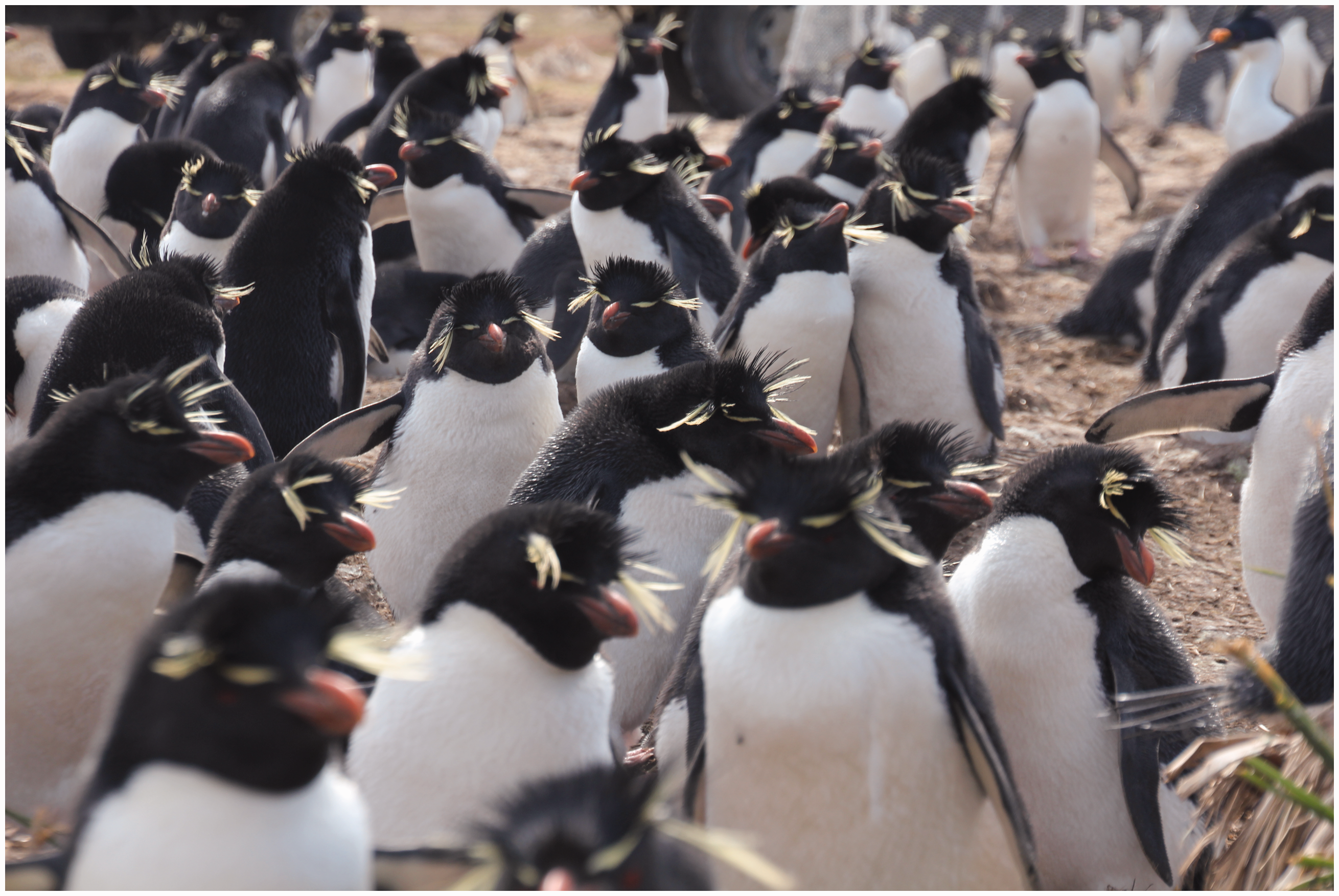
Penguin colony at Cape Bougainville. Photo by James J. A. Blair.

Penguin tagging process. Photo courtesy of Amélie Augé.
Data from the Gap Project would ideally inform new strategies to minimize and mitigate impact in environmental management plans, but Wendi acknowledged, “In all honesty, I don't think there’s any way they’ll stop going ahead with the drilling.” Tracking penguins may offer insights on the birds’ foraging patterns, which will likely interact with oil exploration activities, but the GLS tags did not yield significant data at the time of my research. Further tracking, combined with new forms of modeling, has helped to fill in the blanks, but as I describe in the following sections, new transparency measures do not fully address transboundary impacts or forms of local pollution that may arise from offshore oil development.
Conflict and confidence in environmental impact statements
The Gap Project was supposed to feed into the crafting of environmental regulations for offshore oil exploration in the Falklands. As part of a broader EIA structure and process that ranges from baseline data analysis to public consultations, an EIS precedes each round of drilling licenses. Social scientific studies of EIA and social impact assessment procedures in mining and energy development projects highlight a common tendency to emphasize risks of damage that the industry considers technically feasible to mitigate (Li, 2007, 2015). According to Fabiana Li, this stems from a logic of equivalence between “pollution” and “impacts,” identified as manageable in EIAs. Li argues that “practices of accountability prioritize mining interests and enable corporations to define the standards of performance that governments will use to establish compliance” (Li, 2015: 186). In this sense, EIAs have become neoliberal tools that harness legitimacy to prioritize the growth of commodity markets in a liberal democratic framing of public participation (Horowitz, 2015; Tironi and Barandiarán, 2014). Many of these studies identify a structural problem in the use of under-qualified independent consultants rather than local experts. This has led to disingenuous or poorly prepared EIA evaluations, and ultimately the marginalization, exclusion or displacement of Indigenous or local communities and ecosystems in proximity to extraction sites (Bedi, 2013; Dougherty, 2019; Hoogeveen, 2016; Spiegel, 2017; Westman, 2013). Indeed, British oil consultants I met in the Falklands described the EIS to me as a “box-checking” exercise: in some cases, consultants had literally copied and pasted sections from previous statements based on Northern Hemisphere standards.
However, as Keith noted, SAERI’s unique role as a locally rooted quasi-governmental research center, located in a non-independent settler society without the counterhegemonic presence of Indigenous Peoples, conditioned the possibility for new experiments with “community-controlled impact assessment” (O’Faircheallaigh, 2017). During SAERI’s initial period as a government-funded center, its lead scientists would review the EIS and pass comments on to the regulator, FIG Mineral Resources. With its pioneering role in the Gap Project, SAERI was well positioned to contribute new local knowledge to FIG’s vetting process. Accustomed to rigorous science that advances understanding rather than simply meeting accepted standards, SAERI and its independent collaborators attempted to transform the quality and structure of the EIS by tweaking its methodology. For instance, they questioned the qualitative nature of oil spill fate modeling that had long been based on incomplete data. Initially, the common assumption was that the Sea Lion discovery was far enough away from the islands—around 100 miles north—so if anything were to go wrong, prevailing currents would carry a blowout or spill away from the islands (this obviously did little to address Argentine concerns). However, a British engineer who worked with British Petroleum following the Macondo disaster adapted a computerized “plume 3-D” model that suggested otherwise. The model was developed by Norwegian experts, using 20 years of “hind-cast” data incorporating winds, currents and waves, and suggested that 2% of the hypothetical blowout, equivalent to about 250–300 tons, would arrive on the northern coast of the Falklands in a worst-case scenario. The model showed that the especially waxy Sea Lion crude would solidify and form an emulsion of individual “waxlets,” which would rise to the surface, making wind a stronger factor than currents.
This model caused alarm among Falkland Islanders worried about the pristine coastal image, but local scientists from SAERI and FIG Fisheries were less concerned than the oil company representatives. They questioned the conservative manner of modeling and the data sources, arguing that they neglected oceanographic research on the region’s unique system of geostrophic currents: eddies flowing in a western-northwestern direction (Arkhipkin et al., 2010). This marked a significant difference from the common scenario scholars have identified of marginalization through technocratic procedure in the EIA process. Here, instead of the typical case of independent consultants downplaying potential impacts due to ignorance of community voices, local experts from SAERI and FIG Fisheries drew on their own place-based scientific authority to dismiss the alarm generated by contracted consultants’ modeling of a potential oil spill.
Once it began to distance itself from government and become incorporated as an independent organization, SAERI not only reviewed statements as the regulator, but also accepted contracts from the oil companies to produce them. This shift from the use of knowledge for environmental management to industry-affiliated research signals what Jenny Goldstein (2016) calls “divergent expertise,” which has a tendency of fomenting “green grabbing” (Fairhead et al., 2012; Rocheleau, 2015). Conflicts of interest may be inevitable in such a small, remote “island community.” In this case, SAERI found itself in an awkward position because it remained partially government-funded. To circumvent a potential conflict, FIG issued a letter stating that the government would not interfere in the process, and that SAERI was essentially an independent organization with regard to the consulting work. Of course, SAERI did not review its own EIS, and the authors indicated that if they produce them regularly, they will not continue reviewing others because SAERI might be perceived as more damning to competitors. If SAERI both reviews and produces EIS’s consistently, then it may need to split into separate legal entities. Lead scientists were quite candid about the decision to begin producing EIS’s: reviewing them pays peanuts or nothing at all by comparison, and why not utilize the local skills and expertise SAERI has to do them in order to generate an income that may support other forms of academic knowledge production? Similar to the petroleum industry’s role in enhancing biodiversity conservation science in Ecuador’s Amazon region (Taber, 2016), SAERI researchers thus viewed oil partnerships as potential paths toward more sophisticated research technologies and stronger environmental governance. 9 Oil company managers who spoke with me focused on what they were trying to achieve, and asserted that SAERI likely possessed the best possible information on the subject, providing the added value of local knowledge that UK-based consultants were not capable of contributing.
To make their own presuppositions more transparent, SAERI introduced “degrees of confidence” into the EIS. Armed with a vulnerability score or index parameter, the authors could judge that the less confident one is in an assessment, the more conservative one would need to be in estimating potential risk. In public consultations, Premier’s local representatives and environmental officers highlighted that the data gaps were included in these “degrees of confidence,” saying that they were “proud of the world class product of the Falkland Islands.” SAERI built on this public–private commitment to global excellence through transparency in science to recruit and publicize teams of visiting scientists, including climate change experts from throughout the Americas and Europe. As I analyze elsewhere, SAERI’s researchers also joined FIG and British government functionaries on diplomacy trips to promote the Islanders’ self-determination claim to sovereignty, showcasing the institute’s role as a data infrastructure hub that offers access to research from across the British Overseas Territories in the South Atlantic, Caribbean and Antarctica (Blair, 2019a).
Nonetheless, as Andrew Barry (2013) has shown in the context of the “measured impacts” of the disputed Eurasian Baku-Tbilisi-Ceyhan (BTC) pipeline, transparency may ironically inscribe absences. In the initial EIS that SAERI produced for Premier Oil, the degrees of confidence ratings did not have a major impact on the overall statement. To arrive at the degree of confidence for assessing the impact of a project activity, including accidental events, such as an uncontrolled spill, SAERI considered how the nature of the effect corresponded to its magnitude and the sensitivity of the “environmental receptor” based on available data. The effect’s magnitude and the sensitivity of the “receptor” informed the rating of impact significance: Low (no action required); Moderate (action required to reduce risk through mitigation); or High (also categorized as “Major,” meaning risk unacceptable and immediate action required). This in itself did not differ greatly from previous EIS’s, but SAERI added a confidence rating to the formula. Degrees of confidence were based on: (1) how clearly the activity was defined; (2) how well understood the sensitivity of the receptor was based on availability of data; and (3) how well understood the nature of the impact was. Yet, when Premier held public consultations, it remained unclear in which areas the confidence rating affected the assessment, if at all. One audience member pointed out that there was no area that was so data deficient that it significantly changed the impact. Out of the possible categories of confidence—“Certain,” “Probable,” or “Unlikely”—all aspects of the EIS were rated as either “Certain” or “Probable” (Premier Oil, 2014: 21). Where the word unlikely did appear, it was not a rating but an adjective, used to minimize the likelihood of an uncontrolled oil spill. 10
The confidence ratings, penguin tracking sensors and benthic data curation thus contributed new layers of data infrastructure that perform scientific rigor (Bowker, 1994, 2000), yet these measures also produced a “bandwagon effect” (Fujimura, 1988) for the FIG to continue issuing unilateral licenses for drilling. In some cases, pointing to “many unknowns” signaled caution (Premier Oil, 2014: 302), but in other areas a lack of confidence softened the severity and likelihood of a potential spill. In turn, this lowered the impact significance from “Major” to “Moderate” (Premier Oil, 2014: 36). Moreover, uncertainty in risk evaluations has also been used as a political strategy to limit regulation and allow markets to manage ecological problems (Viatori, 2019). Here, uncertainty rationalized the need for new data gap analyses that would inform future environmental management plans, and set acceptable performance standards and monitoring methods.
Scaled out: Transboundary impacts and local pollution
Unanswered questions of geographical scale highlight gaps that the marine fauna tracking project and confidence ratings have not been able to address in the EIA process. First, and perhaps most alarming, is that the contested regional politics of the sovereignty dispute and Argentina’s contradictory claims over maritime zones are not discussed. The penguin tracking data indicate that the highest overlap of species, such as the Rockhoppers represented in Figure 2 of the scientific report published by Baylis et al. (2019), migrate directly through the Sea Lion drilling area north of the Falklands, and then far into Argentine (and even Uruguayan) waters. From the perspective of the Argentine government, this would merit enforcement of domestic laws against drilling, yet the FIG and its oil licensees viewed the baseline and overall proportion of penguins as properly monitored. This renders the seabird specimens “boundary objects” that maintain their identity as they navigate multiple public and private networks (Forsyth, 2002: 140; Star and Griesemer, 1989). As a boundary object, the Gap Project’s repository of penguin data possesses interpretive flexibility for the respective sovereignty assertions of the Argentine government and FIG to overlapping maritime claims in the disputed South Atlantic territory, or the incompatible objectives of biodiversity conservation groups and oil firms. Crucially, it also affected the scale at which environmental governance work could be arranged and organized (Leigh Star, 2010).
Nonetheless, this highly controversial aspect of the disputed maritime territory was not factored into SAERI’s assessment of drilling’s “transboundary impact.” The FIG has acknowledged that a spill passing into Argentina’s zone would be a political disaster. But Argentina claims the entire continental shelf as its national maritime area (the Pampa Azul). Legislators have not sought transboundary consent because they view it as unachievable when the actual boundaries are not even agreed upon. Given that their drilling activities have been considered illegal according to Argentine domestic law, operators are not likely to consult the neighbors. They are active members in a global network called Oil Spill Response Limited, which has an office in Brazil, but it could take weeks before support vessels arrive to control an accidental spill and rescue wildlife. In recently published scientific reports, SAERI’s researchers have argued implicitly for more integrated data across the region. They seek to show that the “distribution of marine predators on the Patagonian Shelf are not constrained by national jurisdictions,” claiming that their insights “transcend national boundaries” (Baylis et al., 2019: 4, 8). Nonetheless, by performing transparency and expressing confidence in unlikely harm to the natural environment of the region in the EIS, the data also consolidate exclusive claims to territory and resources for the FIG’s British licensees.
Second, despite Falkland Islanders’ demands that little or no development occurs onshore, Premier Oil engineers decided that they would need to use an inshore transfer system to export the oil to market. Concerns over the harsh ocean, offshore safety, and restrictions from accessing a sheltered location near the continent due to the sovereignty dispute influenced Premier to plan for inshore rather than offshore ship-to-ship transfer located in Berkeley Sound, just outside the Falklands’ Stanley Harbour. It is rumored that the inshore transfer option may be removed if Premier has the technology to manage an offshore transfer within health and safety parameters, but a press release has not yet been published at the time of writing. The inshore transfer condition left a “gray box” in the EIS: coastal communities or intertidal zones (Fujimura, 1992). Premier’s consultants considered what kinds of “important bird areas,” particularly penguin colonies, might be impacted. However, available data on these areas were very limited: again, despite our efforts, the poor spatial resolution of GLS trackers used does not offer information about penguin movements within 100 km, so there is a very large margin of error. 11 In these areas, “indicator species,” such as Kelp Geese, Logger Ducks and passerine land birds serve as proxies for the ecological health of individual islands and coastal zones (Tabak et al., 2014). Yet, because SAERI’s Gap Project has focused on more “charismatic megafauna” (Bowker, 2000: 655), and farther offshore areas, much of the onerous work that went into penguin tagging did not factor directly into the initial EIA of inshore areas. An updated EIS that is outside the scope of the present study incorporated more modeling, testing and data results (Premier Oil 2018). The assessment appears exceedingly thorough, but some inconsistencies remain, particularly regarding whether an inshore oil spill during transfer of crude would have a “High” or “Moderate” initial impact on coastal communities. In either instance, such a spill was considered to be “Unlikely” with an “Uncertain” confidence rating. 12 In sum, data gaps and degrees of confidence operate on selective scales of exclusion that are designed to guarantee safety from harm, yet they may also enable the “slow violence” of toxic contamination if they are based on inherently partial mapping technologies (Liboiron et al., 2018; Nixon, 2011; Robbins, 2003).
Reflecting on these unfortunate absences, one SAERI researcher told me that they hoped that the companies never develop oil in the Falklands. “For just 2,000 people, they can survive without oil.” This statement came as a surprise, for this scientist had contributed extensive research in support of the government and its licensees in preparation for the oil development projects. It demonstrated how unnecessary offshore oil development had begun to seem—even to those involved in the forum—particularly in a remote island chain with a small population of settlers enjoying relatively high standards of living. After all, many Islanders have already amassed considerable wealth from other, less toxic enterprises like agriculture, tourism and fishing. Participants in the Gap Project and the broader forum have much to celebrate, for their extraordinary scientific rigor and attention to detail is uncommon in other oil frontiers. Yet to some, the difficulty of prioritizing risks and collecting new data to fill gaps in a limited timeframe before first oil became a frustrating structural problem. While it may have contributed new knowledge informing environmental monitoring and management, the new data infrastructure accelerated the drive toward oil exploitation, and thus may ultimately heighten the risk of environmental despoliation, despite individual researchers’ earnest motivations.
Conclusion
Ethnographic analysis of SAERI’s Gap Project reveals how data generated from penguin tracking sensors may be understood as actors that authorize resource managers to practice continuity rather than change in environmental governance. The increased affordability and availability of wireless sensors with enhanced storage capacity may have made data “key mediators,” capable of making a difference in environmental management (Ascui et al., 2018; Benson, 2010; Gabrys, 2016; Ray, 2014). Yet, the present study suggests that the role of data may run counter to environmental governance when we attend to the particular ways in which extractive capitalism is embedded in local resource management regimes. In spite of considerable technological innovation with regard to data collection, the course of resource exploitation remains undeterred without social intervention, rooted in environmental concern, political commitment or geopolitical cooperation. In the late petro-capitalist normative order, private purchasing power for short-term profit gains continues to capture data infrastructure and yield influence over public resource management. Both the UK and Argentina have declared a “climate emergency,” but at the present moment, the global price of oil and the efficient availability of extractable materials still outweighs risk avoidance. SAERI researchers have made a sincere effort to avoid the common problems of mis-assessment typical of third-party consultants. They viewed oil consultancy as a pathway toward enhancing the region’s digital information technologies and governance standards, but the new tracking data and EIS confidence ratings serve the values of distant private oil interests at the possible expense of the local environment as a public good. Rather than bridging the gap between the natural world and human language through direct correspondence, this study has shown how data infrastructure performs classification and compliance, yet it may do so in a way that boosts rather than challenges regimes of extractive industries. 13 Moreover, it is crucial that we attend not only to the apparent ontological significance of data’s agency, but also consider how the historical condition of imperialism and settler colonialism is prerequisite to ecological modeling in contested resource frontiers (Freidberg, 2007; Hunt, 2014; Todd, 2016). Data infrastructures are nested within uneven scales of power, conditioning whose voice “counts” for conservation. Their effectiveness for environmental governance is especially contingent on historical and localized circumstances, such as ethnonational citizenship in a disputed territory (Sundberg, 2003).
In the case of the Gap Project, the customization of scientific research for extractive industries suggests that analyzing data gaps may not be enough to change political-ecological outcomes. Filling gaps with geospatial facts about penguin migration patterns and general ecological sensitivity not only fails to alter the trajectory of oil exploration, but, in this case, it also advances the path toward exploitation. As they discover new resources, oil firms, and petrostates are continuously making new frontiers; as some gaps appear to close, new ones open. There remains a discrepancy between what the data gap analyses reveal and what is important for sustainable governance and environmental justice (Edelman, 2013; Zoomers et al., 2016). Ultimately, the transparency measures examined here authorize unnecessary harm and may fly in the face of violent realities: namely transboundary impacts exacerbated by the sovereignty dispute and undervalued aspects of local ecology. This instance of an advancement from the digitization of the oil frontier to new forms of “data colonialism” (Thatcher et al., 2016) thus offers a parable for human and nonhuman complicity in geopolitical conflict, local-level pollution and ultimately the climate and ecological crises (Fortun, 2004; Hughes, 2017). Tracked for the purposes of science, statecraft and industry, penguin data have become actors of environmental governance, yet in this case they serve corporate interests. Given the potential hazards of oil exploitation on the ecosystem, and the contingency of data infrastructure on localized political-ecological dynamics, these specimens have become active participants in their own potential extirpation.
Highlights
This study contributes critical and engaged ethnographic perspective on the role of data as authorizing forces for the fossil fuel industry in environmental governance systems. Offshore oil discoveries have made the Falkland Islands (Malvinas) an apt site for examining relations between sovereignty and environmental science. Marine ecologists have built new data infrastructure to address gaps in research on the South Atlantic, rooted in British imperial history. Penguin tracking sensors, benthic data curation and confidence ratings, designed to fill data gaps, authorize continued oil drilling by performing transparency. Transparency measures may exclude transboundary impacts and local-level pollution from data infrastructure.
Footnotes
Author’s note
This manuscript is submitted to ENE’s “Politics of Environmental Data” theme issue, edited by Jenny Goldstein and Eric Nost.
Acknowledgements
I am most grateful to the South Atlantic Environmental Research Institute (SAERI) and the Jane Cameron National Archives for hosting me during various phases of fieldwork in the Falkland Islands (Malvinas). I received helpful comments on earlier versions of the manuscript from Luke Bergmann, Jacqueline Brown, Marc Edelman, Mandana Limbert, Erik Swyngedouw, Gisa Weszkalnys and Gary Wilder. I am grateful to the participants of the 2016 AAA panel on “Development’s ‘Half Life’: Diverse Moments in the Circulation of Extractive Capital” and the 2017 AAG panel on “Data Infrastructures, Nature and Politics” for discussion. Finally, I owe a special debt of gratitude to Jenny Goldstein and Eric Nost, as well as Nik Heynen, Katie Nudd and ENE’s anonymous reviewers.
Declaration of conflicting interests
The author(s) declared no potential conflicts of interest with respect to the research, authorship, and/or publication of this article.
Funding
The author(s) disclosed receipt of the following financial support for the research, authorship, and/or publication of this article: This work was supported by the National Science Foundation under grant #1355717; Fulbright-IIE; the Wenner-Gren Foundation under grant number 8739; and the Social Science Research Council.