
Abstract
Certain lands in the Parigi district of the Pangandaran Regency are dominated by karst (both exokarst and endokarst). The study focuses on the use of land in the karst area of Parigi, a district in the Pangandaran Regency, and how karst areas are used for agriculture and tourism, seeking to identify the synchronisation of the regulations of both. The method of study was the juridical normative method and descriptive qualitative approach. Secondary data was obtained from regulations, while the primary data was obtained from field observation and interviews with the community, local government officials and staff at the West Java Geological Institute. The study showed that Pangandaran karst lands used for agricultural and tourism purposes are not yet regulated by the law although they generate economic benefits for local government. New regulation is needed, which should also cover the unused karst lands that generate intangible benefits as conservation areas.
“Karst” is a type of landscape – a basin or small hill – formed through erosion and dissolution of limestone (CaCO3) and dolomite (CaMg(CO3)2) (Hartmann et al., 2014). Twelve percent of Earth’s surface is covered by karst which stores water for 25 percent of the world’s population (Radulović, 2013). Karst areas are unique and beautiful, with soils that are characterised by high levels of calcium and low rates of fertility (Yang et al., 2015).
Parigi, a coastal sub-district of the Pangandaran Regency in West Java, has karst areas from west to east in its lowlands and highlands. The community has long been using the land for staple food production. Agricultural activities in the karst area are vital to the community, fulfilling the need for food self-sufficiency and economic benefits. Thus, water and soil conservation in these areas are vital. Local governments in the Parigi area recognise the importance of agriculture, which provides 26 percent of Pangandaran’s gross regional domestic product overall (Pangandaran Regency, 2017). To date, however, the local government has not adopted any regulation pertaining to the agricultural use of karst areas. Without regulation, agriculture could damage the karst formations and also lead to a decline in their function as agricultural areas.
Another growing income source in Pangandaran’s local communities is karst-based ecotourism – primarily rafting and “river tubing” (riding down the river in tyre inner tubes) along underground rivers. Other community-based ecotourism sites in Pangandaran include Wonder Hill Jojogan, Green Canyon, Batu Karas Beach and Cisamping Lake. These geological sites have become an important destination for domestic as well as foreign tourists.
Karst landscapes allow the creation of unique habitats and micro-climates which give room for indigenous plants (Efe, 2014), while also supporting ecotourism and protecting water resources. Karst formations and their associated vegetation, however, are vulnerable to overwhelming impacts from anthropogenic activities. Besides physical protection, the Pangandaran legal system should regulate the stewardship and the use of these lands, and those regulations should be implemented as soon as possible.
The objective of such regulation is the protection of vital and unique geological resources. While the value of this geological aspect of the karst landscape in Parigi has been identified (by the Geological Institute in 2017), the stewardship and the use of land in karst areas in Pangandaran as mandated by Article 14 of the Indonesian Fundamental Rules of Agrarian Principles Act (No. 5/1960, hereinafter the “Agrarian Act”) have not yet been studied. This article summarises a preliminary study on the use of land in the karst area of Parigi, Pangandaran.
Method
The study uses the juridical normative method – that is, it embodies a review of legal regulation and policy on geological landscapes and karst in Indonesia, relevant literature, land-use regulation, field observations, and interviews with members of the community. The data is analysed through the juridical qualitative method which considers both primary and secondary data.
Result and Discussion
Regulation on the Stewardship and Use of Land
The inventory of Indonesian regulations shows that there is already a legal instrument which protects the country’s geological resources, namely Article 51(e) of the Government Regulation on National Spatial Planning (No. 26/2008, herein, the “Spatial Planning Regulation”) which governs geological conservation areas or preserves. This regulation is synchronised with the Ministry of Energy and Mineral Resources (MEMR) Guidelines on Geological Preserves (Regulation No. 32/2016, herein, the “MEMR Guidelines”). Determining whether an area should be a “preserve” requires research and analysis – including collection of primary and secondary data – to discover its geological diversity and uniqueness, and whether it constitutes “geological heritage” that needs to be protected (Oktariadi, 2017). Based on the Spatial Planning Regulation and the MEMR Guidelines, the Geological Institute is the entity that has the power to designate such a preserve.
Geological diversity includes consideration of landscape, rocks, fossils and soils. It is determined on the basis of an inventory of primary and secondary data (Oktariadi). Geological diversity has an important value which dictates high and unique historical significance. Such historical significance cannot be renewed: it is a geological heritage which needs to be preserved. Geological diversity includes many types of value: intrinsic; cultural; aesthetic; economic; distinct function; and scientific. Geological diversity is often harmed by modern human activities, especially economic activities, including energy generation, mineral and metal industries, and the mining of gems, fossils and soil.
As defined in the Agrarian Act, “land” is the surface of the earth as a place for mankind to engage in various activities. The regulatory authority on the use of land is provided in Article 4(2) of that Act which states that rights over land relate to use of the surface of the earth and everything on top of it or contained within it, for purposes directly related to the use of the land (Harsono, 2003). Economic value is clearly a part of this determination (Sumardjono, 2001).
In this study, land is divided into two categories: agricultural and non-agricultural. “Agricultural land” includes lands used for plantations, fisheries, ranching, grazing, and forest management as a source of livelihood. Everything else is “non-agricultural land”. In Pangandaran, the use of both categories needs to be governed by a set of legal norms that aim at guaranteeing the protection of rare and unique geological phenomena and other scientific, educational or social values.
At present, national public policy dictates the use of land in karst areas in Pangandaran and is also supported by the following regulations:
Agrarian Act:
Article 14(1)(c): Government adopts a common strategy on the availability, function, and use of land. Its second clause underlines the importance of local government in making such a strategy. Article 15: Every person has the obligation to take care of land fertility and avoid any action that may endanger it.
Protection and Management of Natural Environment Act (No. 32/2009):
Article 3: The protection and management of the natural environment focus on (i) protecting the environment from pollution and damage; (ii) ensuring human safety, health and existence; (iii) ensuring the continuity of organisms and ecosystems; (iv) protecting the preservation of the function of the natural environment; (v) achieving harmony and balance in the natural environment; (vi) ensuring the fulfilment and protection of the human rights relating to or affected by the natural environment; (vi) controlling the exploitation of natural resources; (vii) fostering sustainable development; and (viii) anticipating global environmental issues. Article 5(c): The country’s strategy in protecting and managing the natural environment must be established through the development of a natural environment protection and management plan.
Land Stewardship Act (No. 26/2007):
Article 1(6): The implementation of land stewardship involves every relevant land activity, including regulating, training, implementing and monitoring. Article 2: Land stewardship is implemented through integration, efficiency, effectiveness, harmonious balance, sustainability, public awareness, equality, justice and legal protection. Article 3: The purposes of land stewardship are (i) regulating the function and use of land according to spatial planning; (ii) creating a system on the function and use of land so that these activities correspond with the purpose of spatial planning; (iii) creating “land order”, which includes the rights, function and use of land and its preservation; and (iv) guaranteeing legal certainty on the use of land for the community according to the spatial planning. Article 4: Four key definitional clauses: (i) land stewardship is a key necessity of land functionality; (ii) land stewardship encompasses every land activity in protected and cultural areas; (iii) land stewardship must be implemented according to spatial planning; and (iv) land stewardship must be implemented within the designated time frame according to spatial planning. Article 5: The land stewardship legal policy shall guide the implementation of land stewardship. Article 6: The objectives of the land stewardship legal policy apply to: (i) land to which some person or entity already possesses rights; (ii) government land; and (iii) indigenous community land. Article 7: Five clauses on the role of spatial planning: (i) the function and use of land must be in accordance with spatial planning; (ii) the appropriateness of the function and use of land is determined by the application of guidelines, standards and technical criteria adopted by the central government; (iii) these guidelines, standards and technical criteria are to be further elaborated by the local government (the relevant city or district) according to their distinctive land conditions; (iv) land use which is not in accordance with spatial planning cannot be expanded or continued; and (v) no land function may be developed if it is not in accordance with spatial planning. Article 8: Person(s) who possess the rights over a land must use the land according the spatial planning as well as taking care to avoid any harm that may endanger land fertility.
Spatial Planning Regulation
Article 51(e): A geological area that meets the standards of a preserve shall be considered a national preserve area.
MEMR Regulation on Karst Landscape Establishment (No. 17/2012)
Article 3: A karst landscape should be considered as a national preserve area. Article 11(3): The Minister of MEMR shall review any karst landscape area which is being proposed by the governor or mayor of the city or district, based on the result of an evaluation conducted by the Geological Institute.
MEMR Guidelines
Articles 3(2)(g), 5(2) and 11: Legal standing must be given through the Minister of MEMR to any unique and rare geological phenomenon that has scientific and educational value.
This study conducted an identification/inventory using the regulation as an umbrella act, in relation to the function and use of karst land areas in Pangandaran. Analysis focused on the relationship between regulations at the same regulatory level (note, however, that the Agrarian Act is the first level of reference, since it draws its authority directly from Article 33(3) of the Indonesian Constitution (1945), which emphasises that land, water and any resources contained within are managed by the State).
Karst Land Areas in Pangandaran
From the primary data obtained in West Pangandaran, the landscape is dominated by karst topology, which is formed when rainwater dissolves limestone and dolomite. As shown by the inventory on the existence and location of exokarst and endokarst formations, made by the Geological Institute in 2017, karst topology is found in five different regions in West Pangandaran: the Langkap Lancar, Parigi, Cijulang, Cigugur and Cimerak sub-districts. The scope of the current study was limited to Selasari Village, in the Parigi sub-district.
Direct Use
Limestone and/or dolomite have direct economic value when mined. Environmentally, however, the main function of karst is to regulate the natural water cycle. Water sources, in the form of lakes and springs beneath the surface area, are found there, and are critical for nature and also for the continuation of human life and agriculture.
“Geopark”
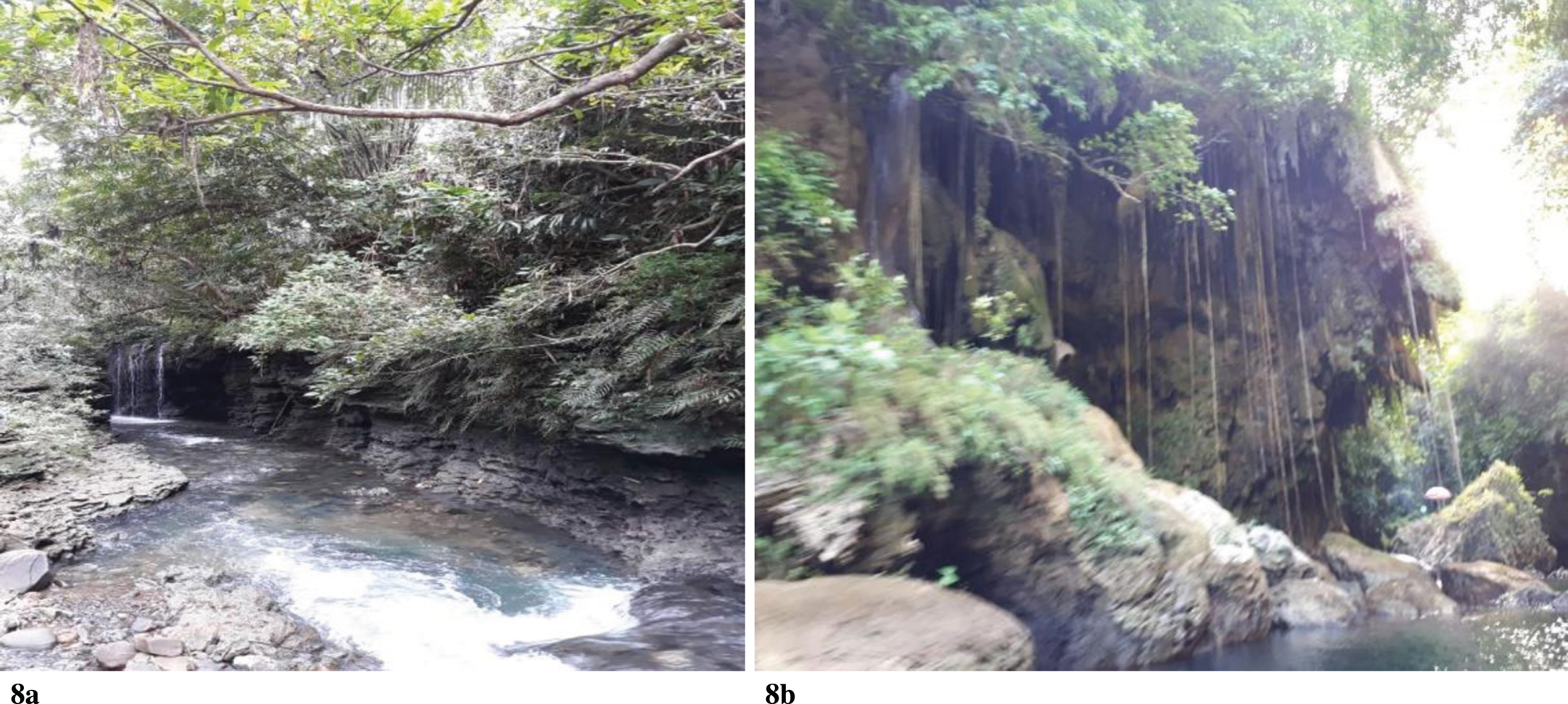
Karst landscapes (both exokarst or endokarst) also have aesthetic, educational and scientific value. Endokarst in Pangandaran can be found in the form of caves, springs and rivers beneath the surface. Exokarst can be found in the form of rivers on the surface and hills (Images 1a and 1b). This is why karst landscapes are so desirable as “geopark” areas. 1
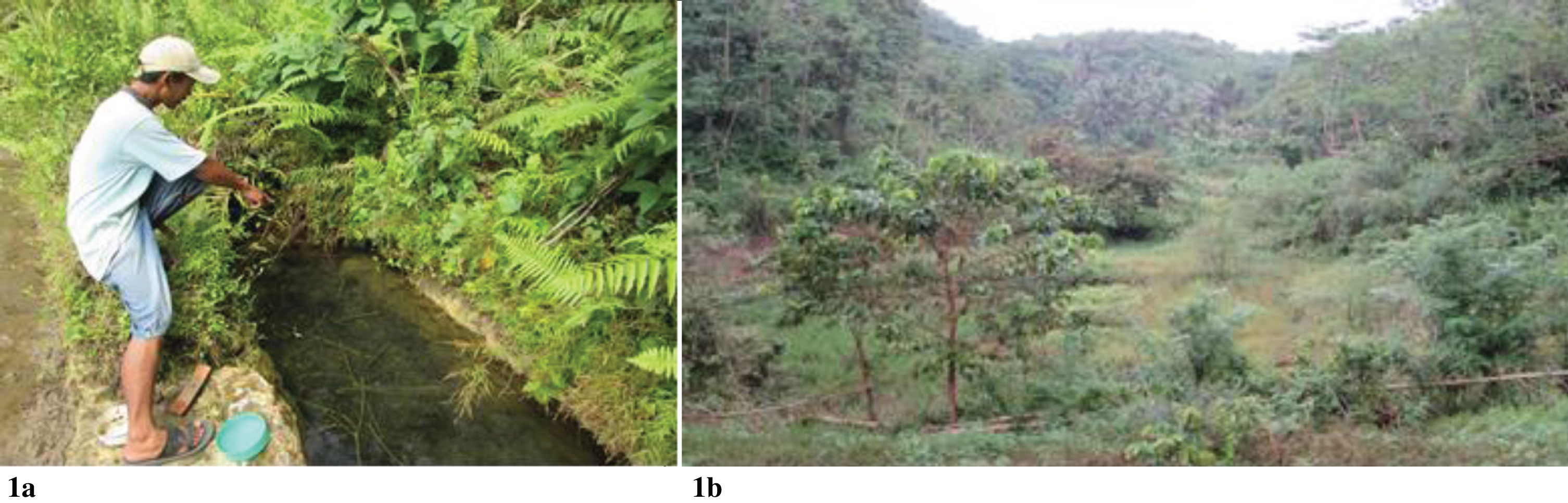
Water springs and karst hills in Pangandaran.
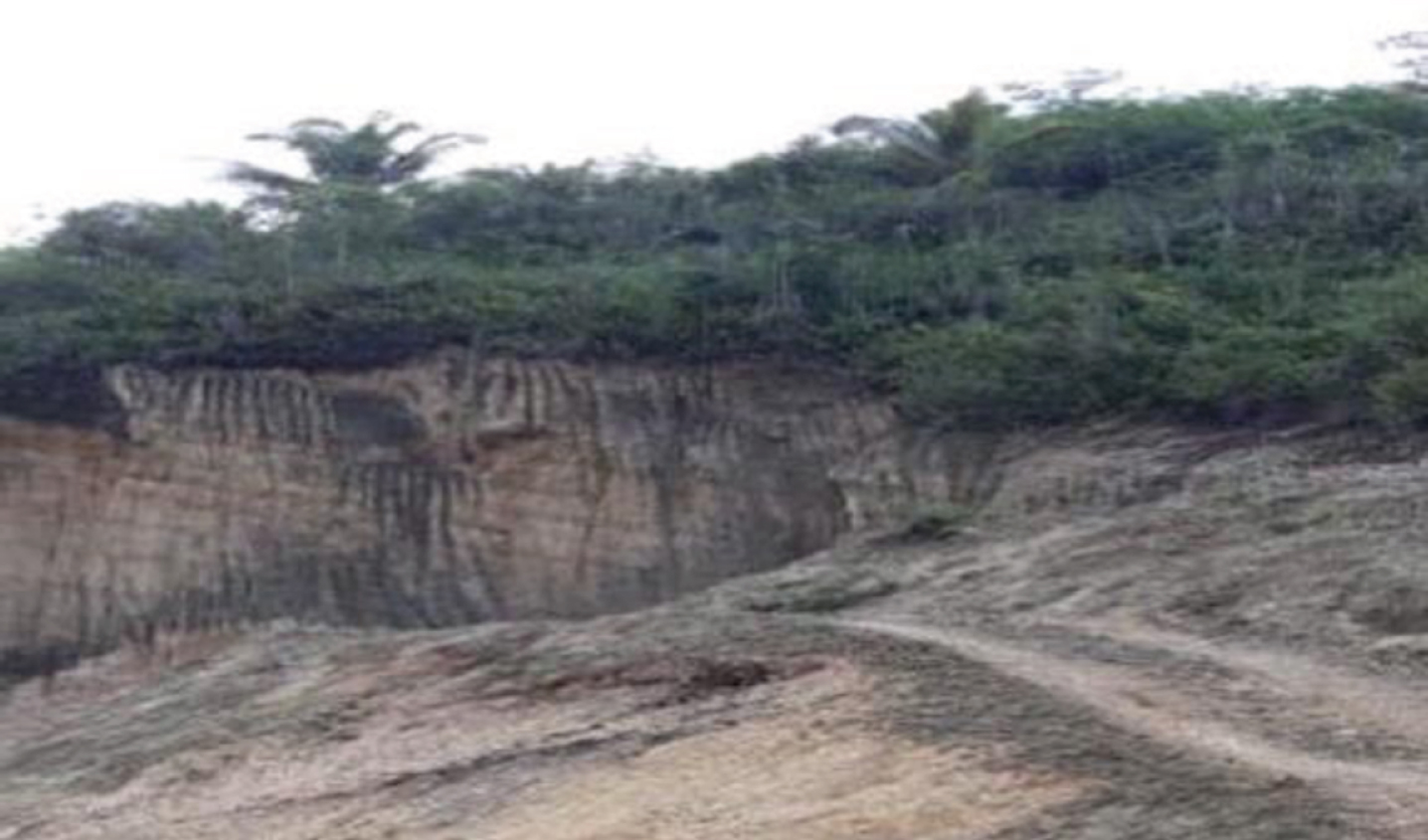
This geopark potential is not yet being realised by the local government in Parigi; and it is not believed that local communities should be the decision-makers responsible for it (Image 2). The lower part of a karst hill is a dolina (a shallow valley or depression) which fills with biological diversity, mainly vegetation (Image 3).
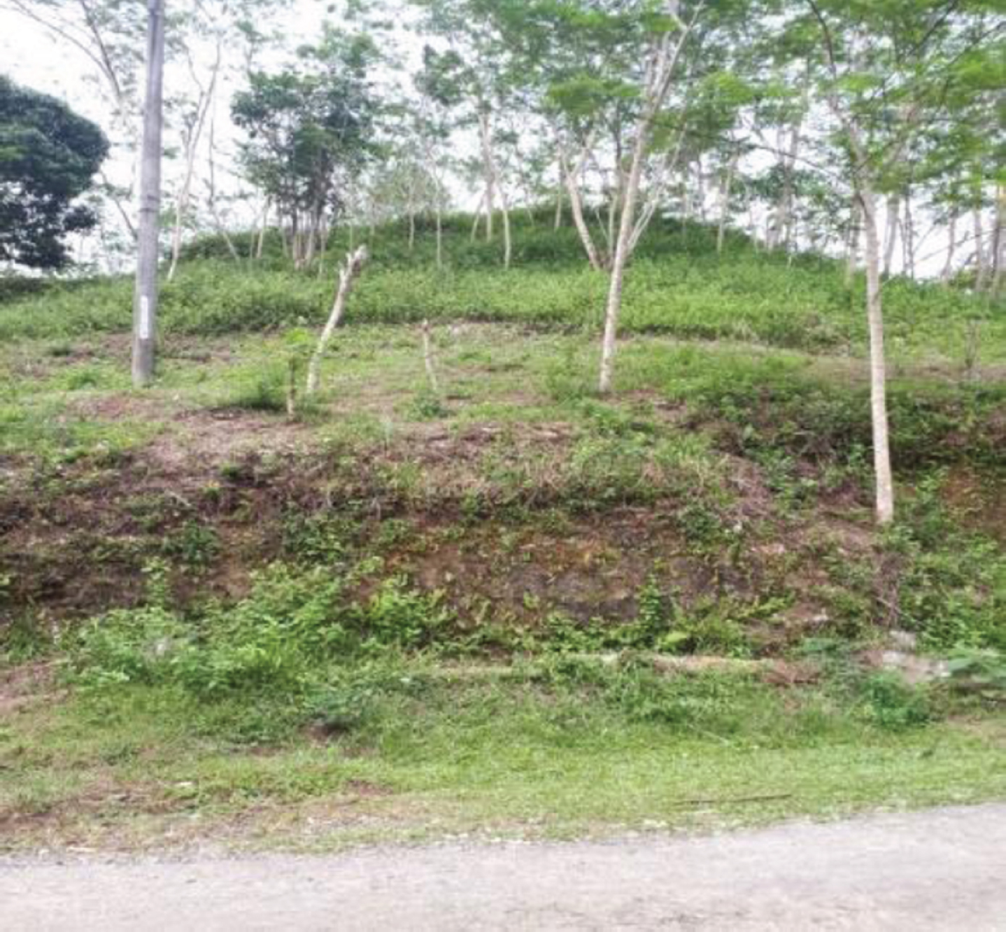
Karst hills.

Dolina in the lower part of karst hills covered with fertile soil suitable for agriculture.
Karst landscapes have recognised potential as a tourist attraction in Pangandaran, and as such they contribute to the regional income. One of the most popular tourist attractions in Pangandaran is the Green Canyon or “Cukang Taneuh” (Images 4 and 5).
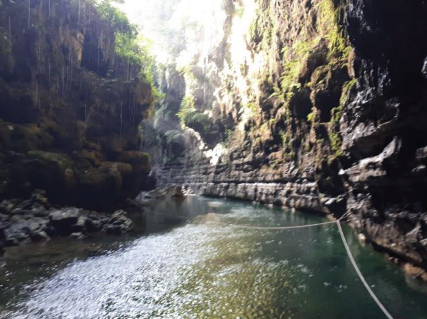
Green Canyon or ‘Cukang Taneuh’ on the Cijulang River.
Hills around the Cijulang River.
This study considered two villages in which tourism is a growing phenomenon:
Selasari Village: This village has the biggest potential for tourism but, as yet, is not ready to be commercialised. The tourist attraction consists of river tubing and rafting in the Pepedan and Jojogan hills along the Surupan-Santirah River. The cave in the Pepedan region in Selasari Village, however, is not being well maintained.
Parakanmanggu Village: The main tourist destination near this village is Batu Lumpang, which features a karst formation with large and unique-shaped rocks. It offers rafting activities along the Ciwayang/Cijulang River.
Water-themed tourist attractions in both villages are being managed by the local community and have been contributing to the income of the people. Some portion of the profit from the business is held by the Selasari Village, which has shared a portion of this income with Cintaratu Village where the river-tubing activities end. At present, no commercial effort is being undertaken to use the natural landscape along the stream to promote tourism in Selasari Village, and the local community has no intention of doing so.
These activities are basically unregulated. Their existence in these areas has generated conflicts amongst the local people. These conflicts are triggered by disputes over the amount of profit shared amongst the people and businesses involved. Land rights among the parties are questioned since they are not reflected in specific legal rights, nor monitored by the government. There is concern that this will lead to a contest in which local communities take turns imposing further levies on tourists.
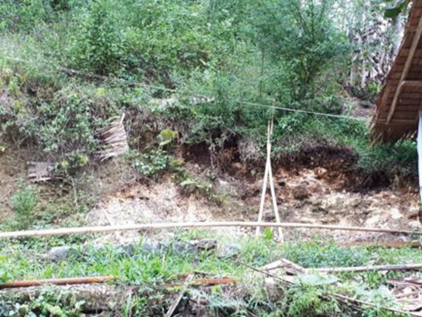
As noted, in Selasari Village, the karst landscape is being used for limestone mining, logging, agricultural activities and tourism. Local government is powerless in managing the limestone mining, because according to the existing legal framework, mining activities are managed by the Province. This condition will accelerate the damage and loss of karst formations (Image 2), and that loss will directly link to the losses of water availability and biodiversity.
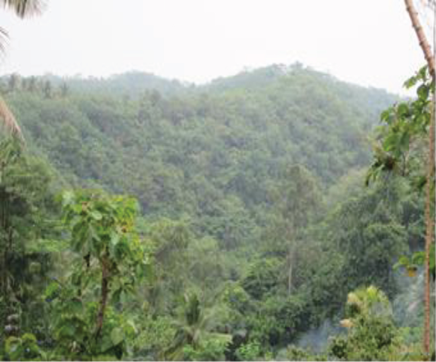
The native biodiversity of karst formations includes a variety of annual plants (Image 6); however, the rapid growth of population and access by public road (e.g., between Parigi and Jojogan) have motivated the local community to chop down the forest for easier access and for wood. Although reforestation is being conducted, it has had no positive impact on bringing the natural vegetation back.
Natural vegetation on karst hills.
The soil on top and on the ridge of the hills is not dense, and is only 10–15 cm deep. Its shallowness makes it difficult for plants to root. This is one of the challenges facing reforestation. The deforested condition of some karst areas threatens the water cycle which becomes the primary axis of plant cultivation and water availability.
Karst formations in Pangandaran, especially on the tops and the ridges of the hills, are not being sufficiently and properly used as a source of livelihood. Annual plants, such as bananas and woody plants, are grown there; however, they are not properly maintained. This condition contributes to the exposure of the limestone, which has been eroded by water, washing soil to the lower places, decreasing the already shallow soil depth on the ridge. Still, this condition is seen as a blessing in the lower areas – valleys and areas of land between the formations, known as dolina. Erosion from the top of the formations is increasing the amount of fertile soil in these areas, improving their usefulness for agricultural activities, such as the establishment of paddy fields and vegetable plantations. In these valleys, the soils have a dense and thick character and are more than 30 cm deep (Image 7).
Density of growth and uses in the dolina.
As noted, the current popularity of rafting, especially river tubing (Images 8a and 8b) on the Jojogan River (a tourist destination) is being well-managed by Selasari Village. The stream carries participants through several villages, ending at Cintaratu Village, which is not yet developed for tourism, although it has potential as a tourist destination. The local community is making an admirable effort to manage these activities, producing real economic benefits.
Infrastructure along the river tubing route.
In the Parigi sub-district, the wide area of karst landscape is not being used according to sustainability principles, especially karst areas near settlements. On the top of the karst formations, natural vegetation is replaced with other plants and the plant coverage, in general, has significantly decreased. The vegetation along and near the river is, however, still well-preserved which indicates the knowledge of the people regarding the function of natural vegetation.
The local community uses the improved soils of the dolina very efficiently. The dolina is filled with paddy fields and secondary plants, such as beans. The local community is conducting logging on top of the karst hills and attempting to plant more economically valuable tree species, such as Albasia (a fast-growing timber tree). They also plant banana and coconut, although these are not being well-maintained. The shallow character of the land on some karst formations is not yet well understood by the local community. Logging activities threaten the karst formations which, in turn, threatens the sustainability of resources. Intensive government intervention is needed, to monitor the local community and ensure that it uses the karst topology as well and as sustainably as possible.
The current use of Pangandaran’s karst areas needs to be comprehensively regulated by the legal system, especially the local community’s exploitation of the karst areas, to prevent prolonged environmental damage. Exploration by the local community regarding the use of these areas needs to be regulated through the use of permits, although at present, no such permit instruments are authorised relating to the function and activities of tourist destinations. The local communities conduct this business without coordination, neither at the district/sub-district level, nor through village government or authorities.
The function and use of the karst landscape in Pangandaran include agricultural activities and tourism as well as limestone mining. Such activities have been giving the local community economic benefits. Logging, agriculture and rafting activities need to be carried out applying principles of land stewardship, and require detailed spatial planning, and a master plan for tourism development and agriculture in Pangandaran which is based on the existing legal framework.
Suggestion
There needs to be synchronisation and harmonisation between national regulation and local or regional regulation to avoid conflict between the existing legal regulations that govern the karst landscape in Pangandaran. Such measures are also needed to avoid conflict between institutions, whether at the central or local levels. This is crucial since the authority given by Local Government Act No. 23 Year of 2014 mandates that both the central government and local government oversee the function, use, preservation and monitoring of karst landscapes.
Footnotes
[The concept of “geoparks” is discussed at global, regional and national levels. Originally coined by UNESCO, the term refers to protected areas that are significant by virtue of their “geological heritage”. UNESCO’s “Global Geoparks Network” is described online at http://www.unesco.org/new/en/natural-sciences/environment/earth-sciences/unesco-global-geoparks/. Ed.]