
Abstract
With the continuous development of synthetic aperture radar technology, the application of SAR image data in landslide hazard information extraction has received attention and achieved some results. In this paper, the grayscale texture information features of SAR images after landslide disasters are combined with the expectation maximization algorithm to extract landslide information. The optimal threshold is calculated using the expectation maximization algorithm, and the image is divided into a landslide area and a non-landslide area.In this paper, the method is applied to Radarsat-2 SAR data in Yingxiu area after Wenchuan earthquake to obtain the distribution of landslide results. The method is also applied to other areas of the image for landslide extraction, and the correctness of the results is judged by comparing with the field measurement data and optical image analysis. Due to the particularity of the landslide, the method still needs further improvement in accuracy. The extraction results need further research in verification, so the method is not very good at present. Improvement needs further improvement.
Introduction
Landslides are one of the top ten natural disasters in the world, and most of the landslide disasters are accompanied by other disasters. How to get landslide disasters quickly is the key to timely rescue and disaster relief. With the continuous development of synthetic aperture radar technology, the application of SAR image data in landslide hazard information extraction has received attention and achieved some results.
This paper will use the grayscale texture information feature of SAR image after landslide disaster and the expectation maximization algorithm to extract landslide information. The optimal threshold is calculated using the expectation maximization algorithm, and the image is divided into a landslide area and a non-landslide area. In order to obtain the landslide information in the SAR image, the grayscale texture features reflected by some features and landslide information in the image are very similar. Therefore, the information of the change detection needs to be combined with the information of the change detection to determine the final landslide result information.
Literature review
Lin and others selected the Badong area of Hubei Province as the research area, and used Sentinel-1 image to extract the time series deformation information of the region based on TCPIn SAR technology [1]. Cai et al. focused on the characteristics of small lobe and sudden strongness of loess landslides. Taking the landslide of Nanxiang Xingyuan in Shaanxi Province as an example, the special treatment measures for lands landslides were studied [2]. Singh and others constructed a regional geological feature of the UAV image seismic landslide sample library; then introduced the migration learning mechanism to complete the UAV high-resolution remote sensing image seismic landslide information extraction [3]. Hong and others used high-resolution remote sensing images, DEM, and basic geographic information data as data sources, and used 3D visualization models to interpret collapse and landslide hazards in a potentially hazardous area using human-computer interaction [4]. The field verification method is verified and the results are corrected, and the geological disaster distribution map of the study area is quickly obtained.
SAR image landslide information extraction
SAR imaging principle
Synthetic Aperture Radar (SAR) is a new type of detection technology based on the development of radar technology. The radar emits electromagnetic waves, and the target is ranged and detected by electromagnetic wave scattering [5, 6]. The imaging principle of the SAR image is shown in Fig. 1.
SAR imaging principle.
After the ground object receives the electromagnetic wave, the two-dimensional distribution of the backscattering exists in the plural form, thereby forming the SAR image data, that is, the real part and the imaginary part constitute each ground resolution unit, and the SAR image is the reconstructed ground target scattering. A two-dimensional deconvolution process of coefficients [7].
Before and after the landslide disaster, the gray information and texture information of the SAR image will change. According to the grayscale texture information of the landslide area, the grading texture information can be extracted by using the grayscale texture feature. The grayscale texture recognition method adopted in this paper mainly includes two steps: the first stage is texture feature extraction, the second stage is landslide information recognition [8, 9], and the flow chart is shown in Fig.
For mountainous areas with complex terrain, the landslide results obtained using only grayscale texture information are not accurate enough. Therefore, in this paper, the landslide results are obtained by using the grayscale texture information. The landslide information obtained from the result is suspected landslide information, and then the final landslide information is judged based on the results of the change information obtained from the two SAR images before and after the landslide disaster. It is considered that the area where both change and suspected landslide is the real landslide area [10].
The combined image is detected and analyzed, and the gradation of each pixel in the image is divided into a landslide region
The superscripts
This is equivalent to solving the maximum likelihood boundary T
Under the condition of Gaussian probability density distribution, it can be obtained by Eq. (2)
The optimum threshold
Test and results discussion
The gray-scale co-occurrence matrix is calculated by using the SAR image after the earthquake disaster in the area around Yingxiu Town of Sichuan Province. The eight feature images are calculated by the gray level co-occurrence matrix, and eight gray-scale texture information images are obtained. It is easy to find each gray from the image. Degree texture features have different recognition capabilities for different features.
According to the optimal threshold obtained by calculation, it is considered that the region where the gray value of the synthesized image pixel is between 2.7 and 3.2 is a landslide, otherwise it is a non-landslide region, and thus the obtained landslide information result is shown in Fig. 2.
Suspected landslide information map.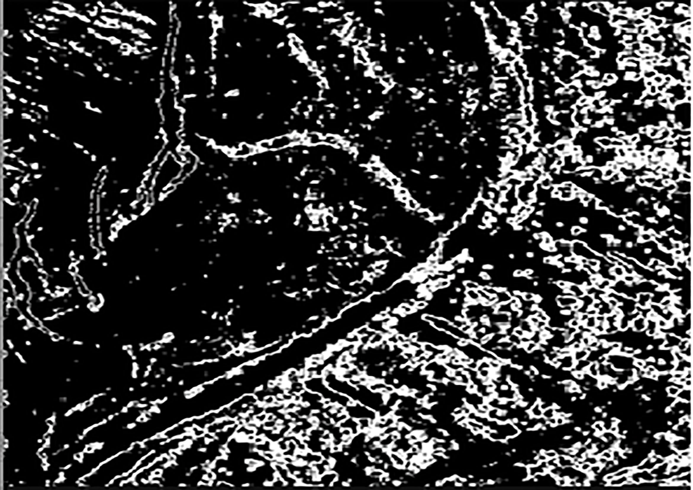
The phenomenon of mountain shadows, overlapping and other phenomena caused by SAR imaging is partially extracted as landslide information in the landslide information result map, and buildings in some areas are also misjudged as landslide information, which leads to certain extraction results.
In this paper, the method of combining the change detection information is used to extract the final landslide result to improve the accuracy of the result. It is considered that only the changed region can extract the landslide information through the gray texture information method. The resulting landslide information is shown in Fig. 3a.
Figure 3b shows an aerial image taken on May 26, 2008 after the Wenchuan earthquake, with a maximum resolution of 0.2 m. In Fig. 3b, the three areas A, B, and D are typical landslide areas, and their central latitude and longitude is (31
Landslide results and corresponding aerial images.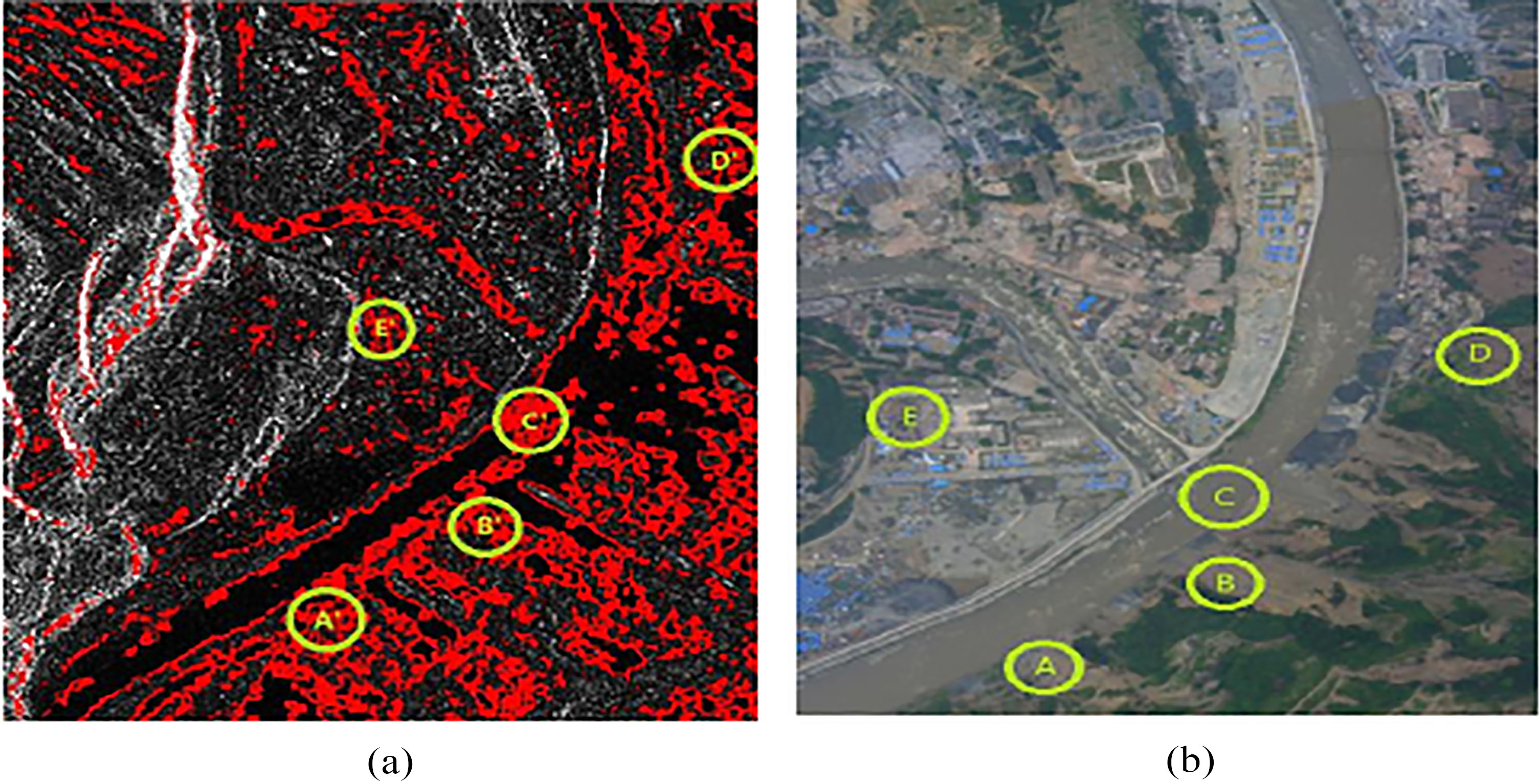
The selected verification data is located in and around Maoxian County, Sichuan Province. The area is mainly dominated by bare soil and low vegetation, and the vegetation with higher growth is relatively small, and there are also Maoxian county towns and rivers flowing in the study area.
In order to ensure the accuracy of the verification results, while the Radarsat-2 satellite transited on August 28, 2017, our researchers made simultaneous measurements on the latitude and longitude coordinates of the landslide area. The Radarsat-2 image data is obtained as fully polarized data, and in order to be consistent with the study area image, HV polarized image data is used in the verification process. During the time when the two images were acquired, several landslides occurred in the area due to rainfall, causing some roads to be interrupted and the village to be destroyed. However, since the landslide disaster is caused by rainfall, the regional distribution of the landslide is relatively scattered. In some mountainous areas where landslides occur, many places cannot obtain latitude and longitude by manpower.
Conclusion
Most of the landslides occur in areas with dense human activities. In the process of using grayscale texture information, the characteristics of landslides are very similar to those of artificial buildings. Because landslides generally occur in mountainous areas, they will be because of the shadows, overlaps, etc. of the mountains. Some of the information is mistaken for a landslide, so it often causes misjudgment of information. After adding the change detection information, the accuracy of the extraction result is greatly improved. In some areas, when the landslide occurs, the same building is destroyed as early as possible, which will cause some misjudgments and reduce the accuracy of the extraction results. Landslides generally occur in mountainous areas with complex terrain. The quantitative information of landslides is difficult to obtain, which makes the verification of test results difficult. In this paper, the field survey data and the aerial optical image are used to verify the extraction results, which has certain persuasive ability. The extraction results are verified by optical images and field surveys. Due to the particularity of the landslide, the method still needs further improvement in accuracy. The extraction results need further research in verification, so the method is not very good at present. Improvement needs further improvement.
Footnotes
Acknowledgments
Program for Innovation Team Building at Institutions of Higher Education in Chongqing (CXTDX 201601034); Chongqing Municipal Key Laboratory of Institutions of Higher Education (Grant No. [2017]3); Chongqing Municipal Key Laboratory (Grant No. [2018]10); Technology research project of Chongqing municipal education commissions’ under contract (KJ1401005).