



Abstract
2012’s Superstorm Sandy had a devastating impact on the New York City metropolitan region, including the suburban Long Island coast and the New Jersey shore. Given the size, density, complexity, and diversity of the region, many approaches have been used to address poststorm recovery. Planning has been central to these efforts. Using in-depth interviews with recovery stakeholders, this analysis of the planning responses to Sandy illustrates what an emergent model of resilient recovery planning looks like and highlights the kinds of resources and approaches that help facilitate this approach. We argue that preexisting planning capacity, strong political leadership, and nongovernmental funding support were critically important aspects of resilience-focused Sandy recovery planning processes.
Introduction
On October 29, 2012, Superstorm Sandy made landfall near Atlantic City, New Jersey, flooding the New Jersey coast, New York City, and suburban Long Island with devastating consequences. Sandy was the second-costliest U.S. tropical cyclone after Katrina at the time of Sandy’s occurrence (National Oceanic Atmospheric Administration [NOAA] n.d.), with $71.5 billion in damages compared with Katrina’s $163.8 billion, though it was quickly surpassed by 2017’s Hurricane Harvey ($126.3 billion) and Hurricane Maria ($90.9 billion). New York State and New Jersey bore the brunt of Sandy’s impact, suffering losses of $33 billion and $30 billion, respectively (Aon Benfield n.d.). Sandy left 8.5 million homes without power (Federal Emergency Management Agency [FEMA] 2013a), took at least 147 lives in the United States (FEMA 2013b) and damaged 346,000 homes in New Jersey alone (FEMA 2018).
Sandy will not be the last large-scale disaster to strike the United States, and this reality has important implications for planning. In 2018, fourteen U.S. natural disasters caused $1 billion or more each in damage, and the frequency of these events appears to be increasing (NOAA 2019) as does the damage they cause (Gall et al. 2011). The 2018 mudslides and wildfires in California, flash floods in Maryland, hurricanes Florence and Michael, and 2019’s Midwest floods illustrate a “new normal” as planners must learn to do more than address day-to-day “blue sky” planning tasks like growth management, development review, and economic revitalization. Instead, they must also negotiate the complexities of rebuilding and recovering after disasters (Berke and Campanella 2006), protecting communities against future disaster risks (Godschalk 2003), and adapting to the realities of a changing climate in a holistic way (Shi, Chu, and Debats 2015). As climate-related risks magnify, the planning response will need to adapt accordingly, and some evidence suggests that the postdisaster period is a potential “window of opportunity” (Birkmann et al. 2010) when these kinds of paradigmatic shifts might occur.
Superstorm Sandy provides timely examples of communities using planning to address urgent recovery challenges while simultaneously pivoting toward climate change adaptation and community resilience goals. Analyzing six post-Sandy recovery planning cases, we ask what a recovery planning process focused on resilience might look like and what planners might learn from these communities’ experiences (see Figure 1). Five of the examples illustrate what we describe as an emergent recovery planning approach focused on resilience, while the fifth case, New Jersey, serves as a useful counterexample showing how different a more traditional business-as-usual recovery model looks.
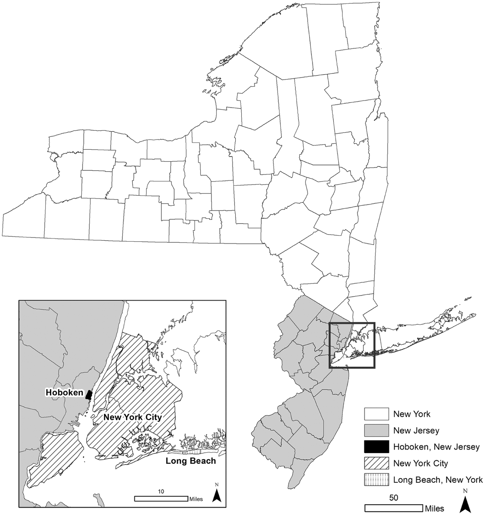
New York and New Jersey with case study communities labeled.
Defining Resilient Recovery Planning
Planning, as used here, describes public sector activities that employ “consensus building, problem solving, and future setting” (Kelly 2004, xii) to develop comprehensive visions of the future that “maximize the health, safety, and economic well-being for all residents” so the various components of a community “fit together like pieces of a puzzle” (American Planning Association [APA] n.d.). Defining disaster recovery is more difficult, because there is no single definition (Olshansky and Chang 2009). Distinct from immediate lifesaving response, recovery also differs from in situ reconstruction because it is a strategic process, not an end-state (Quarantelli 1999), and encompasses “timely restoration, strengthening and revitalization of infrastructure, housing and the economy, as well as the health, social, cultural, historic and environmental fabric of communities affected by an incident” (U.S. Department of Homeland Security 2015, 1).
Planners are important recovery actors (Schwab 2014) because recovery is essentially urban planning and development at high speed (Olshansky, Hopkins, and Johnson 2012). Recovery involves issues of concern to planners in normal times because individual households (Bolin and Stanford 1991; Chandrasekhar et al. 2018; Peacock, Dash, and Zhang 2018) and businesses (Dahlhamer and Tierney 1998; Webb, Tierney, and Dahlhamer 2002; Xiao et al. 2018) are dependent on one another for recovery (Xiao and Zandt 2012) as well as on communal infrastructure, social services, and even ecological systems (Finch, Emrich, and Cutter 2010). Furthermore, disasters are partially a result of, and exacerbated by, social inequality (Fothergill, Maestas, and Darlington 1999; Fothergill and Peek 2004).
Planning is the profession that is concerned with the intersection of all of these issues in normal times and thus positioned to help to address postdisaster challenges holistically and analytically and create better recovery outcomes. But typically, recovery has been a process of “uncoordinated implementation of varied programs administered by different stakeholders acting in isolation” whereby “the failure to plan for disaster recovery results in a process of rebuilding that often presages the next disaster” (Smith 2012, 1). Planning for recovery is important because communities are complex and dynamic systems (Alesch and Siembieda 2012; Mitchell 2006) and recovery of these systems must be coordinated to be effective (Dynes and Quarantelli 1976). Planners can help coordinate among disparate stakeholders, work across professional and jurisdictional silos, and negotiate the complexity of recovery (Rubin 1985; Rubin and Barbee 1985).
Some discrete aspects of recovery have been extensively studied, but there is a relative dearth of scholarly attention focused on community-scale recovery planning, and on the American context specifically. Notable exceptions include early work by Haas, Kates, and Bowden (1977), Rubin, Saperstein, and Barbee (1985), Rubin and Popkin (1990), and the APA report Planning for Post-disaster Recovery and Reconstruction (Schwab 1998), as well as a few more recent studies (Mammen 2011; Olshansky and Johnson 2010; Olshansky et al. 2008; Olshansky, Johnson, and Topping 2006). Nonetheless, such comprehensive studies are rare, and the literature provides scant direction for planners in need of empirical lessons regarding how to manage recovery (Kim and Olshansky 2014), particularly in the U.S. context. The existing literature does highlight some postdisaster challenges that planners will face and catalogs recovery strategies that have proved useful. Perhaps the most important lesson is that when disasters strike, some kind of rebuilding will happen whether planned or not (Campanella 2006), so the postdisaster recovery period can, paradoxically, create opportunities to actively and strategically address existing social, economic, and environmental challenges as citizens and policymakers recognize the unsustainability of pre-event conditions and show some willingness to consider changes, however briefly (Fan 2013).
Finally, what is the meaning of resilience in a planning context? The term has almost become a cliché, but this ubiquity also suggests that the field is searching for ways to redefine modern planning practice (Davoudi et al. 2012; Fainstein 2018; Graham, Debucquoy, and Anguelovski 2016; Jabareen 2013; Meerow and Newell 2019; Pizzo 2015). Building on the concept of ecological resilience proposed by C. S. Holling (1973), community or urban resilience can, at its most basic, “be defined simply as the capacity to rebound from future disasters” (Comerio 2014, 52) or, going further, “to respond effectively to a major storm, recover quickly from it, and adapt to changing conditions, while also taking measures to reduce the risk of significant damage in a future storm” (Hurricane Sandy Rebuilding Task Force [HSRTF] 2013, 14). Meerow et al. (2016, 45) propose the most integrative and comprehensive definition: Urban resilience refers to the ability of an urban system-and all its constituent socio-ecological and socio-technical networks across temporal and spatial scales-to maintain or rapidly return to desired functions in the face of a disturbance, to adapt to change, and to quickly transform systems that limit current or future adaptive capacity.
Thus, despite the absence of a unitary definition, resilience clearly includes balancing risk mitigation with climate change adaptation while simultaneously addressing other challenges like sustainability and social equity (Chu, Anguelovski, and Roberts 2017; Intergovernmental Panel on Climate Change 2014; Meerow and Mitchell 2017). The postdisaster recovery period, importantly, presents both an opportunity to address resilience goals (because rebuilding needs to happen in some manner) and a coherent and compelling rationale for doing so (because the impacts of the disaster are still salient for residents and decision-makers).
Methods and Rationale
While Sandy was a single large storm generating disaster declarations in twelve states and the District of Columbia (HSRTF 2013), recovery responses were highly localized, and our analysis focuses on just a handful of communities that created some of the most extensive resilience-focused recovery programs. Communities in New York and New Jersey suffered the vast majority of the damage from Sandy and these states developed very different recovery planning approaches from one another. While many affected local governments lacked planning capacity or financial resources or political will to plan strategically for recovery and long-term resilience, New York City; Hoboken, New Jersey; and Long Beach on New York’s suburban Long Island were different. While they were not the only communities to engage in active planning for resilience after Sandy, they were among the relatively small set that seized the opportunity to do so, as opposed to merely allowing uncoordinated rebuilding to happen. Many Sandy recovery efforts have been widely criticized, including programs closely connected to planning such as New Jersey and New York City’s housing recovery programs (Nonko 2017; Spoto 2015) and FEMA’s National Flood Insurance Program (NFIP) program (Ryan 2015). These failings, however, do not nullify some valuable lessons to be gleaned from the many proactive community-scale recovery planning efforts reported below.
To better understand how communities navigate the complexities of fostering recovery and resilience in complex, politically charged and fiscally constrained environments, we use an embedded case study approach because it is useful “when examining contemporary events, but when the relevant behaviors cannot be manipulated” and when “direct observation of the events being studied and interviews of the persons involved in the events” are possible (Yin 2014, 12). Large and destructive events like Sandy are, despite increasing regularity, still extremely rare. But we can seize the fleeting opportunity to analyze these unexpected events through in-depth observation as they happen and capture the ephemeral, but invaluable, planning lessons they provide. As Johnson and Olshansky (2017, 3) explain, affected communities often recognize that they lack relevant experience, so they seek lessons from others. Typically, they muddle through, innovate, and learn as they go. But, in the end, most agree that if they had known then what they have since learned, their recovery could have been faster and easier.
Our research has included thirty-six semi-structured in-person interviews and seven phone interviews with municipal, state, and federal recovery officials and civic leaders substantially involved in the recovery planning process. Interviews were conducted between summer 2013 and early 2017. Interviews usually lasted an hour or more and were augmented by attendance at more than fifty public recovery planning meetings and collection of primary data from interview informants, the Internet, and other sources. The authors also have other Sandy-related research projects including surveys and interviews of affected residents, business owners, elected officials, and advocates. These have also informed how we frame the recovery planning process.
Federal Recovery Planning
Federal recovery efforts are legislated by the 1998 Robert T. Stafford Disaster Relief and Emergency Assistance Act (PL 93-288, as amended, 42 U.S.C. §§ 5121–5206), continuing the longstanding precedent of providing federal aid only when local resources are depleted. Community recovery responsibilities are mostly distributed across FEMA, the Department of Housing and Urban Development (HUD), and the Small Business Administration (SBA). Despite recent streamlining efforts including the Post-Katrina Emergency Management Reform Act of 2006 (PKEMRA; 6 U.S.C. § 70) and 2011’s National Disaster Recovery Framework (NDRF; FEMA 2011b), navigating the complex federal bureaucracy is a critical challenge, especially for communities lacking prior experience with long-term recovery (Finn and Marshall 2018; Leicht 2017).
State and local governments typically manage recovery efforts using significant federal funding, though with stringent spending limitations (Gundlach and Jones 2016), but after Sandy the federal government took an atypically proactive approach. President Barack Obama established the HSRTF on December 7, 2012, and on January 29, 2013, signed Public Law 113-2 of 2013, containing both the Sandy Recovery Improvement Act (SRIA) and the Disaster Relief Appropriations Act of 2013, commonly referred to as the Sandy Supplemental. The SRIA streamlined FEMA’s response and recovery policies, while the Sandy Supplemental directed $50 billion in presequester funding for recovery from all presidentially declared disasters between 2011 and 2013 including Sandy. The HSRTF released its Hurricane Sandy Rebuilding Strategy (HSRS), subtitled Stronger Communities, a Resilient Region (HSRTF 2013), in August 2013. Emphasizing many well-established recovery best practices, including efficient resource allocation, local decision-making, and regional coordination, the HSRS built overtly on the NDRF and was, indeed, a planning mandate with a focus on “bringing a wide range of stakeholders together to foster innovative ideas and ensure a comprehensive regional approach to rebuilding” (HSRTF 2013, 3).
The main federal funding stream for community recovery planning was the Community Development Block Grant–Disaster Recovery (CDBG-DR) program administered by HUD. CDBG dates from 1974 and in normal times provides flexible direct grants to local governments for a range of community development projects (Theodos, Plerhoples, and Ho 2017). Congress first utilized the CDBG block grant format to expedite recovery funding after the 1992 Los Angeles riots and for most subsequent major disasters. Eclipsing FEMA’s $11.7 billion allocation (Kousky and Shabman 2012), the newly named CDBG-DR program received $16 billion from the Sandy Supplemental, and CDBG-DR funds were released in three tranches between mid 2013 and early 2015 to six affected jurisdictions. The states of Rhode Island, Maryland, and Connecticut received $19.9 million, $28.6 million, and $159.3 million, respectively, with much larger allocations going to New Jersey ($4.2 billion), New York City ($4.2 billion), and New York State ($4.4 billion).
HUD Secretary Shaun Donovan was intimately involved in long-term recovery as head of the HSRTF and emphasized a recovery process built on collaboration, coordination, technical assistance, and resilience (HSRTF 2013). Rebuild by Design (RBD), for instance, was a HUD-sponsored design competition for large-scale mitigation projects that also addressed social, economic, and environmental issues (Bisker, Chester, and Eisenberg 2016), allocating $920 million in CDBG-DR funds to projects in the Sandy region. The centerpiece of RBD was a robust participatory planning and design process. Funded by philanthropic partners including $3.5 million from the Rockefeller Foundation, local advocacy groups facilitated an intensive community engagement process including sixty-four public workshops and over 350 stakeholder meetings. An expert panel convened by HUD and Rockefeller chose six winning projects in June 2014, awarding between $20 million and $335 million each for implementation. The RBD model was subsequently replicated, in part, for HUD’s National Disaster Resilience Competition (NDRC). Despite the amount of positive publicity generated by RBD and its extensive participatory planning and design processes, the winning projects have been slow to materialize. The New York City “Big U” project has been continually revised and modified; new plans released in early 2019 for the renamed East Side Coastal Resiliency (ESCR) project have generated powerful community opposition (Pereira 2019).
In addition to RBD, HUD made other attempts to coordinate efficient rebuilding efforts among the Sandy region’s complex and overlapping web of federal state, local, and regional entities. The Sandy Recovery Infrastructure Resilience Coordination Group (SRIRC) was comprised of senior regional leadership from federal agencies who collaborated to manage more than 450 recovery and resilience infrastructure projects. Ten SRIRC Technical Coordinating Teams (TCTs) of federal, state, and local agency staff collaborated to address implementation challenges, and a Regional Federal Review and Permitting Team (FRP Team) attempted to minimize federal permitting hurdles to assure that projects meet the 2022 CDBG-DR spending deadline established by congress. These efforts provided atypical opportunities for the region’s numerous stakeholders to collaborate, which is an ongoing challenge in such a large and balkanized region even when there are no urgent recovery needs.
FEMA also has a long-term recovery mandate in addition to its traditional emphasis on short-term response (FEMA 2011a) and was active in promoting resilient rebuilding, particularly in the suburban counties of Nassau and Suffolk on Long Island. Within weeks of the storm, planners with the Community Planning and Capacity Building (CPCB) team in FEMA’s New York Sandy Recovery Office (NYSRO) held Recovery Issue and Opportunity Sessions with local officials on Long Island. FEMA subsequently created a Long Island Smart Growth Resilience Partnership (LISGRP) to address planning needs identified at these sessions, with FEMA acting as a conduit to other federal agencies that could help local governments address recovery and resilience issues outside FEMA’s relatively narrow purview. The Environmental Protection Agency’s (EPA) Building Blocks for Sustainable Communities program, for example, partnered with FEMA to fund code audits and creation of model ordinances for some storm-damaged Long Island communities. FEMA planners based out of the NYSRO, however, acknowledged that many local governments were only interested in FEMA assistance to the degree that it facilitated rebuilding to the prestorm status quo and had no interest in jumpstarting any new resilience-focused planning efforts.
State Recovery Planning in New York and New Jersey
States play a critical role in recovery planning. Federal funds can only be allocated to states at the request of governors, and CDBG-DR funds are typically directed to states, who then develop their own recovery funding programs and work closely with affected municipalities. New York and New Jersey received almost identical CDBG-DR allocations of slightly more than $4 billion, though they utilized them very differently (Finn, Chandrasekhar, and Xiao 2016). New York governor Andrew Cuomo created the Governor’s Office of Storm Recovery (GOSR) in June of 2013, centralizing the state’s Sandy housing, small business infrastructure and community recovery functions including the New York Rising Community Reconstruction (NYRCR) program providing planning assistance to communities affected by Sandy, Hurricane Irene, Tropical Storm Lee, and 2013’s summer floods.
Funded by $700 million of the state’s CDBG-DR allocation, NYRCR launched in July 2013 eventually completing recovery planning processes in 124 jurisdictions including municipalities, unincorporated hamlets, counties, and eighteen New York City neighborhoods. Each NYRCR jurisdiction was allocated implementation funding between $3 million and $25 million based on FEMA damage assessments and predicated on completion of a Community Reconstruction Plan within ten months. Consultant teams hired by the GOSR at a cost of $25 million oversaw local planning processes and wrote plans, with support from planners at the New York State Department of State and Department of Transportation. Led by Local Planning Committees of ten to twenty Governor-appointed civic leaders, communities followed a GOSR-designed process including asset inventories and risk assessments (State of New York n.d.) and collectively held more than 250 public meetings and workshops (see Figure 2) across the state (McDonnell et al. 2016). In 2014, the NYRCR community plans were released (see Figure 3), outlining numerous hazard mitigation, climate change adaptation, community development, and reconstruction projects. Most NYRCR steering committees have since disbanded, while the GOSR continues to oversee implementation, augmenting CDBG-DR allocations with FEMA funds, debt financing, and other sources. A few planning committees, such as the one in the Red Hook neighborhood of New York City, have transitioned into new organizations like Resilient Red Hook to continue to advocate for local resilience projects.
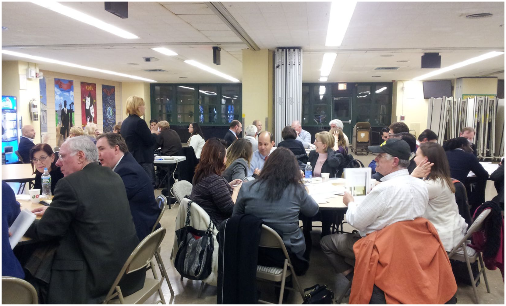
Community workshop for the Staten Island New York Rising Community Reconstruction Plan in December 2013.

Governor Cuomo hosts a public unveiling for the 66 New York Rising Community Reconstruction Plans in Albany, New York, in April 2014.
New Jersey took a much different approach to local recovery planning than New York. Governor Chris Christie created a Governor’s Office of Recovery and Rebuilding (GORR), although the state’s main planning-specific recovery program was the Post-Sandy Planning Assistance Grant (PSPAG) program, administered by the Office of Local Planning Services within the Department of Community Affairs. Using $13.7 million in CDBG-DR funds, the PSPAG program offered recovery and mitigation planning grants to the state’s nine coastal counties and more than 130 jurisdictions within those counties. Jurisdictions first applied for up to $30,000 to prepare a Strategic Recovery Planning Report (SRPR) outlining overall recovery strategies, followed by eighteen additional types of plan-making grants (e.g., neighborhood plans, capital improvement plans, debris management plans), ranging from $5,000 to $50,000 per category per grantee, capped at $715,000. Aside from the relatively small PSPAG program, New Jersey otherwise mostly bypassed local governments and allocated CDBG-DR funds directly to statewide programs like the Reconstruction, Rehabilitation, Elevation and Mitigation Program (RREM) and the Sandy Blue Acres Buyouts Program.
While New York’s NYRCR program was specifically designed to address smaller communities’ lack of planning capacity, participation in New Jersey’s PSPAG program required pre-existing staff and expertise that many small communities simply did not have. To address this challenge, the smart growth advocacy organization New Jersey Future launched a Local Recovery Planning Managers (LRPM) program in December 2012. Funded by the Merck Foundation and the New Jersey Recovery Fund, the organization hired three experienced planners in the summer of 2013, assigning them as adjunct planners for two coastal communities each. Until early 2016, when funding was exhausted, LRPMs applied for PSPAG and other grants, developed local recovery steering committees, managed community engagement processes, facilitated local versions of New Jersey Future’s “Getting to Resilience” self-assessment program, and helped communities enroll in the NFIP Community Rating System.
Thus, despite comparable CDBG-DR allocations, the two states approached local community recovery planning very differently. New York State allocated more than fifty times as much money to the NYRCR program as New Jersey allocated to the PSPAG program. The New York program also provided technical assistance for both planning and implementation and emphasized, at least rhetorically, objectives like public participation and resilience. New York’s process was highly and centrally managed; the state chose consultants, paired them with communities, and mandated a standardized planning process. But NYRCR plans are not adopted municipal plans, merely wish-lists, and each contains numerous unfunded projects that far outstrip allotted implementation grants, so many of these proposals will probably never be implemented. Nonetheless, New York’s process was ambitious. It prioritized planning as a recovery strategy and resilience as a planning goal, and communities were given wide latitude to develop their own planning priorities. There was also enough funding and technical assistance from the state to actually matter, especially to the small communities and urban neighborhoods that were the primary focus of the NYRCR.
If New York illustrates an ambitious model of the way disaster recovery planning might be harnessed as a vector for resilience, New Jersey provides a stark contrast. Their approach eschewed most technical assistance and lacked implementation funding or any mechanism for regional collaboration, which was another hallmark of NYRCR. However, those municipalities that already possessed some planning capacity, as well as the New Jersey Future LRPM partners, were able to use PSPAG funds to develop new municipal plans and ordinances, proving useful for some communities that had not updated many of these documents in decades if they existed at all.
The two states also addressed issues like climate change adaptation, hazard mitigation, and resilience very differently in their recovery programs. Governor Cuomo signed New York’s Community Risk Reduction and Resiliency Act (CRRA) into law on September 22, 2014, adopting official state sea level rise estimates and requiring state agencies to consider climate risk in decision-making. Consistent with this mandate, resilience is a central theme of most NYRCR plans. Climate change, though, was a mostly forbidden topic in New Jersey under Republican Governor Christie. As New Jersey Future noted in the self-assessment of its LRPM program, These are particularly difficult discussions for local officials in New Jersey because (unlike in neighboring states) few of our state policies have acknowledged this issue and there is a dearth of voices at the state level insisting on addressing it. (New Jersey Future 2015, 15)
Municipal Recovery Planning: New York City, Long Beach, and Hoboken
Some local jurisdictions also undertook noteworthy post-Sandy resilience-focused community recovery planning efforts, including New York City, as well as smaller municipalities including Hoboken, New Jersey, and Long Beach, New York. Although most recovery funds are allocated directly to states, New York City received its own CDBG-DR allocation of $4.2 billion. Despite famously lacking a comprehensive land use plan, the city had numerous other long-term planning initiatives in place in when Sandy struck. During Mayor Michael Bloomberg’s tenure (2002–2013), climate change adaptation and sustainability became one of the central organizing principles for the city, with its 520 miles of shoreline. Well before Sandy, Bloomberg created a Mayor’s Office of Long-Term Planning and Sustainability, developed the PlaNYC 2030 sustainability plan (City of New York 2007), and established the New York City Panel on Climate Change. These and other elements of the city’s planning capacity allowed it to begin long-term recovery and resilience planning efforts quickly. Less than a week after Sandy, the Department of Buildings (DOB) began drafting emergency building code changes including flood resistant construction standards and the Department of City Planning (DCP) drafted complementary Zoning Resolution text amendments. On January 28, 2013, FEMA issued the city’s new Advisory Base Flood Elevation (ABFE) maps for the NFIP, placing 7 percent of the city’s 975,000 buildings in the one hundred-year floodplain; three days later, mayoral Executive Order No. 230 temporarily suspended height restrictions and other impediments to FEMA-compliant rebuilding in these areas. The city council approved the Flood Resilience Text Amendment in October of 2013, just prior to the storm’s one-year anniversary. That amendment created new datum lines for measuring building height based on freeboard requirements, allowed mechanical equipment and deployable flood barriers as permitted obstructions on roofs, side-yards and backyards, and modified floor area ratio calculations to accommodate stairways necessary for elevated structures, while the near-simultaneous release of the Designing for Flood Risk manual (New York City [NYC] DCP 2013a) and Urban Waterfront Adaptive Strategies report (NYC DCP 2013b) followed by the Retrofitting Buildings for Flood Risk handbook (NYC DCP 2014) provided further guidance on resilient rebuilding.
The city also launched the Special Initiative for Rebuilding and Resiliency (SIRR) to combine sophisticated climate science, risk analysis, and participatory planning in creating a citywide long-term resilience plan, with a particular focus on Sandy-affected neighborhoods. SIRR was housed in the quasi-governmental New York City Economic Development Corporation (NYCEDC) and staffed by temporarily reassigned city agency personnel and outside consultants. The resultant plan A Stronger, More Resilient New York (SIRR 2013) was unveiled in June 2013, containing 257 action items including infrastructure upgrades, building retrofits, and coastal protections totaling $20 billion (see Figure 4). The newly created Office of Recovery and Resiliency (ORR), led by a SIRR veteran was tasked with implementing the plan and addressing newly emergent resilience challenges.
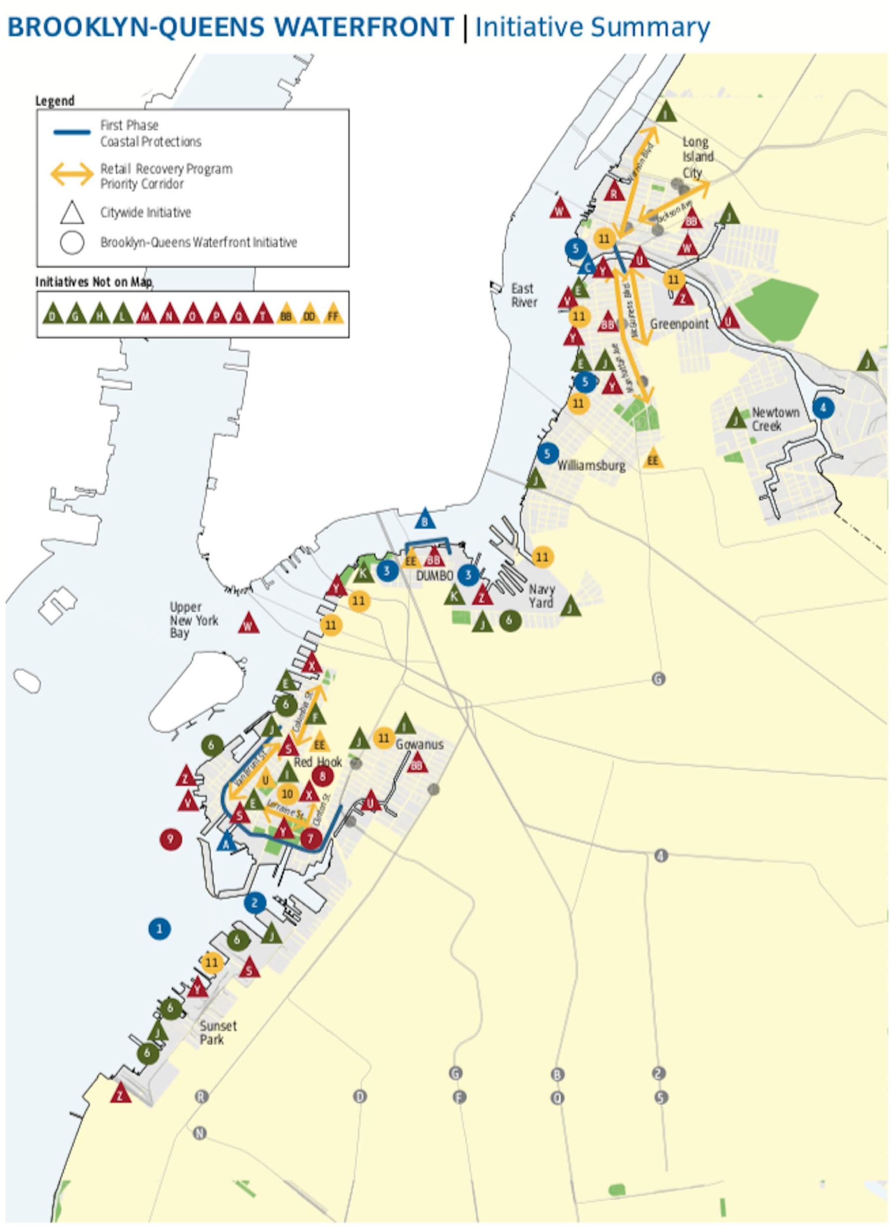
Overview map of the dozens of recovery and resilience projects proposed for just one section of New York City, the Brooklyn–Queens waterfront.
But the city’s built environment is too diverse for citywide policies alone to effectively facilitate resilient rebuilding and protect every neighborhood from future risks. To address fine-grained, localized issues, the city council approved Special Regulations for Neighborhood Recovery in July of 2015. These temporary five-year zoning text modifications addressed conditions like nonconforming uses and the shallow lots that predominate in many Sandy-impacted neighborhoods. Using CDBG-DR funds, DCP also launched its Resilient Neighborhoods Initiative to conduct detailed planning studies in ten vulnerable neighborhoods, assessing local risks and developing resilience strategies using DCP’s newly developed Framework for Risk and Resilience Decision-Making (FRReD). The NYC Department of Housing Preservation and Development (HPD) also integrated resilient recovery planning into its affordable housing mandate. HPD’s Resilient Edgemere Community Planning Initiative focused on a low-income neighborhood on the Rockaway peninsula that was almost wholly inundated by Sandy, combining shoreline protection, green infrastructure, new mixed-use development, and upgrades to the Beach 41st Street Houses public housing complex through the New York City Housing Authority’s (NYCHA) Recovery to Resiliency Program (NYC HPD 2017). The city’s 2007 sustainability plan was likewise rebranded as OneNYC (City of New York 2015), described as “New York City’s plan to become the most resilient, equitable, and sustainable city in the world” (City of New York n.d.).
Long Beach, New York, is a barrier island community of 33,553 on the south shore of Long Island just east of New York City where a seventeen-foot storm surge destroyed $200 million in city property—including the city’s iconic two-mile boardwalk—and damaged 70 percent of the housing units (See Figure 5). The small city had adopted a new comprehensive plan in 2007, but it had been effectively shelved for economic and political reasons, and lack of a plan hampered rebuilding. To jumpstart the recovery planning process, the city partnered with a local nonprofit, Sustainable Long Island, and launched a community participation process called Long Beach Listens. This, in turn, helped inform Creating Resilience: A Planning Initiative, a synchronized planning process for both the city’s new comprehensive plan and its Local Waterfront Revitalization Program (LWRP). Differing substantially from the 2007 version, Long Beach’s new plan focuses on three main themes: environmental resilience, productive sustainable economy, and transportation and mobility (City of Long Beach 2017). The city also prioritized rapid implementation of ideas generated through the planning processes even before the plans were completed, such as resilience-oriented zoning code modifications suggested by Long Beach Listens participants.
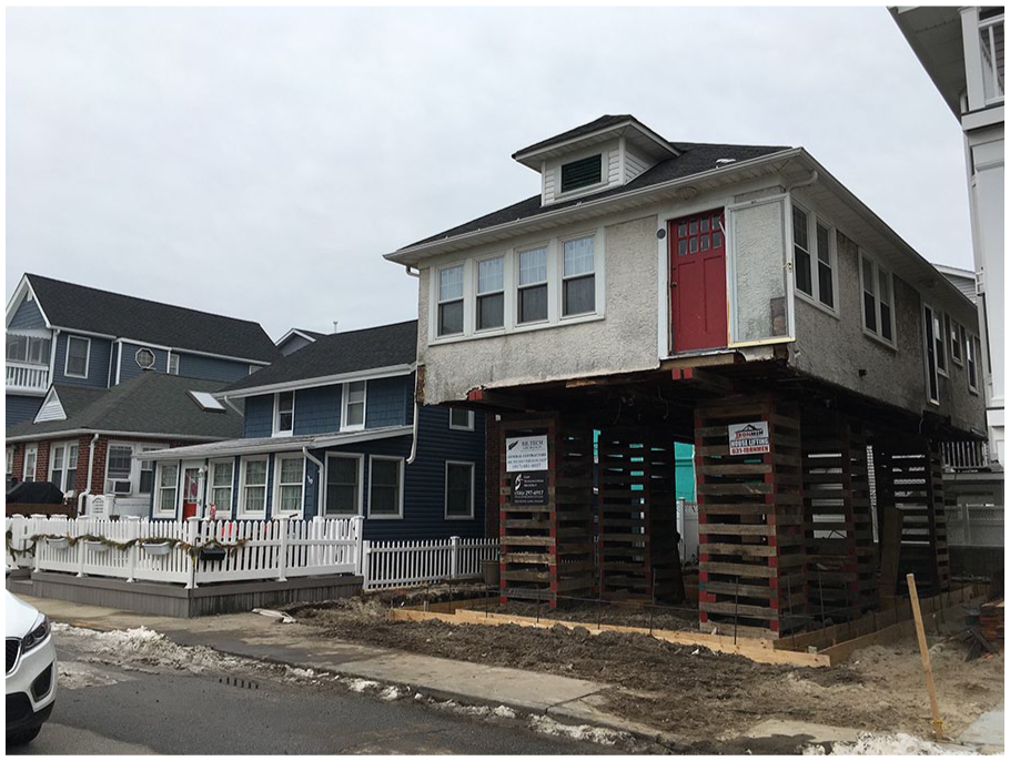
A storm-damaged home being elevated in Long Beach, New York.
Hoboken, New Jersey, lies just west of New York City across the Hudson River. It is one of the most urbanized municipalities in the United States, with 50,005 residents in only 1.28 square miles, which Sandy inundated with five hundred million gallons of water covering 80 percent of the city, knocking out power for ten days and causing more than $100 million in damages (Bailin 2014). The low-lying coastal city already faced numerous risks prior to Sandy, but the storm put these into stark perspective. Flooding is common and has been exacerbated by climate change and more frequent coastal storms. Some inland neighborhoods are less than five feet above sea level. The combined sewer system still contains some wooden pipes dating to the 1870s. And an 1804 master plan failed to allocate any significant open space.
Hoboken first released its Community Resilience Plan (City of Hoboken n.d.) in August 2013. That simple 9-point, 1,600-word framework issued by Mayor Dawn Zimmer committed the city to resilient rebuilding, but the first significant resilience planning product was the Hoboken Green Infrastructure Strategic Plan (Together North Jersey 2013) released two months later. Funded by Together North Jersey, a 2011 HUD Sustainable Communities Regional Planning Grant recipient, the plan integrates resilience across the city’s planning agenda, combining stormwater management projects with policy recommendations such as zoning changes and creation of a stormwater trust fund. The city also embarked on an effort to acquire land for three “resiliency parks” to simultaneously address issues of scarce open space, combined sewage overflows, and stormwater-related flooding. A new Office of Resiliency was created, while the state’s PSPAG program funded a multi-faceted Post Sandy Disaster Recovery Plan including modernized zoning and building codes, new flood maps, and an all-hazard mitigation plan. The city’s 2004 master plan was also updated in 2017 (City of Hoboken 2017) to address risks highlighted by Sandy, and numerous related capital projects are now underway, such as adding bioswales commercial corridors and developing a renewably powered microgrid to power critical sites during power outages.
Discussion
Sandy represents the first major disaster where recovery planning has so overtly been used as a tool for enhancing future resilience in addition to rebuilding. A few key elements were common across these efforts. First, the jurisdictions that were able to effectively bring resilience into the recovery planning process had significant prestorm planning expertise, existing plans, ongoing planning processes, and an existing culture of planning (Berke, Kartez, and Wenger 1993; Olshansky, Johnson, and Topping 2006; Rumbach, Makarewicz, and Németh 2016; Smith 2012) allowing these places to quickly begin recovery planning efforts. The basic structure of New York State’s NYRCR program mirrored its existing Regional Economic Development Council (REDC) initiative. Hoboken’s mitigation strategy was already in development before Sandy and informed its $230 million RBD proposal and other efforts. Long Beach was able to build on momentum from its just-completed comprehensive planning process.
In contrast, many smaller communities in the region had outdated plans and ordinances, little internal planning capacity, limited budgetary flexibility, and no existing culture of planning. Most, in turn, did very little recovery planning, let alone aggressively pursuing resilience goals unless there were significant state resources provided to do so. But this has been a longstanding challenge, with Wolensky and Wolensky (1991, 27) suggesting, twenty years before Sandy, that “the prognosis is less than favourable” for most communities to develop significant internal recovery capacity and instead suggesting, “disaster management will remain a low priority within a generally weak local government.” More research to unpack the specific challenges faced by low-capacity communities after disasters is, therefore, of continued importance.
Strong political leadership that supports planning and resilience is also important. Shaun Donovan, HUD Secretary and Sandy Recovery Czar, was a trained architect and former New York City Housing Commissioner who hired as his Senior Advisor Henk Ovink, the Acting Director General of Spatial Planning and Water Affairs and Director of National Spatial Planning for the Netherlands. New York Governor Cuomo is a former HUD Secretary and the NYRCR process was overseen by Assistant Secretary of State George Stafford, a trained landscape architect who led the state’s community revitalization, waterfront planning, brownfields, and smart growth programs. In New Jersey, though, there was no figure at the highest levels of state government advocating for planning or resilience or with related experience, underscoring the critical role of state-level leadership in recovery planning (Smith, Sabbag, and Rohmer 2018).
Finally, the Sandy experience shows how creative funding, especially from philanthropic sources, can help facilitate more participatory and resilience-focused planning. While philanthropies have long played an important role in short-term humanitarian relief after disasters, they have not traditionally had a large role in long-term recovery (Moore 2006). The Rockefeller Foundation’s $3.5 million investment in creation of the Unified New Orleans Plan (UNOP) after Hurricane Katrina (Nelson, Ehrenfeucht, and Laska 2007) began a trend of philanthropic support for recovery planning with Rockefeller later funding the public participation component of the post-Sandy RBD process, and subsequently the NDRC, and launching their now-shuttered 100 Resilient Cities program the following year. Rockefeller and other groups also subsequently supported the Resilient Puerto Rico Advisory Commission to plan for recovery from Hurricane Maria (Berkowitz 2018). These philanthropic dollars filled crucial gaps created by rigid Congressional spending rules, especially by supporting participatory planning and providing technical assistance for under-resourced communities, which can typically be difficult to fund with federal resources.
Overall, the cases reported here illustrate the varied ways that communities affected by disasters can use the process of long-term recovery to help build community resilience, and how planning can play an important role in that process. But even in places where there has been significant resilience-focused planning, some communities and neighborhoods, especially places that were socially and economically vulnerable before the storm, continue to struggle with challenges caused by, or exacerbated by, Sandy (Sandy Regional Assembly 2013). In some of these low- and middle-income areas, post-Sandy risk mitigation measures have also created incentives for new development and raised the specter of “disaster gentrification” (Rumbach and Makarewicz 2016) such as a 2016 proposal from engineering firm AECOM to build mitigation infrastructure, forty-five thousand housing units and three new subway stations on the Red Hook (Brooklyn) waterfront, which experienced severe damage from Sandy and is currently home to approximately ten thousand residents, 60 percent of whom live in public housing (Warerkar 2016). In addition, even in those communities that engaged in significant resilience-oriented recovery planning, implementation has often been slow, and the 2022 congressional deadline for spending recovery funds is looming. Even widespread and important policy changes like zoning code rewrites will have slow and incremental impacts on community morphology and it may take generations to know how these efforts will pay off in averted risk.
Footnotes
Acknowledgements
The authors would like to thank Rob Olshansky for his encouragement and advice with previous versions of this paper, R. J. Theofield for his valuable assistance, and the three anonymous reviewers, who provided many detailed, constructive, patient, and helpful comments. All errors, omissions, and misinterpretations are responsibility of the authors.
Declaration of Conflicting Interests
The author(s) declared no potential conflicts of interest with respect to the research, authorship, and/or publication of this article.
Funding
The author(s) disclosed receipt of the following financial support for the research, authorship, and/or publication of this article: This material is based on work supported by the National Science Foundation under Grant Numbers: 1333132, 1559664, 1333155, and 1335109. Any opinions, findings, and conclusions or recommendations expressed in this material are those of the authors and do not necessarily reflect the views of the National Science Foundation.
